You must be logged in to view this content. Click Here to become a member of IndyWX.com for full access. Already a member of IndyWx.com All-Access? Log-in here.
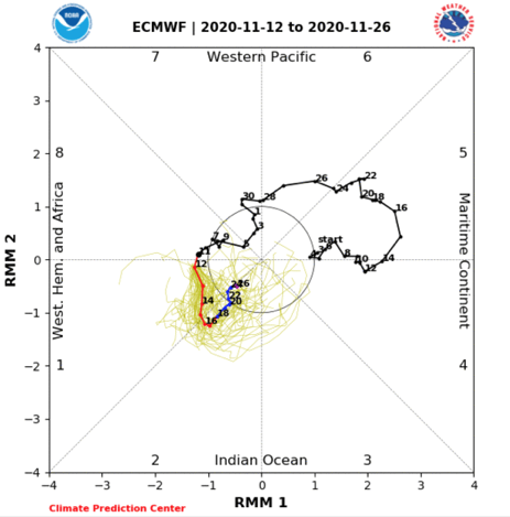
We continue to watch substantial changes in the high latitudes and the modeling (on a daily basis) is being forced to correct towards more of a blocky look by Thanksgiving week. My suspicion is this has to do with Phase 2 of the MJO.
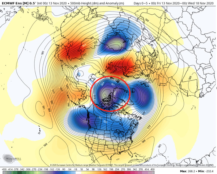
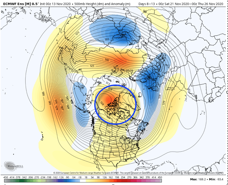
This morning, note the changes highlighted from now (image 1) to the 2 positives beginning to combine (image 2) to eventually form more of a high latitude ridge, or block (image 3).
Lack of any sort of blocking observed presently. As such, the chilly air masses that do impact the region are very transient.
Changes begin taking place next week as 2 separate areas of high pressure form over AK and Baffin Bay/ Greenland.
That then forms a more “mature” high latitude block by Thanksgiving.
By the time we get to Thanksgiving, note how there’s a totally different look and a pattern has ‘suddenly’ developed that can drive cold air (in more of a sustained manner) south into the Lower 48- particularly eastern portion of the country.
This doesn’t just happen overnight, but what we should begin to see on the modeling is more substantial cold shots for the last 10 days of November, including the threat of some sort of wintry “fun and games” from the Plains, stretching out to the Great Lakes and interior Northeast around Thanksgiving, itself. (Too soon to call for the OHV).
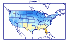
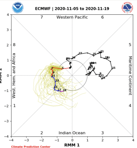
My suspicion is this is all thanks to the MJO. Note how the European continues to slow things in Phase 2 (a cold phase this time of year for our portion of the country).
The question then becomes “can we take things back into Phase(s) 7, 8, and 1 in December (all traditionally cold phases).
Or do we roll right into Phases 3, 4, 5, and 6 (all big time warm phases). That’s what our December forecast hinges on and we’ll keep a very close eye on things. Stay tuned.
You must be logged in to view this content. Click Here to become a member of IndyWX.com for full access. Already a member of IndyWx.com All-Access? Log-in here.
You must be logged in to view this content. Click Here to become a member of IndyWX.com for full access. Already a member of IndyWx.com All-Access? Log-in here.
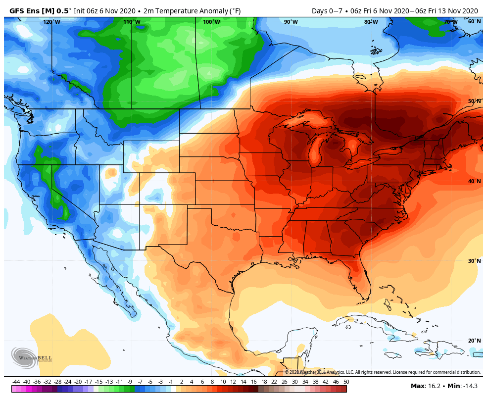
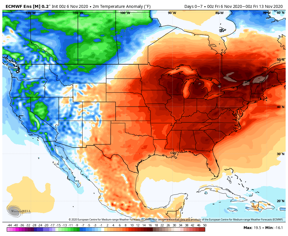
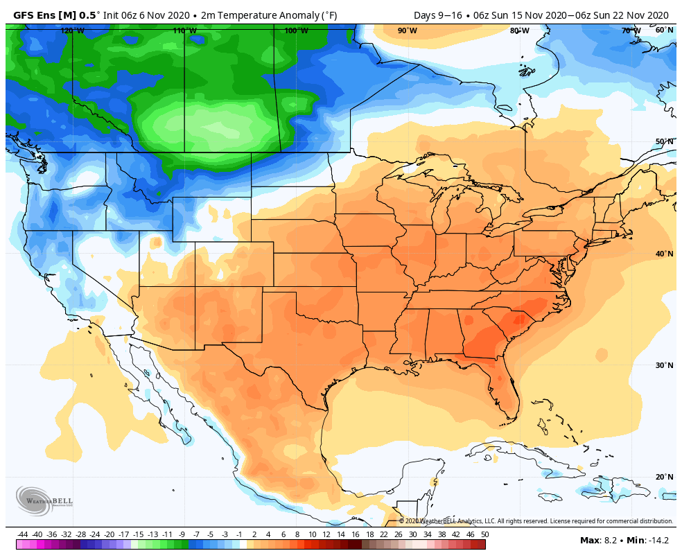
The unseasonable warmth won’t last, at least not to this magnitude, but an overall warmer than average pattern should persist over the upcoming couple of weeks.
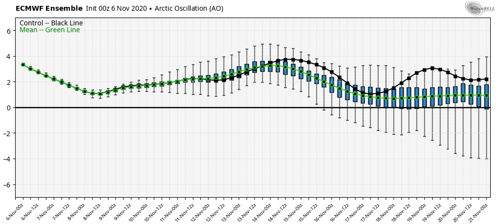
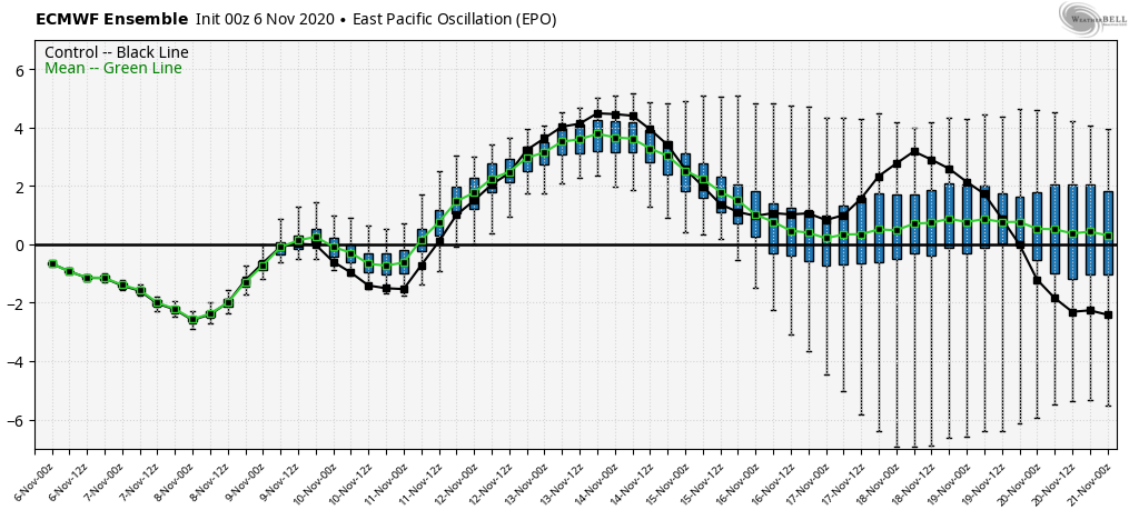
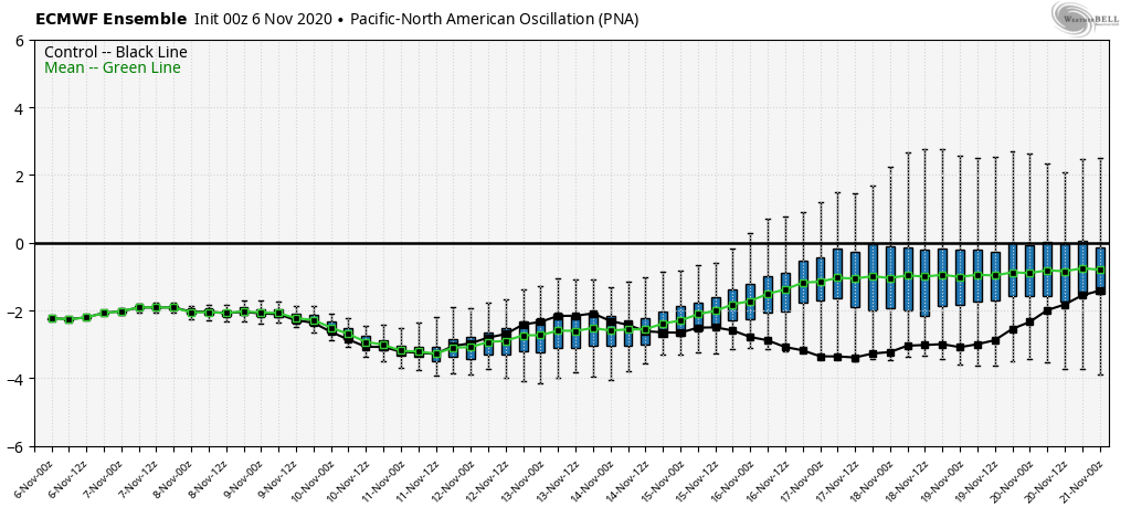
The teleconnections (positive AO, positive EPO, negative PNA) are aligned in a manner that will drive the ‘mean’ ridge position across the eastern portion of the country.
Subsequently, the warmth, relative to normal, remains locked in over the East through mid month. Note how similar the GEFS and EPS are between Week 1 and Week 2.
Though we will cool off behind the passage of a cold front next week, we’re still running above normal into Week 2.
We’re not ready to throw in the towel on the idea we could be looking at a more wholesale pattern shift late month. The MJO supports that idea. Note Phase 2 this time of year favors the chill to settle into the East.
It’ll be an interesting test case in what otherwise looks to be a mild to much milder than normal (and quiet) pattern.