With a little over a week left in April, thoughts continue to focus more and more on May. While our official monthly outlook will come out later next week, we did want to present our early thoughts on the first week of the month.
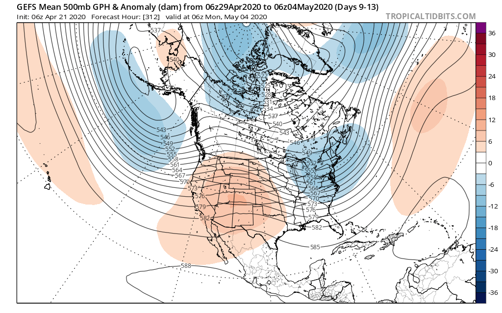
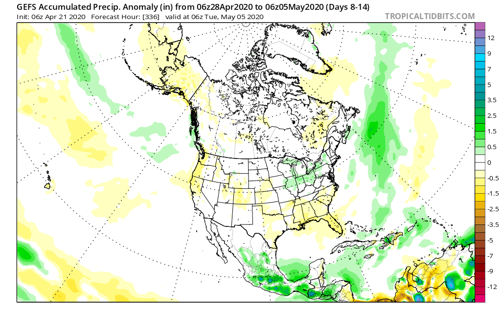
In short, a rather persistent upper trough is expected to dominate the eastern 1/3 of the country into the 1st week of the month. This should keep things cooler than normal, overall.
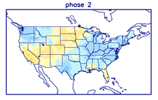
This also lines up perfectly with Phase 2 of the MJO in early May. (After a week of disagreement, model data now agrees that the MJO should “flirt” with Phase 3 before cycling back into Phase 2 early May). We note this favors cooler than normal temperatures across our portion of the country.
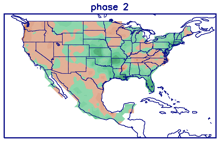
From a precipitation perspective, there aren’t particularly strong signals for wetter/ drier than average conditions with Phase 2 in May- at least for the Ohio Valley.
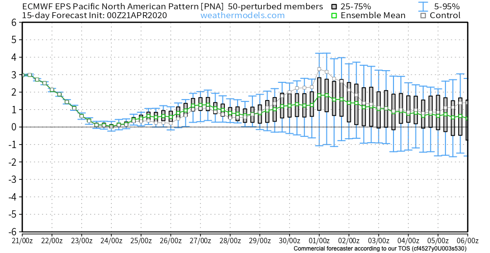
The positive PNA, however, can support a bit more of an active storm track through our region and that’s what model data is showing from this distance.
The positive PNA, of course, also supports cooler than normal temperatures across our portion of the country…
You must be logged in to view this content. Click Here to become a member of IndyWX.com for full access. Already a member of IndyWx.com All-Access? Log-in here.
You must be logged in to view this content. Click Here to become a member of IndyWX.com for full access. Already a member of IndyWx.com All-Access? Log-in here.
Permanent link to this article: https://indywx.com/late-season-wet-snow-storm-for-northern-portions-of-the-ohio-valley-fresh-long-range-thoughts-into-may/
Updated client video to go along with this morning’s discussion…
You must be logged in to view this content. Click Here to become a member of IndyWX.com for full access. Already a member of IndyWx.com All-Access? Log-in here.
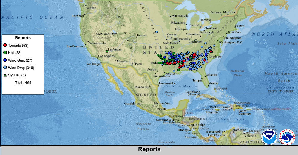
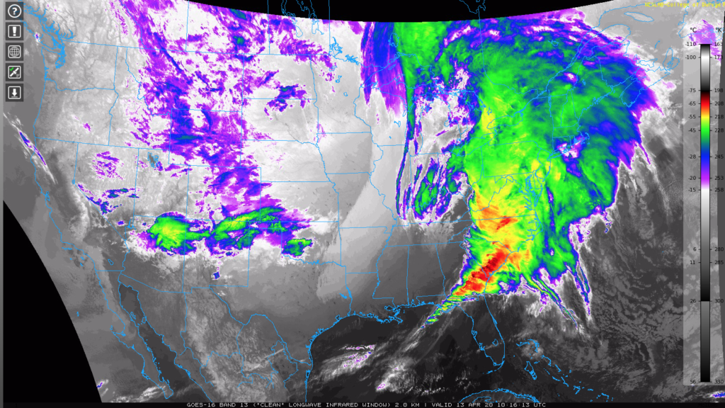
Easter Sunday was a tough day across the Southeastern portion of the country, including a total of 465 severe reports. 53 of those were tornadoes, and the storm system continues to ravage the eastern seaboard this morning. Our thoughts and prayers are with our friends and family across the Southeast as they begin to clean up.
Much colder air has now filtered into the region on the backside of this storm system. We’ve already seen our high for the day (occurred at midnight) and temperatures will remain stuck in the 40s the remainder of the daytime before falling into the 30s this evening.
The big story today will be the wind. Northwest gusts of 40-50 MPH can be expected into the early to middle part of the afternoon before diminishing.
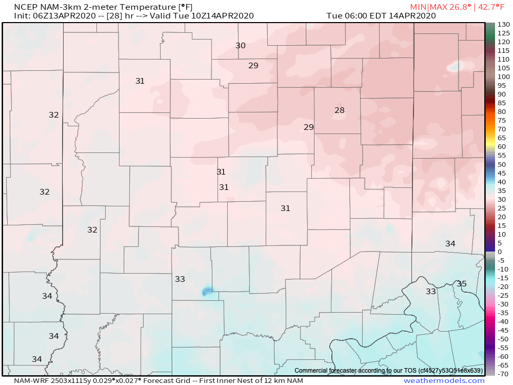
Clouds and wind will diminish tonight and set the stage for a cold night, including areas of frost throughout central Indiana. Most should fall to around 30° but there will be a few reports of upper 20s.
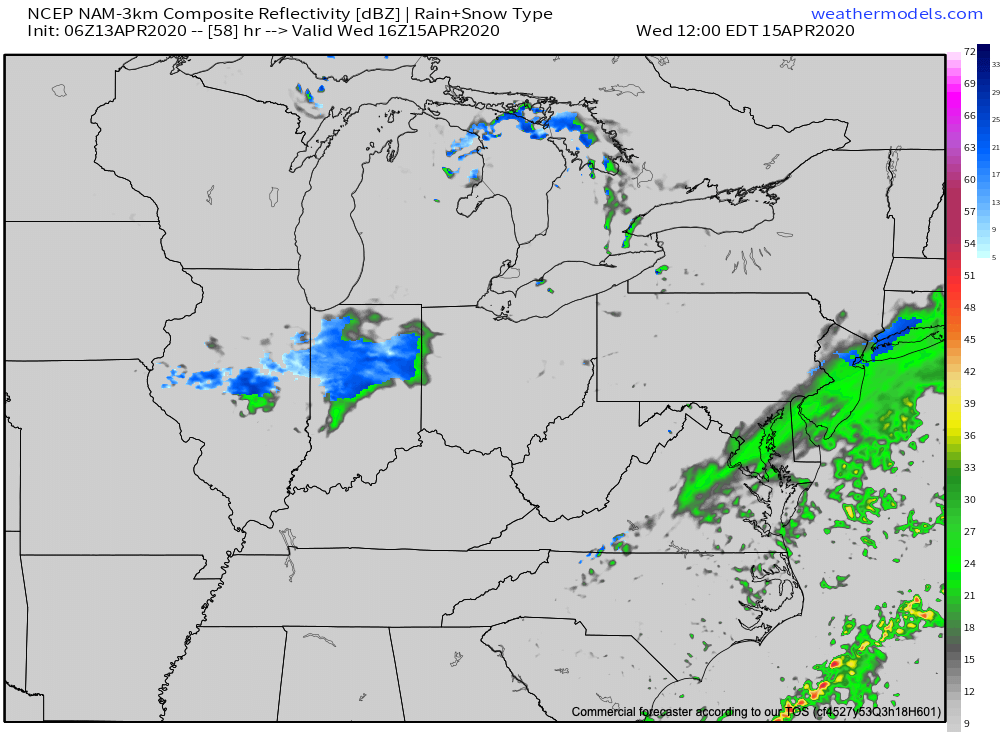
While a couple of instability-driven showers are possible Tuesday afternoon and evening, most of the day should be free of any precipitation. Unfortunately the same can’t be said for Wednesday. An upper level disturbance will track through the central Ohio Valley and this will be responsible for spreading a mixture of rain and snow showers through central Indiana Wednesday morning into the afternoon hours. We’re not expecting much if any snowfall accumulation with this system and precipitation totals, overall, should be light, but it’s certainly not what those ready for spring are wanting in mid-April.
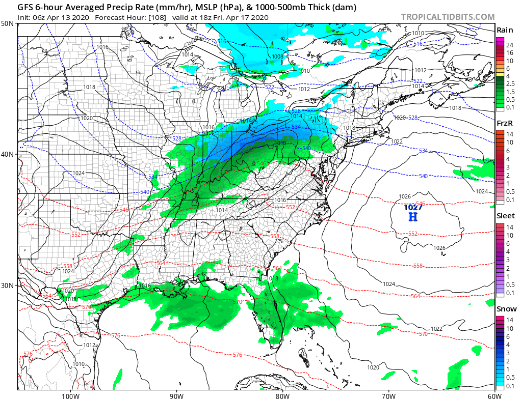
If that wasn’t enough, another (stronger) system is dialed up late Thursday into Friday. It’s this wave of low pressure, combined with the unseasonably cold air mass entrenched across the region, that may lead to wet snowfall accumulation across portions of the region. As of now, we think northern Indiana into northern Ohio stand the chance of picking up some wet snow accumulation and this system will require our attention over the next couple of days.
Thankfully, fleeting high pressure will build overhead to produce a return of the sun and drier conditions by Saturday before our next cold front approaches with showers for Sunday.
In the longer range, the MJO is deserving of our continued focus. Over the weekend, we noted the differences in handling the MJO amplitude between the American and European models, in particular. The European slows things down and keeps us in Phase 2 late-April which would have colder/ drier implications on the late month forecast. Meanwhile, the American models continue to move things into Phase 3 (wetter/ milder). We’ll keep close tabs on this and include another update with our Long Range discussion Thursday.