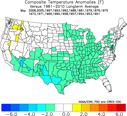
More Evidence Behind Mid-May Shift To Cooler And Drier…

Though May has opened warmer than average (to the tune of 1 degree F above normal, month-to-date), there’s growing evidence behind a shift towards not only a cooler pattern for mid-month, but drier, as well.
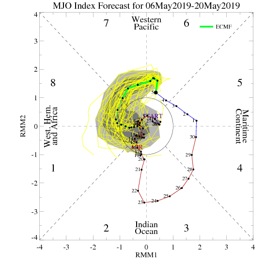
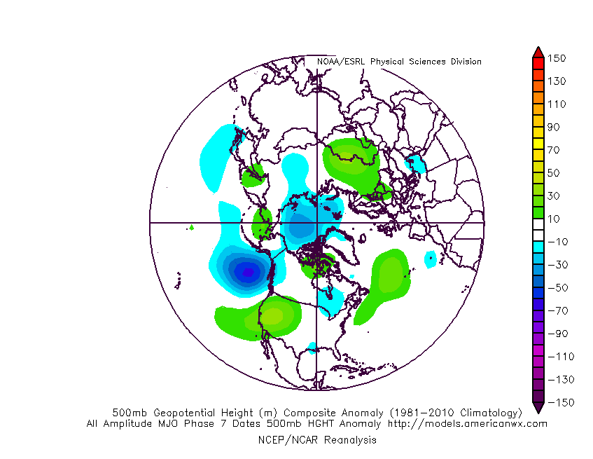
MJO:

The Madden Julian Oscillation is forecast to move through Phase 7 (a cooler phase in May across the eastern half of the country).

PNA:

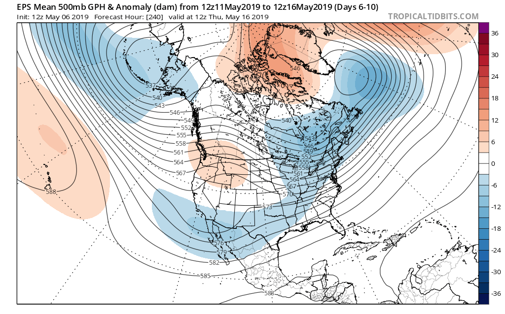
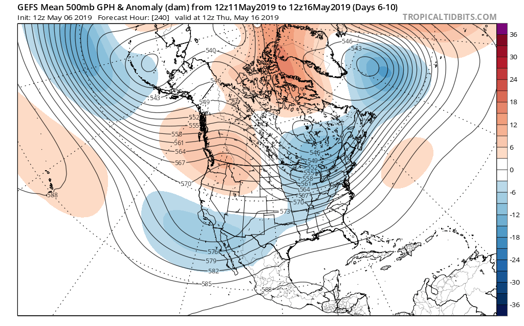
The Pacific North America pattern is forecast to remain positive into mid-May. This favors a cooler than normal south-central into the eastern portion of the country, as well.

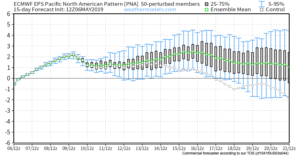
To no surprise, we see modeling now in excellent agreement of the cooler mid-month shift that awaits on deck. Recall that this wasn’t the case last week when the GFS and EPS were in vast disagreement.

The cooler shift also will provide relief from the seemingly unending wet regime we’ve been in as of late.

Hang in there; after a warm, wet open to the month, the pattern will begin to shift around in significant fashion as we move into the weekend and beyond…

VIDEO: All-Access Long Range Update…

This evening’s long range video update discusses the pattern drivers behind the late-March weather pattern…

You must be logged in to view this content. Click Here to become a member of IndyWX.com for full access.  Already a member of IndyWx.com All-Access?  Log-in here.

Snow Update And Looking Ahead Towards Mid-March…

Snow will overspread central Indiana through the late morning hours into the afternoon.

While the overall idea where the accumulating snow would fall was a good one from early week, our initial expected amounts won’t come to fruition. The reason? The storm system is much weaker and faster moving than originally modeled.

Accordingly, this is a 1″ to 2″ type event for most of the area. The majority of the snow will fall from noon to 5p.

A period of snow will scoot across central Indiana from late morning into the early evening hours.

This same storm system will be responsible for a severe weather outbreak, including the possibility of a couple of strong tornadoes, across the Deep South this afternoon.

Back here on the home front, MUCH colder air will pour into the region this evening, remaining in place into the new work week. Back-to-back nights with lows in the upper 0s to lower 10s can be expected across central Indiana Monday and Tuesday mornings.

This is all part of the overall colder than normal first half of March, powered by the SOI crash (several week ago), deeply negative EPO, and MJO rumbling through the cold phases.

Additional storm dates to keep note off include Thursday night into Friday (more of a wintry threat with the 3/7-3/8 system) and Saturday into Sunday (potential strong thunderstorms with the system on 3/9-3/10).

Looking ahead, it still appears the mid-March warm-up is on track as the EPO flips to positive.

With that warm-up will also come a return of heavier precipitation events and a continued overall active storm track across the region. Precipitation looks to run above average for the mid-month stretch.

We’ll dig deeper early week on what lies ahead as we close the month of March and look ahead towards April…

VIDEO: Updated Thoughts Around This Weekend’s Winter Storm And The Pattern Through March…

Here’s our latest thinking around this weekend’s winter storm and a long range update through the month of March…

You must be logged in to view this content. Click Here to become a member of IndyWX.com for full access.  Already a member of IndyWx.com All-Access?  Log-in here.

All-Access Video: Looking Deeper Into The Reasons To The Cold Open To March & Mid-Month Changes…

Discussing the reasons behind the frigid open to March and the mid-month changes that await…

You must be logged in to view this content. Click Here to become a member of IndyWX.com for full access.  Already a member of IndyWx.com All-Access?  Log-in here.