Unsettled Open To The Week And Looking Towards Next Weekend…
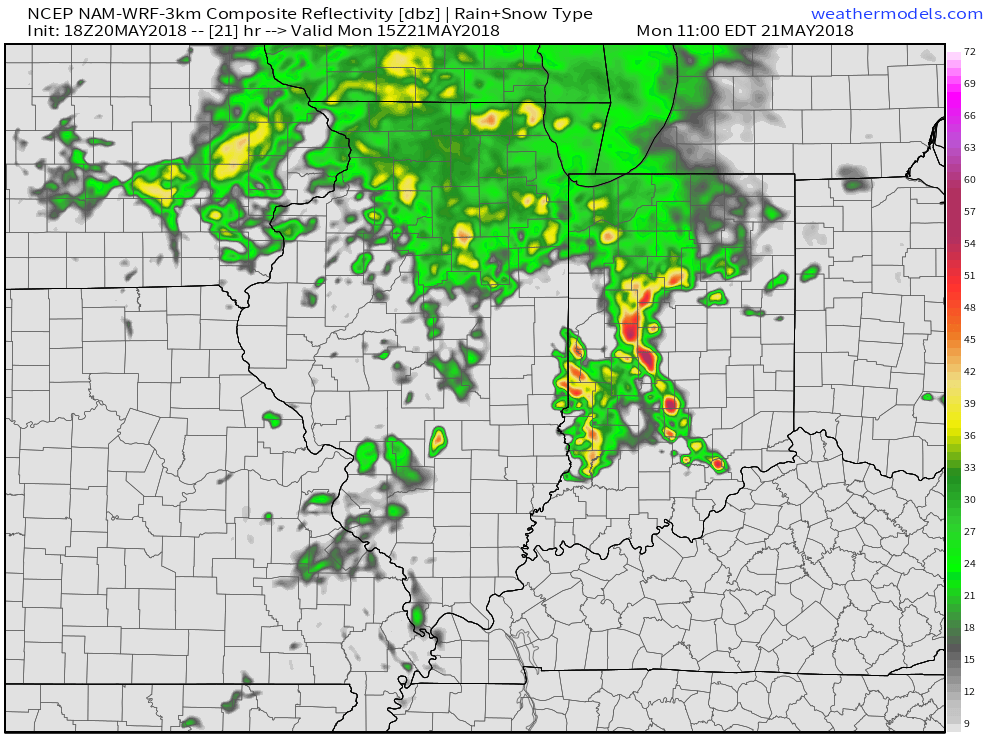
As we type this Sunday evening a few strong storms have developed across east-central Indiana. If your travels take you east this evening, a couple of these storms have been producing large hail and strong winds.
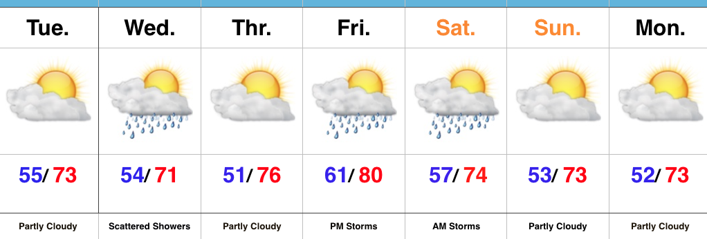
Otherwise, a stalled frontal boundary remains draped across the Ohio Valley and will serve as the focal point for additional shower and thunderstorm development through the early stages of the week. Rainfall coverage will likely be most widespread Monday, and come in a couple waves: Monday morning into early afternoon and again Monday evening.
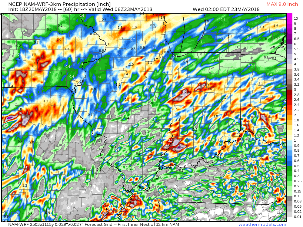
 By the time all is said and done late Monday night and early Tuesday, expect widespread rainfall totals between 0.50″ and 1″ with locally heavier amounts where the stronger storms track.
 High pressure will build into the region through the midweek stretch and result in increasingly sunny and pleasant conditions. With a drier air mass in place, overnight lows will fall into the 50s through the midweek period.
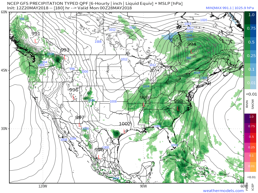
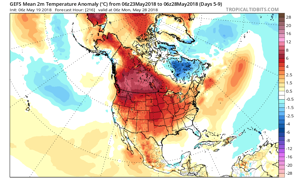
Our attention will then shift to the threat of active times for the Memorial Day weekend, including the 102nd running of the Indianapolis 500. After a mostly dry Friday, shower and thunderstorm chances will be on the increase Friday night through the weekend, continuing into early Monday as of now. While it won’t rain the entire time, it might be a good idea to have a “plan B” in mind at times for the busy upcoming weekend. Models like the idea of a rather significant, albeit likely brief, cool down to close the month…
 Our attention will then shift to the potential of strong thunderstorms late Sunday. Higher resolution guidance suggests storms will begin to rumble into western Indiana late Sunday evening (around 9p to 10p) before tracking east into the overnight hours.
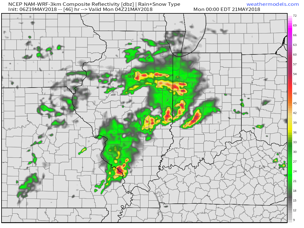 With a stalled front nearby, shower and thunderstorm chances will remain in our forecast into the middle of the week. While it won’t rain the entire time, unsettled conditions will remain into Wednesday before high pressure provides drier conditions Thursday and most of Friday.
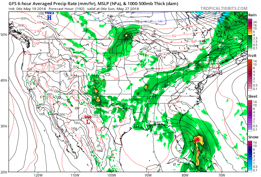
 Highlights:
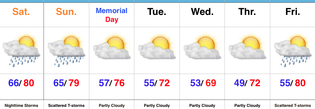 Highlights: