Category: Memorial Day weekend

From One Extreme To The Other…

The work week will get off to the same unusually chilly start we’ve begun to grow accustomed to. Additional frost and freeze threats are present Tuesday and Wednesday mornings if skies can clear (big if there). However, significant changes loom as we flip the page to the second half of the work week and longer term indications suggest we’re well on our way to a true summer-like feel by week 2.

Note how bullish the European ensemble is regarding the significant pattern flip over the next couple weeks.

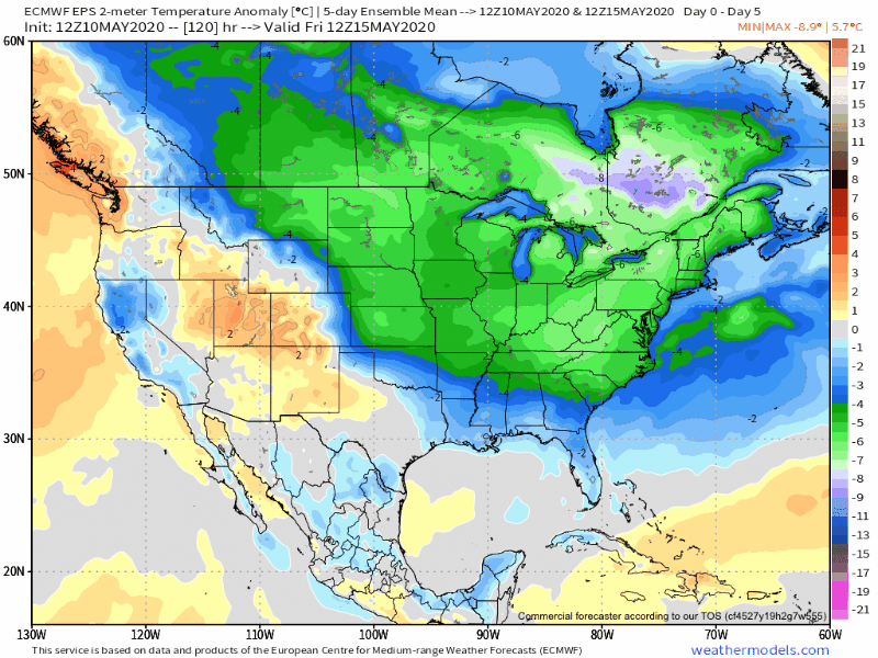
A lot of this is driven by a change in the EPO. This is the kind of pattern that stands to at least threaten sending high temperatures soaring to between 85°-90° between Week 2 and month’s end. Talk about a contrast from the late winter and early spring-like chill to open the month!

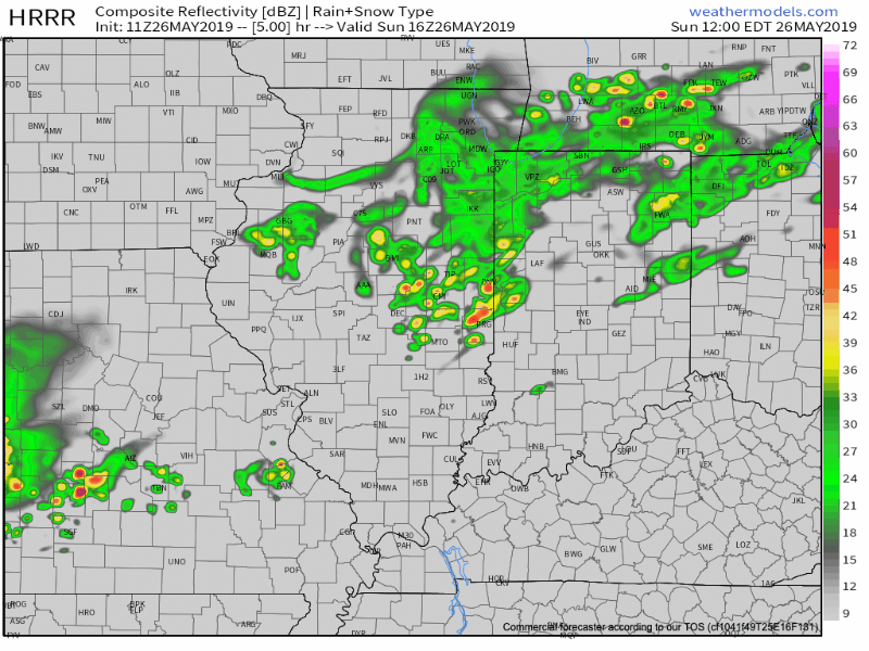
The transition in the pattern is likely to be met with a much more active storm track through the area beginning midweek. There will be a threat of locally heavy rain and stronger storms that will continue at times into the weekend and beyond into next week, as well.

For a month that’s gotten off to a dry start, we’ll likely recover quickly with this wetter regime that accompanies the flip to warm.

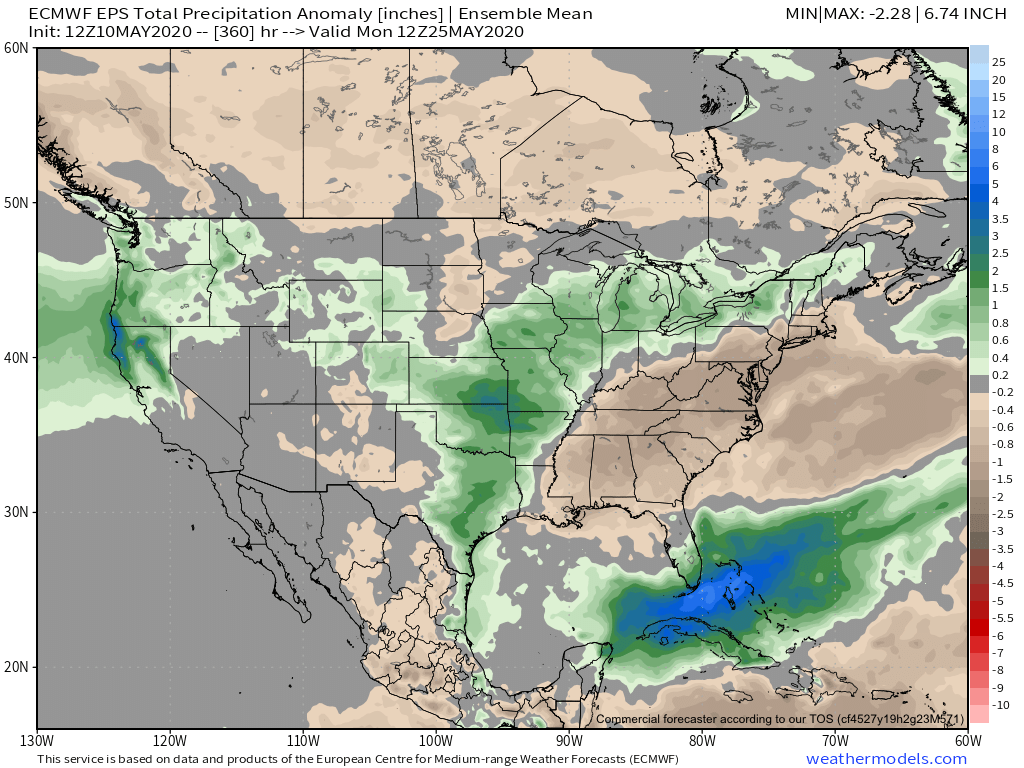
We continue to believe most central Indiana neighborhoods will see between 1.75”-2.25” late week into the weekend, but there will be locally heavier amounts. The majority of data also suggests a corridor of wetter than normal conditions sets up from the Plains into the northern Ohio Valley/ Great Lakes into Week 2.

Stay tuned.

Permanent link to this article: https://indywx.com/from-one-extreme-to-the-other/

VIDEO: Stage Set For Record Cold Saturday AM; Updated Long Range Thoughts Towards Memorial Day Weekend…

You must be logged in to view this content. Click Here to become a member of IndyWX.com for full access.  Already a member of IndyWx.com All-Access?  Log-in here.

Permanent link to this article: https://indywx.com/video-stage-set-for-record-cold-saturday-am-updated-long-range-thoughts-towards-memorial-day-weekend/

VIDEO: All Modes Of Severe Weather Possible This Evening; Another Unsettled Week On Deck…

You must be logged in to view this content. Click Here to become a member of IndyWX.com for full access.  Already a member of IndyWx.com All-Access?  Log-in here.

Permanent link to this article: https://indywx.com/video-all-modes-of-severe-weather-possible-this-evening-another-unsettled-week-on-deck/

Stormy At Times For The Indy 500…

We’ve dealt with one round of showers and thunderstorms already this morning, but the bulk of the action remained north of the immediate area. Accordingly, there will be a greater chance of redevelopment this afternoon across central Indiana. A few of these storms could reach strong to severe levels with damaging winds and large hail the primary concern.

Don’t be surprised if future updates from the Storm Prediction Center (SPC) “pull” this Slight Risk area northward to include Indianapolis. Regardless, the ingredients are in place for a couple of severe cells this afternoon, locally, and it’ll be important to remain weather-aware.

While a shower is still possible this morning, thunderstorm coverage will likely increase in earnest between 1p and 4p. Locally heavy downpours and vivid lightning are a good bet with any storm that develops today.

The other item race goers will have to deal with today will be the heat and humidity. Heat indices will flirt with 90 out at the track this afternoon.

Another active day is dialed up for Memorial Day, itself, across portions of the state. More on this and beyond in another update later today.

Permanent link to this article: https://indywx.com/stormy-at-times-for-the-indy-500/

VIDEO: #Indy500 Update And #AGwx Report…

You must be logged in to view this content. Click Here to become a member of IndyWX.com for full access.  Already a member of IndyWx.com All-Access?  Log-in here.

Permanent link to this article: https://indywx.com/video-indy500-update-and-agwx-report/