Client LR Update: Flip On Deck…

Updated 04.09.21 @ 6:45a

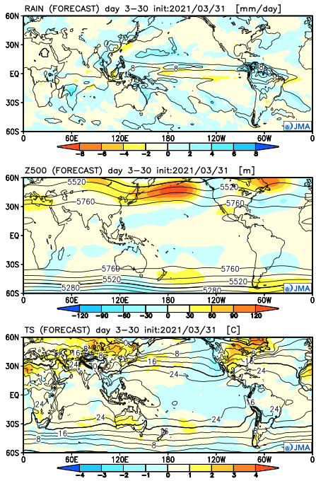
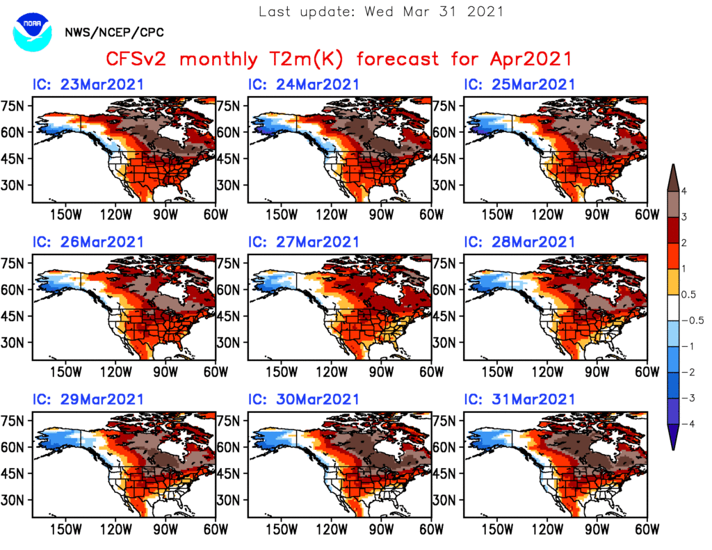
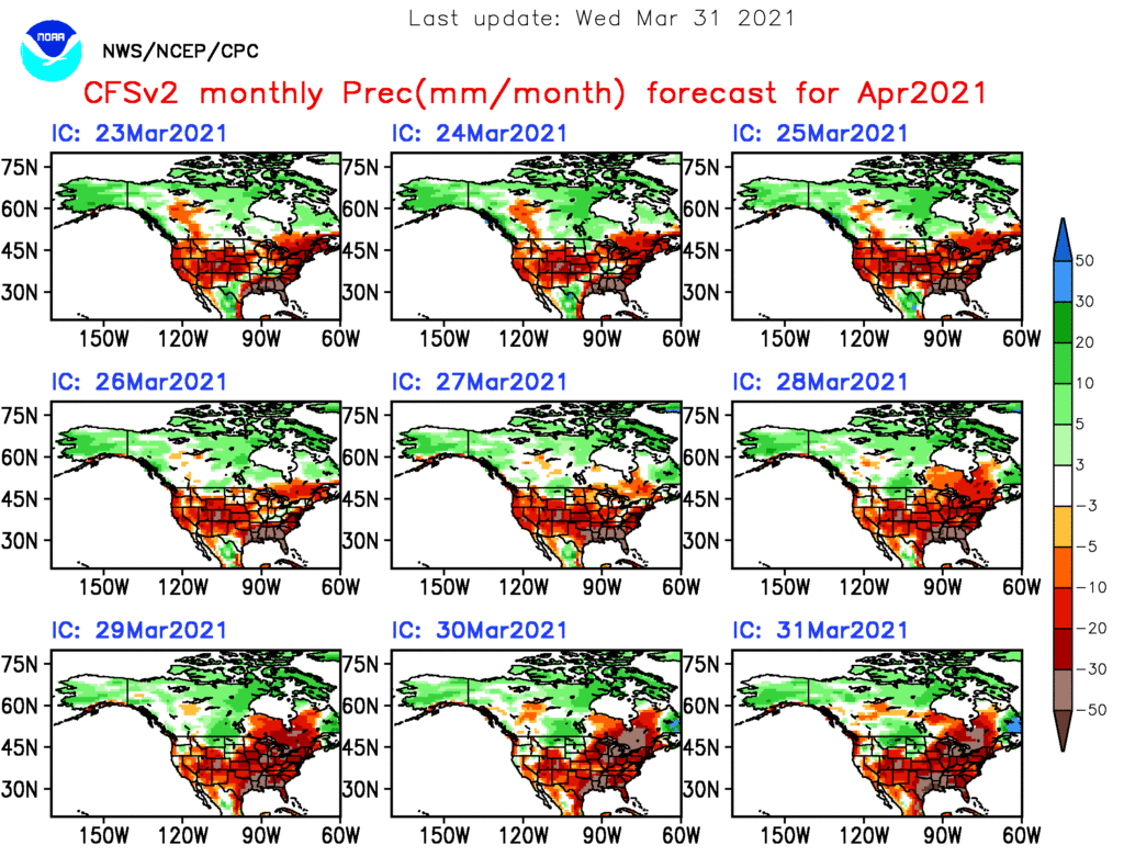
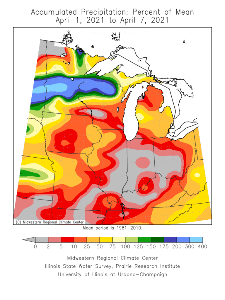
Month-to-date, April has opened up quite warm (little more than 5° above normal) and dry (half inch below normal) across central Indiana.

There are changes on the horizon that will at least result in significantly cooler times ahead. While the transition will be accompanied by an unsettled, wetter stretch, the long range pattern appears to continue the overall recent dry theme.

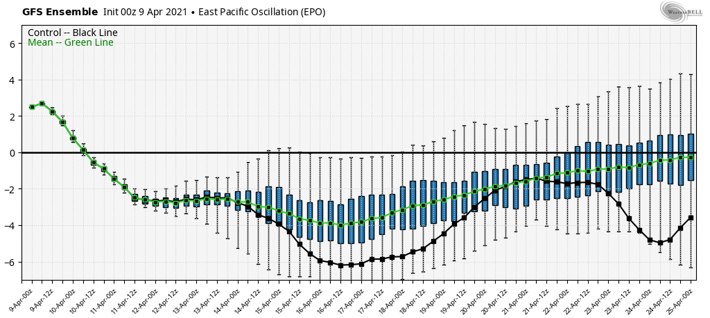
The drivers behind the cooler shift ahead have to do with the EPO and NAO going negative.

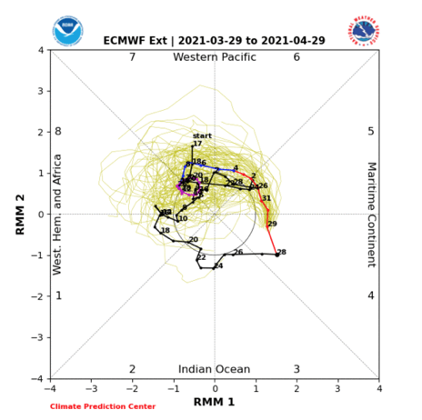
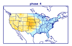
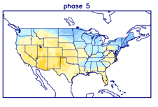
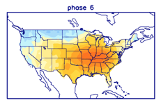
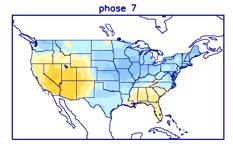
Additionally, the MJO is going to rumble through Phase 7. This is the interesting driver as a stall in Phase 7 would allow for an extended period of colder weather, whereas if things remain amplified and we blow right into Phase 8, the cooler period will be brief. As it is, it appears the latter is more likely from this distance.

That would produce an 8-10 day stretch of cooler conditions (centered on mid-month) before a modifying trend as we close April. Within this cooler stretch a late season frost threat is present towards the middle to latter part of next week.

To reiterate, after the wet period in the short-term, this is still an overall dry pattern (relative to normal) through mid month.

We’ll keep a close eye on the MJO for any potential delay in bringing back the warmth, but the idea here is the look of getting into Phase 8, combined with the NAO and EPO returning to neutral/ positive, milder times should return towards late month.

April 2021 Outlook…

Updated 04.01.21 @ 7:43a

While April is getting off to an unusually cold start for a good chunk of the country, this (thankfully, for most) won’t be the theme for the month, as a whole. We anticipate a quick bounce back in the temperature department over Easter weekend and on into next week. We’ll let our shorter term products handle that and focus more on the month, overall, with this post.

Let’s take a look at some of the various modeling for the month of April.

JMA take-away: large scale drier than normal conditions with widespread warmth (exception being the immediate West Coast and Southeast).

CFSv2 take-away: widespread warmth through the central and north along with widespread drier than normal conditions (exception being the northern Rockies/ western Plains).

European Weeklies take-away: large scale drier than normal with warmth through the central, upper Midwest, and Northeast.

From a teleconnection perspective, you know we really like to key in on the NAO this time of year. Should that flip negative, then blocking would likely force a colder pattern into our immediate part of the country (can also lead to wet times, as well). That doesn’t appear to be the case this year- at least over the next few weeks. Perhaps what’s more interesting is the MJO as it’s showing signs of wanting to be more amplified throughout the coming weeks.

You get a transitional theme in the temperature department as the MJO traverses phases 4-7 this time of year:

The one constant (exception being Phase 7) is relative warmth throughout the Plains.

Given all of the above, we’re leaning towards a widespread warmer than normal month and relatively quiet month, as well, given the time of year.

Note On The Spring Severe Weather Season And Long Range Update…

Updated 03.18.21 @ 6:40p

You must be logged in to view this content. Click Here to become a member of IndyWX.com for full access.  Already a member of IndyWx.com All-Access?  Log-in here.

VIDEO: Short-Term Update; Looking Ahead To Late March…

Updated: 03.11.21 @ 8a T-storm chances ramp up across central IN into the early afternoon. We trend cooler over the weekend and rain returns Sunday. More on this and a…

You must be logged in to view this content. Click Here to become a member of IndyWX.com for full access.  Already a member of IndyWx.com All-Access?  Log-in here.