Category: Long Range Discussion

The Long Awaited Shift To More Winter-Like Conditions Begins…

Updated 01.01.22 @ 8:06a

From our family to yours, here’s wishing you a happy, healthy, and prosperous 2022!

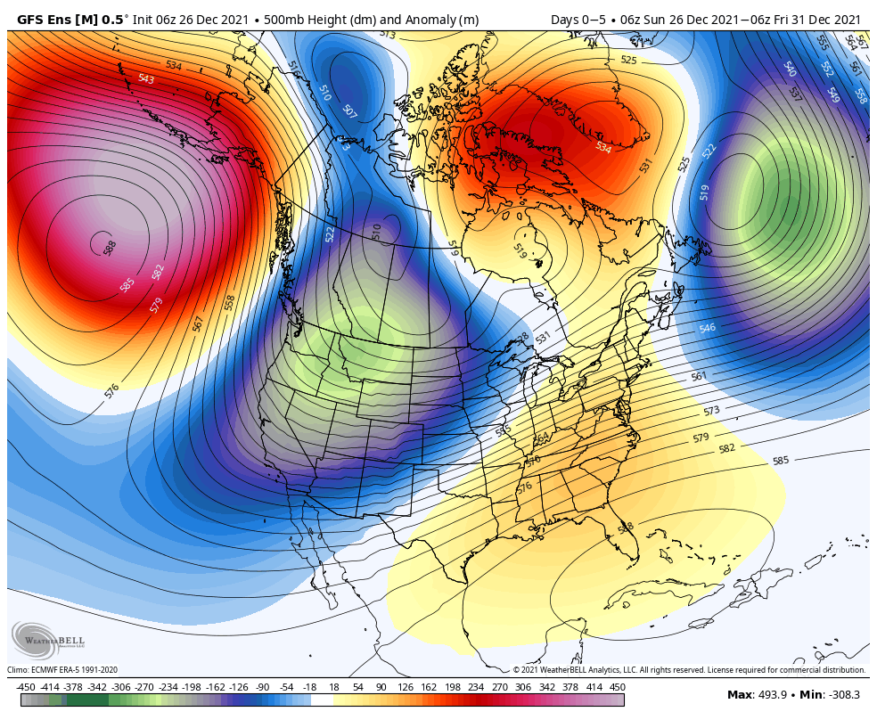
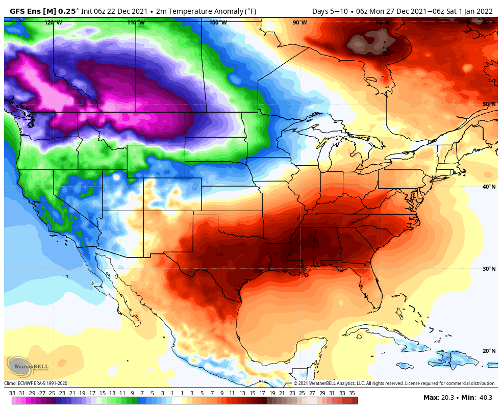
As we embark on a new year, a new weather pattern will take hold. Consider the drastic difference of going from a regime that’s been much more October or November-like (December ‘21 temperatures ran a stunning 8.8° above average on the month) to one that will feature a series of reinforcing blasts of cold air- at what’s traditionally the coldest time of the year.

Temperatures ran well above normal in December from the Plains into the Ohio Valley, Great Lakes, and East.
A flip in the overall regime will drive cold over the upcoming couple weeks into the very place December was warm.

The reasons behind the shift in the pattern start with the MJO moving into Phase 8.

Can we amplify things into Phase 1 towards mid month? The American modeling suggests that’s on the playing field. Meanwhile, the Euro wants to take things towards the neutral phase. If we can swing into Phase 1, the ante would be upped for “locking” the cold in for the 2nd half of the month.


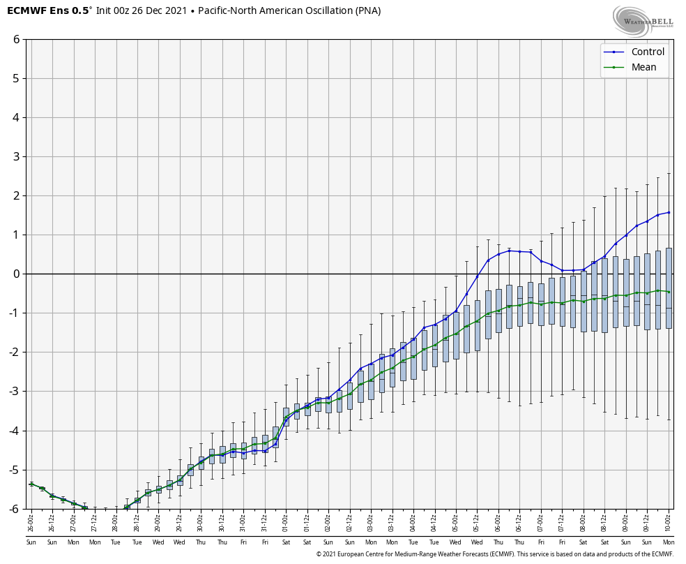
As it is, the majority of teleconnections are being “forced” (byproduct, in my opinion, of the MJO) into more favorable phases for cold. Remember, only a couple days ago this wasn’t being shown, but as the data is understanding the driving force (MJO movement), the EPO is joining the PNA and WPO colder camp. I would expect the AO trend to follow suit in the week ahead.

More on all of this in the AM, including the opportunities for snow and wintry precipitation (more than the novelty level stuff we’ll deal with early Sunday AM) in the weeks ahead…

Permanent link to this article: https://indywx.com/the-long-awaited-shift-to-more-winter-like-conditions-begins/

VIDEO: More Significant Storm As We Usher In The New Year; Long Range Update…

Updated 12.30.21 @ 8a

You must be logged in to view this content. Click Here to become a member of IndyWX.com for full access.  Already a member of IndyWx.com All-Access?  Log-in here.

Permanent link to this article: https://indywx.com/video-more-significant-storm-as-we-usher-in-the-new-year-long-range-update/

For Now, It’s A Tale Of The MJO And PNA…

Updated 12.26.21 @ 7:38a

Over the past couple of weeks, several of the teleconnections (EPO, AO, and NAO) have been in favorable phases for cold air to take up residence in our neck of the woods. However the combination of Phase 6 of the MJO (image 1 below) and a deeply negative PNA (image 2 below) have fought off any sustained or significant cold.

As we look ahead, there are changes in both of these critical pattern drivers. First, the MJO looks to continue progressing deeper into Phase 7. This is significant as today, though while officially in 7, we’re really still feeling the effects of 6. There’s a lean from guidance that Phase 8 is also within reach as we get towards mid-January, but we won’t get greedy. 🙂 
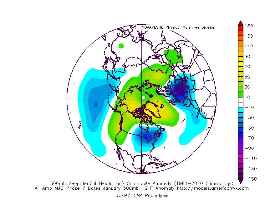
If we can at least get deeper into 7, that will greatly lessen the influence of the warmth that continues to linger with Phase 6.

Note how the trough likes to settle into the eastern portion of the country during these phases.

That then brings us to the PNA. Guidance is trending things closer to neutral towards Day 10. This is significant as it would allow the southeastern ridge to at least get beaten down (not totally squashed as long as we remain negative), but certainly enough to allow the cold currently bottled up out west to bleed east.

This can be illustrated best by looking at the 500mb pattern evolution over the next couple weeks per the latest GFS ensemble below.

To summarize, while we still have warm days ahead of us, there does at least appear to be a couple trends heading in the right direction for all of those longing for colder and potentially more wintry times as we get past the new year.

Hang in there you snow lovers. It’s far too early to jump off the ship…

Permanent link to this article: https://indywx.com/for-now-its-a-tale-of-the-mjo-and-pna/

VIDEO: Busy Short-Term Pattern; Drivers Behind The Regime Into Mid-January…

Updated 12.24.21 @ 7:35a

You must be logged in to view this content. Click Here to become a member of IndyWX.com for full access.  Already a member of IndyWx.com All-Access?  Log-in here.

Permanent link to this article: https://indywx.com/video-busy-short-term-pattern-drivers-behind-the-regime-into-mid-january/

The Beat Goes On And On And On…

Updated 12.22.21 @ 7:45a

Average temperatures on the 22nd of December include a high of 38.6° and a low of 24.7°. We’ll be slightly under those levels today in what can be termed an “island” of cold in a “sea” of warmth. In fact, the month is running close to 7° above normal thus far.

Highs today will top out in the lower to middle 30s for most of central Indiana.
December 2021 has featured widespread above normal temperatures, centered across the s-central Plains into the TN and OH Valleys.

As we look towards the all-important Christmas forecast, quiet weather will carry us into Christmas Eve. That’s when we’ll tighten the pressure gradient and build in southwest gusts of 30 to 40 MPH.

Those southwesterly winds will transport a few scattered light showers into the region Christmas Eve evening into Christmas Day, but these won’t be a big deal. “Scattered” and “light” are the key words.

What will be a big deal are the temperatures. In fact, latest guidance is pointing towards a new record high on Christmas Day. Should we see any sunshine get into the mix, this will be easily achievable.

Modeled high temperatures on Christmas afternoon.
A look at Christmas Day records in Indianapolis, IN

Thereafter, the same general pattern remains intact, locally (- PNA ridge), but notice the cold bleeding into the West between Christmas and New Year’s. Does this eventually make progress east? We think so as we get into January…

Permanent link to this article: https://indywx.com/the-beat-goes-on-and-on-and-on/