Updated 02.05.24 @ 6p Potential is on the increase for a period of notable cold during late-February. We look into this along with the staying power, and early thoughts on…
You must be logged in to view this content. Click Here to become a member of IndyWX.com for full access. Already a member of IndyWx.com All-Access? Log-in here.
Updated 02.05.24 @ 7:30a This week will be about as quiet and mild as it gets around these parts for early-February. Enjoy, friends. A weak frontal boundary will slip through…
You must be logged in to view this content. Click Here to become a member of IndyWX.com for full access. Already a member of IndyWx.com All-Access? Log-in here.
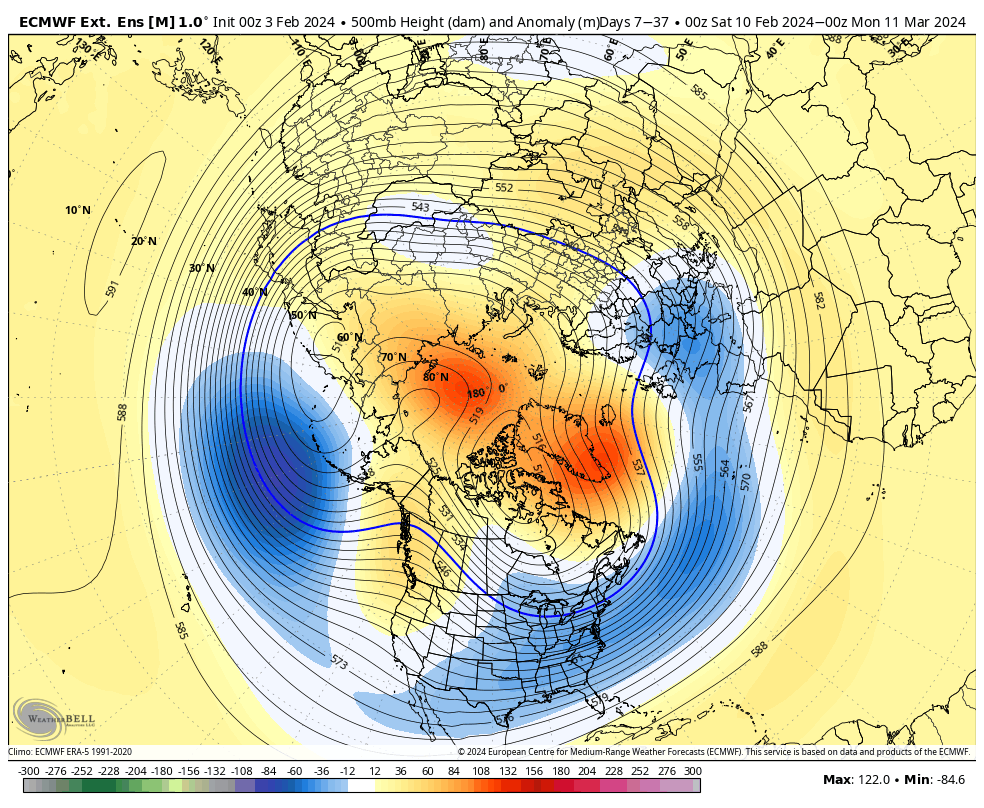
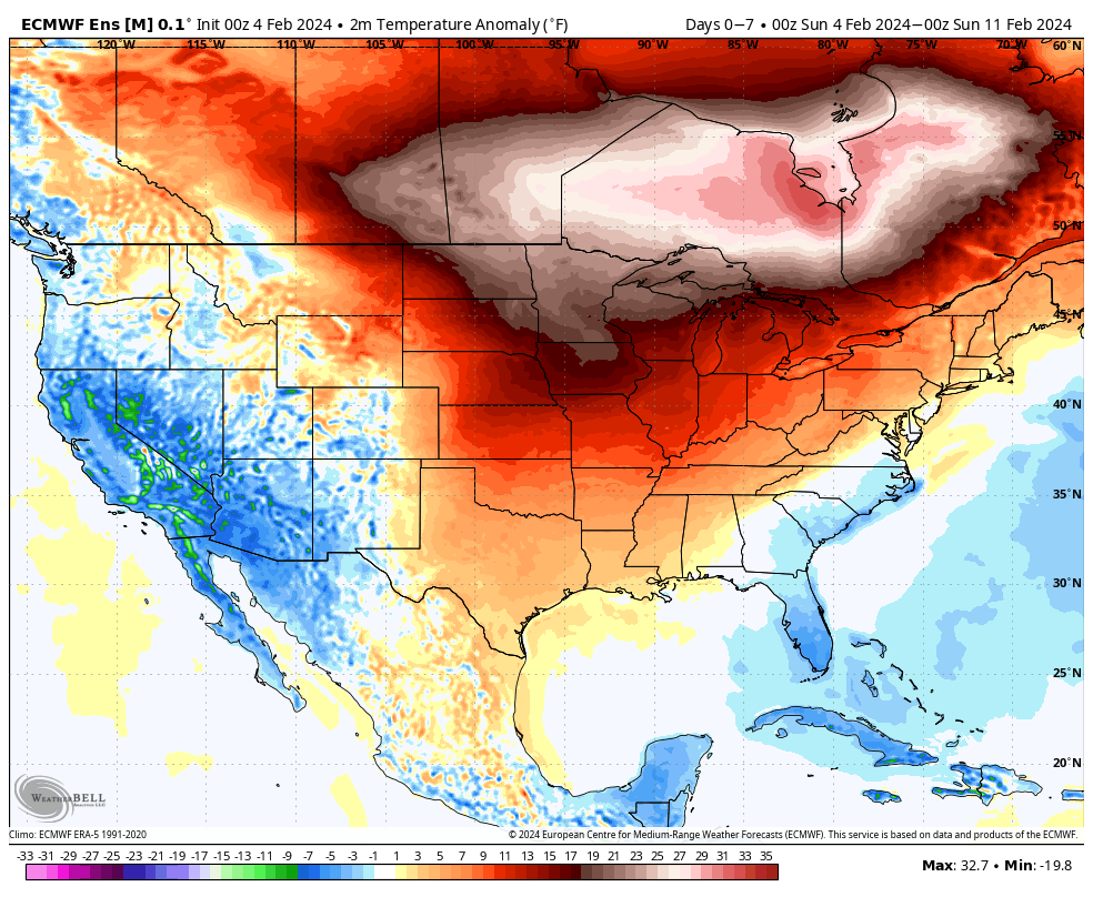
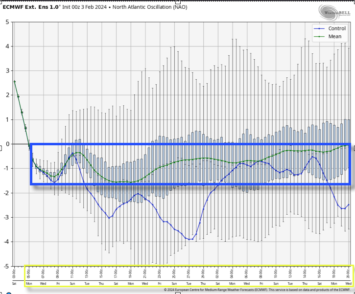
The coming pattern change back to cold has been long advertised and fits the overall theme of El Nino winters. The question now centers squarely on not “if” the cold is going to return, but just “how” cold will it get? Should we spend time in Phase 8 then the door opens for another opportunity to rival the magnitude of cold we saw in January. The strongly negative AO and NAO argues for pronounced high latitude blocking to develop yet again, and likely with more staying power than our January blocking episode.
500mb pattern Feb. 10 – Mar. 10
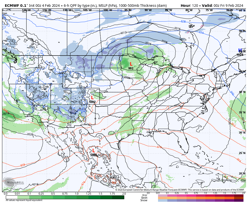
But enough about the return of below normal temperatures. What is the longer range guidance suggesting as far as the overall precipitation pattern goes? During the pattern “transition state” (late week into Week 2), we favor a more active precipitation pattern as at least (2) more organized storm systems should roll through the Ohio Valley. Specifically, we’re targeting a system 2/8 into 2/9 followed by a more organized and heavier precipitation maker in the 2/11 -2/13 timeframe.
Beyond mid-month, the majority of extended, long range forecast models highlight a drier than normal pattern returning to the picture. This is forecast to continue into the 1st half of March. A more active (wet) pattern is forecast for the Southeast. Not shocking, especially given the anticipated colder than normal regime.
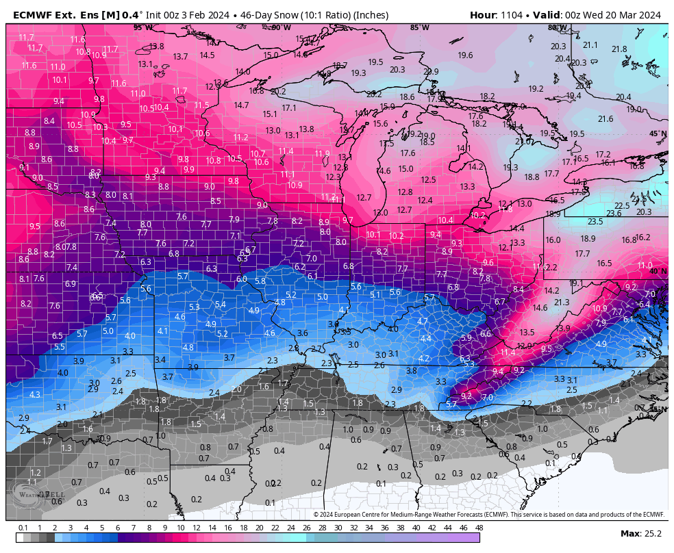
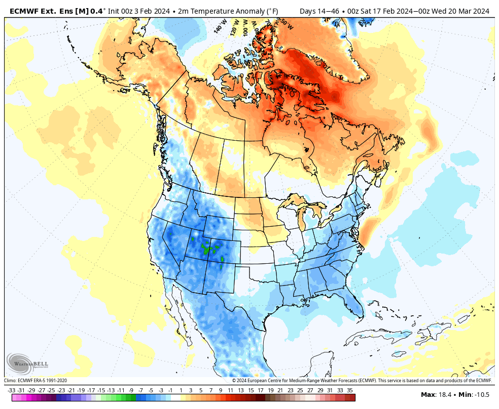
This doesn’t mean snowfall will run below average, but it’s also impossible to get specific with winter storm potential more than a week out. While we’ll keep an eye on next weekend, the threat of winter weather potential will increase through the 2nd half of the month and into the 1st half of March with the colder pattern returning. The latest ensemble guidance is bullish on a snow pattern emerging during that time period.
Perhaps we’re gearing up for a busy 2nd half of the season?
An unseasonably mild and quiet week is on tap. We aren’t forecasting rain to return into the picture until late week and the upcoming Super Bowl weekend. Highs will likely flirt with, if not exceed, the 60° mark Friday ahead of a frontal passage.
An unseasonably mild week is on tap.
Highs will flirt with, if not surpass, the 60° mark Friday.
After Friday’s FROPA, we’ll watch the trailing, more significant piece of energy impact the Ohio Valley next weekend. Obviously, it’s far too early to determine if we’re talking about more rain and/ or snow, but the initial hunch here is that this should be primarily a liquid event, despite the snowy solution on the overnight European model. We’ll watch carefully in the coming days.
The more active pattern late week and over the weekend is a signal that the pattern is changing. Once again, we believe that we’re heading into more of a prolonged version of what we dealt with in January, thought the jury is still out on the extreme solutions on the table with respect to just how cold (should we get into Phase 8 of the MJO then look out). As it is, the teleconnection suite aligning in a manner that they are is reason enough to be fired up on an all-out return of winter for mid-February. The forecasted strongly negative NAO (North Atlantic Oscillation) provides us with a greater than normal confidence level that this cold pattern will have staying power not only through the remainder of the month, but into the 1st half of March (at least).
Latest long range modeling highlights the prolonged nature of the cold pattern:
Updated 02.03.24 @ 10:12a The calm weather pattern that we’ll enjoy this weekend is giving us time to look ahead to a significant pattern transition to La Nina and the…
You must be logged in to view this content. Click Here to become a member of IndyWX.com for full access. Already a member of IndyWx.com All-Access? Log-in here.