Another Nice Weekend In The Middle Of An Unsettled Pattern…

The upcoming 7-10 days looks unsettled overall and quite wet.  That said, we’re set to enjoy another beautiful weekend with a refreshing northeast breeze in play.  We discuss this and look deeper into the month of June in this evening’s video update below!

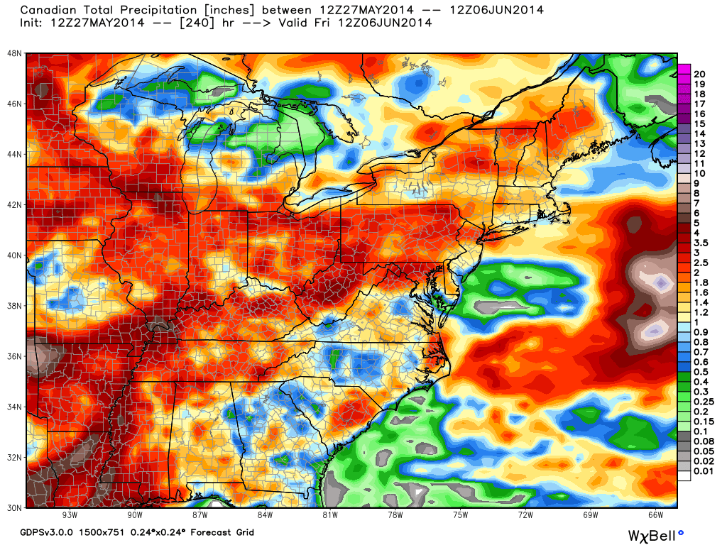
Latest model data suggests widespread 2-3" of rain could fall across central Indiana over the course of the upcoming 7-10 days.
Latest model data suggests widespread 2-3″ of rain could fall across central Indiana over the course of the upcoming 7-10 days.

Indy Weather Recap And A Look Ahead

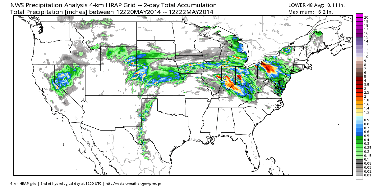
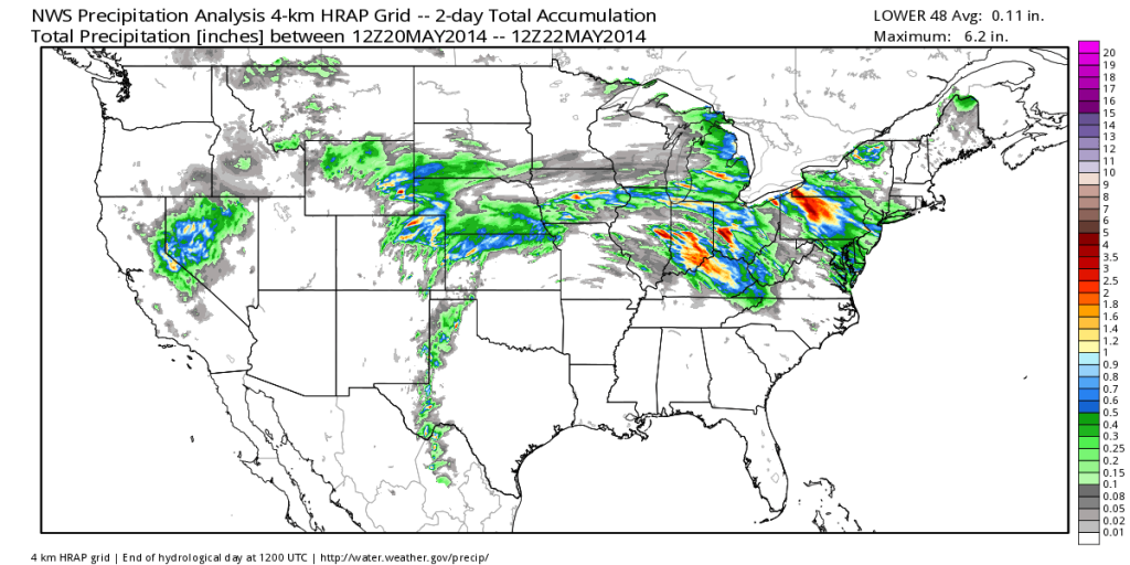
Wednesday was a stormy day across central Indiana, including damaging wind and hail. Flooding was also a concern in some areas.  Officially here at IndyWx.com HQ we picked up 2.21″ of rain Wednesday- most of which fell in a 3 hour time period.  Here’s a cool image from the fine folks at Weatherbell Analytics showcasing the heaviest rainfall.
nws_precip_conus2_2

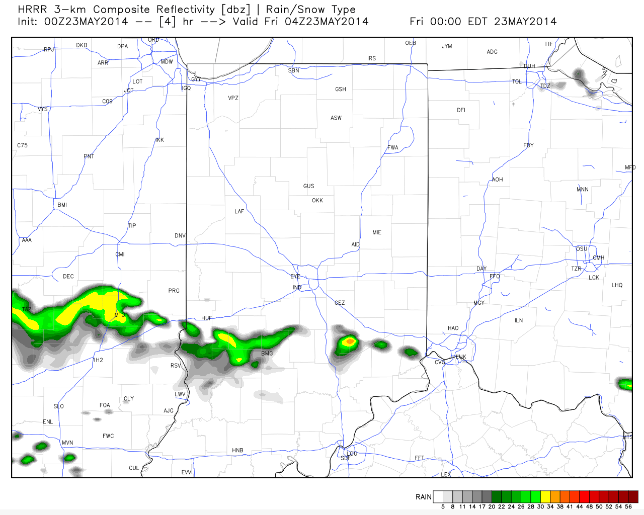
Despite a couple of showers (primarily south of the city) later this evening the upcoming three days will be beautiful and rain-free!
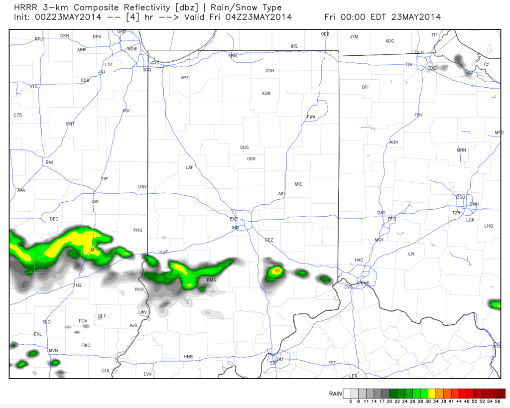
hrrr_ref_indy_5

Temperatures are trending cooler when compared to 24 hours ago and as noted here by the 24 temperature difference, the cooler air to our north will continue to push south tonight.

t0

Temperatures and humidity levels will be below normal levels the next couple days before warmth slowly builds Sunday.  Lows Saturday morning will dip into the upper 40s for several communities.
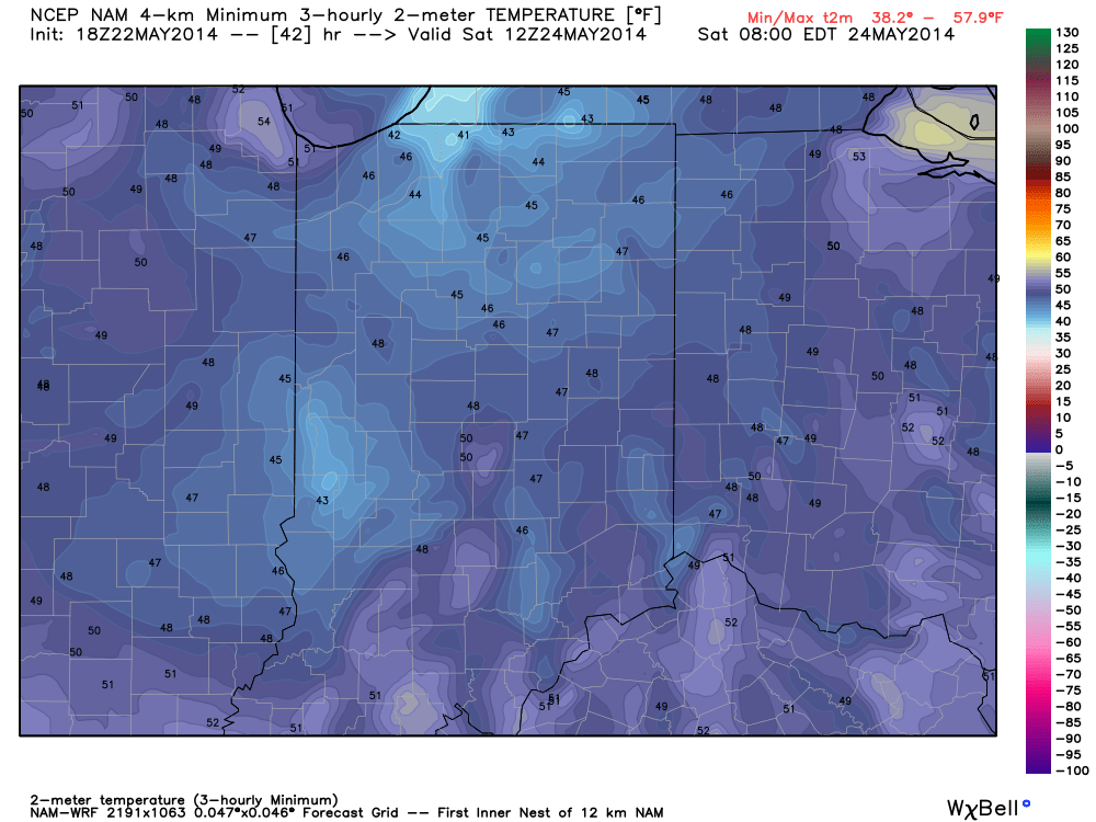
hires_t2m_min_indy_14

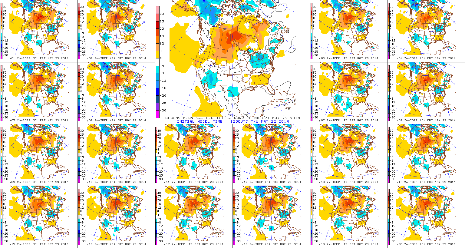
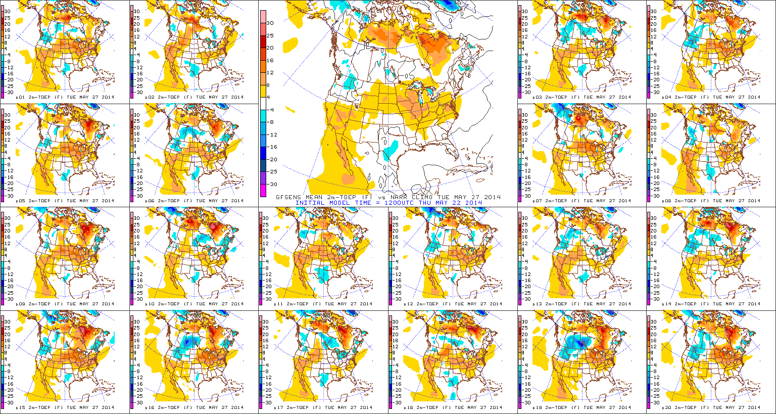
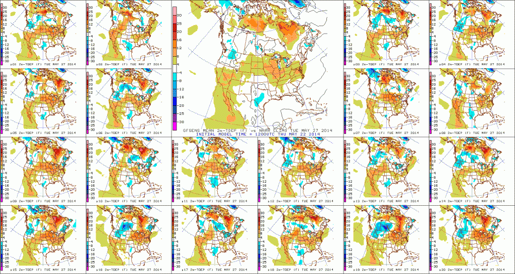
True summer-like heat and humidity will lift north Memorial Day into Tuesday.  Note the temperature anomalies do an about face from Day 1 to Day 5.  Heat and humidity will be on the rebound for the unofficial start to summer, but, as noted above, should remain in the “comfy range” for race day.
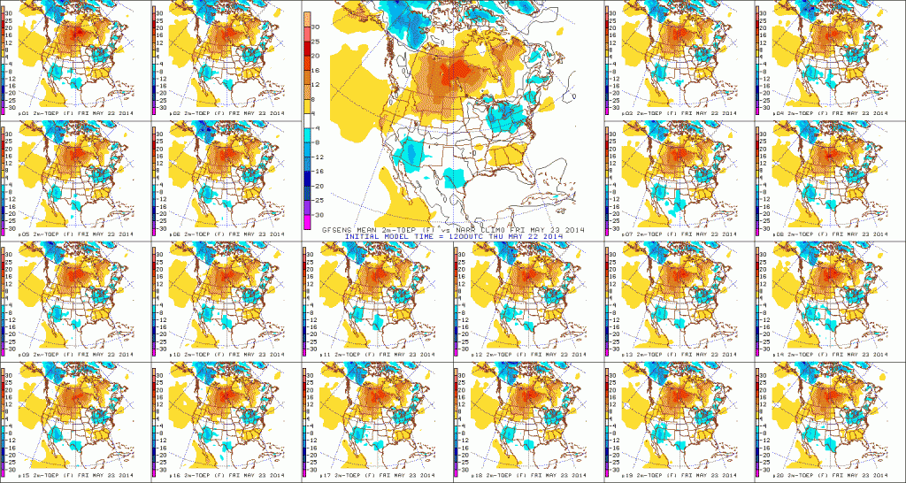
D1

D5

With the increasing warmth and humidity will come a return of scattered shower and thunderstorm chances early next week.

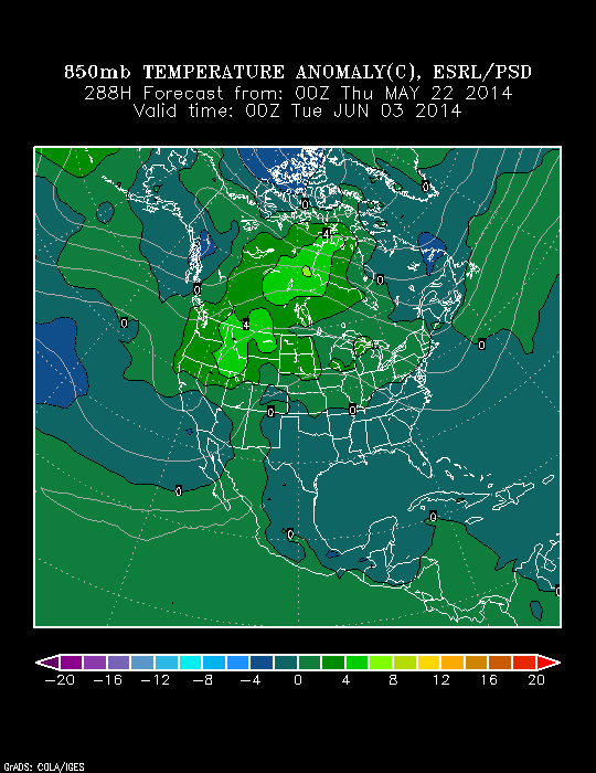
As we look forward to early June, there are indications it could open on the warm side.  Note relative agreement between the CFSv2 (Climate Forecast System version 2), NAEFS, and Physical Science Division model.  Does the warm pattern stick and hold?  Not so fast, my friend… 😉
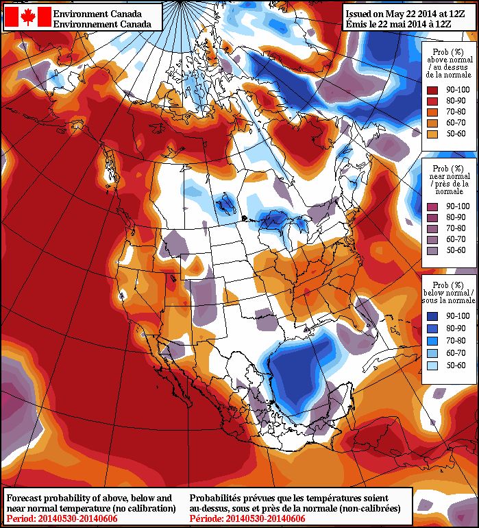
2014052212_054@007_E1_north@america_I_NAEFS@TEMPERATURE_anomaly@probability@combined@week2_186wk1.wk2_20140521.NAsfcTt850_anom_f288_ussm

Lots Of Weather To Talk About…

There are growing concerns about quite the rainy and cold close to April and open to May. We’ll discuss that in a bit. The month so far has been cold…

You must be logged in to view this content. Click Here to become a member of IndyWX.com for full access.  Already a member of IndyWx.com All-Access?  Log-in here.

Where We’ve Been And Where We’re Going…

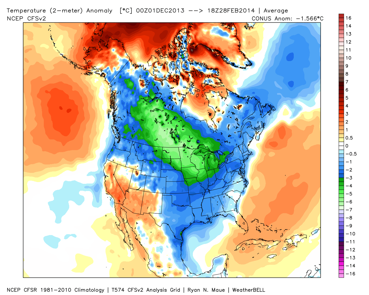
It was a cold winter across the Lower 48, including Indiana:

2

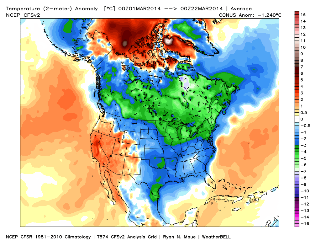
March has followed suite, month-to-date:  Cold continues for the majority of the upcoming week, but we note moderating late week temperatures.

1

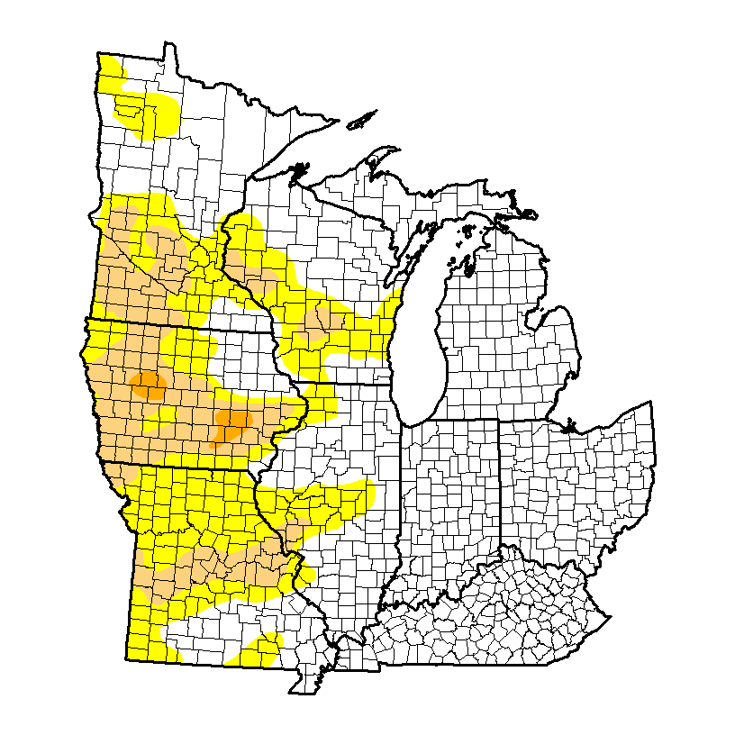
It’s been dry as of late, but after a snowy winter, the region is doing just fine from a drought perspective.  We note abnormally dry conditions west:

4

Latest CFSv2 data points to a wet spring ahead.  We also note the latest European weeklies suggesting a potentially “busy” 1st half of April, including a couple of “bowling ball” systems of note.  With the changing seasons, it’s not unusual to see big spring cut off lows slowly moving through portions of the country.

3

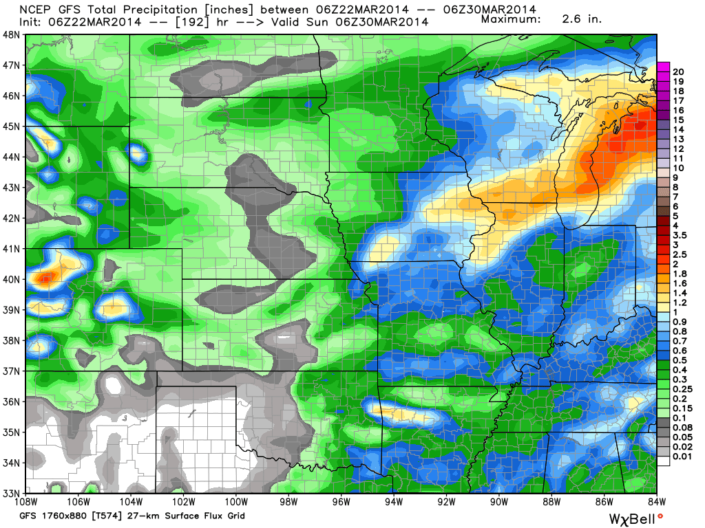
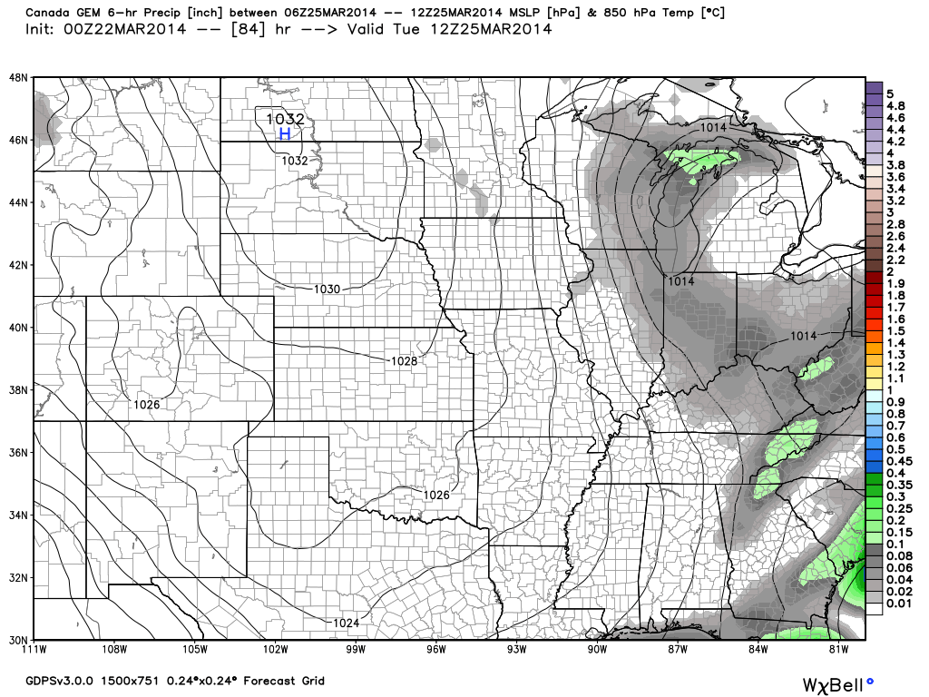
Note the GFS (7-day) and Canadian (10-day) precipitation forecast:

56

We also are still forecasting light snow Tuesday.  Most of this won’t accumulate with the high sun angle and low snowfall rates, but a brief coating to less than an inch is possible in spots:

78

Video Update On The Mid Month Storm Brewing…

We wanted to take the time to quickly update you on a couple of very minor events in here tomorrow evening and again Saturday.  Additionally, we’re monitoring the prospects of…

You must be logged in to view this content. Click Here to become a member of IndyWX.com for full access.  Already a member of IndyWx.com All-Access?  Log-in here.