|
Sun.
|
Mon.
|
Tue.
|
Wed.
|
Thr.
|
Fri.
|
Sat.
|
|

|

|

|

|

|
|
|
|
16/ 25
|
15/ 33
|
20/ 39
|
24/ 42
|
35/ 57
|
28/ 45
|
28/ 50
|
|
0.00”
|
1-3″ (and ice)
|
0.00”
|
Trace
|
0.50″-1.00″
|
0.00″
|
0.00”
|
Forecast Updated 02.16.14 @ 11:15a
Cold Sunday…Fresh off celebrating our snowiest winter on record (surpassed last night at IND at 51.6″ and the Record Event Report can be found here), we’ll enjoy a dry day, but blowing and drifting snow will remain an issue in the open country. A few breaks in the cloud cover can be expected this afternoon on what will otherwise be a rather cloudy day. Highs will only climb into the lower to middle 20s (well below the average high of 40 and closer to the normal low of 24). Yes, our cold, snowy winter just keeps on keepin’ on!
Snow And Ice Issues Monday…A storm system will move through the region Monday and deliver a mixture of precipitation types across central Indiana. The way we see things unfolding as of this forecast update brings a wintry mix of sleet and snow into the city around noon with periods of moderate to even heavy wintry precipitation falling into the mid to late afternoon hours before we begin to see the shield of moisture push northeast. This will be a “thump and go” type event.
As for precipitation type, this remains a challenge and will require much fine tuning later tonight and through the day tomorrow (another now cast scenario). We’re thinking mostly snow is the dominant form of precipitation from the northern suburbs of Indianapolis and points north. Here, 2-3″ of wet snow is possible, polished off with a light glaze of a freezing rain/sleet mixture before precipitation ends. For the city, itself, we think around 1-2″ of snow is possible with a glaze of freezing rain of around a tenth of an inch. Farther south, to include the southern Indianapolis suburbs, an icy mixture of sleet and freezing rain will be the concern with glaze potential approaching one quarter inch. Again, we caution this is our best idea at this point and we’ll post some fresh thoughts later this evening.
Needless to say, tomorrow stands to include treacherous driving conditions in and around central Indiana and the National Weather Service will likely issue Winter Weather/ Freezing Rain Advisories later this afternoon to account for the wintry conditions anticipated tomorrow afternoon.
Flooding Concerns On The Rise…With such a deep snowpack across central Indiana, combined with a frozen ground, flooding concerns will be on the rise as early as the middle to latter part of the week. We think dry and chilly (albeit milder) conditions will be with us Tuesday, but low clouds, fog, and drizzle likely develop by Wednesday as milder air streams north over the snowpack locked in across the region.
By Thursday, our attention turns to the potential of heavy rain and a couple of thunderstorms as a cold front blows through the region. Early ideas of Thursday rainfall numbers would suggest anywhere from .50-1″ of rain is laid down and when combined with the heavy snow pack and milder air, flooding concerns will certainly be present. Needless to say, if you live in a flood prone area, please monitor the situation closely later this week.
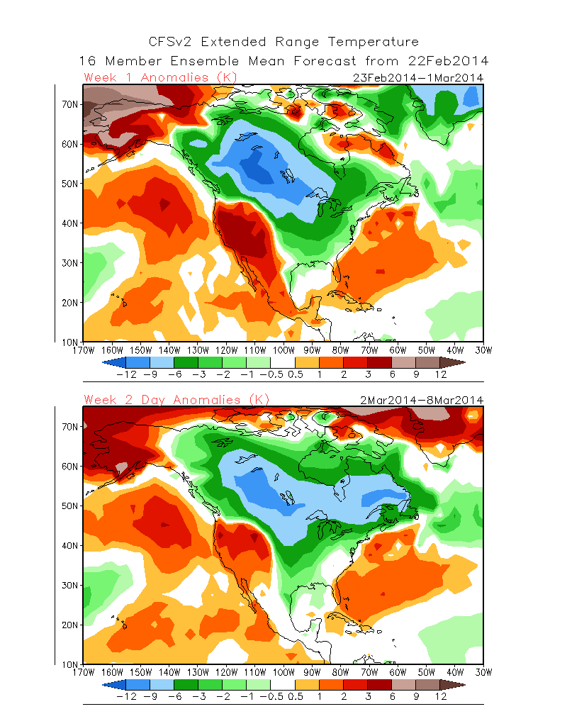
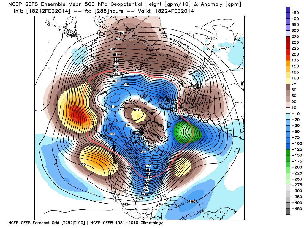
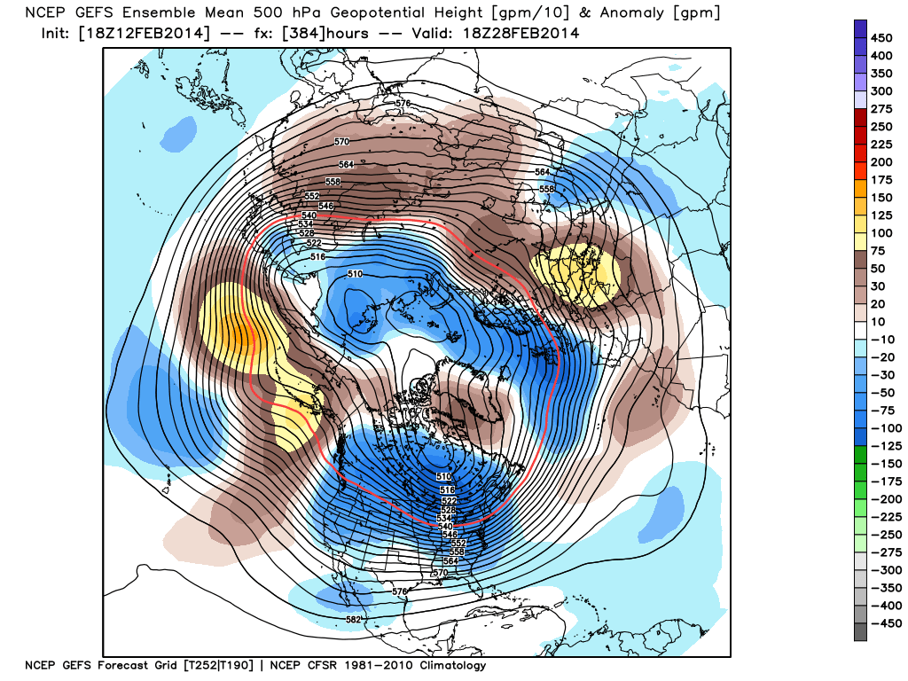
Winter Blows Back In…As promised, the briefly milder shot of air would be just that- brief. We continue to monitor data that suggests a colder, more wintry, pattern blows right back into the region to wrap up February.

For weather updates and more “behind the scenes” data on the go, be sure to Follow Us on Twitter @indywx or become a Friend of IndyWx.com on Facebook!