
You must be logged in to view this content. Click Here to become a member of IndyWX.com for full access. Already a member of IndyWx.com All-Access? Log-in here.
Category: Long Range Discussion
Permanent link to this article: https://indywx.com/video-storm-chances-return-and-we-look-ahead-to-meteorological-fall/
Aug 13
The Week Opens Quiet Before More Unsettled Times Return…
High pressure will remain in control of our weather pattern through the early portions of the new week. This will supply continued dry conditions, along with plentiful sunshine. Humidity values will remain comfortable as we open the work week before turning increasingly muggy as midweek nears.
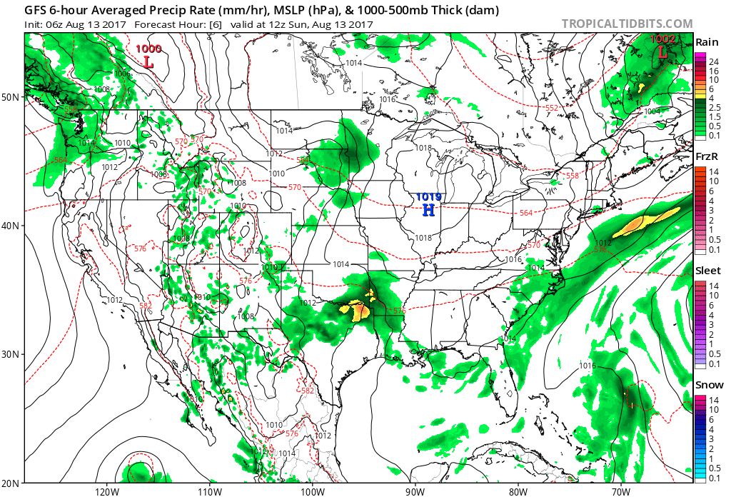
High pressure will keep us dry through early week.
As high pressure moves off to the east, a southwesterly air flow will help moisture return to the state by mid and late week. As a cold front enters the picture, overall coverage of showers and thunderstorms will increase and become scattered to numerous. We’re not expecting any sort of all-day rains, but chances of getting wet from time to time will go up Wednesday through Friday.
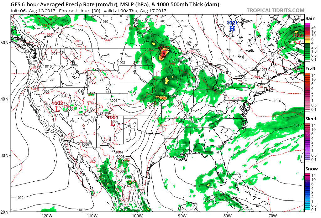
Thunderstorm coverage increases mid and late week.
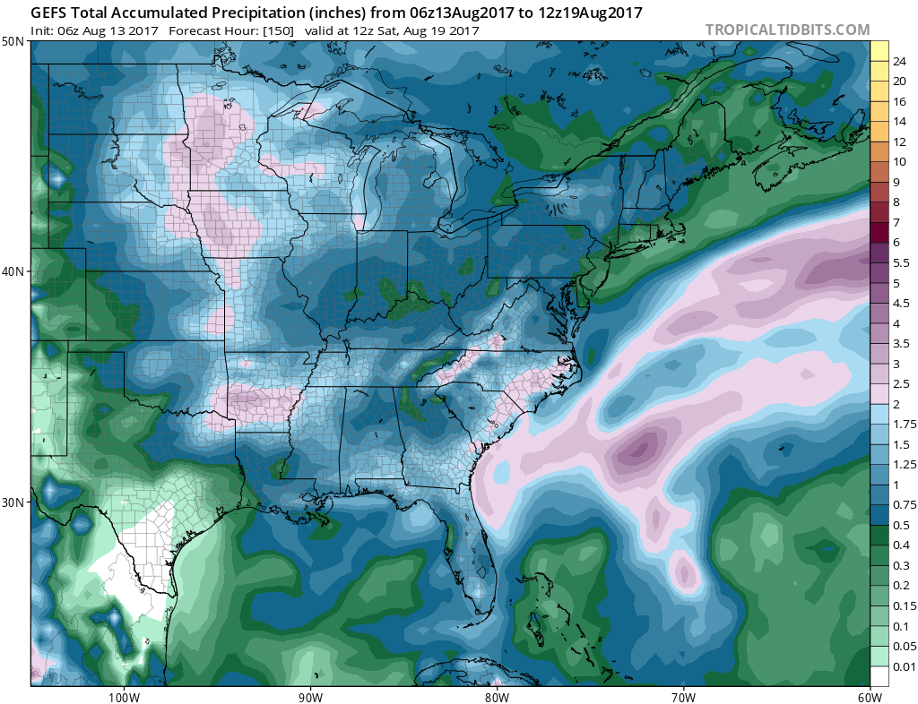
Rainfall totals should fall in the 0.50″ to 1.00″ range for most, but there will be a few folks who pick up locally heavier amounts the second half of the week.
 As of now, we think the cold front will pass Friday evening and set-up another pleasant weekend with seasonable temperatures. The stretch of gorgeous August weekends’ appears to roll along.
What else we’re working on: With us about to flip the page to the second half of August, thoughts continue to shift to the upcoming meteorological fall and winter seasons ahead. Early data paints an “intriguing” look, complete with high latitude blocking and neutral ENSO look. Winter enthusiasts should like the look overall as this will have an impact on the prospects of cold getting going earlier than recent years past. Much more on fall and winter in the weeks ahead… The other big item of interest has to do with the tropics. A new disturbance will traverse the MDR (Main Development Region) this week and given the overall upper level pattern over the CONUS, we’ll have to keep an eye on the East Coast Weeks 2-3.
Permanent link to this article: https://indywx.com/the-week-opens-quiet-before-more-unsettled-times-return/
Jun 01
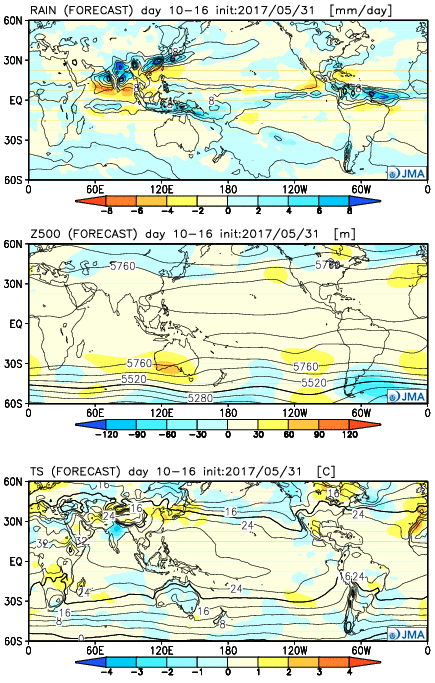
JMA Weeklies: Cool Gives Way To More Seasonal Conditions…
The new JMA Weeklies are in and the highlights include:
- Unseasonably cool conditions Week 1
- Anomalously wet across the Southeast
- Warmer, more seasonal early-summer weather arrives
Week 1:
The pattern is dominated by an eastern trough and western ridge. Accordingly, cooler than average conditions will dominate the central and eastern portions of the country. Very wet conditions should dominate the southern and eastern tier of the country (heaviest rains should fall east and south of Indiana).
 Week 2:
The pattern begins to “relax” a bit, locally, with warmer conditions set to develop. We note three areas of anomalously wet weather- west coast, northern Plains and Southeast.
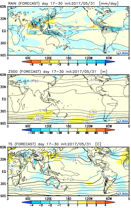
 Weeks 3-4
While the pattern doesn’t seem to promote any sort of significant heat or cool (relative to normal), this is certainly a warmer look, overall, to close the month than how we’re starting. This look would suggest warm, seasonal, summer conditions locally with average precipitation. Wet weather continues to dominate the pattern across the south and begins to emerge into the central.
Permanent link to this article: https://indywx.com/jma-weeklies-cool-gives-way-to-more-seasonal-conditions/
Apr 06
Word On The Weeklies…
New JMA Weeklies stream in on Thursday mornings and we send out a Thursday morning report, in detail, to our clients dissecting the latest data, but want to try and start making public comments on the model here, as well.
The overall idea after looking at the JMA Weeklies is wet and warm over the upcoming (4) weeks relative to average. That said, there will be periods of drier times, especially Week 1, and late season chill- as can be expected every April.
Week 1:
 Week 2:
 Weeks 3-4:
 The big picture is one that shows a drier pattern developing across the East during Week 1, but we caution that this drier regime doesn’t look to “lock” in. Data suggests we get back to an active pattern between Week’s 2-4, biased wetter than normal in the Mid West and Plains. The other screaming message is that a busy severe season should continue through the period. Cold sets up across the Pacific Northwest, associated with the “mean” trough position, while spring-like warmth continues to build across our region in overall terms. We know what that means as storms eject off the Rockies and track east…
Permanent link to this article: https://indywx.com/word-on-the-weeklies/
Feb 26
Looking Ahead To Spring…
Meteorological spring begins in a few days (runs March through May). We’ve already touched on the expected busy severe weather season and want to dedicate this post towards looking deeper into the weather pattern and the resulting precipitation and temperature impacts.
The latest longer-range data continues to be in very good agreement on the upper air pattern. In short, the balance of the spring season looks to offer up a continued theme of warmer than average temperatures for our region. (Not saying we won’t have to deal with a wintry “trick or two” over the first couple weeks of March). When we look at spring, as a whole, we believe it’ll be one known more for the warmth and active, stormy times.

CFSv2 March Temperature Anomalies
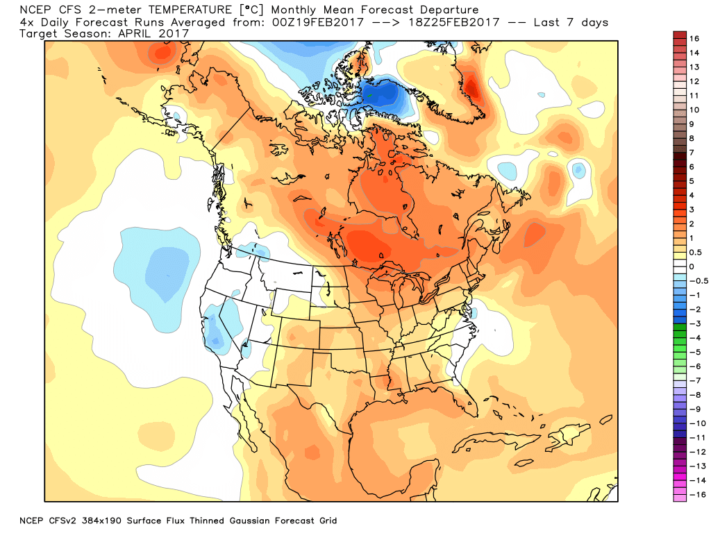
CFSv2 April Temperature Anomalies
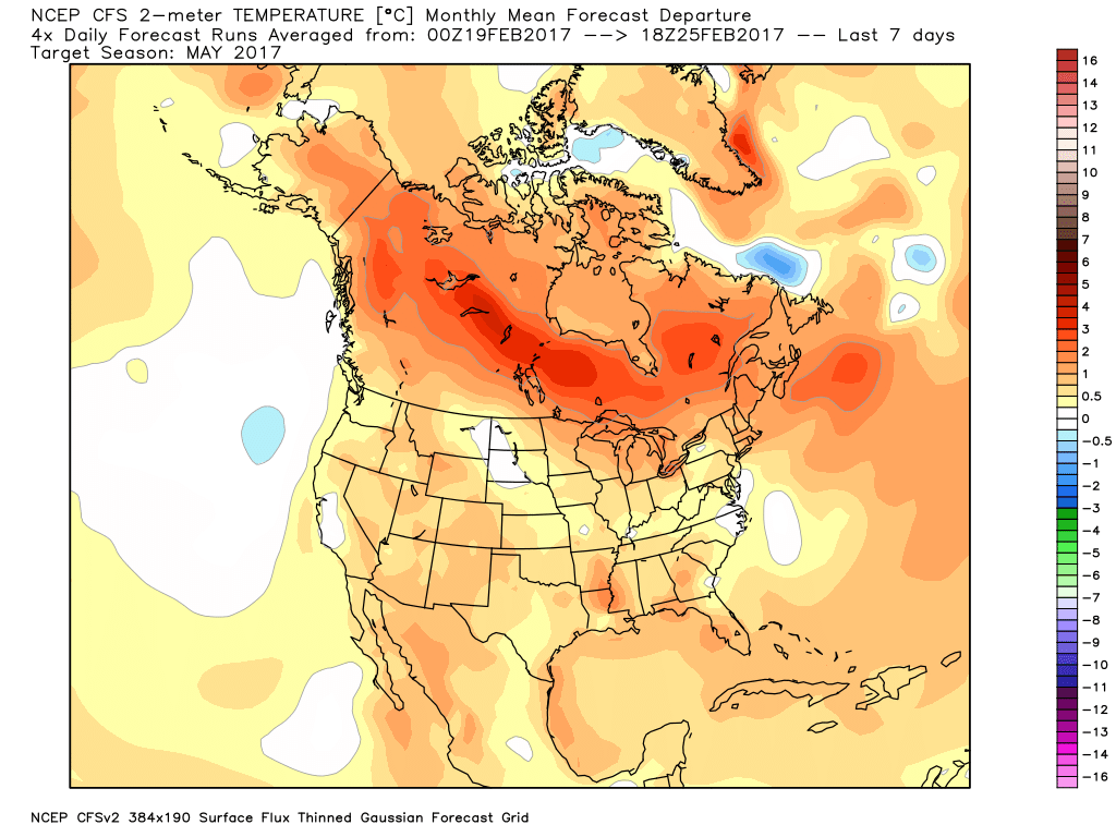
CFSv2 May Temperature Anomalies
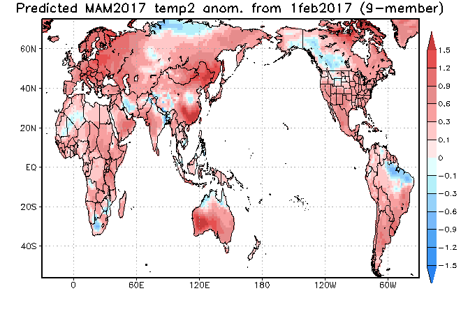
JAMSTEC March through May Temperature Anomalies
The latest JMA monthly idea is one that has to raise an eye brow as it would paint an early summer across the Ohio Valley and Great Lakes. Anomalous warmth (true summer-like air) would develop with a strong ridge over the Great Lakes and northeast. This is something we’ll have to keep an eye on. A big caveat here is how strong and quickly the coming El Nino develops. It should be noted, El Nino years can feature some of the hottest air early, not late, in the summer season (relative to averages), and the JMA would, indeed, yield an early summer with such a look.
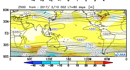
JMA May Forecast 500mb Pattern
It should also be noted modeling is suggesting a wet look, locally, especially during the early portions of spring. The JAMSTEC and JMA are particularly bullish on a wet pattern.

JAMSTEC March through May Precipitation Anomalies

JMA March through May Precipitation Anomalies
The CFSv2 hits the wet March hard before a drier regime mid and late spring.

March Precipitation Anomalies

April Precipitation Anomalies
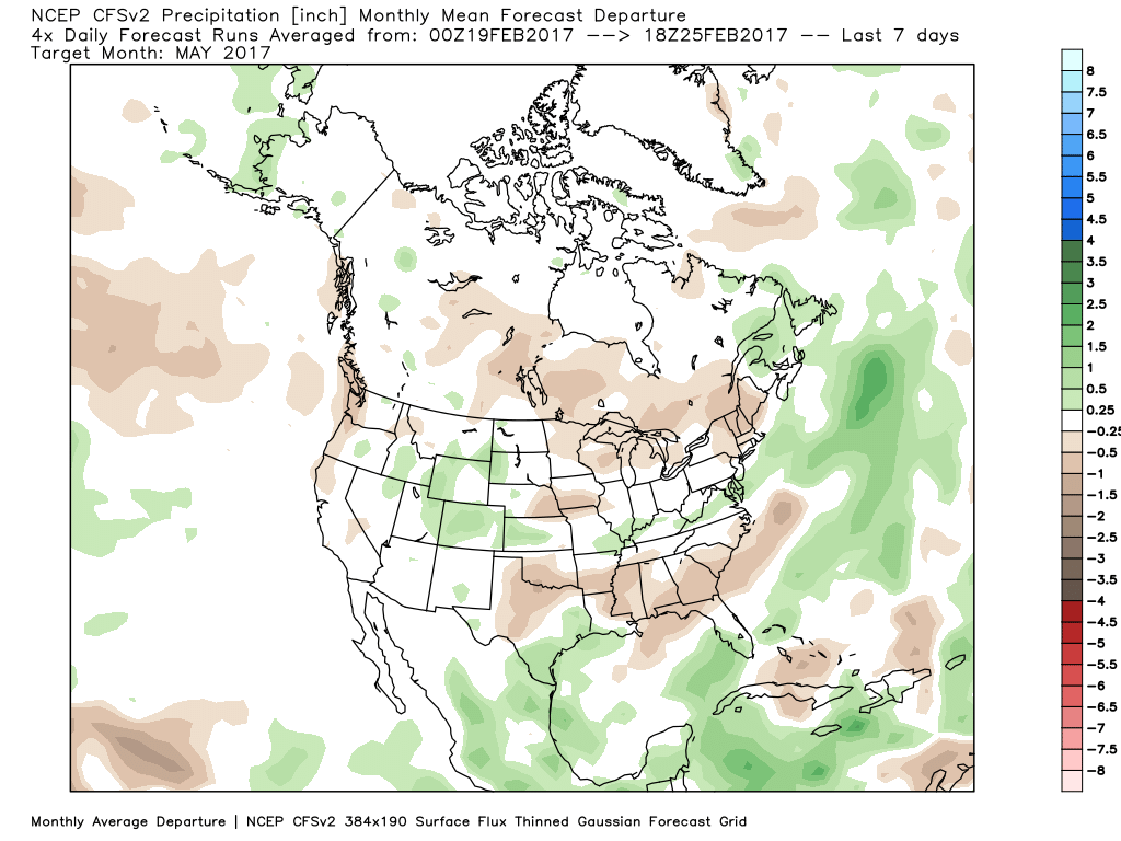
May Precipitation Anomalies
In closing, we seem to have a bit of a bumpy ride in front of us as meteorological spring begins. While Old Man Winter hasn’t been seen much as of late, don’t be shocked if he makes his presence felt a few more times through the first half of March- both from a cold and snow perspective. That said, data really points towards more of an overall warm regime developing the second half of the month, and continuing through the majority of spring, for that matter. We’re keeping a close eye on May for an early summer-like feel to take hold, locally. Subsequent JMA updates will be monitored closely. We also remain confident of an active severe weather season. Note the tendency of model data (above) to pull the mean trough position to the northwest March into April. The clash of late-season wintry conditions west, combined with unseasonably warm temperatures across the east (not to mention the warmer than average Gulf of Mexico) likely will equal busy times as we progress through the spring severe weather season.
Permanent link to this article: https://indywx.com/looking-ahead-to-spring/