It’s quiet now, but a very active and stormy pattern will get underway as we head into the weekend. This busy weather pattern will continue to rule the day into…
You must be logged in to view this content. Click Here to become a member of IndyWX.com for full access. Already a member of IndyWx.com All-Access? Log-in here.
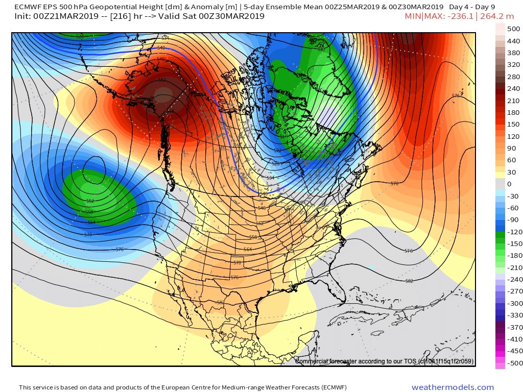
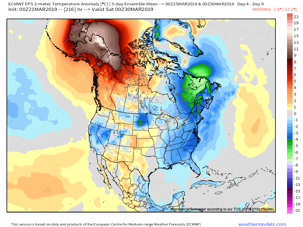
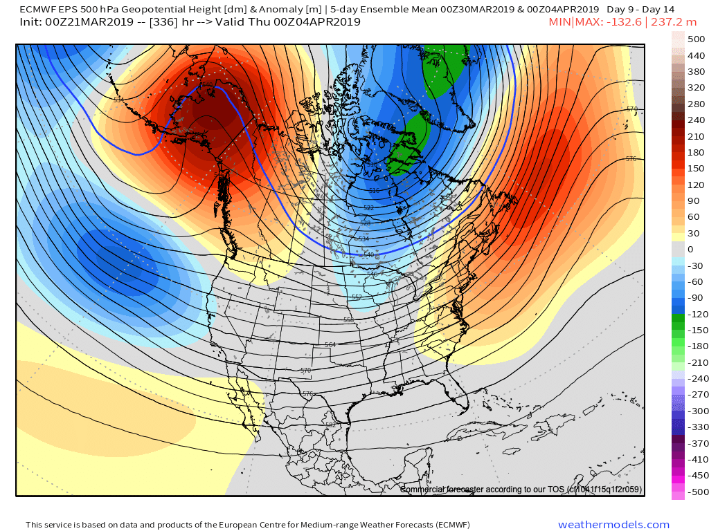
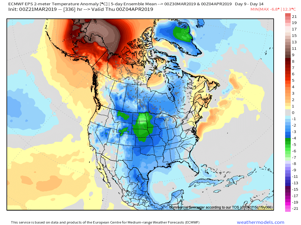
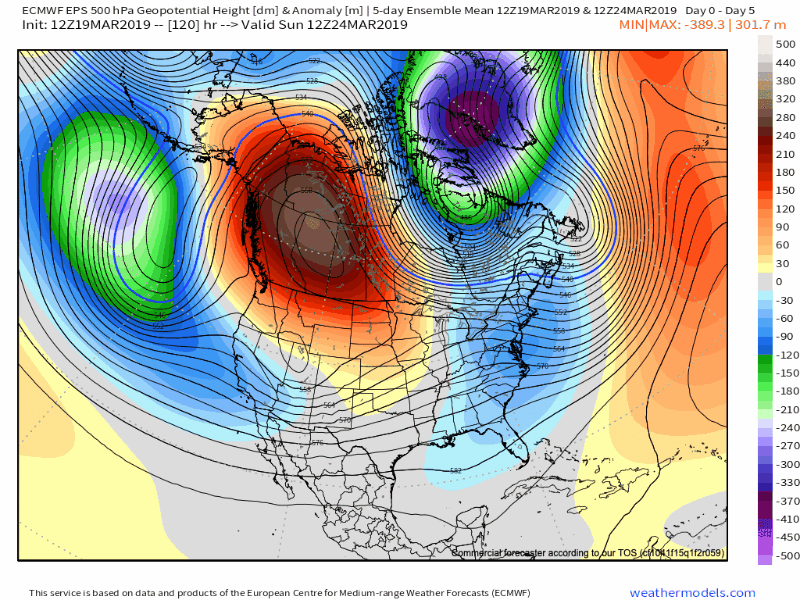
As we look ahead, a persistent western Canada/ Alaska ridge continues to show up on the medium to long range data. The downstream implications are for cooler than normal temperatures, overall, across the eastern and central portions of the country into early April.
Upper air pattern- Days 4-9
Surface temperature anomalies- Days 4-9
Upper air pattern- Days 9-14
Surface temperature anomalies- Days 9-14
Given the time of the year (and pattern), cool won’t rule the entire period. It’s just that the cold will “out do” the transient warmth in between storm systems over the next couple of weeks.
When we look at the teleconnections (combo of negative EPO and neutral to slightly positive PNA is ruling the day for now), they support the lingering chill into early-April.
However, as we turn the page from early-April to mid-April, the idea here is that an eastern ridge will begin to expand west with more “umph” and eventually lead to warmth overwhelming the pattern. We aren’t budging from the original idea of a warmer than normal April by month’s end. It sure appears as if the NEW JMA Weeklies are catching onto this idea.
Weeks 3-4 (mid April) forecast upper air pattern.
From a precipitation perspective, the majority of medium and long range model data does show a return of wetter times (relative to normal) as we move into April, including an active storm track. The beginning of this overall shift in the pattern back towards wetter than normal conditions will begin early next week.
We’ll recap our latest short-term thinking, including an update on the NEW European Weeklies that will arrive this evening later tonight in a video update.
In the meantime, make it a fantastic Thursday- and happy tip off to March Madness!
A weak system will spread showers across central Indiana later today. We take a look at timing and amounts, along with spending time going over the long range pattern into…
You must be logged in to view this content. Click Here to become a member of IndyWX.com for full access. Already a member of IndyWx.com All-Access? Log-in here.
There are growing indications the once thought warm flip in the pattern will be delayed. While “seasonality” is helping us certainly improve in the temperature department from the frigid open to March, data is trending (and some dramatically so) colder for late March and early April.
Part of this can be attributed to the persistent AK ridge and positive PNA/ negative EPO pattern in place. Without question, medium and long range modeling as early as less than a week ago missed this. Note the above image and tendency for prolonged ridging across AK into early April. This will favor cooler anomalies downstream, including here across central Indiana. That’s not to say there won’t be multiple warm and pleasant days thrown in the mix (it’s late March, after all), but instead to say that the pattern overall looks much cooler when compared to what the majority of data was painting only a handful of days ago.
Embedded within this pattern will come a return of active times, including multiple storm systems of note over the upcoming 10-14 days. The flavor of said systems will change from originally thought as hefty rain and potential severe events to rain and perhaps some wintry precipitation. With that said, specifics are impossibly to come by in this “chaotic” pattern and we suggest staying tuned as we get closer to the arrival of the first system early next week.
Like your weather pattern “interesting?” You’re in luck over the upcoming couple of weeks…
You must be logged in to view this content. Click Here to become a member of IndyWX.com for full access. Already a member of IndyWx.com All-Access? Log-in here.