Category: Long Range Discussion

Looking Ahead To The 2nd Half Of September…

A gorgeous mid September day awaits, with plentiful sunshine and unseasonable warmth. A cold front sits off to our northwest. Meanwhile, a disturbed area of weather in the Bahamas will be monitored for the potential of further development late week into next week as it eventually moves into the Gulf of Mexico.

We’ll remain quiet across central Indiana today, but notice a flare up of thunderstorm activity across northern parts of the state tonight. Some of this shower and thunderstorm activity will drift south into central Indiana early Wednesday, but “widely scattered” will be the appropriate word to describe the coverage and many won’t see a drop of rain.

Scattered storms will fire up across northern IN tonight. (Forecast radar midnight Wednesday).

Scattered showers and thunderstorms will remain in the forecast Thursday into Friday before a cold front sweeps through the area. This front will lead to lower humidity as we head into the weekend, but temperatures will remain above average. While some will make it through the rest of the week without seeing a drop of rain, others may pick up 0.25″ to 0.50″ with those scattered downpours.

As we look ahead to the 2nd half of September, a warmer to much warmer than average pattern is anticipated to continue. A big reason behind the warmth is the predominantly positive EPO.

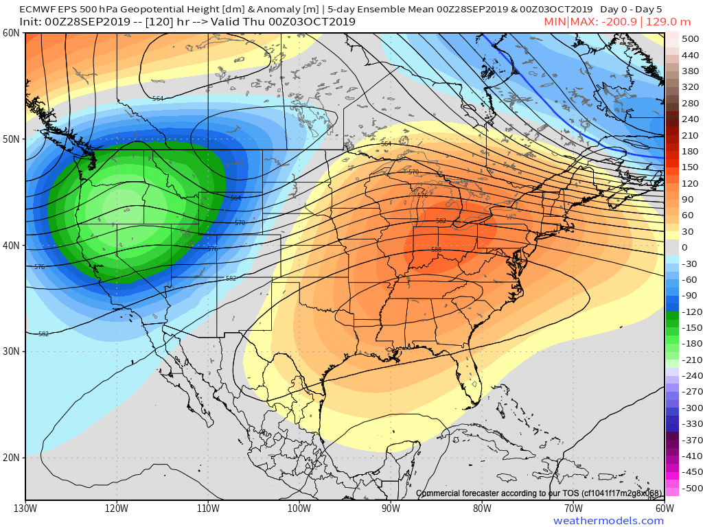
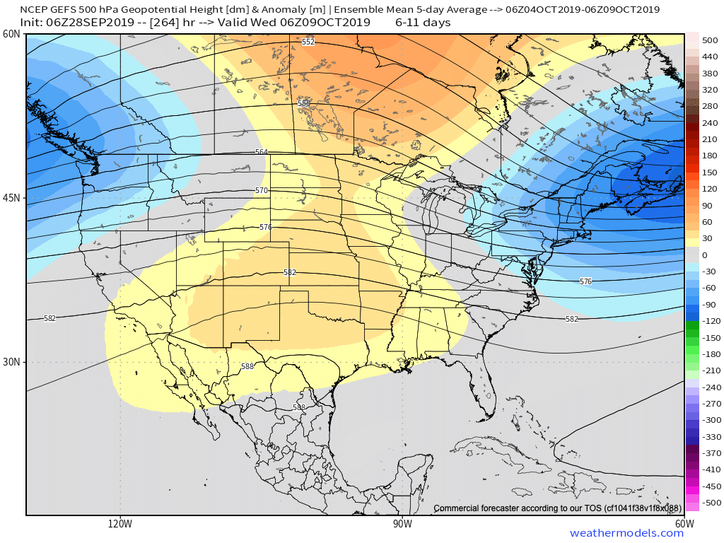
A true blow torch of a pattern will result into the late month stretch. Eventually, we should see a pull back of the heights into the NW and western Canada and more of an eastern trough showing up in the means, but this isn’t likely to take place until the last couple of days of this month or early October. Until then, expect an overall summer-like feel.

Permanent link to this article: https://indywx.com/looking-ahead-to-the-2nd-half-of-september/

A Teleconnection Tale…

Before we display the mean upper level pattern ahead over the next couple weeks, let’s look at some of the various teleconnections to gain some insight behind what’s driving the overall pattern.

EPO- primarily positive to strongly positive (warm signal).

WPO- primarily positive to strongly positive (warm signal).

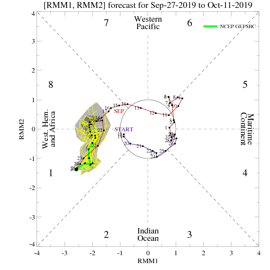
MJO- heading into Phase 6 with a look like it wants to rumble into Phase 7. This is a warm signal this time of year.

With the warm signals above, it should come as no surprise of the next couple weeks offering up a predominant eastern ridge.

Days 6-10

Days 10-14

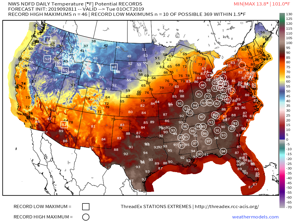
While a couple of weak cold fronts may lead to somewhat cooler air briefly, the balance of the next couple of weeks looks to offer up much more in the way of summer-like heat and well above normal warmth. It should also be noted that the overall pattern looks like a dry one over the next 10-14 days, as well.

Don’t put away that swim suit just yet!

Permanent link to this article: https://indywx.com/a-teleconnection-tale/

Summer Isn’t Finished Yet…

After an unseasonably cool weekend, significant late season heat will return next week.

Note the ridge expand over the eastern portion of the country next week.

To no surprise, the EPO pops positive and this really helps drive the warm mid-September pattern.

Positive EPOs in September favor warmth from the OHV, Mid Atl and into the Northeast.

The question then becomes “how long does the late season heat last?” As the EPO trends negative, cooler times would be favored as we move into late September. We’ll keep a close eye on things.

For now, those not ready to say goodbye to summer will be in luck next week with highs around 90 and lows in the upper 60s to lower 70s…

A few opportunities (today and Sunday) for showers can be expected over the next few days, but these won’t amount to much and some may not see any rain of significance. Better rain and storm chances will return the middle of next week.

Permanent link to this article: https://indywx.com/summer-isnt-finished-yet/

VIDEO: Fall-Like Now, But Summer Warmth Isn’t Finished…

You must be logged in to view this content. Click Here to become a member of IndyWX.com for full access.  Already a member of IndyWx.com All-Access?  Log-in here.

Permanent link to this article: https://indywx.com/video-fall-like-now-but-summer-warmth-isnt-finished/

Pulling The Curtain Back On The Medium Range Pattern…

A cold front will sink south across the state this evening. As the front moves through the area, we expect thunderstorms to increase in coverage and intensity across northern Indiana over the next few hours. These storms should push off to the south during the overnight, weakening as they do so. We still aren’t expecting much in the way of widespread severe weather across immediate central Indiana.

Once the front passes, northwest winds will take over during the predawn hours and help push a drier and cooler brand of air south into the region.

The cold front will move through central Indiana during the overnight hours.

Thereafter, get used to unseasonably cool air, to the tune of what we’d normally expect by late September, for the 2nd half of the week- including this weekend. Mostly dry weather is expected to prevail through the period.

As we look ahead to next week, moderating temperatures are expected next Tuesday and Wednesday, including lower to middle 80s. That said, we do have questions if the warmth will have staying power.

We note the MJO “toying around” with the warmer Phase 6 for a time before returning to Phase 5 (a cooler phase this time of year).

Add in the fact that the EPS and GEFS are in disagreement in handling the EPO in the medium term and this results in lower confidence in the overall staying power of the warmth come mid month.

Unfortunately, this time of year, the tools we can really “lean on” for indications of where the longer range pattern will head are limited (compared to late fall through early spring). That’s when we can really focus on the other drivers such as the AO, NAO, PNA, recurving WPAC tropical activity, etc.

As such, while we continue to believe the pattern trends warmer after the cool spell into the weekend, patience is required with respect to the staying power of said warmth…

Permanent link to this article: https://indywx.com/pulling-the-curtain-back-on-the-medium-range-pattern/