What Can We Learn From A Persistent Negative October AO For The Upcoming Winter?
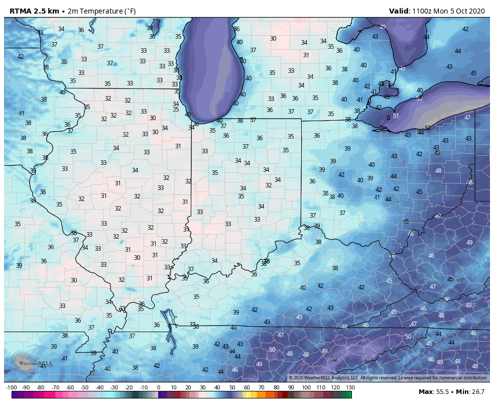
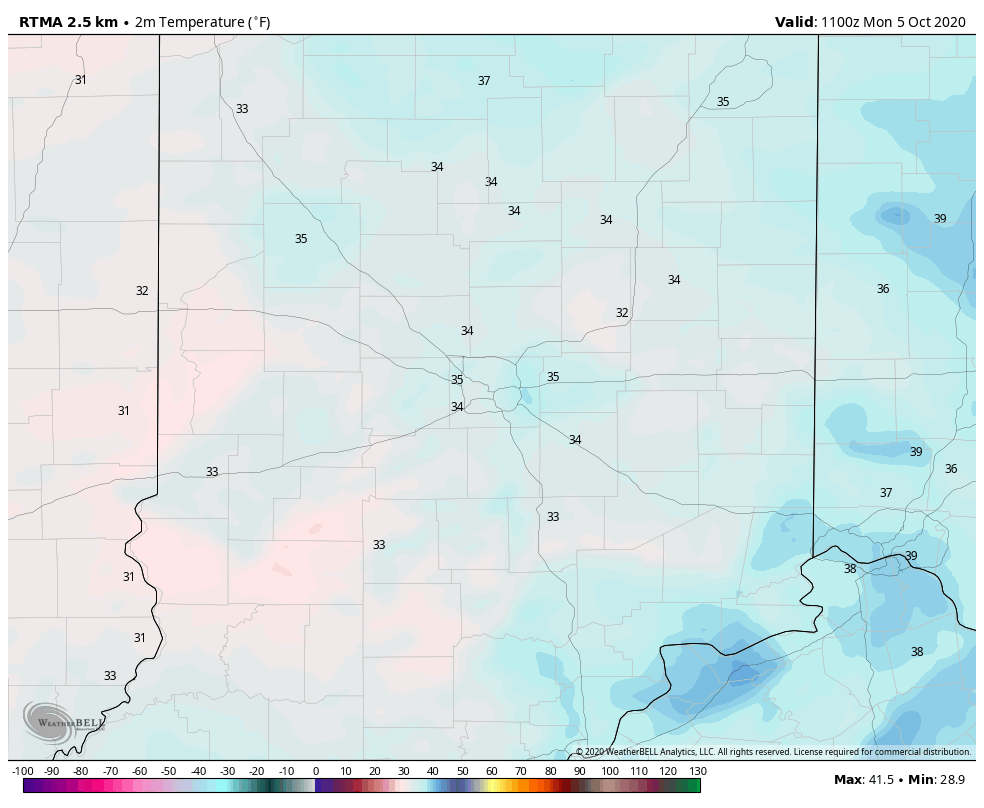
October has opened on quite a chilly note across not only central Indiana, but a good chunk of the eastern half of the country. Officially, Indianapolis is running 8.4° below average, month-to-date.

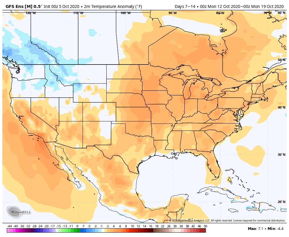
While warming will occur in the upcoming 7-day period, there are already seeds being planted for the return of unseasonably chilly conditions after this transitional warmth.
The pattern will take on signs that you’d expect from a positive PNA and trending negative EPO. That will pull the chill back into the east and we may just may trend wetter during the mid and late month period, as a series of cold fronts sweep through the region (fingers crossed).

The purpose of this post is to focus on the predominantly negative Arctic Oscillation (or AO) and what, if anything, we can learn for the upcoming winter. Note the AO continues a negative look over the upcoming couple weeks (it’s been negative so far this month, as well).

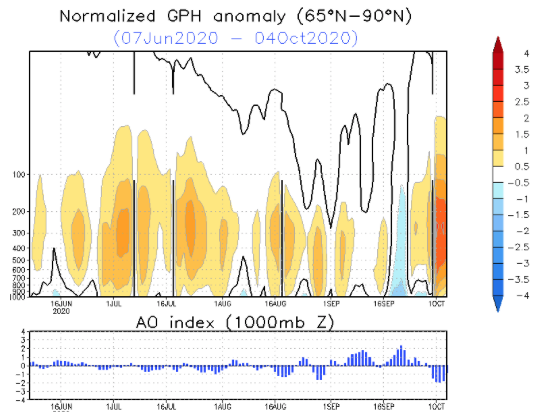
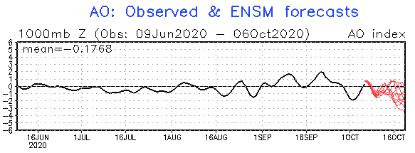
The combination of the persistent negative AO so far this month, along with what’s forecasted over the coming few weeks, got us interested to see what kind of patterns occurred during the following winter (Dec. through Feb.). We went back and looked at all October with a negative AO of 1, or more, since 1960 and this is what the analogs produced:
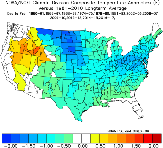

There’s obviously a lot of other ingredients we’ll factor into our winter outlook this year (per usual), but this is another interesting case study in front of us, especially with so many climate models blow torching the upcoming winter.
Our complete annual winter outlook will be online Sunday, November 1st.