VIDEO: Wetter Trends Next Week? Potential Of More Widespread Frost Late Next Week…
You must be logged in to view this content. Click Here to become a member of IndyWX.com for full access. Already a member of IndyWx.com All-Access? Log-in here.
You must be logged in to view this content. Click Here to become a member of IndyWX.com for full access. Already a member of IndyWx.com All-Access? Log-in here.
Unfortunately there likely won’t be any significant changes to our precipitation pattern until late autumn and winter. Until then, we’ll have to take any drop of rain we can find. Once the pattern flips though, it may do so in quick and rather dramatic fashion (still expecting a wet winter).
The consensus of long range data shows the dry pattern continuing over the upcoming few weeks, including the JMA Weeklies, CFSv2 Weeklies, and ensemble products.
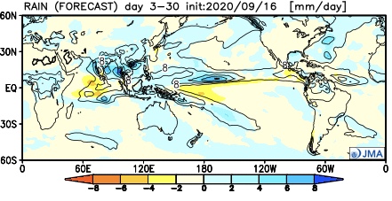
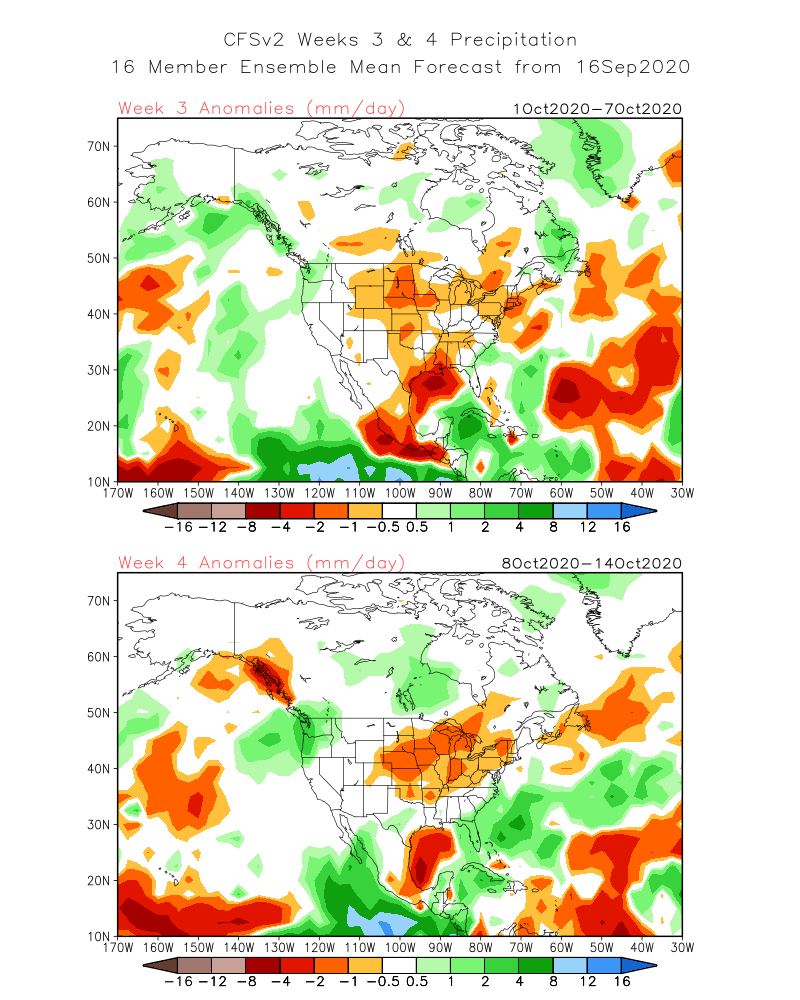
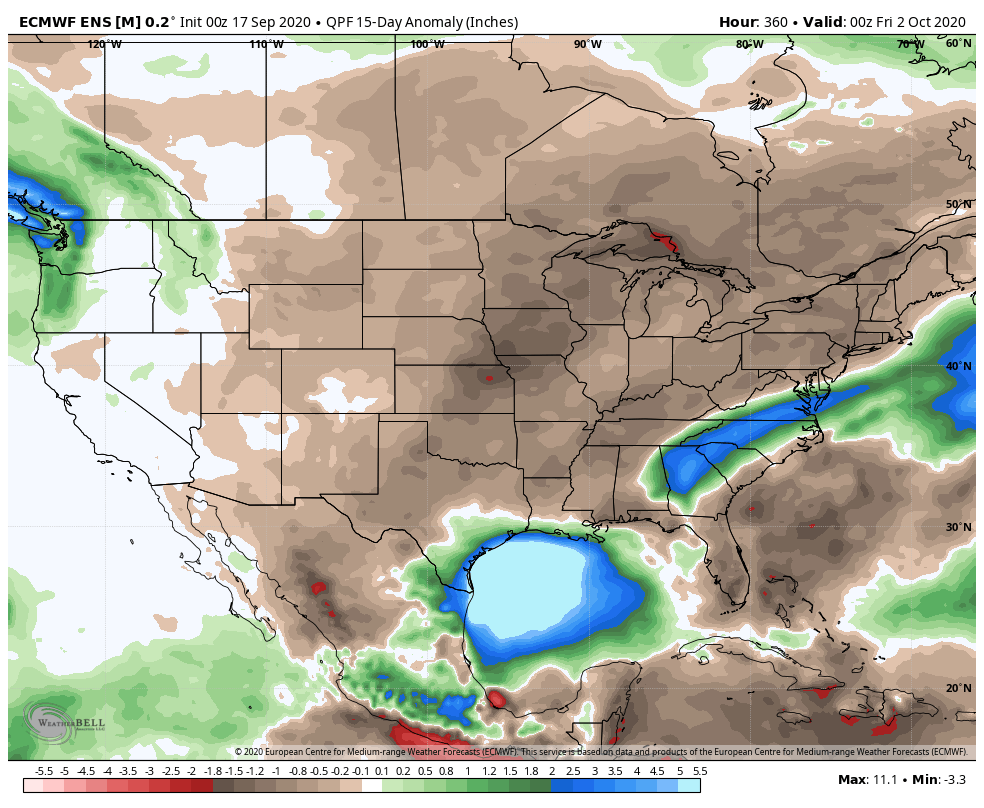

Analogs and other teleconnections support this dry theme. At least in the immediate range (through mid October) the only way to bust up this dry pattern is to get tropical moisture involved.
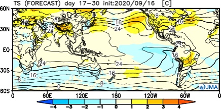
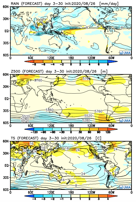
The new JMA Weeklies maintain the ‘mean’ ridge position across the West for the majority of the upcoming few weeks, but there will likely be attempts to expand the ridge across the northern tier Week 2 and 3 that would lead to at least transitional periods of much warmer air, after the cool period in the short term.
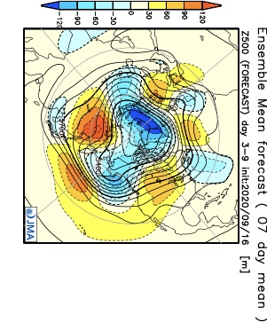


The model sees the ridge expanding Weeks 3-4 and the associated warmth that spreads east after the chilly regime.

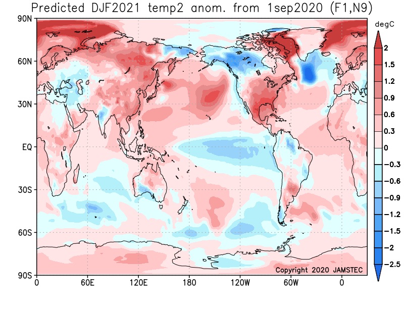
The new JAMSTEC seasonal data is also in and maintains a warm look this winter. A lot of this has to do with an expected persistent southeastern ridge. We agree with this but, as is the case each winter, there will be challenges that have to be dealt with.
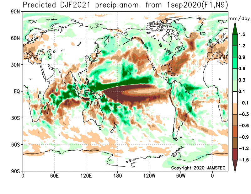
We also agree with the active storm track through the Ohio Valley and associated well above normal precipitation in the December through February period.
You must be logged in to view this content. Click Here to become a member of IndyWX.com for full access. Already a member of IndyWx.com All-Access? Log-in here.
Before we dive into our latest long range discussion, Laura continues to track north this morning through western Louisiana, and remains a category 2 as of the latest update (5a eastern time). Our thoughts and prayers are with all of those affected by Laura as they wake up this morning and begin to see the horror left behind from this beast of a storm.
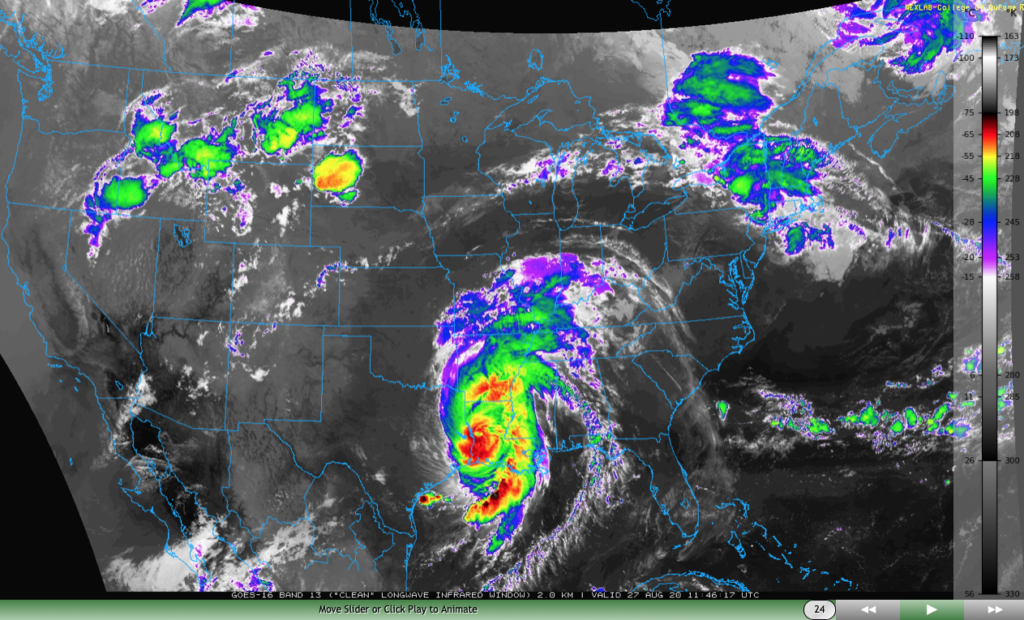
Laura will take a hard “right” turn Friday and deliver gusty winds and heavy rain to the TN Valley and into the mid-Atlantic through the weekend.

We won’t deal with any impacts from Laura’s remnants up this far north, but we will increase coverage of shower and thunderstorm activity now through Saturday evening. This is thanks to a warm, sultry airmass in place along with an approaching cold front. As that boundary drives through the region Saturday evening, a much drier airmass will arrive for the 2nd half of the weekend.

Rainfall amounts between this afternoon through Saturday afternoon should top out between 0.50″ and 1″ for most, but there will be localized 1″ to 2″ totals in the heavier storms.
Friday will also pose a severe weather threat across the state, including the potential of damaging straight line winds as a couple “bowing” segments that move from the upper Midwest into the central Ohio Valley.
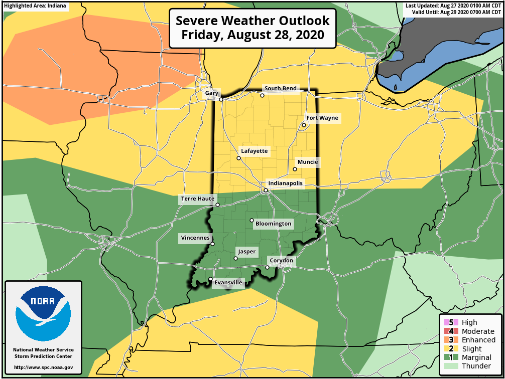
As we look ahead, we’re tracking 3 significant cold fronts between now and September 10th:
I. Aug. 29th
II. Sept. 3rd
III. Sept. 10th
Each of these cold fronts will be capable of producing strong storms and locally heavy rain, and behind each boundary, the air will grow cooler and cooler. While “transitional” warmth (relative to normal) is likely ahead of the boundaries, the first 1/3 of September should run cooler than normal across our region. Things also looks MUCH wetter than normal through the upcoming couple of weeks- a byproduct of the busy nature of the pattern.
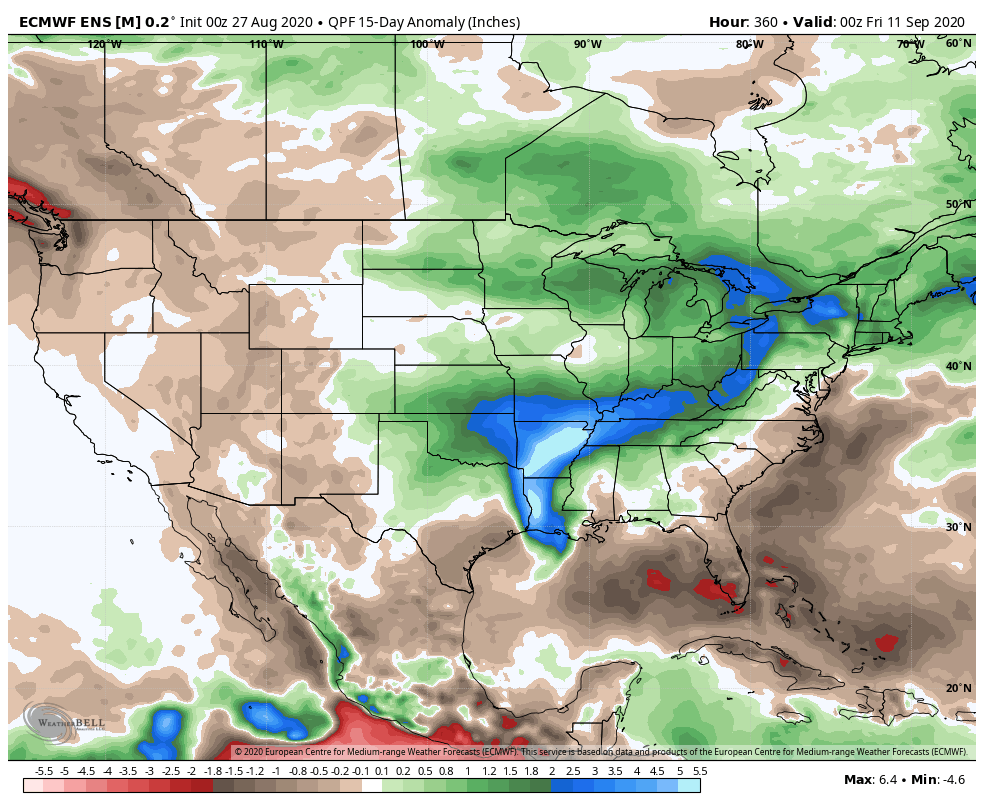
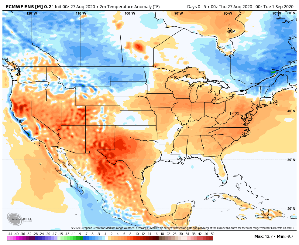
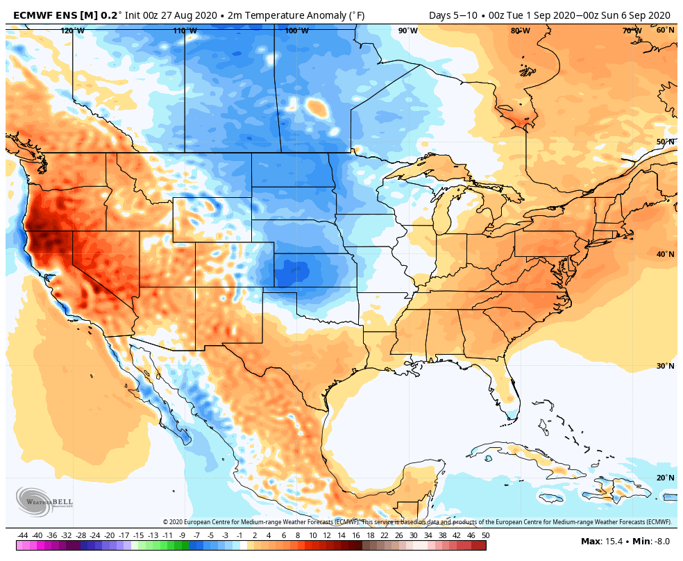
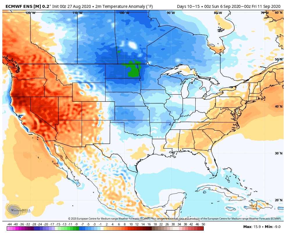
Note how the latest JMA Weeklies are also similar handling the pattern (we’ll take the week-by-week snap shots into our video a bit later) over the upcoming 3-4 weeks:
One more item of note, the tropics aren’t done, unfortunately. There should be another hurricane threat in the medium to longer range period (early September) and early thoughts here include that threat centering more on the East Coast vs. the Gulf.
You must be logged in to view this content. Click Here to become a member of IndyWX.com for full access. Already a member of IndyWx.com All-Access? Log-in here.