Running the Gamut; Looking Ahead to April…
We’ll apologize in advance for the long-winded post tonight, but there’s a lot to cover. Not only do we have the accumulating snow on deck, a couple of strong storm systems this weekend into the middle of next week, but the long range pattern is set to turn cold (again) after a mid-month respite. We also want to look ahead to our early thoughts towards April…
Let’s take things one at a time:
Thursday-Friday Snow
While we don’t have major changes to our ongoing snowfall forecast, we have “sagged” the swath of 1″ to 3″ snow south just a hair given the latest computer model guidance. Steadiest snow should fall Thursday night into the predawn hours Friday. We’d anticipate a slick Friday morning commute through the heart of central Indiana.
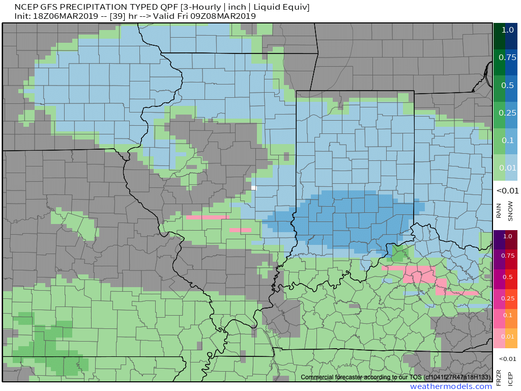
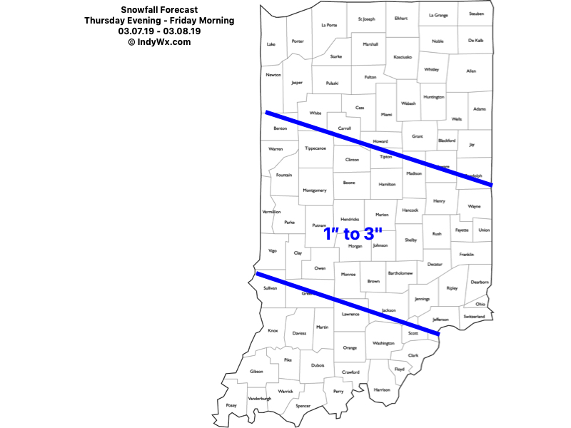
Snow should exit off to the southeast around, or just before, lunchtime Friday. As always, your ground-truth reports are welcome (feel free to send to us on Twitter or via e-mail).
Warmer Side Of Things
The ‘mean’ trough position will shift to the west (temporarily) and lead to an overall milder time of things for the mid-month stretch. Unfortunately, the milder air will come with a wetter pattern.

This milder, wetter pattern will be highlighted by (2) storms:
I. Saturday, 3/10
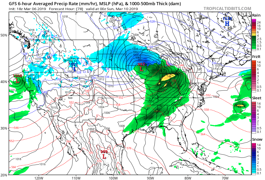
II. Tuesday-Wednesday, 3/12-3/13

Both storm systems will be capable of producing locally heavy downpours and embedded thunder. Greatest chances of severe will remain south of central IN with this weekend’s storm, but may be further north next week. We’ll keep a close eye on things and issue Client Briefs if need be as we get closer.
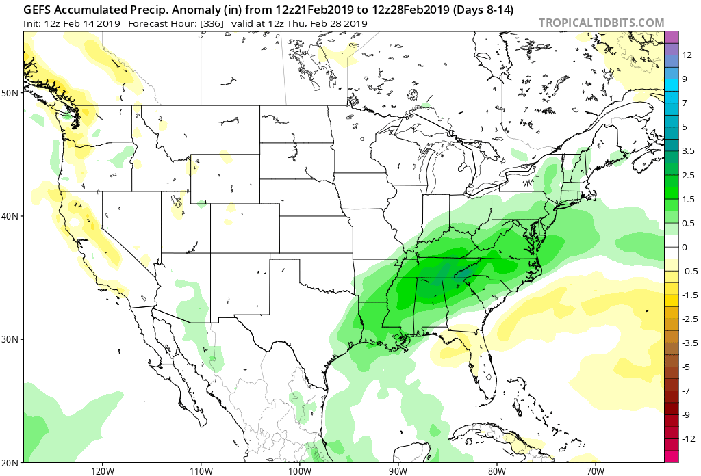
A combination of the GFS and European computer models print-out rainfall totals between 1″ and 2″ over the upcoming 10-days and this seems reasonable given the fact both storm systems will be able to tap into Gulf of Mexico moisture.
From a temperature perspective, the brutal cold will come to an end behind our late week snowmaker. While “transient” chill will follow both of the upcoming storm systems, we’re heading into a much milder pattern, overall, through the mid-March stretch. Mildest air will come directly in front of the storm systems, highlighted by a couple of 60 deg. + days the middle of next week.
Positive PNA takes over
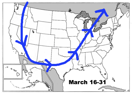
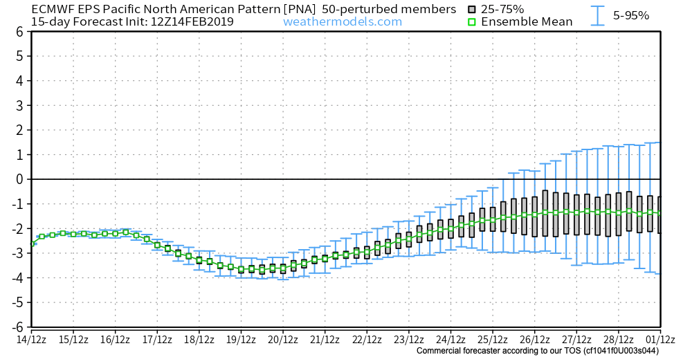
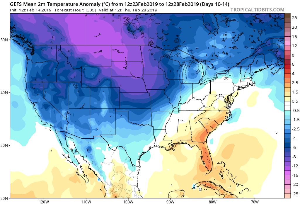
Unfortunately (for lovers of spring), the mid-month warm-up will be only a “tease” as we’re set to trend cooler, relative to normal, for the last 10 days of the month. The reason? A developing positive PNA.
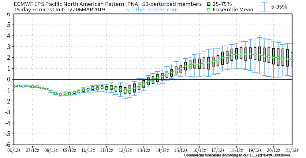
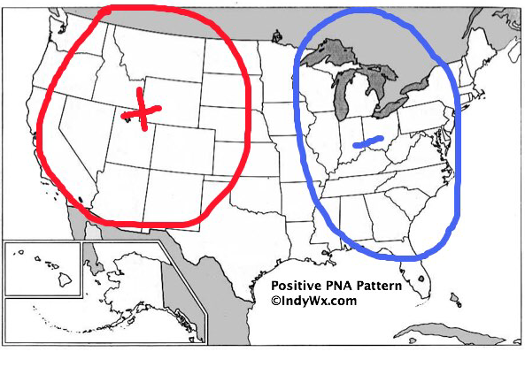
To no surprise, we see the cooler pattern returning on the computer models:

Not only will we turn colder to close the month, but Thursday likely won’t be our last accumulating snow of the season…
Looking Towards April
Despite the late-March “set back” to a chilly time of things, we continue to think a more sustained “stick and hold” spring pattern looms around the corner. In fact, we agree with the latest CFSv2 delivering a warmer than normal pattern for April, as a whole, to the eastern portion of the country.
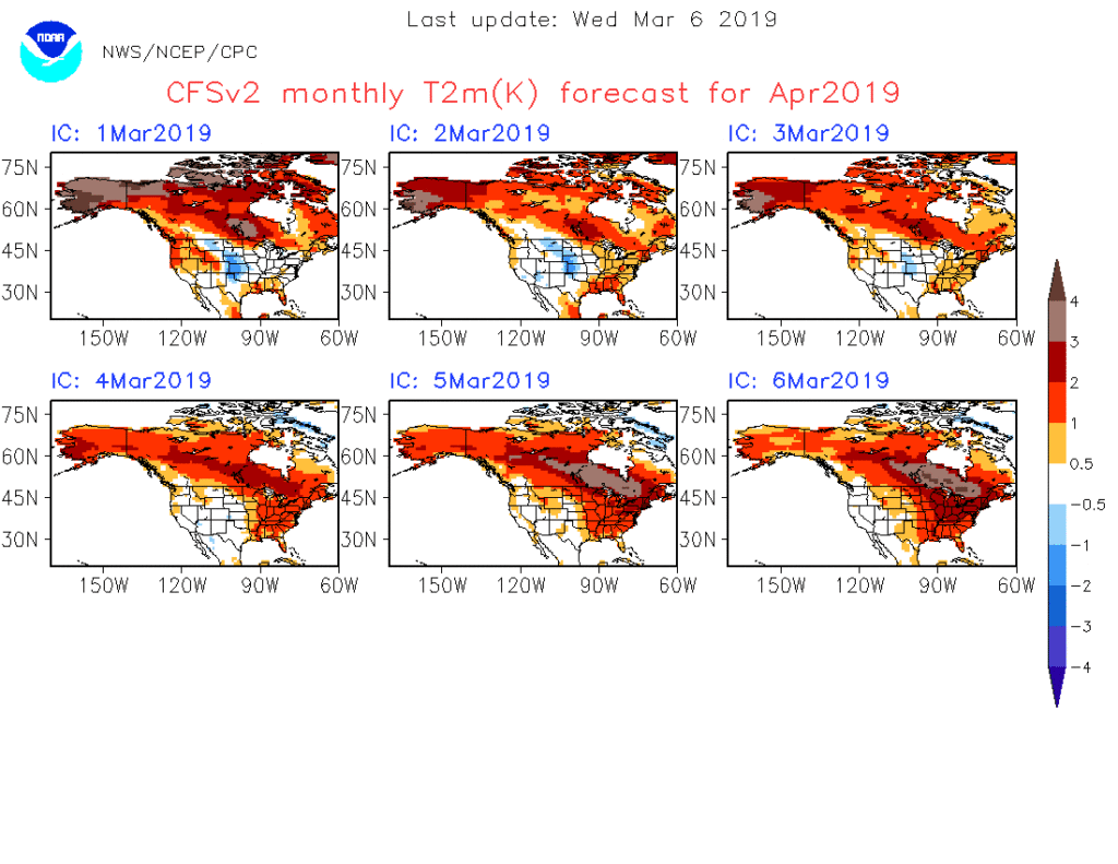
Note that as we go, the model is getting warmer for April with each passing day. As things stand now, we think the trough will pull back to the west with a more sustained ridge in place across the eastern portion of the country in April. With this, a wetter than average regime likely awaits, including an uptick in severe chances further north into the region.

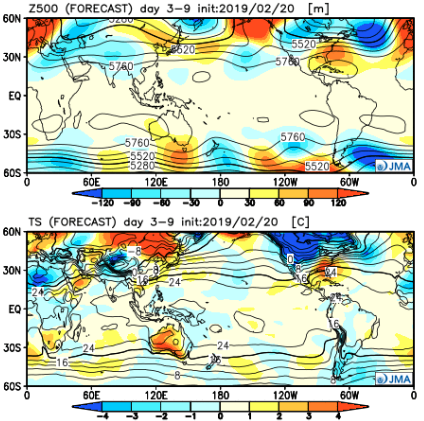
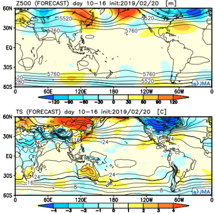
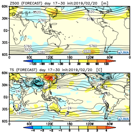
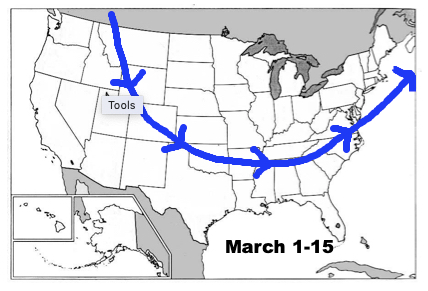
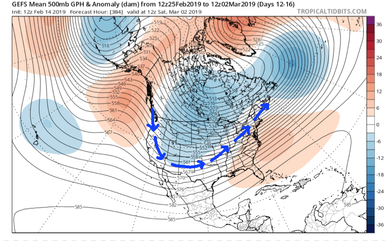
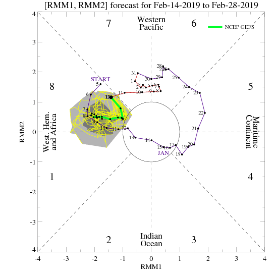
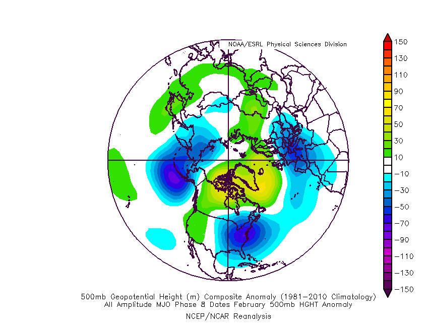

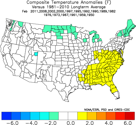

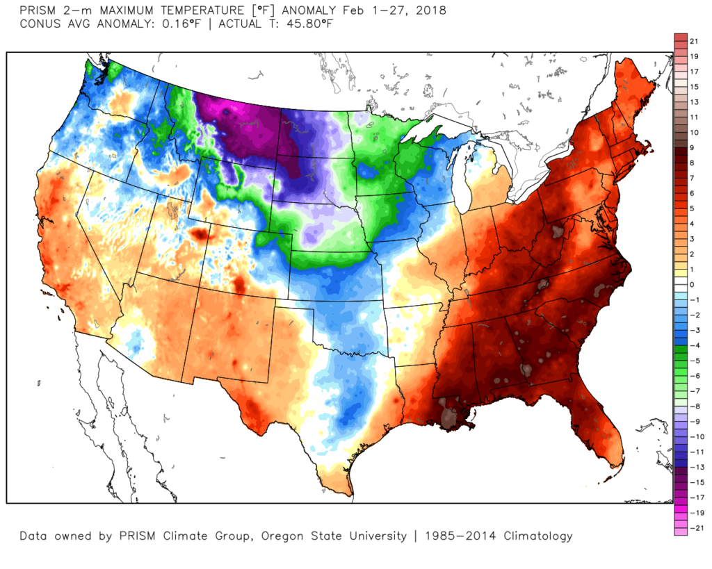 The early spring “fling” has lulled many into believing winter’s finished. While the worst of the winter is certainly behind us, we continue to think a dose of “reality” awaits as we progress through the better part of the first half of March. To be more specific, we feel the period March 6th through the 20th will offer up below average temperatures and an active pattern- capable of producing wintry threats.
 Sure enough, modeling is going to the pattern that will produce below normal temperatures (doesn’t appear to be anything particularly frigid, but colder than average, nonetheless) through mid-month.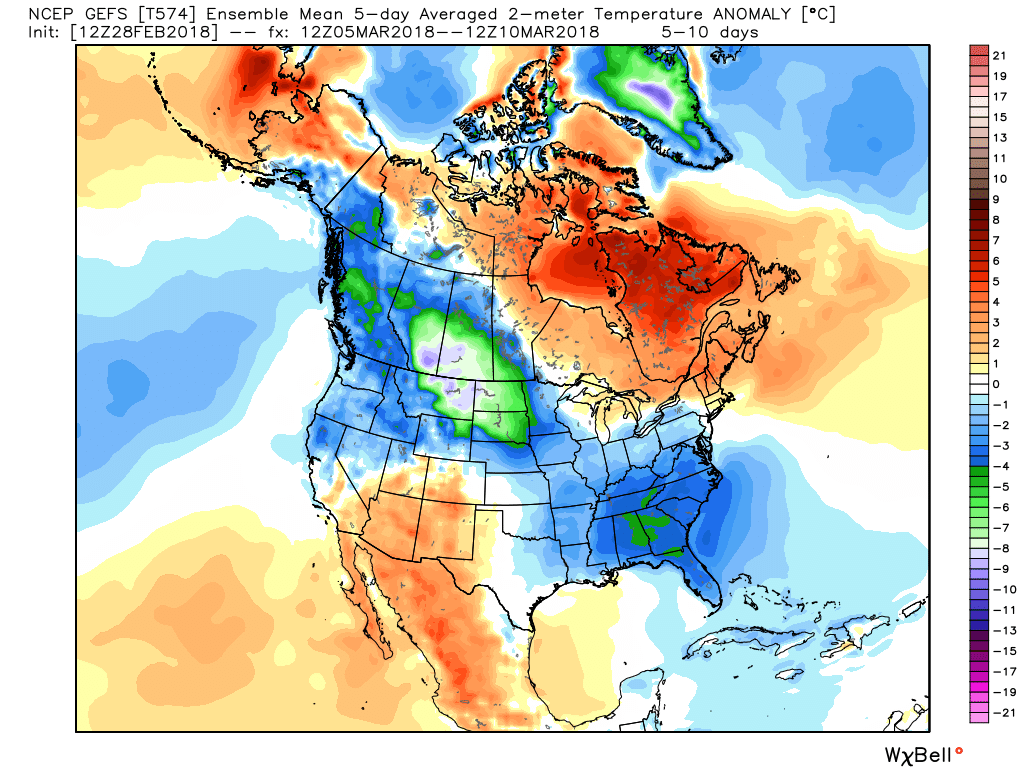
 With blocking in place, an undercutting jet will serve to deliver an active storm track.
 Keeping in mind March winter events need multiple items to come together to create impactful situations, it’s also important not to simply “buy in” to the idea that just because it’s been warm lately that winter is finished. March can be a wild month, as long-time Hoosiers are aware. The pattern we’re heading into over the next 10-14 days is one that’s been void most of the winter (high latitude blocking in place) and can serve as the player needed to flip a “nuisance” variety late-winter event to one that’s much more significant. We’ll need to remain on guard for the potential of one or two “more significant” wintry events as we move through the first couple weeks of the month.
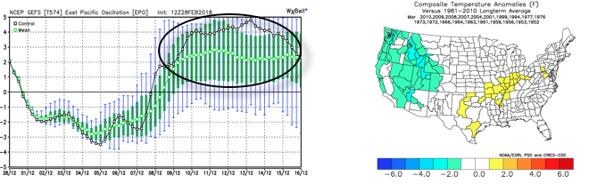 The end result is one that should promote colder than average times over the next couple weeks, overall, along with an active storm track. With blocking in place, the potential of one or two more significant late-winter events are on the table, and we’ll have to fine tune specifics as the individual storms come. While confidence is high that someone within the Ohio Valley region is likely to still deal with a big-hitter event, there’s no way to get specific until the individual players are on the field. Thereafter, the pattern should begin to transition to one more conducive for “stick and hold” spring conditions during the latter portion of the month.