Category: January Thaw

January Thaw Takes Hold…

January is running more than 11.5° below average and more than 50% of the country is currently covered in snow.

However, big changes begin to take place this weekend and will remain intact for the majority of the next couple weeks.  The mean trough position will back into the west while ridging takes hold across the east.  This will feature temperatures that will push to above average values and lead to an active and moist southwesterly flow.

Over the upcoming (10) days, temperatures may reach 50°, or greater, on 3 to 4 of those days.  Compared to how frigid we’ve been (already had 7 mornings this month with sub-zero lows), this will feel like a heat wave.

We’ll leave you with a heads up to enjoy the January thaw (yes, even if you’re one of those winter lovers out there) as the pattern sure looks like it’ll deliver a return to bitterly cold, wintry times as we head into February…  In fact, analogs would suggest once winter returns, it’s likely to remain in place deep into spring this year.

Permanent link to this article: https://indywx.com/2018/01/19/january-thaw-takes-hold/

VIDEO: Frigid Times “Moderate;” Looking Ahead…

You must be logged in to view this content. Click Here to become a member of IndyWX.com for full access.  Already a member of IndyWx.com All-Access?  Log-in here.

Permanent link to this article: https://indywx.com/2018/01/17/video-frigid-times-moderate-looking-ahead/

Winter Returns…

January got off to a frigid start.  Remember this coast-to-coast cold, including sub-zero temperatures across central IN, during the first week of the month?

t0-1024x818After the past week to ten days, that frigid open to the month seems like forever ago!  The past 7-10 days has featured a significant January thaw, and temperatures now, MTD, are warmer than average across the Ohio Valley.  Warmest anomalies can be found across the southeast region.

conus_mtd_t2max_anom_2017That said, the pattern is shifting back to winter for the last week of the month and while the duration, longer-term, can be argued, the next 2-3 weeks appear to offer an opportunity to play “catch up” in both the snow and cold departments.  Note the developing eastern troughiness.  This will bring colder air back into the east as we close January and open February.  The GFS ensembles, courtesy of Tropicaltidbits.com, also develops an interesting “blocky” look towards the end of the period in Week 2.  Should this verify, it would lead to a better chance of the cold, active pattern locking in.

GEFS2wk12417
You’re corresponding temperature anomalies show the shift back to a colder than normal regime.

Days 2-6

Days 2-6

Days 4-8

Days 4-8

Days 6-10

Days 6-10

Days 12-16

Days 12-16

A fast northwest flow will also result in multiple “pieces” of energy rotating southeast and we’ll forecast a period of snow showers by mid and late week, continuing into the weekend.  There’s the chance of a stronger clipper system sometime in the Sunday-Tuesday time frame that we’ll have to keep a close eye on.  We want to stress that global modeling will struggle with the specifics (timing and strength) of these clipper systems until within a couple days.

Longer term, while confidence is high on the evolution to a cold, wintry regime through the medium range, the longevity and sustainability of the cold is in question.  For instance, by Day 10 (as the GFS continues to drill cold into the region), the European ensembles are much less impressed and suggest the overall transient pattern we’ve dealt with for the balance of the winter continues:

ecmwf-ens_z500aNorm_namer_11

ecmwf-ens_T850a_namer_11Thinking here at IndyWx.com believes the European is likely rushing the warmer central look.  Time will tell…

**We do note the NEW European Weeklies lock a period of cold into the east from mid-February through early March, including a stormy (snowy) look.  Will Old Man Winter have the final say?

Updated 7-day later this evening!

Permanent link to this article: https://indywx.com/2017/01/24/winter-returns/

Spring-Like Weekend, But Changes Loom…

Screen Shot 2017-01-20 at 10.25.29 PMHighlights:

  • Spring-like weekend
  • Unsettled times continue
  • Winter returns

Rare January White Leg Alert…The big news this weekend will be temperatures close to 30 degrees above normal and a legitimate spring feel.  Average highs across central IN this time of year are in the middle 30s and temperatures this afternoon will zoom to the lower-middle 60s.  Patchy morning fog and drizzle will be with us, but we’re remaining optimistic we could squeeze a couple of looks at the sun during the day.  Count yourself lucky if you do, indeed, see that weird giant bright thing in the sky! 😉

A developing storm system will track east across the central Plains and into the TN Valley this weekend.  This will result in a significant severe weather outbreak across the south and increasing rain chances here for the back half of the weekend.  The magnitude of the rain and potential embedded storms remains in question, but shower chances will at least be on the increase Sunday afternoon into the evening.  We note short-term, higher resolution modeling hitting the locally heavy rain threat harder than global data early this morning (centered on Sunday evening) and we’ll keep a close eye on things as most central IN communities remain waterlogged.  Winds will increase Monday- NE shifting to the N and gusts to 40 MPH with leftover showers continuing.

Tuesday will present a bit of a break in our active pattern before a fast-moving cold front blows into town Wednesday with scattered showers amidst blustery conditions.

We turn colder (you knew this incredibly mild pattern had to break at some point) late week and upper level energy will help ignite snow showers with the return of the wintry feel Thursday into Friday.

Upcoming 7-Day Precipitation Forecast:

  • Snowfall: Dusting – 1″
  • Rainfall: 0.50″ – 0.75″

Permanent link to this article: https://indywx.com/2017/01/21/spring-like-weekend-but-changes-loom/

Taste Of Spring Today, But Winter Roars Back…

Screen Shot 2016-01-30 at 9.32.06 AMHighlights:

  • Active period of weather ahead
  • Spring-like now turns much colder
  • Storms in between
  • Snowy February ahead?

Taste Of Spring Today, But Winter Roars Back…A quick scan over the 7-day above shows the busy times that lie ahead.  Our suggestion to you?  Enjoy today’s sunshine and early taste of spring!  Let us worry about what lies ahead.  You’re welcome!  😉

We’ll add some mid and high level cloudiness into the picture later today and those clouds will lower and thicken tonight.  Tomorrow, though still warm, won’t be as nice.  Look for cloudy skies, scattered showers, and breezy SW winds.

We’ll be in between systems Monday with a generally dry day and a bit cooler, though still above average for this time of year.

A strong area of low pressure will quickly move from the central Plains Monday night into the Great Lakes Tuesday night.  We’ll be on the warm side of this storm’s track and will note a dramatic shift in our wind to the SW early Tuesday that will help temperatures zoom into the lower 60s Tuesday.  The downside?  We’ll have to monitor things closely for strong to severe thunderstorm potential.

The area of low pressure will swing a cold front through here late Tuesday night and send temperatures into a free-fall for mid week.  We’ll have to watch things closely as we’ll be in an active NW flow heading into next weekend.  You know the drill by now- models struggle picking up pieces of energy plenty capable of producing accumulating snow from this distance with that potentially active NW flow.

Longer term, winter fans should really like what we’re seeing.  We’ll have a more extensive post on this later in the weekend, but the pattern shaping up is one that’ll feature the more sustained cold pattern (relative to normal) in the middle of the country through most of February, including the Ohio Valley.  A busy interior storm track is also noted in the coming weeks.  Far too early for specifics, but it’s a pattern plenty capable of leading to above normal monthly snowfall in our neck of the woods.  Again, more later!

Permanent link to this article: https://indywx.com/2016/01/30/taste-of-spring-today-but-winter-roars-back/

Step Down Process To Cold Before The Return Of Truly Frigid Times…

The past 5-7 days have featured a common “January thaw-” something typically seen in even the coldest Januarys.  The coming 5-7 days will see a “step down” process of colder weather, interrupted by a day or two of milder southwest breezes.  In the longer range, we hold firm on the idea of more sustained cold, and potentially frigid air, setting up shop to open February.

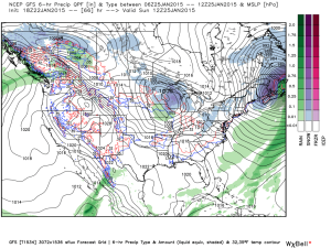
See the GFS track the clipper through the lower lakes this weekend.  This is a mild track for central Indiana and will keep the accumulating snows over the Lakes region, extending into northern portions of the state.  Some light snow will fly here late Sunday night/ early Monday, but accumulations should be minimal.
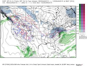
gfs_ptype_slp_conus2_12

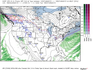
gfs_ptype_slp_conus2_16A brief surge of arctic air will invade early next week and may be accompanied by light snow Tuesday.
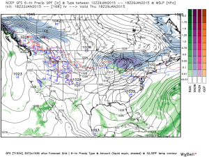
gfs_ptype_slp_conus2_21A brief southwesterly flow will allow milder air into the region by the middle of next week, but we caution this will be brief.
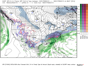
gfs_ptype_slp_conus2_29Much colder times loom to open February, potentially with a winter storm.  Obviously with this being in the 8-10 day period, there will be a lot of time to watch the storm potential.  Models have struggled mightily with storms this winter so far.  We’re much more confident on the cold, and potentially downright frigid air at that (still don’t think we’ve seen the coldest air of the winter yet).  Note the GFS sees the arctic highs “lining up.”
gfs_ptype_slp_conus2_41The European ensembles and operational are also keying in on the cold and wintry pattern closing January and to open February:
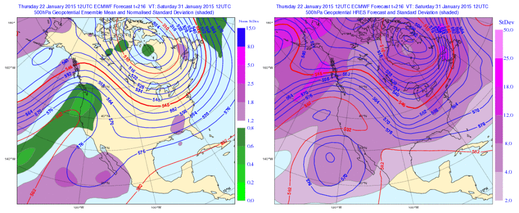
Geopotential32at32500hPa_North32America_216Initially the cold attacks the northeastern portions of the country, but “backs” west with time in the longer range:

Days 5-10
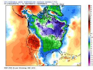
1Days 10-15

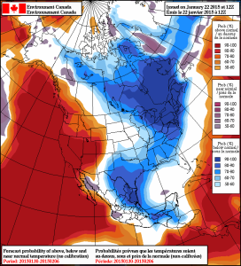
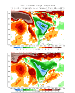
2The NAEFS and CFSv2 see the colder pattern returning:

2015012212_054@007_E1_north@america_I_NAEFS@TEMPERATURE_anomaly@probability@combined@week2_186

wk1.wk2_20150122.NAsfcT

We still think there’s a lot of “winter” left in the coming months.  Many folks enjoy snow Christmas into January, but begin to crave spring in February and March.  This is the type pattern that can be quite “ugly” for spring lovers as colder and snowy weather can push well into the spring months…  (Noted that we still have a lot of catch up to do in the snow department, but we’re not ready to say we won’t make up for “lost time”).

Permanent link to this article: https://indywx.com/2015/01/22/step-down-process-to-cold-before-the-return-of-truly-frigid-times/

Facts Are Facts…

I’m hearing rumblings out there that you can’t get sustained cold across Indiana without a negative Arctic Oscillation (AO) and/ or negative North Atlantic Oscillation (NAO).  I would ask those with that belief to please explain the following:

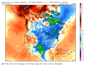
January temperature anomalies month-to-date show widespread cold (even accounting for the January thaw the past week).

ncep_cfsr_noram_t2m_anom


The first two weeks of the month were downright frigid and this was in the face of an AO that was not just positive, but strongly positive.

AO

To take this a step farther, the recent relative warmth has come with a negative AO.

Bottom line is that a ton of drivers are trying to take the wheel this winter.  Admittedly, that makes things incredibly difficult for forecasting- short-term or longer range.  That said, coming out with a “blanket statement” that you can’t have sustained cold without a negative AO or NAO is a flat-out lie and we wanted to address it.  Teleconnections can help many times with coming weather patterns, but not always.  This winter is a prime example of that.

Quick note on the clipper system- all forecast models today have taken the primary impacts (at least from a snow standpoint) north of the immediate region (central Indiana). Heaviest snows are favored across the Great Lakes, extending down into northern IN. We’ll continue to keep a close eye on things…

Permanent link to this article: https://indywx.com/2015/01/21/facts-are-facts/

A Word On The Longer Range; Steady As She Goes…

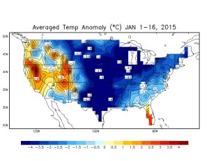
We wanted to touch briefly on the longer range weather pattern as we’ve been answering questions this weekend out there concerning what lies ahead. Ultimately, the good Lord above is the only one who knows tomorrow and this idea we have very well may be the wrong one. However; we still see a lot of winter in this weather pattern. The combination of below average snowfall to date, combined with milder air the past 24 hours has led some winter lovers into a panic. Despite the past 24 hours, let’s remember where we are for the month of January through the first half:

image

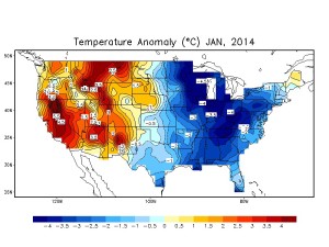
Now let’s compare this to the infamous January 2014:

image

So far, this January the cold is more widespread across the nation. Additionally, through the first half of January, IND is actually running colder than last January. Many remember the brutal cold following the major winter storm early last January. Let’s also remember that a few days after that snow and cold we were dealing with much milder air and rain- a bonafide January thaw.

That brings us back to the present and our current January thaw. Looking back through the record books indicate even the coldest Januarys on record have “thaws.” What’s perhaps more impressive is that the end of this year’s thaw appears to be seen really before it even begins.

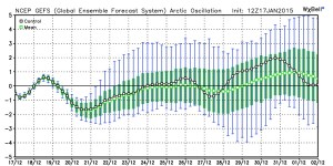
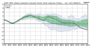
There are so many different drivers trying to take the wheel this winter it, admittedly, makes for an incredibly challenging time of things forecasting. That said, should we see the “stars align” (negative AO, negative NAO, positive PNA) in the coming weeks, this is the type scenario that could carry winter deep into spring.

In the shorter term, as of now we see no reason to abandon the idea the cold reloads to close January and open February. It’s possible that some weather outlets lean heavily on particular model runs and base their mid to long range forecast accordingly. While we agree you have to supplement some of that data into your mid and long range forecast, this is the type pattern than can make for risky business putting all the eggs in one basket.  (We also suggest any outlets leaning solely on operational and ensemble output are in need for a serious dose of dramamine). Instead, we prefer a blend of the above with the foundation being a combination of a nearly ideal SST profile for wintry times continuing and big-hitter analogs. It must also be noted that we have to keep the current AO/ PNA state in the back of our mind.

Speaking of those teleconnections… The current AO and PNA leave a lot to be desired for winter lovers in the longer range:

image image

That said, it should be noted the first two weeks of January cold was in the face of teleconnections that screamed of a warm pattern and a MJO phase that was also mild.

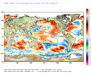
Perhaps the bigger driver here is the surface temperature profile in the PAC and ATL. Also note the modoki El Niño.

IMG_2167.PNG

That warmer water sitting across the northeast Pacific Ocean promotes ridging into the PAC NW and AK.  In return the upper level winds tap available arctic air and send it southeast (see the first two weeks of January).

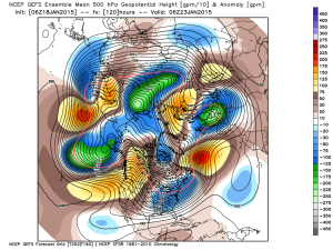
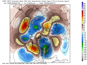
In the mid range, ensemble data is bullish on this aforementioned pattern returning after the very brief January thaw.

1

2

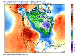
The sensible weather that should result the upcoming 10-12 days?  An active pattern and one that’s very challenging with that northwest flow (we’ll be on clipper watch), biased colder than average.  In fact, the GFS ensembles aren’t too shy about eastern cold week 2.

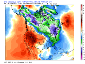
gefs_t2m_mean_noram_d8_16

Let’s watch things unfold in the coming couple of weeks.  Make it a great day and GO COLTS!

Permanent link to this article: https://indywx.com/2015/01/18/a-word-on-the-longer-range-steady-as-she-goes/

IndyWx.com