You must be logged in to view this content. Click Here to become a member of IndyWX.com for full access. Already a member of IndyWx.com All-Access? Log-in here.
You must be logged in to view this content. Click Here to become a member of IndyWX.com for full access. Already a member of IndyWx.com All-Access? Log-in here.
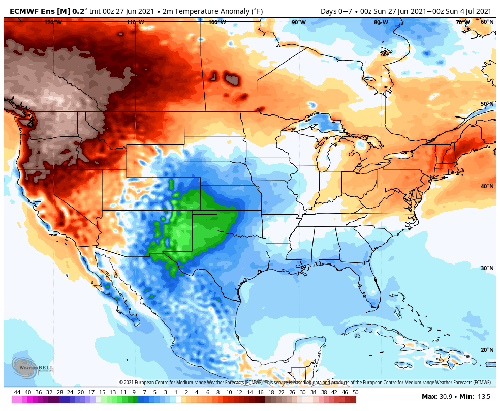
The upper level pattern this week will feature troughiness in the central portion of the country while a significant high pressure ridge continues to bake the Northwest with unseasonably hot, record-breaking temperatures.
Record heat will continue to bake the Northwest while unseasonably cool temperatures will be welcomed into the Front Range, southern Plains, and along the Gulf Coast.
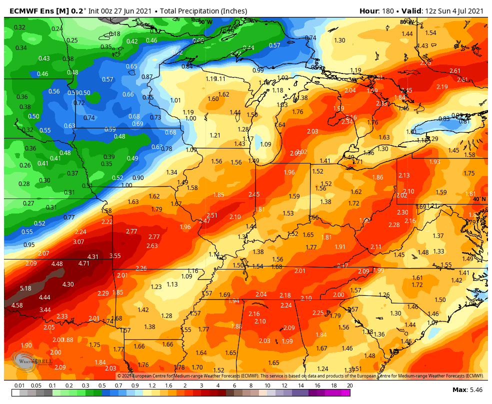
We forecast widespread rainfall amounts between 1.5″ and 2.5″ across central IN in the upcoming 7-day period, but there will be locally heavier totals.
Well above normal precipitation can be expected ahead through the period from the southern Plains into the Great Lakes, TN Valley, and Mid-Atlantic.
While ingredients aren’t in place for a widespread severe weather event, one or two cells could pulse to severe levels later this afternoon across the northern half of IN, including an isolated tornado, given the parameters.
Forecast Period: 06.27.21 through 07.04.21
A frontal boundary will remain draped across the general area through the middle part of this week. While subtle differences will remain regarding greatest concentration of shower and thunderstorm coverage each day, it’s a safe bet most of the region will see a passing shower or storm at some point each day this week. We’ll keep an eye on radar trends this afternoon for the possibility of a local severe weather warning (threat is primarily going to be centered on western and northern parts of the state). Eventually the front will get shoved south and we’ll welcome in drier, cooler air as we get ready to kickoff the long Independence Day weekend. In fact, overnight lows will likely fall into the lower 50s for some by the weekend with highs only in the low-mid 70s. Rain chances will persist Friday and Saturday before we dry things out in earnest for the holiday, itself.
You must be logged in to view this content. Click Here to become a member of IndyWX.com for full access. Already a member of IndyWx.com All-Access? Log-in here.
You must be logged in to view this content. Click Here to become a member of IndyWX.com for full access. Already a member of IndyWx.com All-Access? Log-in here.