Category: HRRR

Tuesday Evening Video Update!

Good evening and thank you for logging onto IndyWx.com!  Tonight’s video covers the unsettled time of things tonight into Wednesday morning as low pressure continues to have a hold on our area’s weather.  Also, we talk long range weather and give you an idea of what you can expect for the rest of the month of June, temperature-wise!  While we didn’t get into the precipitation side of things in tonight’s video for late month, I will say it continues to look very unsettled with above average rainfall anticipated to wrap up the month of June.  Anywhere from an additional 3-5″ of rain is possible as we go through the rest of the month here across central Indiana.

While the CFSv2 can be a bit erratic at times, we feel the model has a good handle on the way the overall pattern will evolve late June into July.

While the CFSv2 can be a bit erratic at times, we feel the model has a good handle on the way the overall pattern will evolve late June into July.

Permanent link to this article: https://indywx.com/2014/06/10/tuesday-evening-video-update/

Wet Day Ahead…

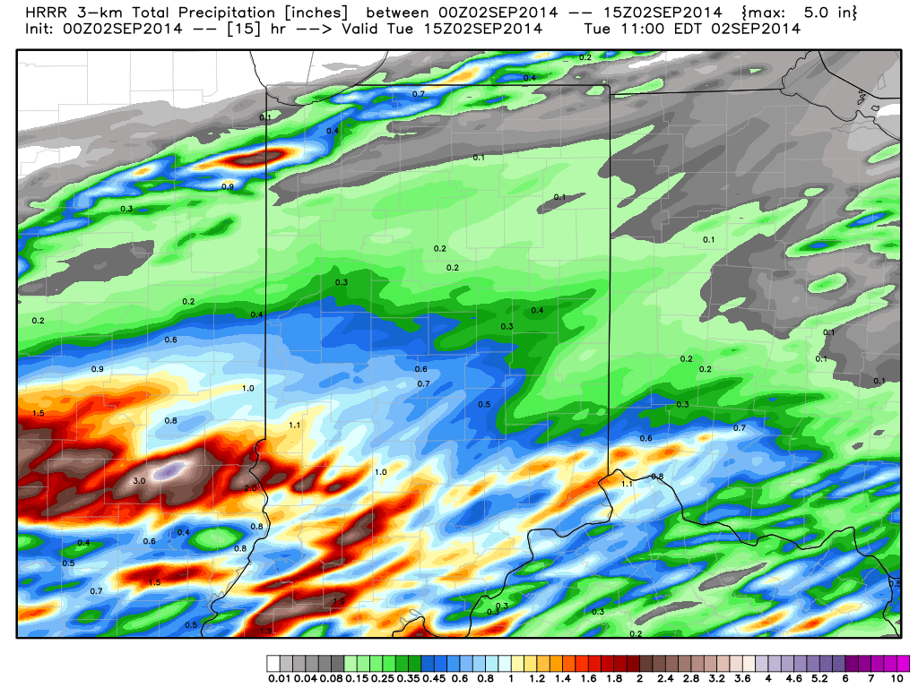
Widespread light to moderate rain moved into central Indiana during the predawn hours.  Most communities picked up .20″-.30″ since midnight.  Some of asked if this is it for the rain today?  Unfortunately not.  The large low pressure system that’s sitting and spinning to our southwest will continue to pump copious amounts of moisture north through the afternoon and into Wednesday.  Heavy showers and embedded thunderstorms (non-severe) will redevelop this afternoon and evening and be responsible for locally heavy rainfall.

Forecast radar through the afternoon and heading into the evening hours.

3 4 7

We still anticipate widespread rainfall totals of 1-2″ across central Indiana when you look at the 48 hour period- 12a Tuesday through 12a Thursday.

Grab a good book and settle in for a wet day!

Permanent link to this article: https://indywx.com/2014/06/10/wet-day-ahead/

Video Brief On Tonight’s Storms…

Quick video update this afternoon to discuss what we can expect this evening into the overnight.

You must be logged in to view this content. Click Here to become a member of IndyWX.com for full access.  Already a member of IndyWx.com All-Access?  Log-in here.

Permanent link to this article: https://indywx.com/2014/06/07/video-brief-on-tonights-storms/

Wednesday Severe Threat Far From Etched In Stone…

Many central Indiana neighborhoods picked up copious amounts of rainfall within a short time period this afternoon and evening.  We received 2″ here at the IndyWx.com HQ within just under 90 minutes.

Forecast radar 5am Tue

Forecast radar 5am Tue

The rest of the evening will feature a drier theme as the axis of slow moving, torrential, downpours presses east.  That said, a couple of “rumblers” may be present during the early Tuesday morning period as a boundary slowly sinks south. We’re not talking about widespread heavy rain and storms, such as this evening, but a couple of thunderstorms may rumble across central Indiana early Tuesday morning before we dry things out and introduce sunshine for the majority of your Tuesday.

Our attention will then shift to another round of heavy rain and thunderstorms Wednesday.  A severe weather outbreak will unfold to our northwest late Tuesday afternoon.  While this severe weather episode is likely to begin with individual severe thunderstorms (including potentially tornadic super cells), the activity should eventually morph into a mesoscale convective complex (otherwise referred to as a MCC in the wonderful meteorological world) during the night Tuesday as the storms roll towards our neck of the woods.

The Storm Prediction Center (SPC) highlights the region for a Slight Risk of severe weather Wednesday.

day3otlk_0730

We want to stress that this particular severe weather episode is far from etched in stone.  Diving into our short to mid term forecast models would suggest the initial round of heavy rain and thunderstorms rumble into the state around 4-6am Wednesday- potentially in a weakened state when compared to what our friends and neighbors off to our north and west will experience Tuesday night.  Now it’s important that we insert the timing disclaimer to the equation as similar events in the past have been known to accelerate forward motion and arrive “ahead of schedule.”  (We’ll keep a close eye on the timing side of things and update Tuesday).

hires_ref_ky_37hires_ref_ky_43

We’re confident we’ll be dealing with heavy rain around these parts Wednesday morning along with plenty of thunder and lightning.  That said, there are many more questions than answers at the moment around whether or not severe levels will be reached, at least in our humble opinion.  Should severe weather be an issue, it would most likely come from the following two impacts- damaging straight line winds and large hail.  Again, we’re leaning more towards this initial round of showers and thunderstorms blowing into town in a weakening state.

Finally, there will be one more opportunity for strong to severe thunderstorms Wednesday afternoon, but this will be fueled by just how quickly the local air mass can warm and destabilize.  There are, again, questions around heating potential across the local area (central Indiana) and our thinking currently places a greater concern for damaging severe weather across southern Indiana into Kentucky (folks traveling to Louisville Wednesday afternoon would need to prepare for damaging severe potential).  Should we recover quicker than currently expected from Wednesday morning’s convection then we would need to hit the severe threat harder across central Indiana Wednesday afternoon.  Stay tuned for updates!

Storms will likely strengthen yet again Wednesday afternoon, especially across southern Indiana.

Storms will likely strengthen yet again Wednesday afternoon, especially across southern Indiana.

Permanent link to this article: https://indywx.com/2014/06/02/wednesday-severe-threat-far-from-etched-in-stone/

IndyWx.com