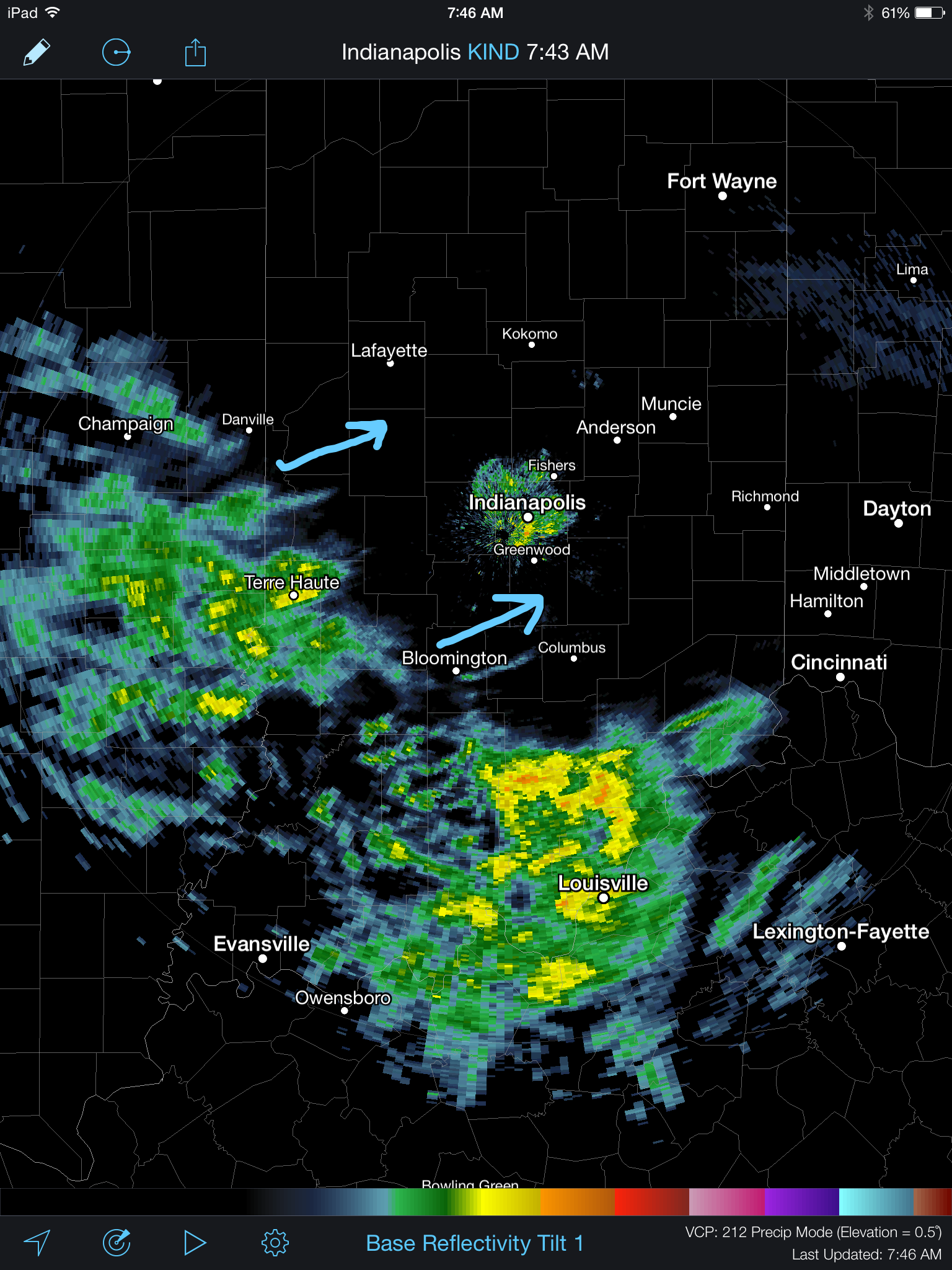
A wintry mix of sleet and freezing rain continues to advance slowly northeast this morning. Thankfully, most of the rush hour should be over by the time any of this wintry precipitation arrives and we have a couple things going for us this morning: 1.) Drier air is giving this precipitation a tough time advancing northeast and 2.) by the time the precipitation arrives, temperatures will be marginal for many road problems, if any. By far the more concerning issues are off to the southwest of Indianapolis, including places like Terre Haute (where moderate snow was reported at 9am).
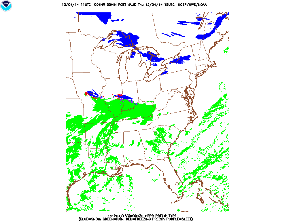
The HRRR slowly pushes the wintry mix along the I-70 corridor this morning.
Attention then turns to a heavy rain event Friday into Saturday morning. Widespread 1-2″ amounts are expected.
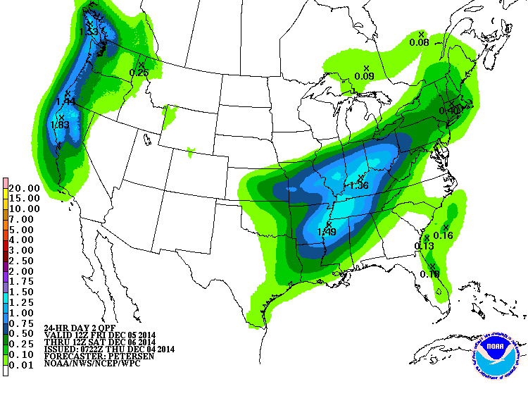
Forecast radar shows periods of heavy rain overnight Friday into Saturday morning.

Much more this evening!