You must be logged in to view this content. Click Here to become a member of IndyWX.com for full access. Already a member of IndyWx.com All-Access? Log-in here.
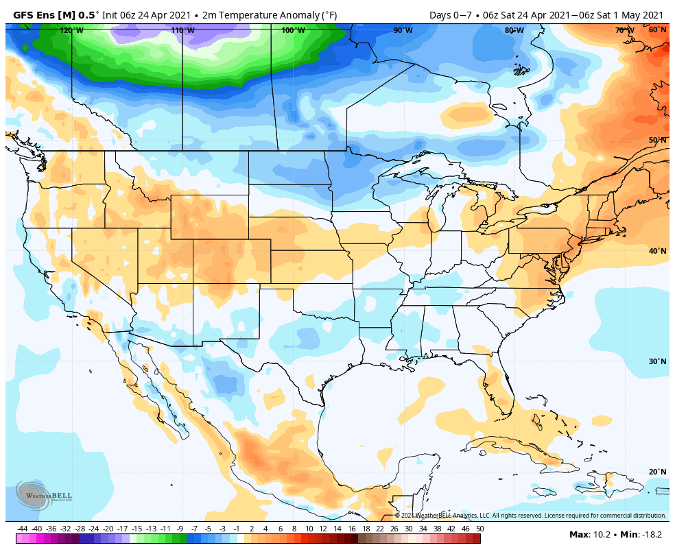
Temperatures will moderate from the unseasonably cold conditions as of late. We’ll make a run for 80° by Tuesday here in central IN.
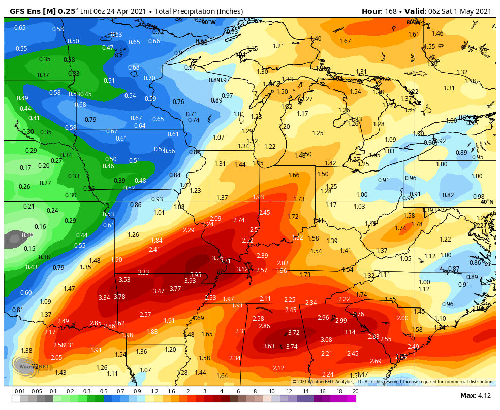
Above normal rainfall is expected in the week ahead from the mid MS Valley and Gulf Coast into the Ohio Valley and Great Lakes.
We forecast most central IN rain gauges to receive between 1.75″ and 2.25″ in the week ahead.
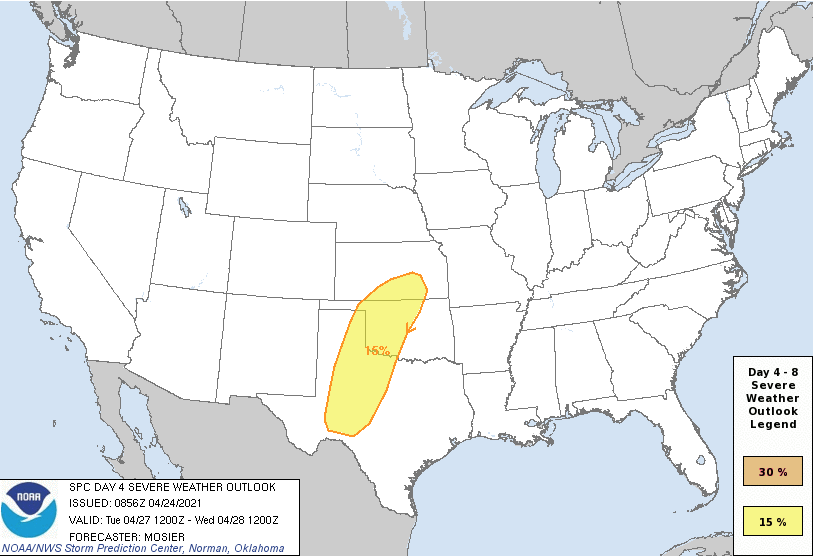
A new spring storm will emerge out of the Plains Tuesday and likely ignite a round of severe weather throughout tornado alley.
Forecast Period: 04.24.21 through 05.01.21
A relatively weak storm system will lead to plenty of clouds today and a couple of light passing showers (better chance of steadier rain downstate). This system will blow by to our east tonight and allow a drier air mass to build into the region as we move through the 2nd half of the weekend, complete with a return of sunshine! Enjoy the sunny and much warmer open to the week as significant changes await by Wednesday. Before this, a strengthening southwesterly air flow will push high temperatures into the lower 80s Tuesday! Attention will then shift to a complex and multifaceted storm system that will deliver heavy rain and thunderstorms (potential present for a couple stronger storms midweek that we’ll continue to monitor) in rounds Wednesday through Friday. While it won’t rain the entire timeframe, periods of heavier rain can be expected. We’ll dry things back out heading into next weekend.
You must be logged in to view this content. Click Here to become a member of IndyWX.com for full access. Already a member of IndyWx.com All-Access? Log-in here.
II. Heavy rain/ potential flooding threat looms late week across OHV
Widespread above normal temperatures can be expected this week. Only exception to this will be across the West and far Southeast.
Above normal precipitation will target the MO Valley and into the western OHV.
We expect between 1″ and 2″ for most of IN in the week ahead.
Widespread significant drought continues across the West, especially Southwest/ Four-Corners region.
Forecast period: 03.07.21 through 03.14.21
While our weather will remain “eerily quiet” to open this forecast period, significant changes await on deck by the 2nd half of the week. These changes will be ushered in from a cold front that will lead to increasing shower (maybe even embedded t-storm) chances Thursday before rain becomes widespread Thursday night into Friday. The GFS and European computer models begin to disagree on the evolution of things next weekend. The GFS stalls the front just to our south before a surface wave of low pressure rides along the boundary over the Saturday-Sunday period. Meanwhile, the European shoves the front off to the south in a quicker fashion, allowing for a drier weekend. We’ll need to keep a close eye on things and update in the days ahead. Should the GFS idea be correct, a flood threat would ensue, including weekend rainfall totals of several inches. We’re not ready to jump on the excessive rainfall idea yet, due to the differences in the handling of the frontal boundary/ associated surface wave, but will keep a very close eye on things. Stay tuned.
You must be logged in to view this content. Click Here to become a member of IndyWX.com for full access. Already a member of IndyWx.com All-Access? Log-in here.