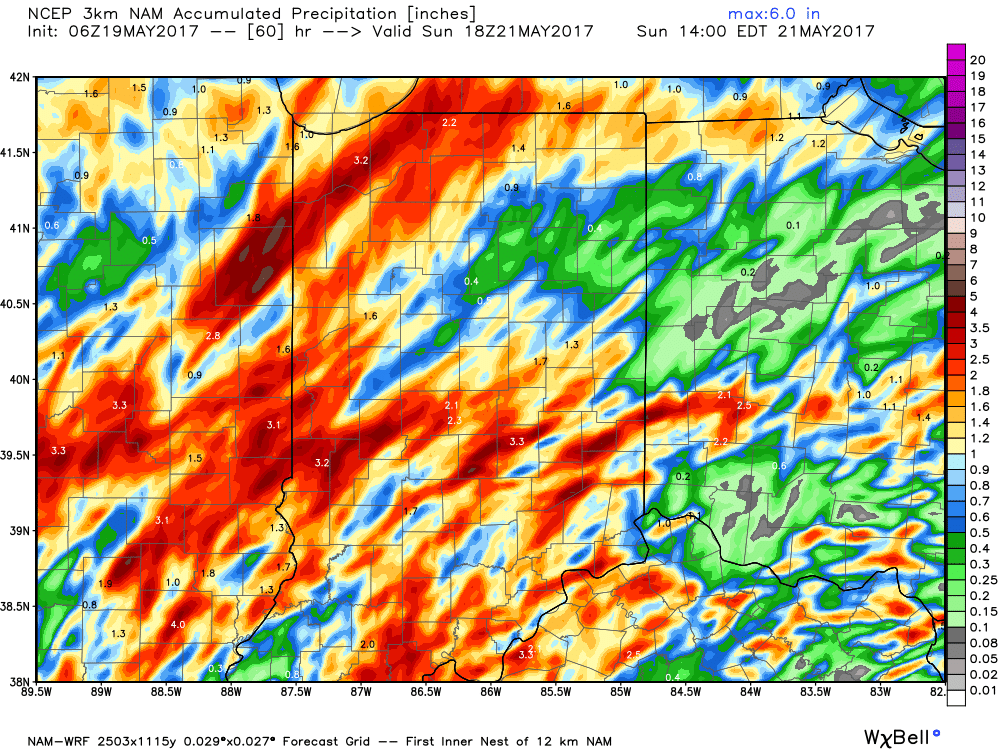
Category: Heavy Rain
 Highlights:
- Strong storms late tonight
- Turning cooler and less humid
- Unsettled pattern back half of next week
Storms Rumble In Late Tonight…Most of the daytime today will be dry and hot. High humidity will also be with us and will help boost heat indices into the middle 90s. Take it easy outdoors today.
We’ll have to keep a close eye on radar trends upstream tonight as a complex of thunderstorms is expected to erupt to our northwest this evening. This storm complex will track southeast and begin impacting Indiana by late-evening (thinking around 11p, or so, across northwest portions of the state as of now). As we push into the overnight, these storms will continue to settle southeast, including central Indiana. A couple of these storms may be strong and with such high moisture content, locally heavy rainfall is, once again, a good bet.
A couple of showers or thunderstorms will be with us Father’s Day, but outdoor plans shouldn’t be cancelled, as most of the day appears to be dry. It’ll be a cooler day and less humid air will filter into the state Sunday night. This will produce a glorious open to the work week!
Unsettled weather will return by the middle and latter portions of next week, along with a briefly warmer and more humid feel.
Upcoming 7-Day Precipitation Forecast:
- Snowfall: 0.00″
- Rainfall: 1.50″ – 2.00″
Permanent link to this article: https://indywx.com/2017/06/17/tropical-feel-stormy-later-tonight/
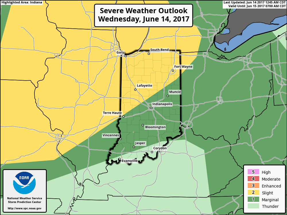
The Storm Prediction Center includes the northwestern portions of the state in a Slight Risk of severe weather later this afternoon and evening. Given the overall set-up and morning trends from data, it wouldn’t surprise us if this threat expands further southeast in future updates later today from the SPC.
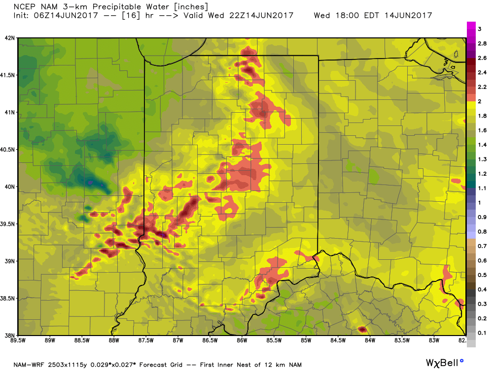
 Similar to Tuesday, any storms that develop will be capable of locally heavy rain and flash flooding. While storms should move in a quicker fashion today, precipitable water values (PWATs) remain downright tropical and will exceed 2″ later this afternoon.
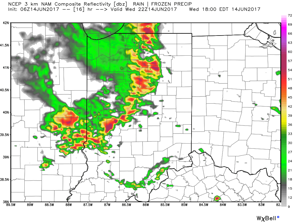
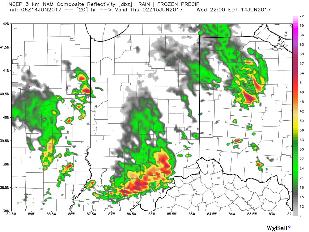
 Overall storm coverage should become more widespread as we push into the afternoon and evening hours. Here’s what the radar may look like during the 4p, 6p, and 10p time frames:
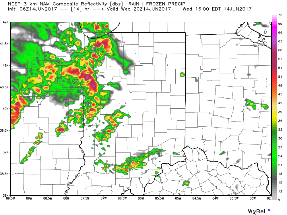
 From a severe perspective, the biggest concern is damaging straight line winds with stronger storms. Remain weather-aware later today, friends!
Permanent link to this article: https://indywx.com/2017/06/14/another-stormy-day-ahead/
 Highlights:
- Scattered storms remain
- Oppressive feel
- Cooler times next week
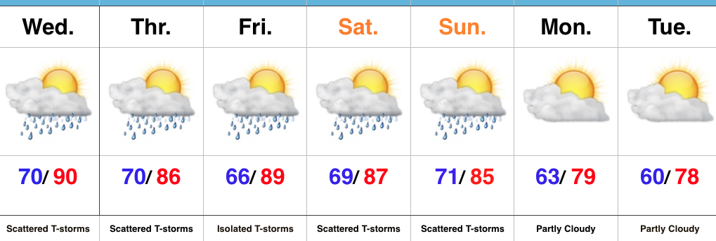
Locally Heavy Storms…We’ll remain locked into a very warm and moist air mass through the remainder of the week, but there’s light at the end of the tunnel. If you’re not a fan of the hot, humid weather, hang in there; next week will offer up a much different feel!
Before we discuss the cooler times that loom next week we still have to face several days of muggy weather and daily scattered storms. With such a “soupy” air mass in place (precipitable water exceeding 2″), any storms will be capable of producing torrential downpours. Similar to that of today, there will be “haves and have nots” over the next few days, but any storms that develop will have the potential of quickly pulsing to strong to severe levels and producing localized flash flooding.
Once to Sunday, a cold front will sweep through the state and finally wash all of the warm and humid air off to the southeast. While scattered storms will remain in our forecast through the weekend, a drier and cooler air mass will arrive on the scene early next week. Hang in there, friends!
Upcoming 7-Day Precipitation Forecast:
- Snowfall: 0.00″
- Rainfall: 1.00″ – 1.50″ (locally heavier totals)
Permanent link to this article: https://indywx.com/2017/06/13/soupy-now-but-changes-loom/
 Highlights:
- Dry conditions continue
- Hot and turning humid
- Storm chances return
Tropical Feel Develops…Pleasant air is on borrowed time and we’ll begin to notice an increasingly muggy feel to the air as early as this afternoon. Dew points will reach oppressive levels Monday into Tuesday (70° and above). With the increased moisture, isolated thunderstorms will develop Tuesday, but most should still remain rain-free. Better shower and thunderstorm coverage will be noted Wednesday into Thursday as a frontal system moves through the state. This won’t be a “uniform” rain, but locally heavy downpours can be expected in the stronger storms. As dry as we’ve been, we’ll take what we can get. It’s a start, at the very least, towards a more active second half of June.
We’ll dry things out briefly Friday before another storm system approaches next weekend. Early indications would suggest next weekend’s storm system will provide more widespread shower and thunderstorm activity.
Tropics: Interesting times appear to be looming in the Gulf of Mexico as we push into the last couple weeks of the month. Models continue to paint various scenarios on potential early season tropical development and any one solution can’t be bought just yet. That said, the overall pattern does seem to want to promote some tropical “mischief” in the coming 10 days, or so.
Upcoming 7-Day Precipitation Forecast:
- Snowfall: 0.00″
- Rainfall: 0.75″ – 1.00″
Permanent link to this article: https://indywx.com/2017/06/11/hot-and-humid-storms-chances-return/
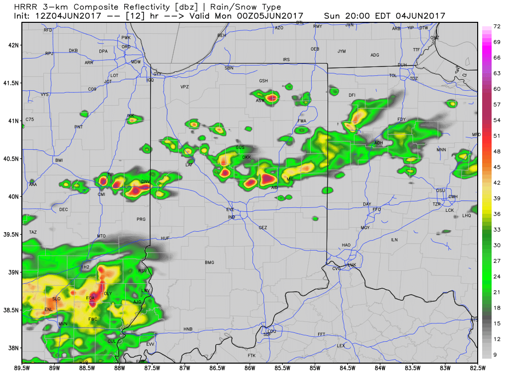
We’ve enjoyed a warm and beautiful weekend, and most of Sunday will follow that pleasant them. However, a cold front will drop south into the state later today and this “trigger” mechanism, combined with the heating of the day, will likely spark a broken line of thunderstorms. These storms will sink south into central Indiana later this evening, and a couple of storms could become strong.
Modeled radar shows how things may evolve later this evening, including time stamps at 5p, 8p, and 10p.
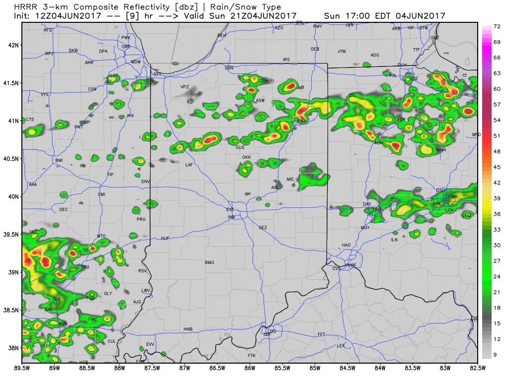
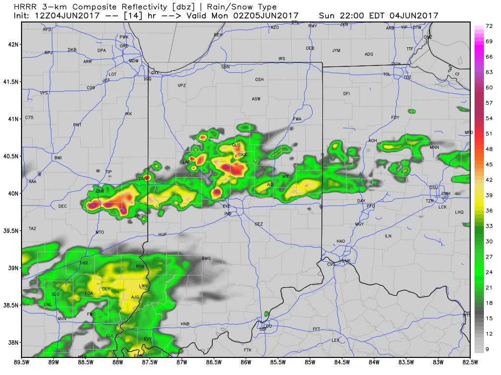 Most significant rainfall will occur across the northern half of the state, including a couple of 1″+ totals in the heavier storms.
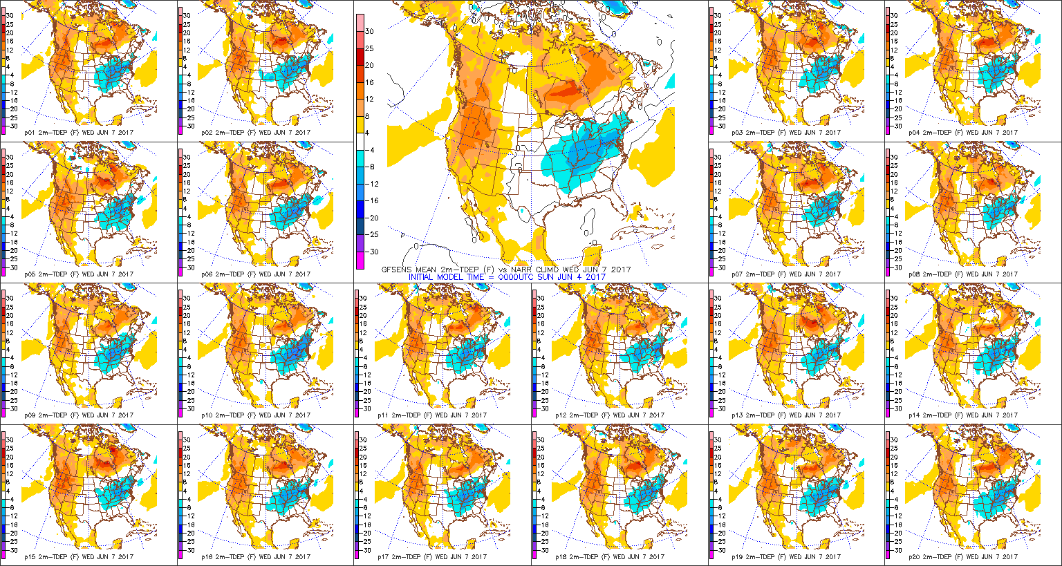
As we push into the midweek stretch, cooler, refreshing air will take up residence across the region. Temperatures will run significantly cooler than average, including lows in the upper 40s for some Wednesday and Thursday morning and highs only in the upper 60s to lower 70s. Dry weather will continue, as well.
Permanent link to this article: https://indywx.com/2017/06/04/storms-may-rumble-in-later-today-cooler-for-midweek/
The morning is starting off dry across most of central Indiana, but that will begin to change as we progress into the afternoon and evening hours as rainfall grows in coverage and intensity.
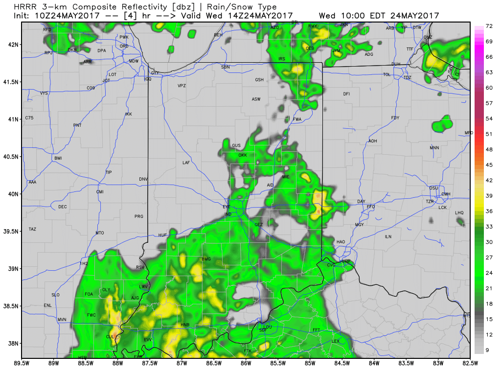
10a forecast radar
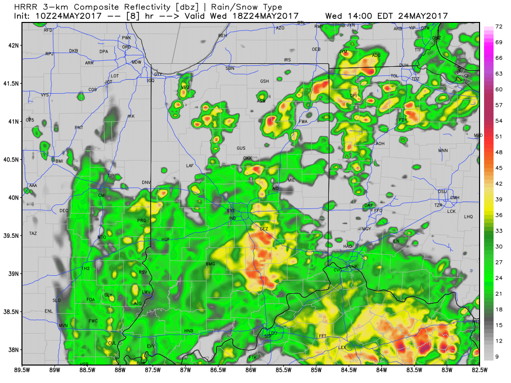
2p forecast radar
Widespread rain will continue tonight as low pressure tracks north out of the TN Valley and slowly meanders across eastern IN and OH tonight before pulling off to the northeast Thursday.
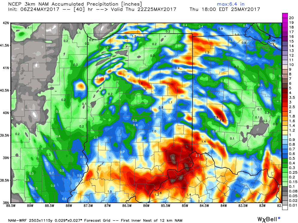
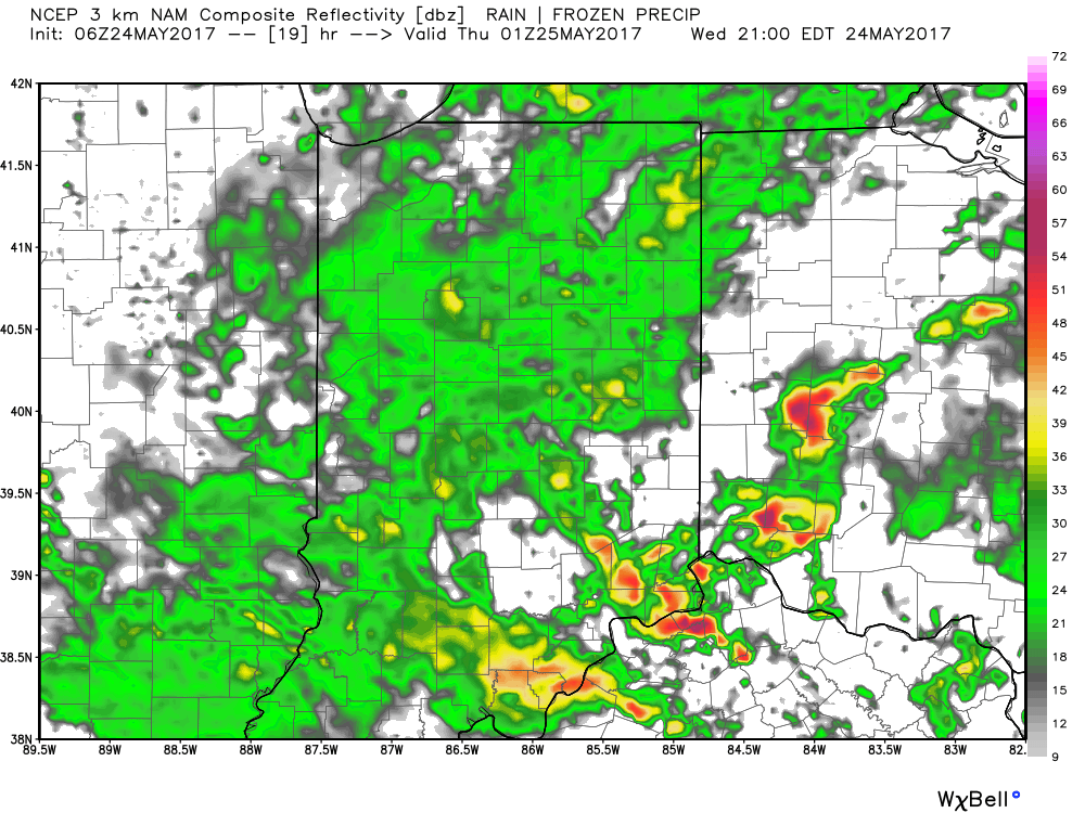 Thankfully, rain will begin to diminish Thursday morning and we’re back to mostly dry conditions by Thursday afternoon. Before dry weather returns, some neighborhoods can expect to accumulate between 1″-2″ of rain.
 With the clouds and showers around, expect unseasonably cool conditions both today and Thursday. Highs will only reach the mid to upper 60s both days.
As we look ahead, we think our dry Thursday afternoon should continue into most of Friday before scattered showers and thunderstorms return to the forecast Saturday and Sunday. More on those details later today! Make it a great Wednesday!
Permanent link to this article: https://indywx.com/2017/05/24/cool-and-increasingly-wet-today/
-
Filed under 7-Day Outlook, Forecast Discussion, Forecast Models, Heavy Rain, Indy 500, Memorial Day weekend, T-storms, Unseasonably Cool Weather, Unseasonably Warm, Weather Videos
-
May 23, 2017
You must be logged in to view this content. Click Here to become a member of IndyWX.com for full access. Already a member of IndyWx.com All-Access? Log-in here.
Permanent link to this article: https://indywx.com/2017/05/23/video-unsettled-weather-returns-for-midweek-and-looking-ahead-to-race-day-weather/
 Highlights:
- Sunny open to the work week
- Midweek storms
- Storm chances remain for the long race and holiday weekend ahead
Pleasant Open To The Work Week…High pressure will support dry and pleasant weather conditions as we open up the work week. Expect plentiful sunshine and comfortable conditions to spend time outdoors today! Enjoy!
Unsettled weather will return for midweek as low pressure moves into the Ohio Valley. Scattered showers Tuesday will increase in overall coverage and intensity Wednesday, including the potential of locally heavy rainfall. With all of the clouds and rain around through midweek, temperatures will run significantly below average.
Thankfully, we’ll get a breather Friday, with a mostly dry day expected. We’ll turn the temperature up a couple notches heading into the long race and Memorial Day weekend. Additionally, expect an increasingly muggy feel with scattered thunderstorms returning to the forecast this weekend.
Upcoming 7-Day Precipitation Forecast:
- Snowfall: 0.00″
- Rainfall: 1.50″ – 2.00″
Permanent link to this article: https://indywx.com/2017/05/22/busy-week-of-weather/
 Highlights:
- Scattered storm chances continue
- Much cooler next week
- Midweek showers return
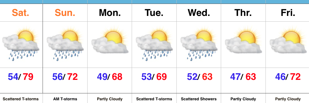
Watching For Afternoon And Evening Storms…We’re starting the day with low clouds, fog, and a chilly easterly breeze. That said, a warm front will begin to lift north this afternoon, allowing a warmer and increasingly muggy feel to return. Scattered thunderstorms will also increase in overall coverage later this afternoon and evening. While widespread heavy rains aren’t anticipated, localized heavy downpours are possible in slower moving, stronger storms.
Scattered showers and thunderstorms will remain Sunday morning, but a cold front will pass around lunchtime with drier air arriving by the afternoon hours. If you have plans outdoors Sunday, the afternoon and evening looks absolutely beautiful with a more pleasant air mass building in with those drier conditions.
Unsettled conditions return Tuesday into Wednesday with unseasonably cool air. As of now, the early outlook for the big race weekend and Memorial Day holiday is a dry one, with just a scattered shower chance Saturday. Stay tuned.
Upcoming 7-Day Precipitation Forecast:
- Snowfall: 0.00″
- Rainfall: 0.50″ – 1.00″ (Locally heavier amounts)
Permanent link to this article: https://indywx.com/2017/05/20/scattered-storm-chances-through-sunday-morning-much-cooler-next-week/
The Storm Prediction Center includes portions of the state, including Indianapolis, under a Slight Risk of severe weather today and Saturday.
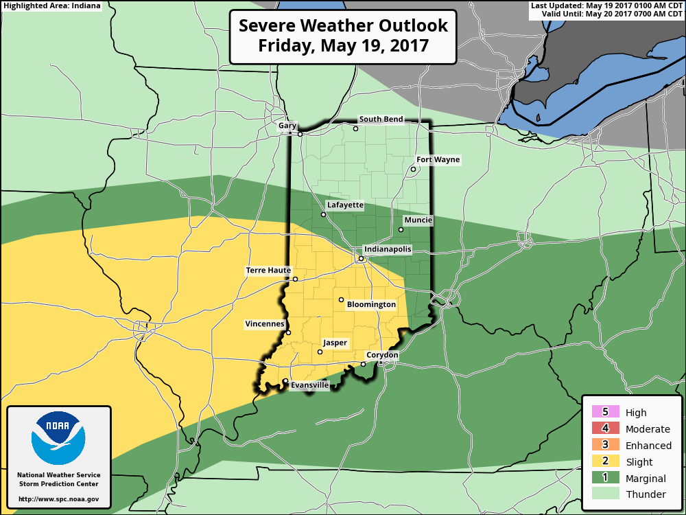
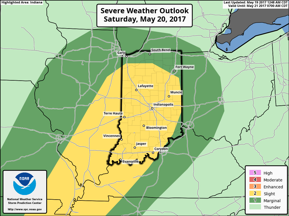 The culprit is a stalled frontal boundary that lies across the center of the state. This front will “bobble” around from time to time over the next 24 hours before lifting back north as a warm front Saturday evening. Accordingly, expect a significant temperature spread from north to south today and periods of showers and thunderstorms scattered about central Indiana. With high precipitable water values, localized heavy rains are expected, but, as mentioned, this won’t be a “uniform” event and there will be “haves and have nots.” Some neighborhoods can expect to pick up a 2-3 inches of rain between now and Sunday afternoon. Greatest severe threats include large hail and damaging straight line winds with storms, but we’ll also have to monitor things for the potential of a couple rotating storms as well.

Permanent link to this article: https://indywx.com/2017/05/19/periods-of-storms-through-the-weekend/
 Highlights:
 Similar to Tuesday, any storms that develop will be capable of locally heavy rain and flash flooding. While storms should move in a quicker fashion today, precipitable water values (PWATs) remain downright tropical and will exceed 2″ later this afternoon.
 Overall storm coverage should become more widespread as we push into the afternoon and evening hours. Here’s what the radar may look like during the 4p, 6p, and 10p time frames:

 From a severe perspective, the biggest concern is damaging straight line winds with stronger storms. Remain weather-aware later today, friends!
 Highlights:
 Highlights:

 Most significant rainfall will occur across the northern half of the state, including a couple of 1″+ totals in the heavier storms.


 Thankfully, rain will begin to diminish Thursday morning and we’re back to mostly dry conditions by Thursday afternoon. Before dry weather returns, some neighborhoods can expect to accumulate between 1″-2″ of rain.
 With the clouds and showers around, expect unseasonably cool conditions both today and Thursday. Highs will only reach the mid to upper 60s both days.
 Highlights:
 Highlights:
 The culprit is a stalled frontal boundary that lies across the center of the state. This front will “bobble” around from time to time over the next 24 hours before lifting back north as a warm front Saturday evening. Accordingly, expect a significant temperature spread from north to south today and periods of showers and thunderstorms scattered about central Indiana. With high precipitable water values, localized heavy rains are expected, but, as mentioned, this won’t be a “uniform” event and there will be “haves and have nots.” Some neighborhoods can expect to pick up a 2-3 inches of rain between now and Sunday afternoon. Greatest severe threats include large hail and damaging straight line winds with storms, but we’ll also have to monitor things for the potential of a couple rotating storms as well.