Harbinger Of Things To Come?

Updated 12.25.21 @ 11:27a

First and foremost, from our family to yours, we want to wish you a very merry Christmas and the warmest of holiday wishes during this season!

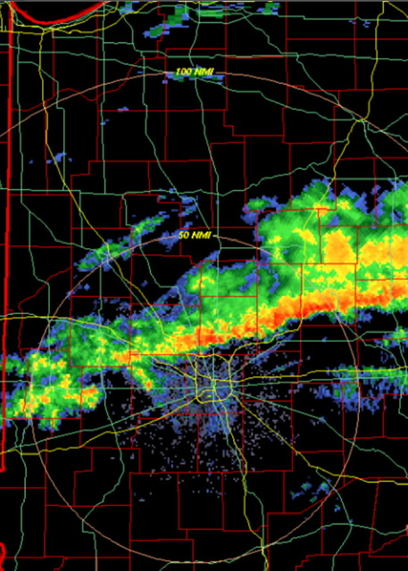
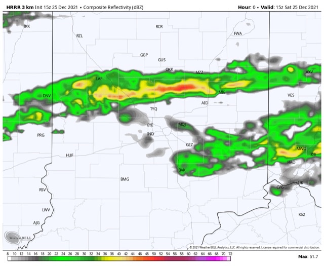
A line of rain and embedded thunder continues to plague portions of central Indiana late Christmas morning. Localized training of heavy downpours has led to this being an “overachiever” in spots across the region (closing in on 2” in a narrow strip from Frankfort over to Elwood, for example).

Radar at 11:32a

The trend should be a drier one through the afternoon as temperatures slowly begin to fall (how weird was it to walk outside on Christmas morning with temperatures in the lower and middle 60s?!).

Rain will push southeast of the area this afternoon.

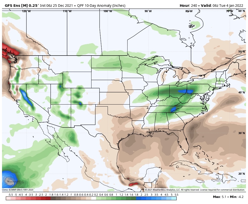
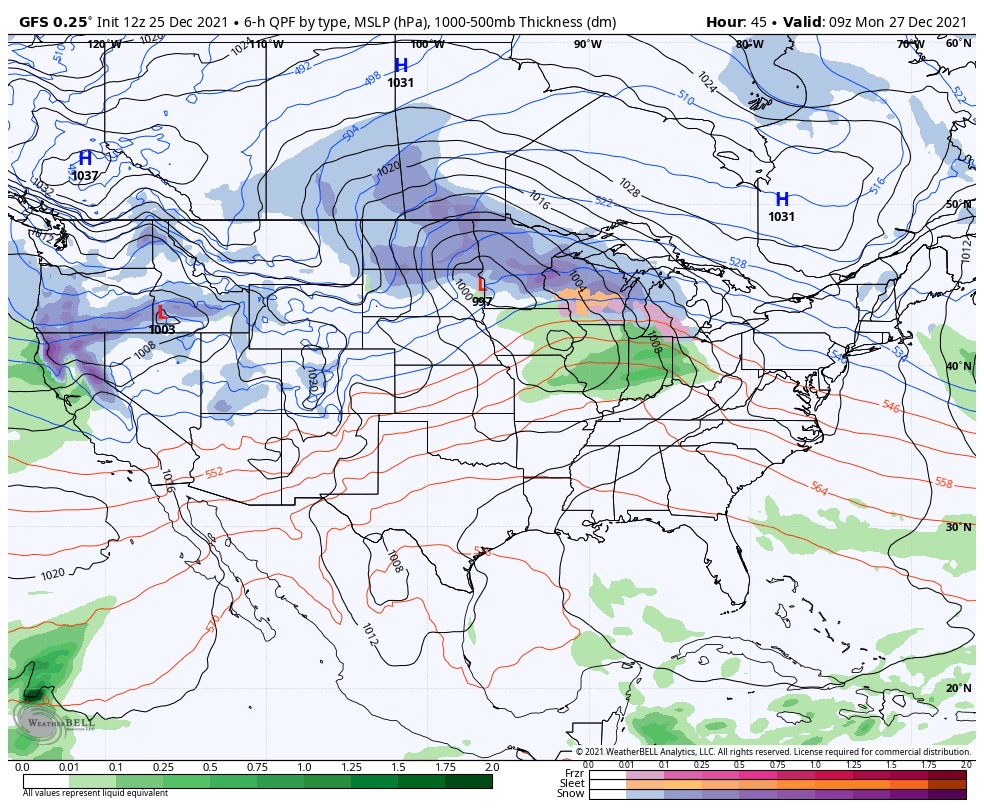
With that said, the damp theme this Christmas morning can serve as a hint to what lies ahead as we put a bow of 2021 and open up the new year. A very Niña-like pattern will force the storm track into the Ohio Valley, leading to multiple storms of significance as we go through the upcoming week to 10 days.

Sunday night into Monday, Monday night and Tuesday, followed by next Saturday into Sunday all appear to provide a good soaking to central Indiana.

Storm #2 comes along Sunday night into Monday
Storm #3 arrives Monday night into Tuesday
Storm #4 rolls in New Year’s Day

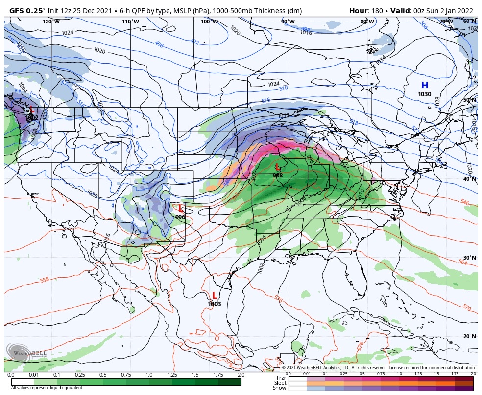
Certainly by the time all is said and done, widespread hefty totals are likely. We’ll have to hone in on specific numbers as we get closer, but it’s safe to say amounts in local rain gauges may approach 3”+ by Jan. 2nd. The heaviest rain appears slated with the storm Tuesday and again next Saturday.


Periods Of Heavy Rain Late This Evening-Overnight; Drier, Colder As We Open Christmas Week…

Updated 12.17.21 @ 7:34a

The cold front that moved through here yesterday is now draped across the TN Valley. Colder air has filtered into central Indiana this morning. We’re waking to temperatures more than 30° colder than 24 hours ago (upper 20s for most this morning out the door).

The frontal boundary will begin to lift back north this afternoon in response to a surface wave of low pressure developing in eastern OK. As a result, showers will spread back into the region as we progress through the 2nd half of the afternoon and into the evening. Eventually, as the low pressure system passes by to our south, a period of heavier rain can be expected during the overnight hours, including here in Indianapolis.

For most, an additional .50″ to 1″ of rain is anticipated (on top of what fell yesterday), but there will be locally heavier amounts.

The front will get one final shove to the southeast Saturday afternoon allowing colder and drier air to win out for the 2nd half of the weekend (highs Sunday likely won’t make it out of the upper 30s to around 40°).

This will set us up for a quiet open to Christmas week. You’ll want to take advantage of the calmer conditions as an active period is expected the closer we get to Christmas, itself, and through the New Year’s timeframe. Just in that time alone, we’re on the table to have to deal with (4) systems… More on those in the days ahead.