You must be logged in to view this content. Click Here to become a member of IndyWX.com for full access. Already a member of IndyWx.com All-Access? Log-in here.
Category: Heavy Rain
Permanent link to this article: https://indywx.com/2019/06/02/needed-48-hour-break-from-the-rain-unfortunately-heavy-rain-returns-later-this-week/
May 31
VIDEO: Gusty Saturday Storms; Wet Pattern Returns Next Week After 3-Day Break…
You must be logged in to view this content. Click Here to become a member of IndyWX.com for full access. Already a member of IndyWx.com All-Access? Log-in here.
Permanent link to this article: https://indywx.com/2019/05/31/video-gusty-saturday-storms-wet-pattern-returns-next-week-after-3-day-break/
May 30
Short-Term Video Update: How Long Do Storms Last Tonight? Strong Storms Saturday PM?
You must be logged in to view this content. Click Here to become a member of IndyWX.com for full access. Already a member of IndyWx.com All-Access? Log-in here.
Permanent link to this article: https://indywx.com/2019/05/30/short-term-video-update-how-long-do-storms-last-tonight-strong-storms-saturday-pm/
May 28
No Rest For The Weary…
Active weather will continue as we move through mid and late week. A cold front currently north of the region will slowly move south into central Indiana before stalling out and lifting back north as a warm front Thursday. This will serve as a focal point for additional thunderstorm development over the next few days.
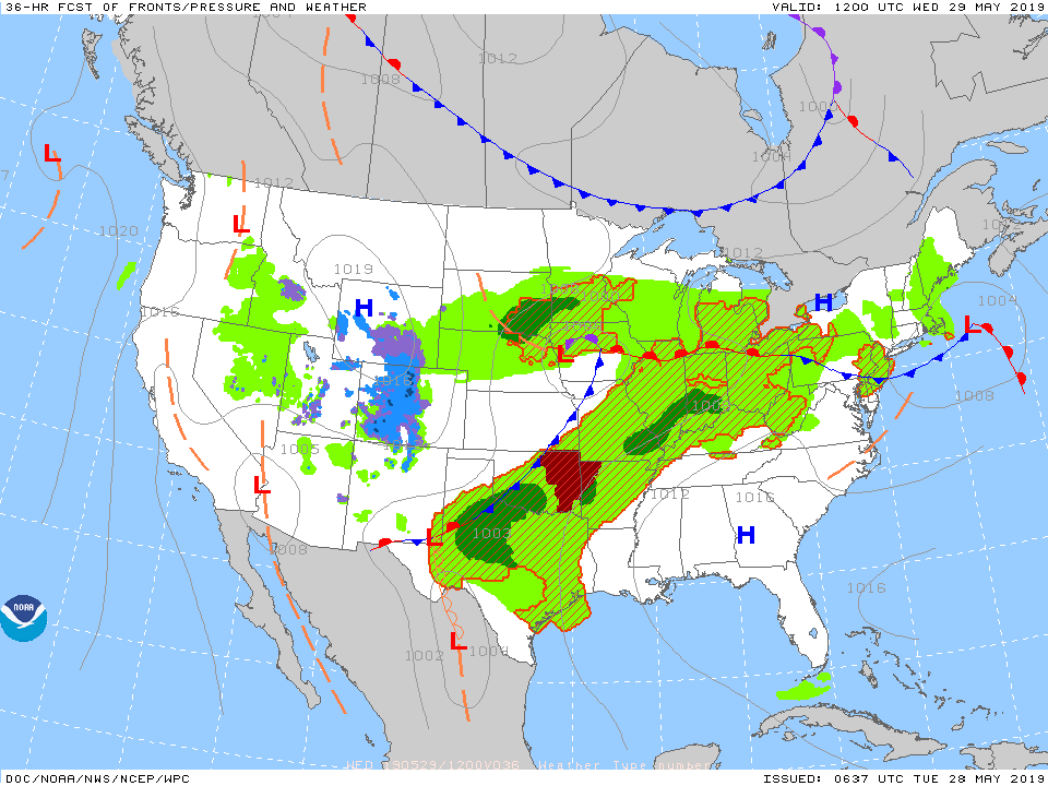
With a warm and moist environment in place, along with enough instability and forcing, storms may become strong to severe at times. While the setup the next couple of days doesn’t appear as favorable for tornadoes (when compared to yesterday), all modes of severe weather will be possible with the stronger storms. (Always have to be leery with a warm front nearby).
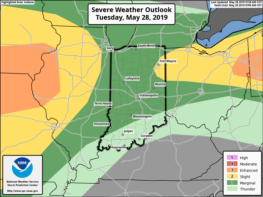
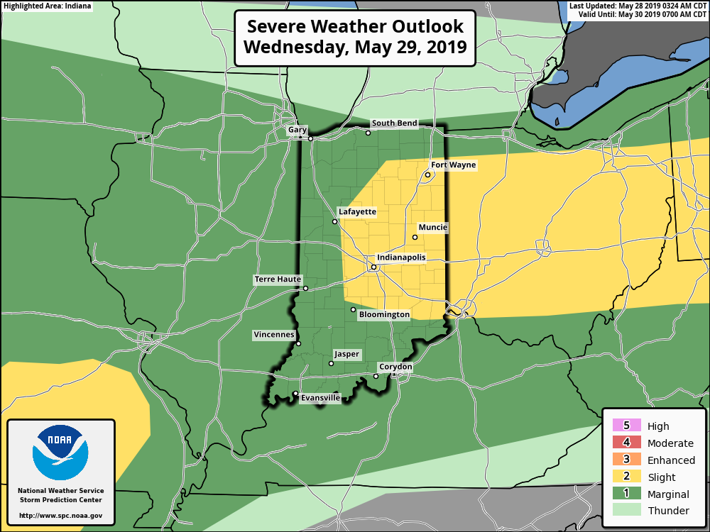
Periods of more concentrated storms can be expected this evening into Wednesday morning and again Wednesday evening into Thursday morning. In addition to a strong thunderstorm threat, locally heavy rain is a good bet.
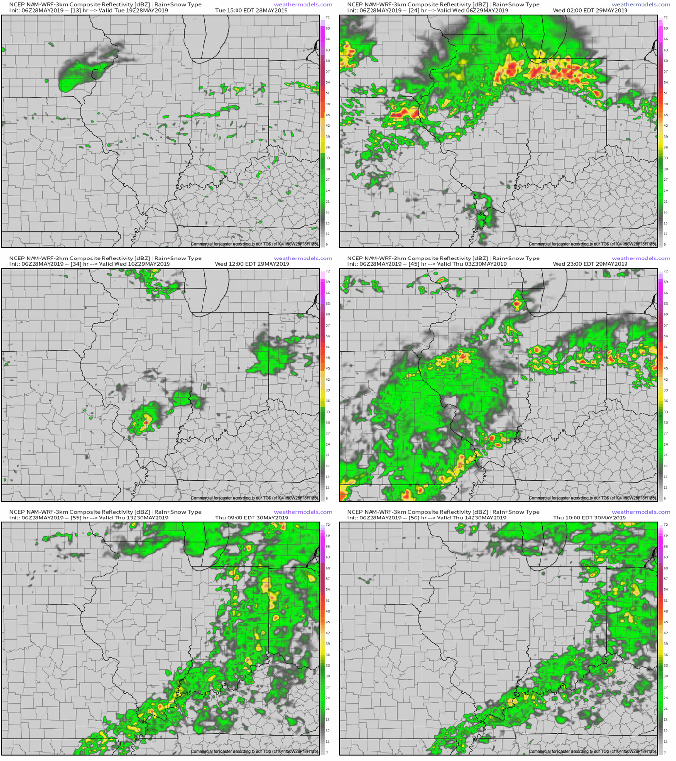

There is hope that we will be able to work drier air into the region over the upcoming weekend, helping to reduce rain chances between Sunday and next Tuesday. Let’s keep our fingers crossed…
Permanent link to this article: https://indywx.com/2019/05/28/no-rest-for-the-weary/
May 25
VIDEO: Detailed Short-Term Analysis Of Storm Threats; Discussing The Long Range Pattern Into The 1st Half Of June…
You must be logged in to view this content. Click Here to become a member of IndyWX.com for full access. Already a member of IndyWx.com All-Access? Log-in here.
Permanent link to this article: https://indywx.com/2019/05/25/video-detailed-short-term-analysis-of-storm-threats-discussing-the-long-range-pattern-into-the-1st-half-of-june/
May 20
VIDEO: Pleasant Open To The Work Week; Discussing MJO Implications Into June…
You must be logged in to view this content. Click Here to become a member of IndyWX.com for full access. Already a member of IndyWx.com All-Access? Log-in here.
Permanent link to this article: https://indywx.com/2019/05/20/video-pleasant-open-to-the-work-week-discussing-mjo-implications-into-june/
May 17
Sudden “Stick And Hold” Summer? Think Again…
The upcoming couple of weeks sure will feel like summer has arrived. After “pulling teeth” to get any sort of sustained warmth, the flip to warm/ hot and humid conditions is upon us.
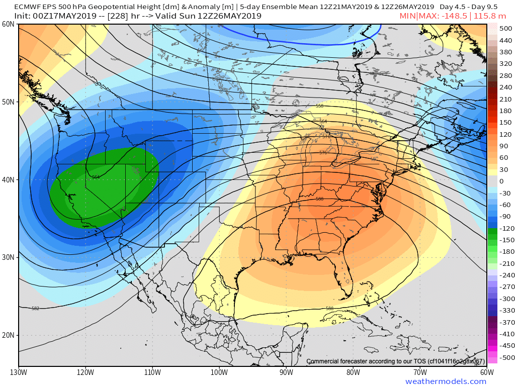
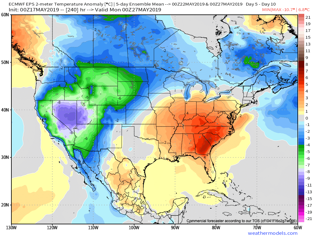
This kind of pattern will keep heaviest rain to our northwest, but that’s not to say we won’t deal with storm complexes from time to time that will be plenty capable of depositing a quick hefty amount of water in a short period (case in point yesterday evening).
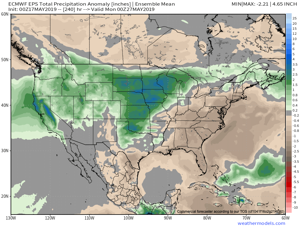
As we look ahead, the MJO continues to look like it’ll roll right into Phase 1 as we get set to close May and open June. This should ultimately mean the eastern ridge is replaced with more troughiness (may be tough to erode the southeastern ridge- where anomalous heat will likely continue for the foreseeable future) and an associated cooler pattern as we move towards early-June across our region.
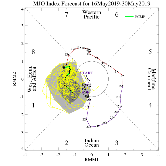
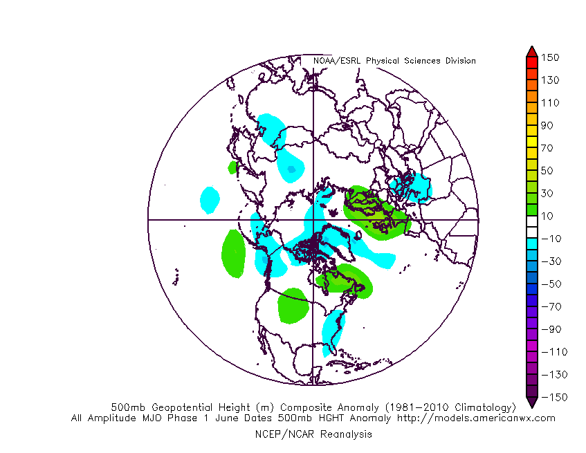
As this transition takes shape, the heaviest precipitation totals will likely shift east, including more of our immediate region, as we progress through late-May and into early June. The modeling sees this taking shape nicely.

Though we’ll likely back away from the anomalous warmth and replace things will cooler air as we move into the half-way point of the year, the same ole song and dance is expected from a precipitation perspective: wetter than average, and, at times, excessively so…
Permanent link to this article: https://indywx.com/2019/05/17/sudden-stick-and-hold-summer-think-again/
May 14
Watching From Afar: Summer-Like Warmth, But Heaviest Rain/ Severe Threat Remains NW Of Immediate Region…
An expanding upper level ridge will drive the warmest air so far this season into the Ohio Valley, including central Indiana, as we get set to close the work week and head into next week.

This will not only deliver mid to upper 80s, but the first truly “oppressive” feel of the season as moist Gulf of Mexico air flows northward into the Ohio Valley. At times, dew points will approach the 70 degree mark.
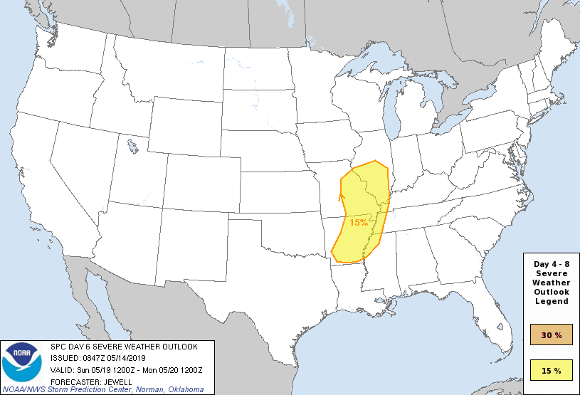
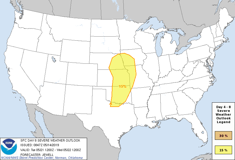
Though the pattern will turn warm and humid, the worst of the heavy rain events are expected to remain to our west-northwest. (Unfortunately, this pattern is one that will lead to a multi-day severe weather and eventual flood threat for the Plains into the upper Midwest).
That isn’t to say we won’t see rain and storms at times (most numerous Thursday night across northern and east-central Indiana, Sunday afternoon across all of the state, and again Tuesday), but instead the most concentrated heavy rain and severe potential will be focused from OK, MO, IA, and into MN and WI over the upcoming 7-day period. Instead of us looking at widespread 2″ to 4″ totals, we’re instead looking at 7-day rainfall amounts around an inch, with locally heavier amounts.
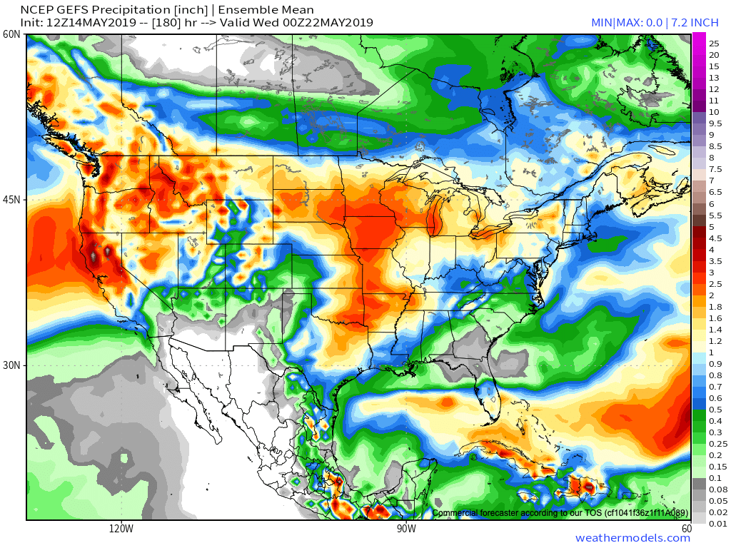
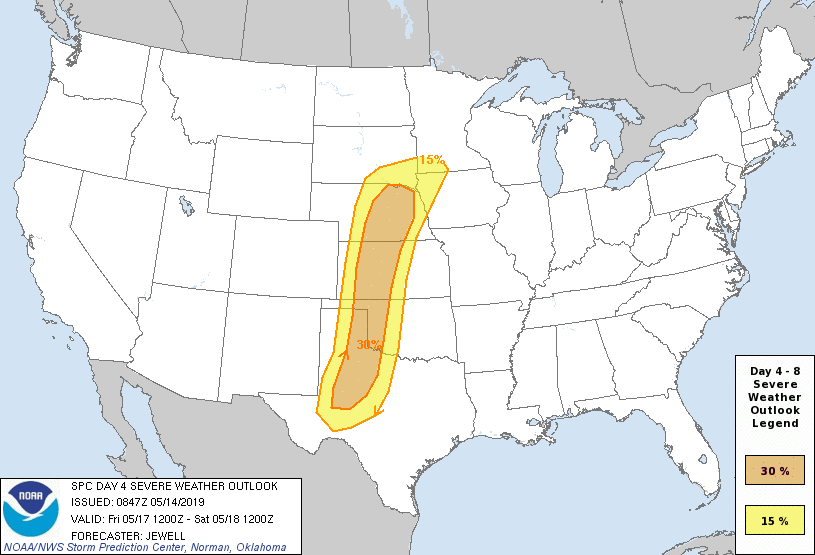
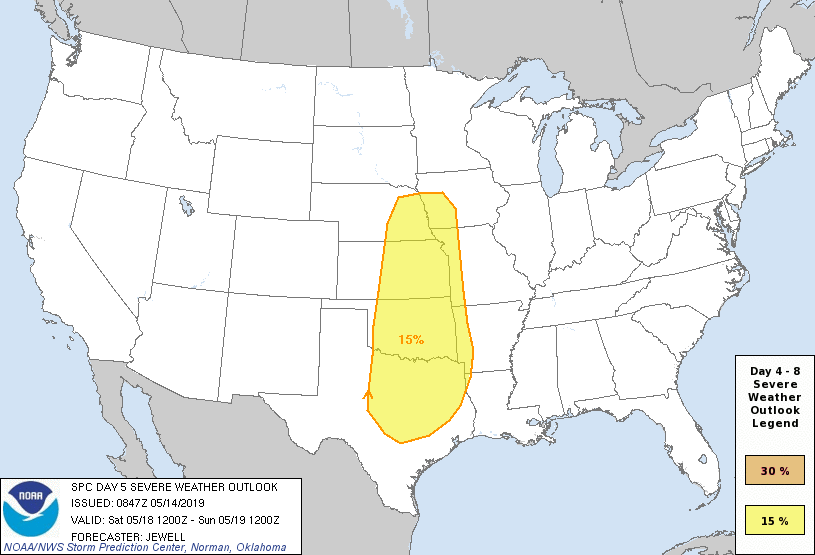
From a severe perspective, similar to the heavy rain events, this, too, is expected to remain to our west for the better part of the upcoming 7-day period. While storm chasers coverage on the Plains this weekend into next week, we’ll, thankfully, be watching the bulk of the action from afar for the better part of the period.
Days 4-8 Severe Weather Outlook, courtesy of the Storm Prediction Center (SPC), can be found below:

Permanent link to this article: https://indywx.com/2019/05/14/watching-from-afar-summer-like-warmth-but-heaviest-rain-severe-threat-remains-nw-of-immediate-region/
May 08
Short-Term Video: Thursday Storms And Weekend Weather Update…
You must be logged in to view this content. Click Here to become a member of IndyWX.com for full access. Already a member of IndyWx.com All-Access? Log-in here.
Permanent link to this article: https://indywx.com/2019/05/08/short-term-video-thursday-storms-and-weekend-weather-update/
May 07
Tuesday Afternoon Rambles: Weekend Model Differences; What’s Beyond The Cooler Mid-May Shift?
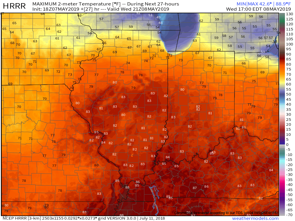
I. A couple widely scattered light showers have flared up this afternoon, but most central Indiana neighborhoods have enjoyed dry conditions with sunshine and temperatures in the mid-upper 70s. Look for more of the same Wednesday, including filtered sunshine through a good chunk of the day. Warm Air Advection (WAA) will help boost temperatures into the lower 80s for most of the immediate area.
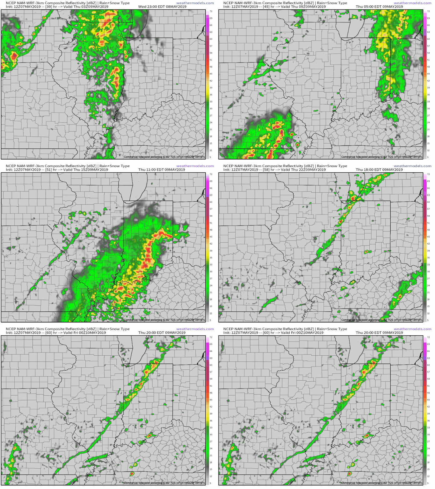
II. Better aerial coverage of showers and thunderstorms will develop late Wednesday night into Thursday night. We believe 3 rounds of showers and storms are possible during this time frame (at least impacting portions of the central Indiana viewing area):
- Late Wednesday night into the predawn Thursday
- Thursday afternoon
- Thursday evening as the cold front sweeps through the state
III. High pressure will build into the region as we close the week. This will lead to improving weather conditions, including increasing sunshine. A very nice close to the work week/ open to the weekend is dialed up! Make those patio plans now!

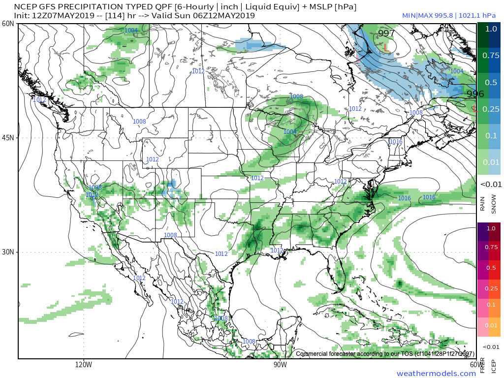
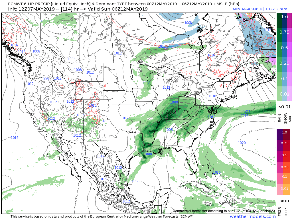
IV. Modeling differs on the handling of our weekend weather feature(s). The GFS (image 1) maintains the idea of a dry Saturday, followed by showers Sunday as a cold front sweeps through the region. Moisture would be limited with such a solution. The European (image 2), however, is more bullish on a more widespread rain event arriving Saturday PM into Sunday AM. Stay tuned as we work to reach some sort of agreement between the data.
V. After a cooler than normal period of weather through the middle of the month, we’re thinking the coolest anomalies will pull back into the intermountain west and 4-Corners region. Do we foresee any major late-May heat? No, but we should moderate against the norms during the last week to 10 days of the month.
After a drier stretch of weather through the mid-May period, precipitation should return to at least average levels through the late month stretch. Early indications would then suggest wetter than normal times return as we get set to open June…
Permanent link to this article: https://indywx.com/2019/05/07/tuesday-afternoon-rambles-weekend-model-differences-whats-beyond-the-cooler-mid-may-shift/
