Updated 06.21.21 @ 5:58p
You must be logged in to view this content. Click Here to become a member of IndyWX.com for full access. Already a member of IndyWx.com All-Access? Log-in here.

Jun 21
Updated 06.21.21 @ 5:58p
You must be logged in to view this content. Click Here to become a member of IndyWX.com for full access. Already a member of IndyWx.com All-Access? Log-in here.
Permanent link to this article: https://indywx.com/2021/06/21/evening-update-concern-growing-for-renewed-flash-flooding-this-weekend/
Jun 21
Updated: 06.21.21 @ 7:20a
You must be logged in to view this content. Click Here to become a member of IndyWX.com for full access. Already a member of IndyWx.com All-Access? Log-in here.
Permanent link to this article: https://indywx.com/2021/06/21/video-looking-at-the-pattern-over-the-next-2-weeks/
Jun 19
Updated 06.19.21 @ 12:11p
You must be logged in to view this content. Click Here to become a member of IndyWX.com for full access. Already a member of IndyWx.com All-Access? Log-in here.
Permanent link to this article: https://indywx.com/2021/06/19/video-tracking-additional-storms-and-looking-ahead-to-early-july/
Jun 19
Updated 06.19.21 @ 7:58a (We’ll have a full video discussion posted later this morning, but here are some headlines grabbing our focus into early July). I. Tropical, Soupy Airmass Remains…
You must be logged in to view this content. Click Here to become a member of IndyWX.com for full access. Already a member of IndyWx.com All-Access? Log-in here.
Permanent link to this article: https://indywx.com/2021/06/19/saturday-morning-rambles-changes-on-the-horizon-unseasonably-cool-open-to-july/
Jun 17
Updated 06.17.21 @ 5:58a
You must be logged in to view this content. Click Here to become a member of IndyWX.com for full access. Already a member of IndyWx.com All-Access? Log-in here.
Permanent link to this article: https://indywx.com/2021/06/17/video-severe-and-localized-flood-threat-increases-friday-unseasonably-cool-by-midweek/
Jun 08
Updated 06.08.21 @ 7:52a
You must be logged in to view this content. Click Here to become a member of IndyWX.com for full access. Already a member of IndyWx.com All-Access? Log-in here.
Permanent link to this article: https://indywx.com/2021/06/08/video-still-tropical-for-now-but-theres-light-at-the-end-of-the-tunnel/
Jun 07
Updated 06.07.21 @ 7:28a
You must be logged in to view this content. Click Here to become a member of IndyWX.com for full access. Already a member of IndyWx.com All-Access? Log-in here.
Permanent link to this article: https://indywx.com/2021/06/07/video-humid-tropical-feel-this-week-before-week-2-changes/
Jun 06
Updated 06.06.21 @ 8:28a


Forecast Period: 06.06.21 through 06.13.21
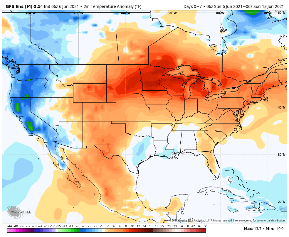
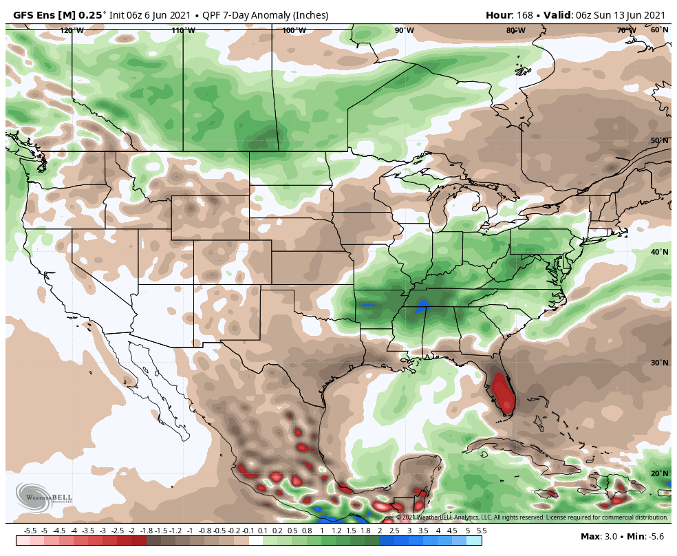
Our weather pattern will be dominated by a stubborn upper low moving slowly northeast out of the southern Plains. Eventually, this upper low will get entangled in the westerlies and begin to lose influence on our weather towards the tail end of the week. Before that, we’ll notice a rather marked difference in the type of airmass this week compared to what we’ve seen of late. A deep tropical flow, straight out of the Gulf of Mexico, will bring moisture-rich air into the Ohio Valley, including dew points that will approach the oppressive level (65° to 70°). While daytime highs will be kept cooler with the clouds and rain around, overnight lows will be elevated with such a humid airmass in place. A daily dose of showers and thunderstorms can be expected in this pattern- most numerous during the afternoon and evening hours. Given the humidity, locally heavy rain is a good bet at times. While coverage of showers and storms should slowly begin to diminish towards Friday and Saturday, we’ll still keep mention of scattered storms in our forecast into next weekend.
Permanent link to this article: https://indywx.com/2021/06/06/weekly-agwx-and-severe-weather-outlook-33/
May 22
Updated 05.22.21 @ 8:55a
You must be logged in to view this content. Click Here to become a member of IndyWX.com for full access. Already a member of IndyWx.com All-Access? Log-in here.
Permanent link to this article: https://indywx.com/2021/05/22/video-all-eyes-on-the-upcoming-big-race-and-memorial-day-weekend-cooler-times-loom-to-open-june/
May 16
Updated 05.16.21 @ 7:40a
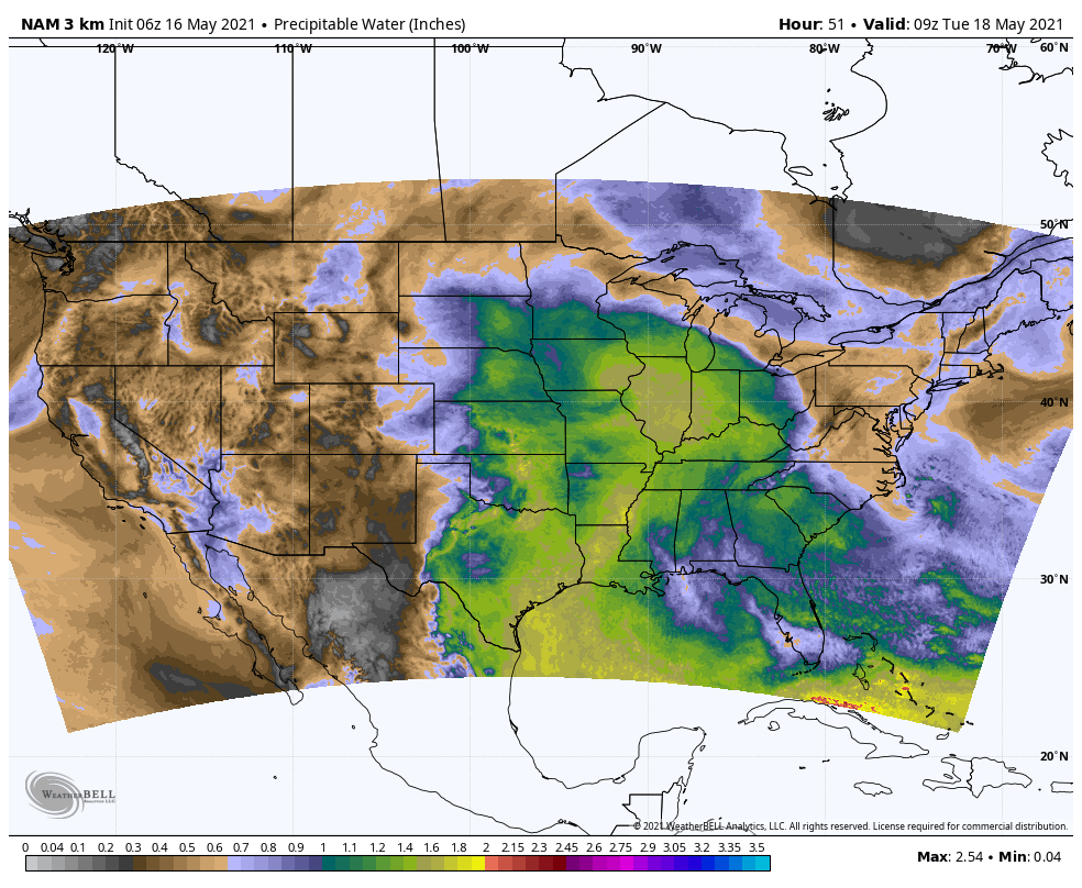
Scattered light showers are scooting across central Indiana this morning but our airmass still will take some time to saturate throughout all levels. As such, we don’t expect widespread heavy rain and embedded thunder until we get into the new work week. You’ll notice an increasingly muggy time of things Monday and Tuesday. Note the Gulf connection below. This will send dew points well into the 60s. Temperatures will also be on the rise (low/mid 80s) which will have things feeling very much like summer by mid and late week.

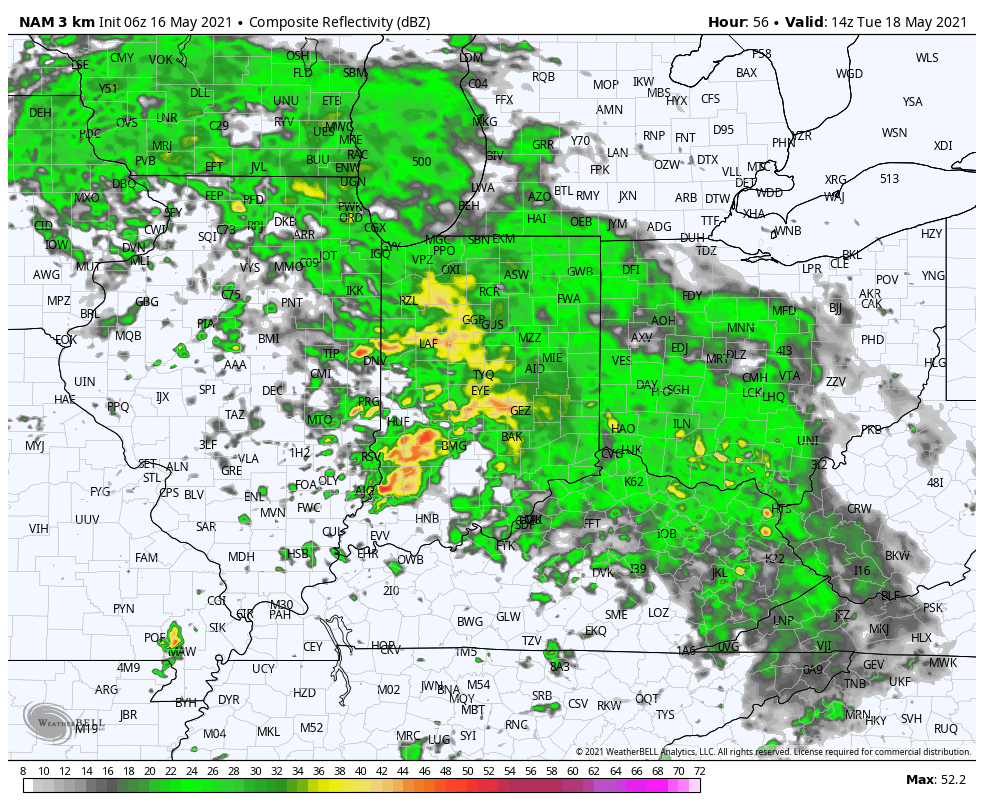
The transition of air masses will lead to a stretch of unsettled weather. We note model guidance has trended wetter over the past 24 hours for immediate central Indiana. We’re now honing in on Monday evening into Tuesday morning offering up the most widespread heavy rain and embedded thunder. Locally heavy rain will be possible during this timeframe. Some central Indiana rain gauges may pick up more than 2” of rain during this time period. Widespread 1.25” to 1.75” amounts can be expected.

Scattered, “splash and dash” storms will remain in our forecast into midweek before high pressure nudges itself into place and promotes a drier regime for the 2nd half of the week.

Permanent link to this article: https://indywx.com/2021/05/16/change-is-on-the-horizon/