Multiple Rounds Of Severe Weather Beginning Sunday…
Good morning and happy Saturday, friends! After a prolonged stretch of clouds, rain, drizzle, and fog, today will feature a good deal of sunshine and very pleasant conditions. Unfortunately, the sunshine and pleasant weather won’t last long as storms and severe weather chances ramp up beginning Sunday, and continues through Monday.
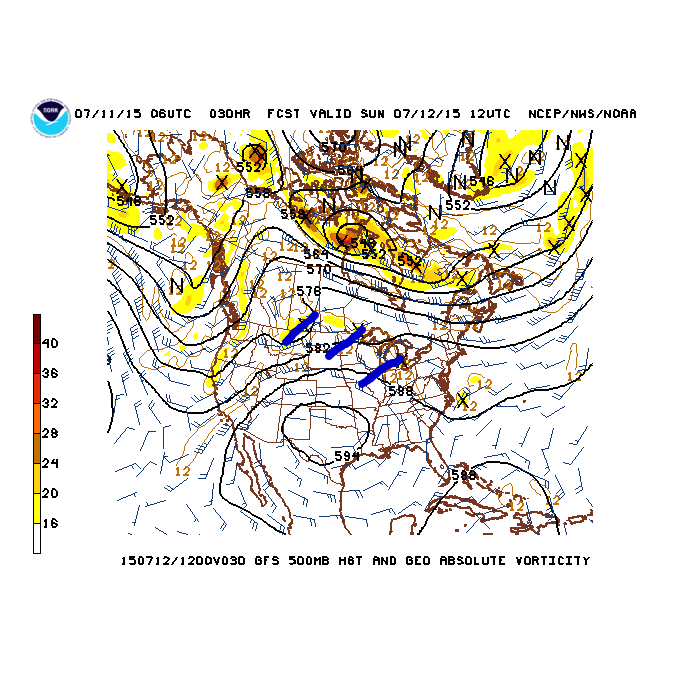
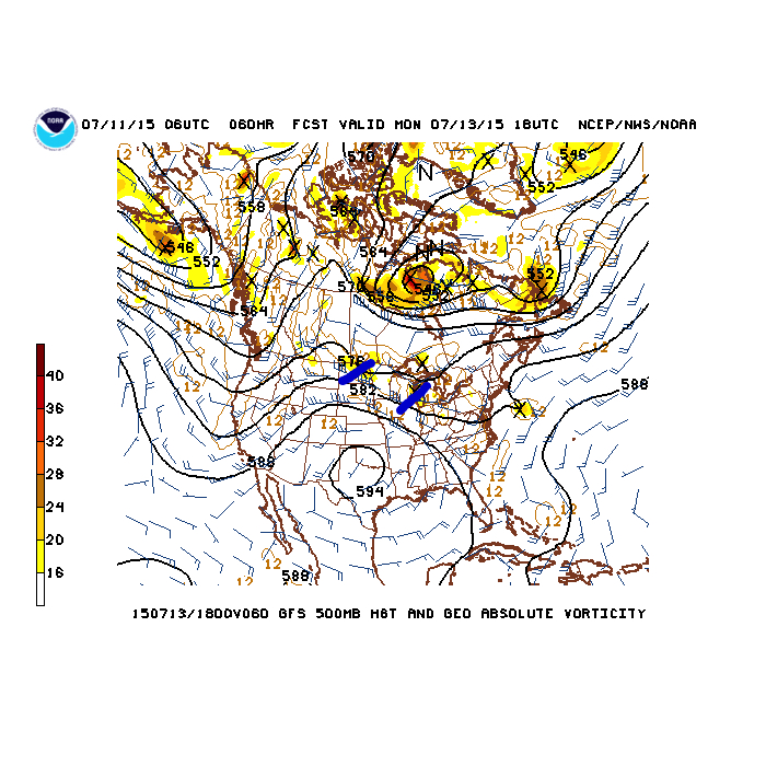
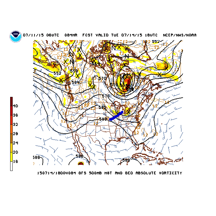
A hot dome (high pressure ridge) will be centered over Texas and this will place our immediate region under a rather busy northwest flow. Multiple disturbances (highlighted in blue below) will rotate northwest to southeast around the periphery of the Texas ridge. Each disturbance will be capable of producing heavy rain and thunderstorms, including severe weather.
Sunday morning
 Monday morning
 Tuesday morning
 The Storm Prediction Center has outlined the region for a risk of severe weather both Sunday and Monday, and they mention large hail, widespread damaging wind potential, and isolated tornadoes- particularly with Monday’s event.
Day Two Outlook (Sunday)
 Day Three Outlook (Monday)
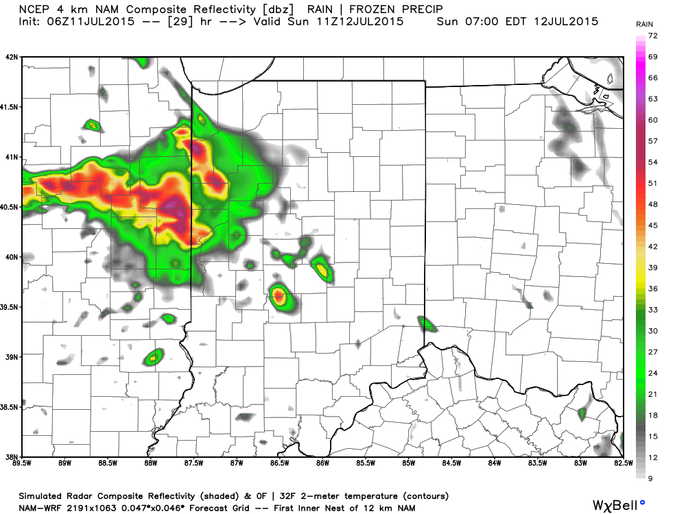
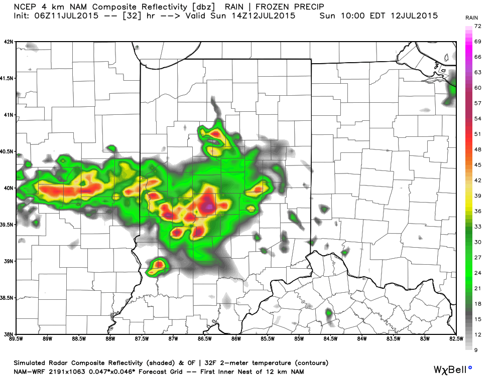
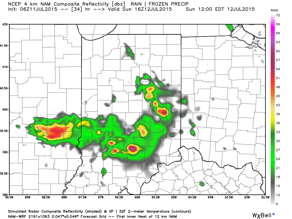
 We’ll begin the action late tonight/ Sunday morning (forecast radar below is a time stamp series from 7a to 12p Sunday) with the first in the expected series of thunderstorms rumbling in from the northwest.
Moral of the story? Enjoy today’s sunshine, but get ready for more active weather in the coming days!