Updated 10.05.23 @ 7:33a
You must be logged in to view this content. Click Here to become a member of IndyWX.com for full access. Already a member of IndyWx.com All-Access? Log-in here.

Oct 05
Updated 10.05.23 @ 7:33a
You must be logged in to view this content. Click Here to become a member of IndyWX.com for full access. Already a member of IndyWx.com All-Access? Log-in here.
Permanent link to this article: https://indywx.com/video-rain-becomes-widespread-reasons-to-continue-buying-into-the-cooler-mid-late-october/
Oct 04
Updated 10.04.23 @ 7:47a
You must be logged in to view this content. Click Here to become a member of IndyWX.com for full access. Already a member of IndyWx.com All-Access? Log-in here.
Permanent link to this article: https://indywx.com/video-wet-weather-builds-in-thursday-unseasonably-chilly-weekend-change/
Oct 03
Updated 10.03.23 @ 7:18a
You must be logged in to view this content. Click Here to become a member of IndyWX.com for full access. Already a member of IndyWx.com All-Access? Log-in here.
Permanent link to this article: https://indywx.com/video-last-couple-really-warm-days-until-next-spring/
Oct 02
Updated 10.02.23 @ 7:44a
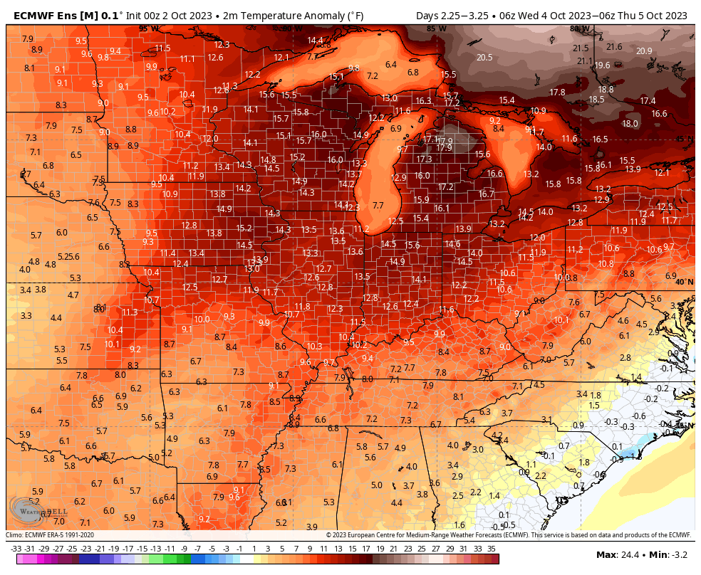
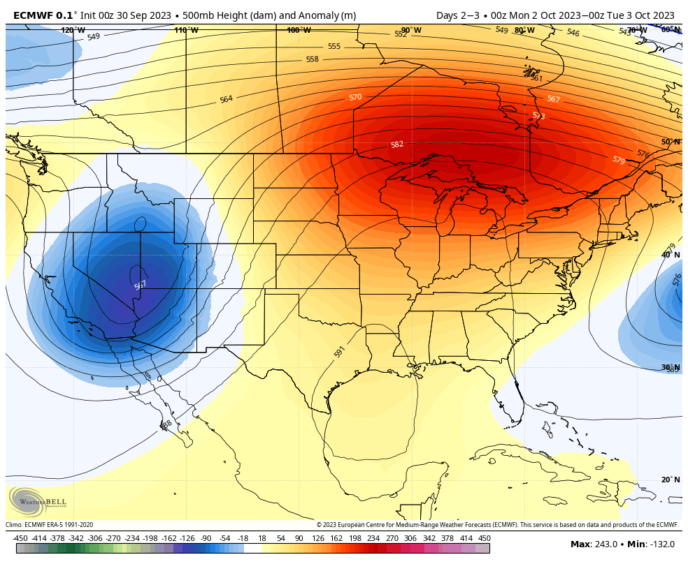
“Severe” clear dominates weather headlines in the short-term. This and the unseasonably warm pattern we’re currently enjoying is a byproduct of an omega blocking pattern. Look for plentiful sunshine and afternoon highs 10° to 15° + above average through Wednesday. The combination of our dry airmass and longer nights will still allow for comfortably cool lows (mid to upper 50s).
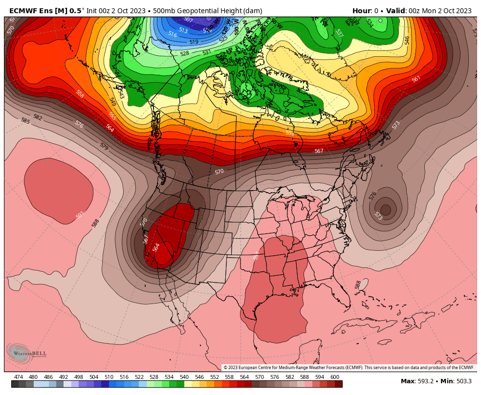
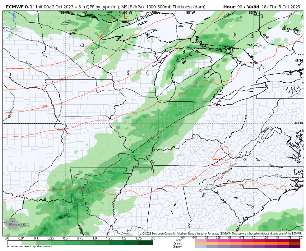
A game changing cold front will come plowing through the region Thursday morning. Models have upped the ante a bit with respect to moisture return. We now believe scattered to numerous showers (embedded thunder) will arrive Thursday morning, continuing into the afternoon and early evening hours. Rainfall totals of 0.25″ to 0.75″ seem like a good bet now with this FROPA, with local amounts to 1″. A secondary front will pass Friday night and Saturday morning with even chillier air behind the boundary. Winds will also turn gusty as we open the weekend. By early next week, patchy frost is possible for areas outside of the city, itself.
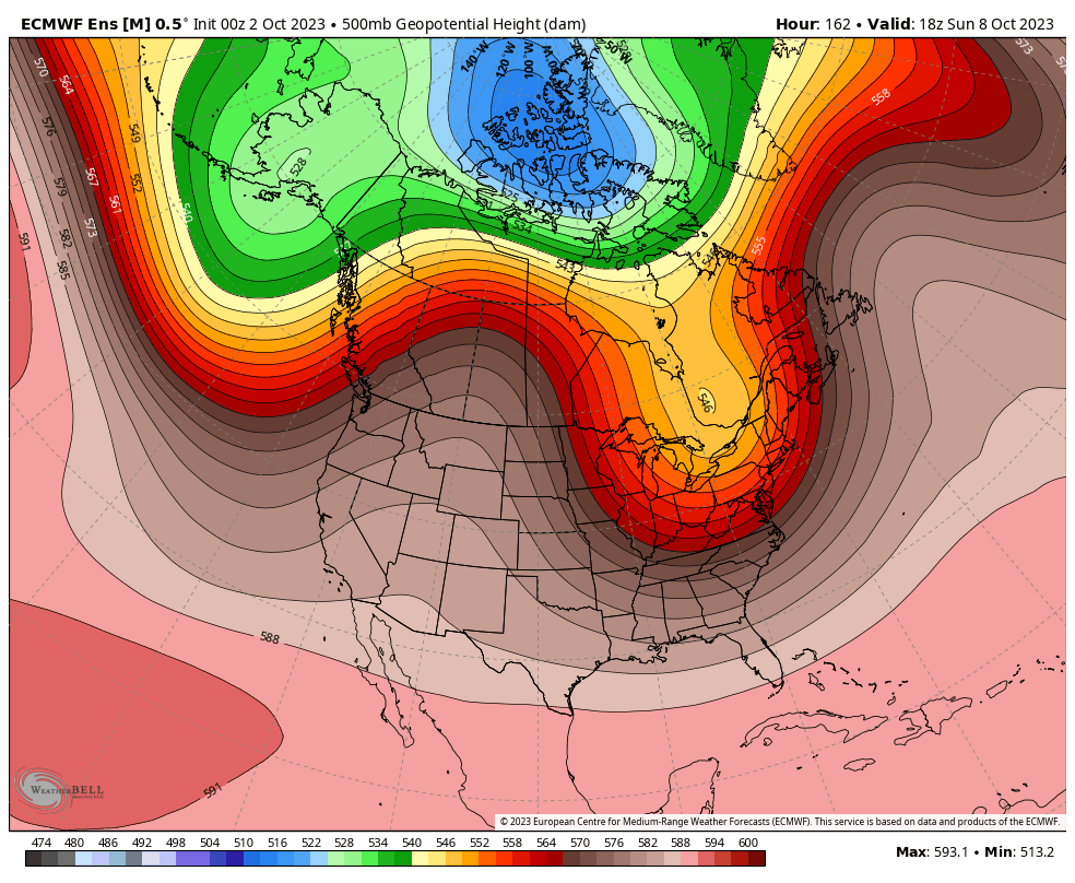
The bigger “shock” to the system will likely come from the swing in daytime highs. Those unseasonably warm readings will take a nose dive and result in temperatures close to 10° below normal over the weekend into early next week.
Permanent link to this article: https://indywx.com/what-goes-up-must-come-down/
Sep 30
Updated 09.30.23 @ 7:44a
There’s no reason to waste a bunch of pixels on our weather over the next 5 days. Despite morning fog in spots (a byproduct of just enough lingering moisture from rain earlier this week along with the longer nights) we’re talking about a “rinse and repeat” regime with plentiful sunshine and seasonably cool mornings warming quickly to well above normal levels during the afternoon.
High pressure will dominate our weather through Wednesday with dry skies.
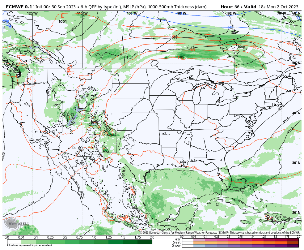
2 cold fronts will have eyes on our region late week. The 1st boundary will increase our cloud cover and offer up a passing shower Thursday. The 2nd cold front will sweep through the Ohio Valley around a week from today and provide a shot of much cooler air to close the weekend and open the following week.
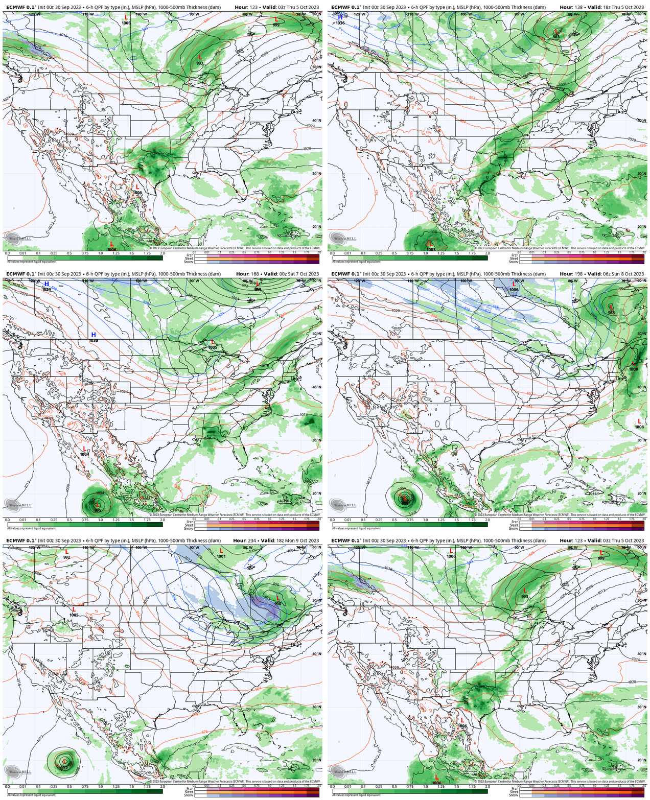
Moisture levels don’t look impressive with either frontal passage at this point. If we can squeak out 0.10″ we’ll have to count ourselves lucky.
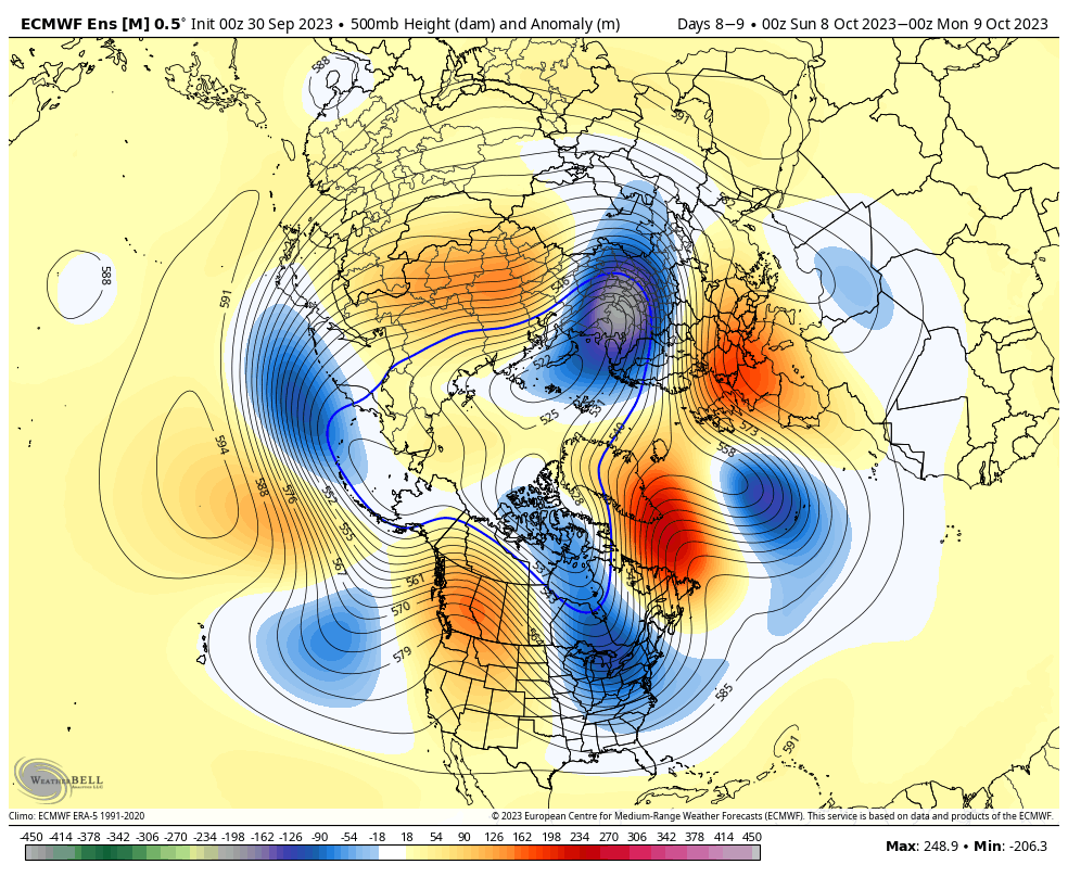
The coolest air of the young autumn season will filter into our region next weekend. A total reversal of the upper air pattern we open the period with…
Permanent link to this article: https://indywx.com/toasty-open-to-october-takes-a-back-seat-late-next-week/