Updated 10.30.23 @ 7:45a
You must be logged in to view this content. Click Here to become a member of IndyWX.com for full access. Already a member of IndyWx.com All-Access? Log-in here.

Oct 30
Updated 10.30.23 @ 7:45a
You must be logged in to view this content. Click Here to become a member of IndyWX.com for full access. Already a member of IndyWx.com All-Access? Log-in here.
Permanent link to this article: https://indywx.com/video-wintry-feel-for-halloween-closely-watching-week-2/
Oct 29
Updated 10.29.23 @ 8:50a
You must be logged in to view this content. Click Here to become a member of IndyWX.com for full access. Already a member of IndyWx.com All-Access? Log-in here.
Permanent link to this article: https://indywx.com/video-gearing-up-for-another-wave-of-rain-ahead-of-a-taste-of-winter-watching-the-week-2-time-period-for-another-storm/
Oct 28
Updated 10.28.23 @ 9:50a
You must be logged in to view this content. Click Here to become a member of IndyWX.com for full access. Already a member of IndyWx.com All-Access? Log-in here.
Permanent link to this article: https://indywx.com/video-2-rounds-of-heavier-rain-on-deck-1st-flakes-of-the-season-await/
Oct 27
Updated 10.27.23 @ 7:09a
I. Most of our Friday will be rain-free and unseasonably pleasant. Enjoy as time is ticking. A cold front arrives tonight with increasing shower and thunderstorm chances after dark, continuing through the overnight. Most area rain gauges will accumulate 0.10” to 0.25” with this initial wave of rain, but there will be a few lucky folks that pick up 0.50” +.
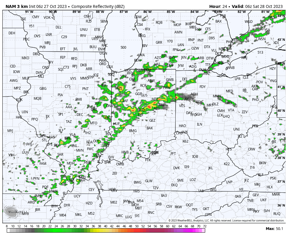

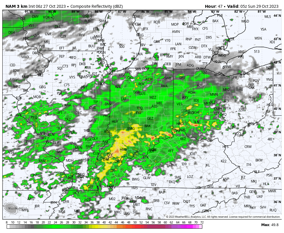
II. A second, more widespread, round of rain will push across central Indiana Saturday night and Sunday morning followed by a potential break through most of the daytime Sunday. One final round of rain will then arrive Sunday night into the predawn hours Monday. Look for nearly steady or slowly falling temperatures into the upper 40s Sunday and highs remaining stuck in the 40s area wide Monday.
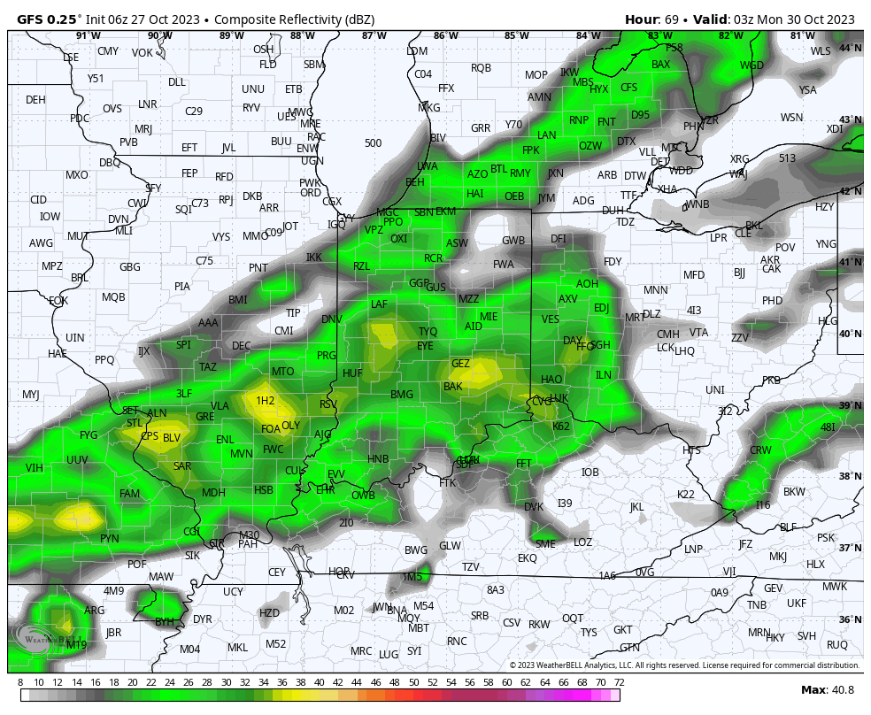
III. As attention shifts to Halloween, itself, a vigorous piece of upper level energy will dive into the Ohio Valley. Originating in Alberta, this will officially be the season’s first Alberta Clipper.

This feature will offer up a round of gusty winds and snow showers Halloween night into the predawn hours Wednesday.
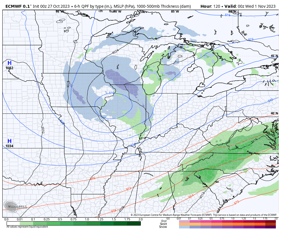
We’ll wake up to temperatures in the 20s and ‘chills in the 10s Wednesday morning.
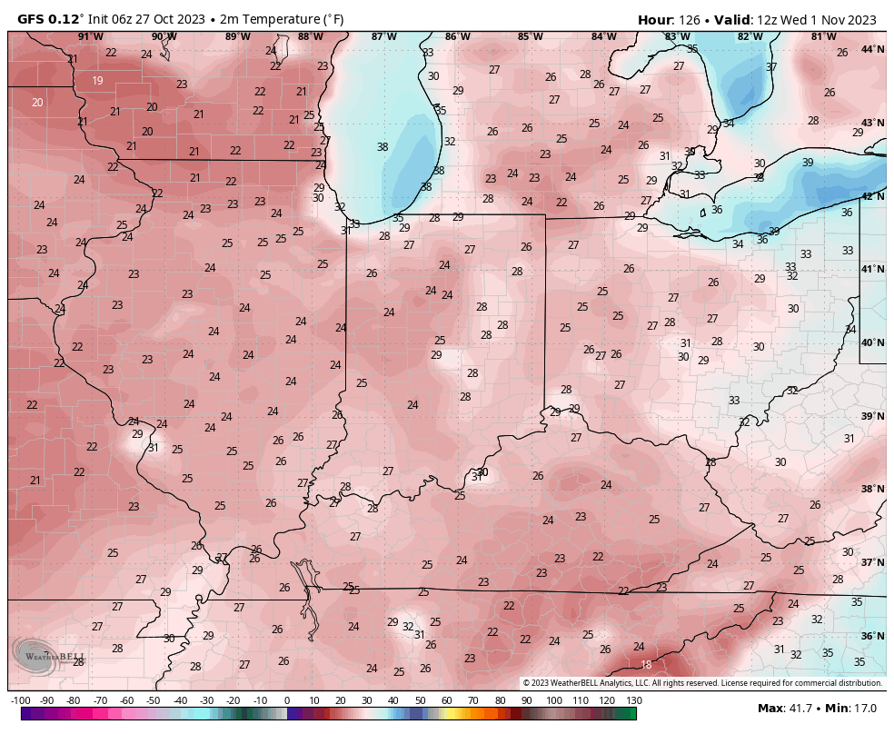
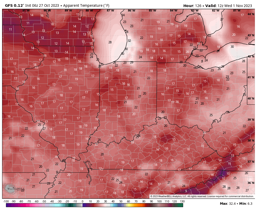
IV. We’ll dive in to our November pattern in greater detail with a video this weekend, but as of now, the early call is for a fairly typical November with many “ups and downs” and an overall transitional regime through the bulk of the month. Again, more on this and the associated pattern drivers a bit later!
Make it a great Friday!
Permanent link to this article: https://indywx.com/friday-morning-rambles-blast-of-arctic-air-halloween-night-snow-and-more-on-november/
Oct 26
Updated 10.26.23 @ 6:45a
The next couple days will be the last of temperatures in the upper 70s to lower 80s until next spring. The first of 2 cold fronts will settle into central Indiana tomorrow evening followed by a strong frontal passage Monday. If you rather go right to the punch line instead of reading through the rest of this post, trick or treaters will need the heavy cold gear this year.
A few showers will skirt northern counties later this evening but the lions share of the next 36 hours will be rain-free. A line of showers and even thunderstorms will be associated with Friday evening’s cold front.
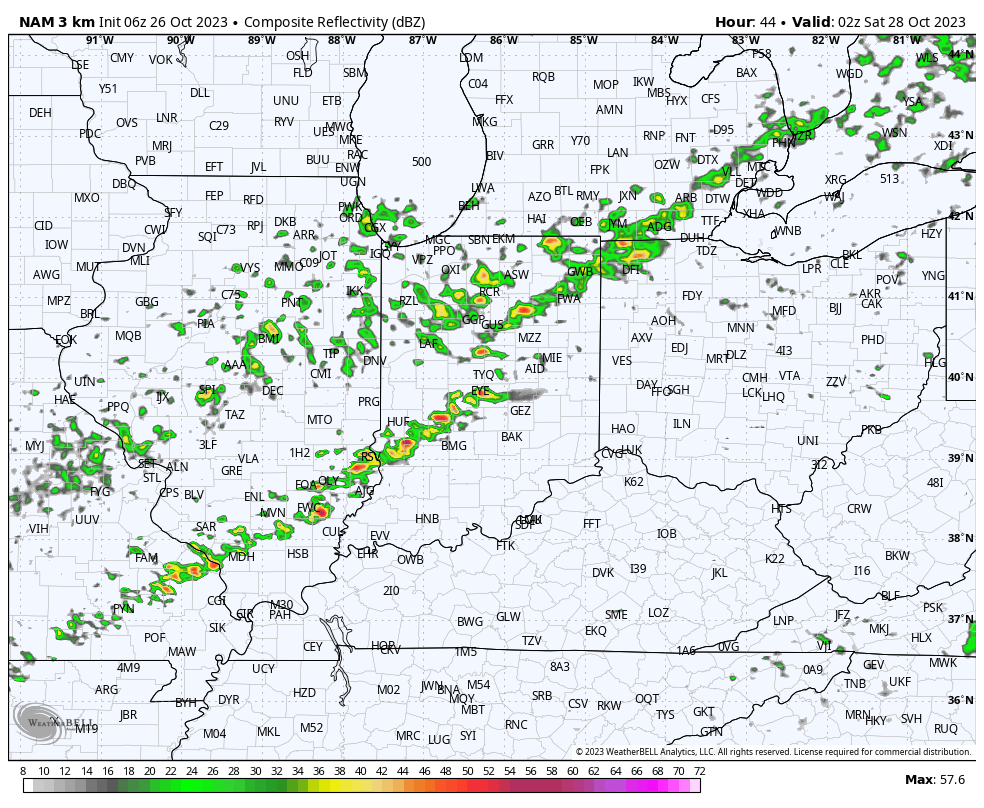
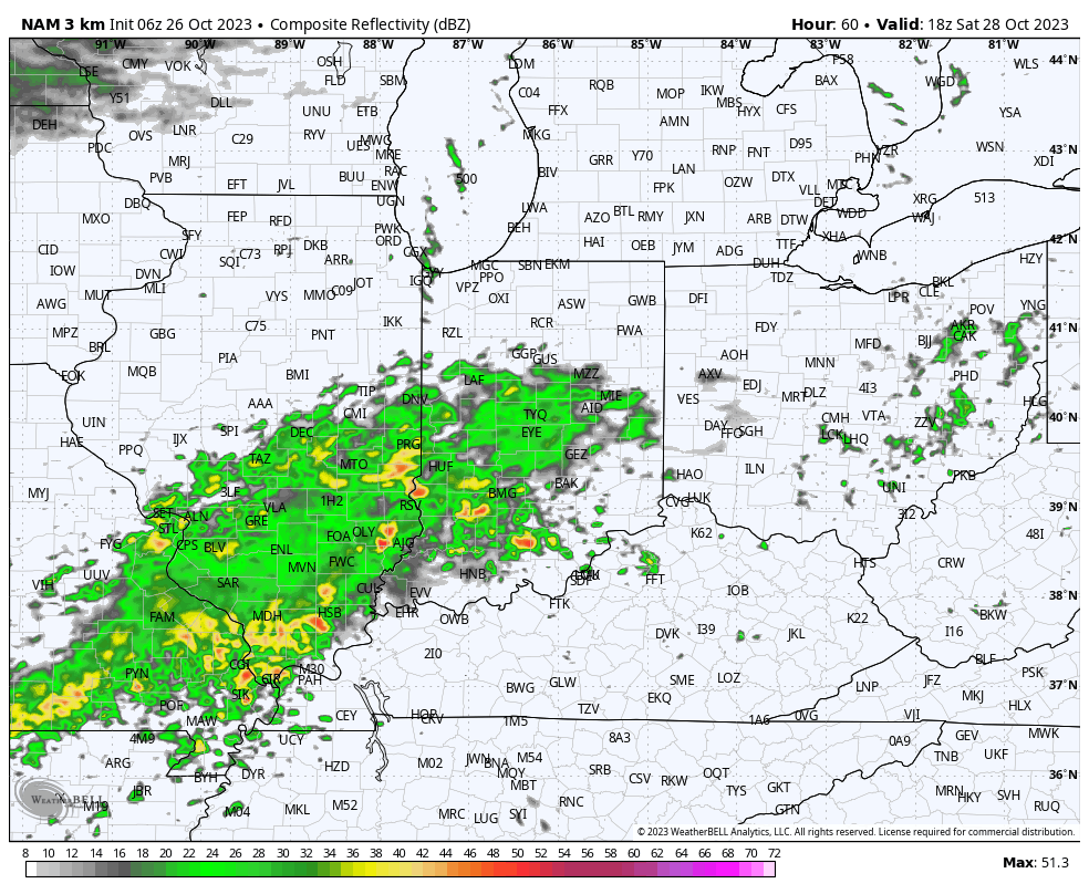
A much more widespread, heavier rain will build into central Indiana through our Saturday afternoon. It’s this period, continuing into Sunday where the bulk of our widespread 1”+ rain will come. A smaller axis of heavier totals (2”+) likely sets up shop south of the city, itself.

After a “step down” process to cooler air Friday into Saturday, the bottom will really fall out Monday. This will set us up for a downright cold Halloween (lows in the upper 20s with highs in the lower 40s). Add in winds and the “feels like” will be in the 10s and 20s into the 1st day of November.

If that isn’t enough, trailing upper level energy will push into the area Halloween night and have enough moisture to generate snow showers late into Wednesday morning. A renewed push of gusty winds can also be expected during this time period.
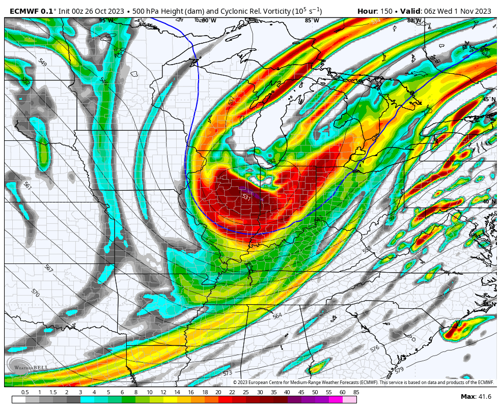

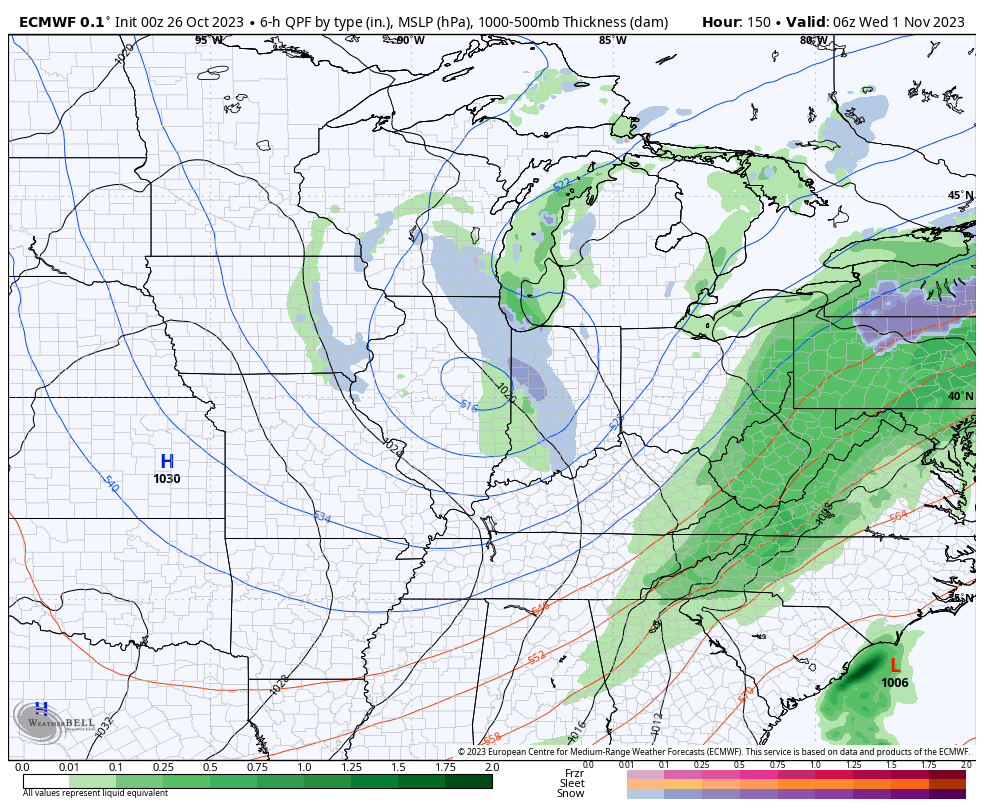
Coldest mornings of this stretch will likely take place next Wednesday or Thursday with overnight lows into the middle to upper 20s.
Permanent link to this article: https://indywx.com/first-taste-of-winter-the-wild-swings-of-autumn/