Updated 08.26.23 @ 6a
You must be logged in to view this content. Click Here to become a member of IndyWX.com for full access. Already a member of IndyWx.com All-Access? Log-in here.

Aug 26
Updated 08.26.23 @ 6a
You must be logged in to view this content. Click Here to become a member of IndyWX.com for full access. Already a member of IndyWx.com All-Access? Log-in here.
Permanent link to this article: https://indywx.com/video-big-changes-in-the-week-ahead/
Aug 25
Updated 08.25.23 @ 5:02a
I. It’s about as oppressive as it gets around these parts out the door early this morning. Temperatures will only fall a couple more degrees between now and sunrise before another dangerously hot day ahead. Check out these temperature and heat indices at 4:45a:


II. We’re tracking (2) frontal boundaries that will put an end to this heat and humidity in the coming days. The first front slips through here Saturday and will break the heat wave with a secondary, more robust, push of dry, cool air early next week. While a shower or storm is possible with both FROPAs, widespread rain isn’t expected with either.


III. A taste of fall is on deck as we move through the middle of next week and get set to kick off the Labor Day weekend. How does overnight lows into the 40s sound with highs in the upper 70s? This breath of fresh air will hold into the early part of the Labor Day weekend along with anticipated dry conditions.
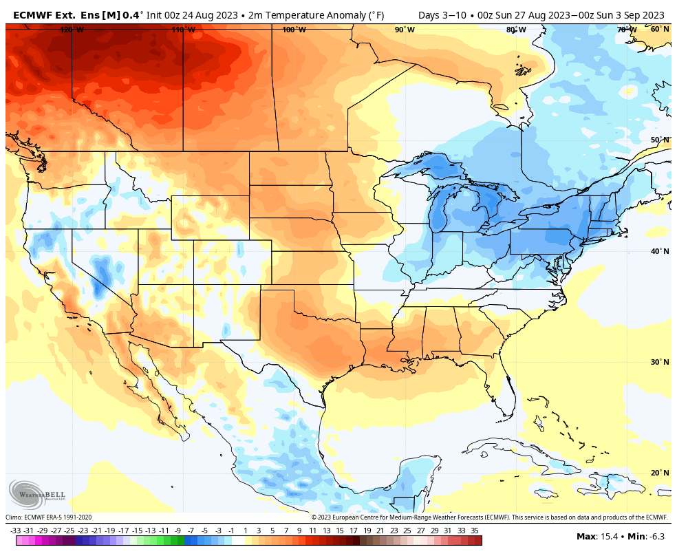
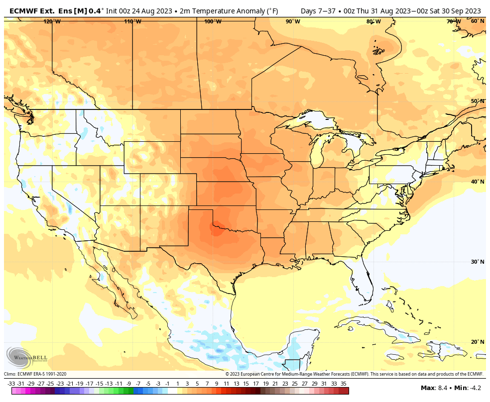
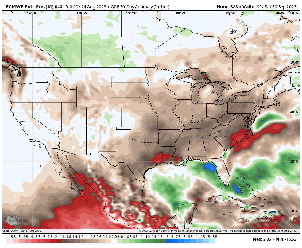
IV. We’re not expecting the cool, refreshing air to last as “endless summer” returns shortly after the open to September. In fact, we continue to believe a warmer than normal and drier than average September awaits as we push through the initial month of meteorological fall. The latest European Weeklies, updated last night, for September say the same:
Permanent link to this article: https://indywx.com/friday-morning-rambles-taste-of-fall-next-week/
Aug 18
Updated 08.18.23 @ 4:35a
Despite the blazing heat that awaits in the week ahead, another push of unseasonably cool and refreshing air that we’ll enjoy to open the weekend is a sign that autumn isn’t that far away.
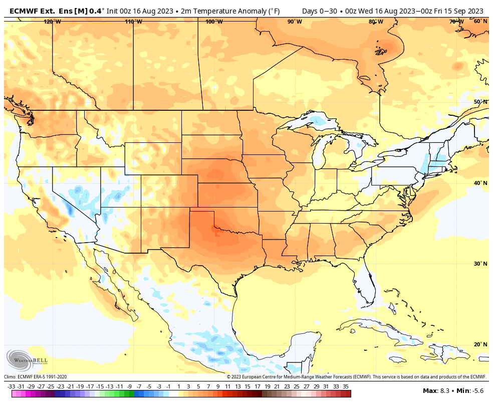
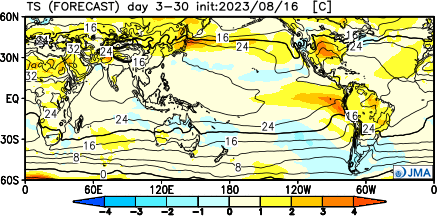
As the El Niño continues to strengthen heading into fall, we’re bullish here at IndyWx.com that an unseasonably warm start to autumn is on tap. While not nearly as hot as what the week ahead will entail, we think we’ll remain close enough to the ‘mean’ upper ridge position to result in at least slightly to moderately above normal temperatures for September as a whole (say in the + 1.5° to + 3° range).
The latest European extended product and JMA Weeklies back this idea up, including a drier than normal look. While we’ll have to be on guard for the potential of ridge rider storm clusters as the ridge retrogrades west at times, the overall pattern through at least mid-September sure appears drier than normal as a whole.

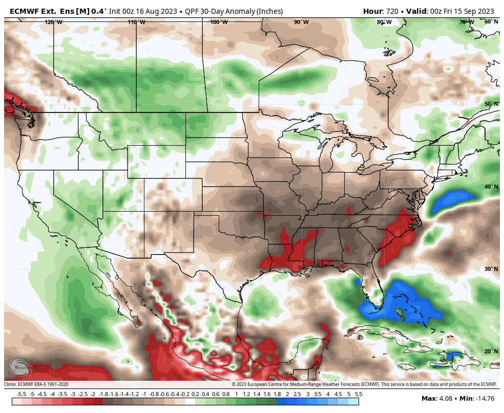
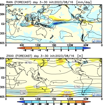
While not quite as toasty, the GFS extended product is also painting a dry regime into mid-September.
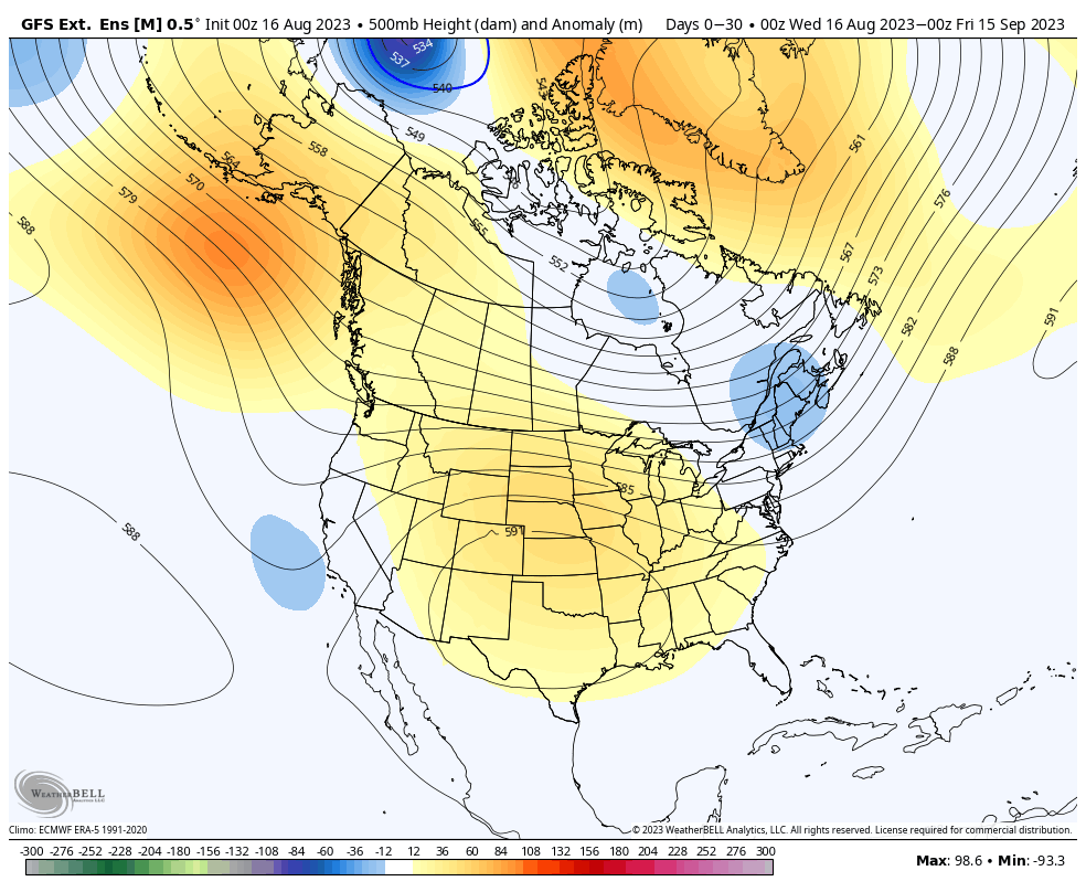
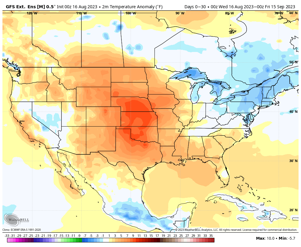
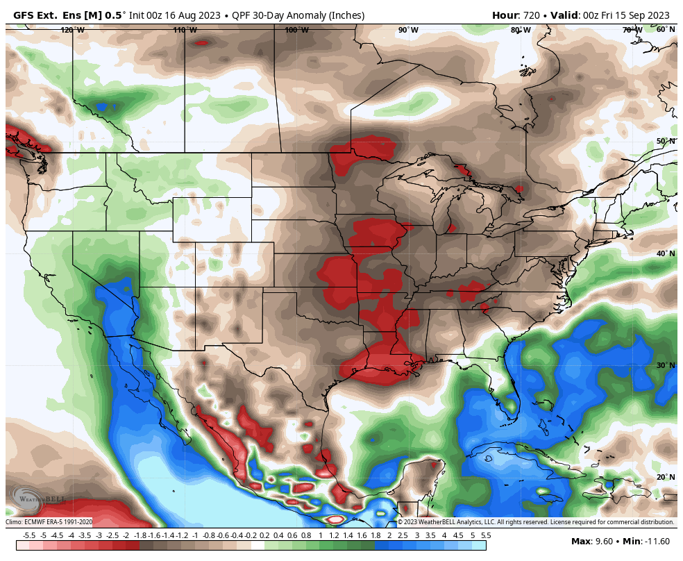
From a temperature perspective into mid September, we prefer a blend of what the JMA/ Euro and GFS are suggesting. Again, slightly warmer than normal overall o/ the upcoming 3-4 week period.
As we evolve deeper into September and closer to early October, we believe the threat of an early season cold blast, including frost threat will show up a few weeks earlier than normal this season. This likely won’t be a full scale, permanent shift to cold, but rather a chilly “jolt.” Given the evolving Niño, we’ll have to likely wait until later into October before we have something more meaningful and sustained from a cold weather standpoint. . .
Permanent link to this article: https://indywx.com/long-range-outlook-flips-the-page-into-meteorological-fall/
Aug 16
Updated 08.16.23 @ 7:26a
Most Hoosiers woke up to a hint of autumn this morning. We’re getting to that point on the calendar where we typically hear that most aren’t ready for the cooler days of autumn that are literally on the doorstep. If you find yourself in that club, take heart in knowing the hottest air of the season awaits next week as an upper level ridge expands overhead for a period of time.
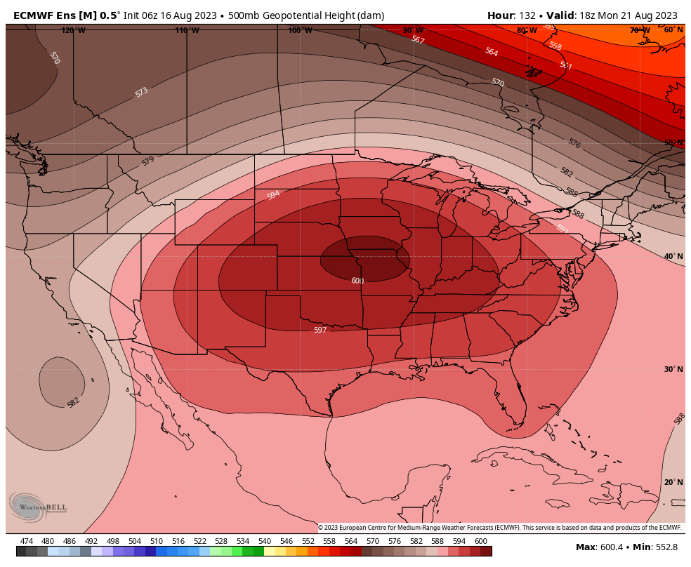
This should feature multiple days next week with high temperatures into the low-mid 90s, however, this will at least be a “drier” heat compared to most other spells this summer. Most, if not all, of next week will be free of any rain along with plentiful sunshine. Aside from the big time heat, a quiet week is in store.
In looking at the long range charts, we see something similar with the ‘mean’ ridge position as it retrogrades west towards the Day 10-15 period. This should pull the more significant heat west and open us up for wetter times as we push into early September.
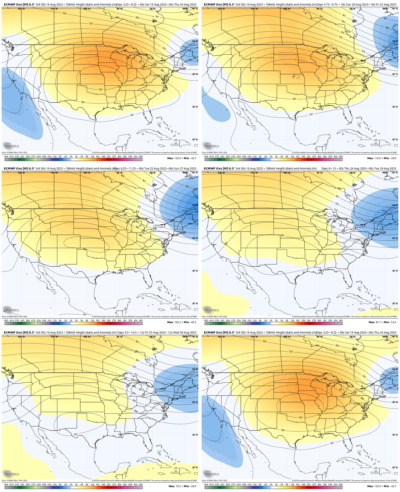
Perhaps the threat of some late summer/ early autumn ridge riding storm complexes are in our future? Regardless, while the upcoming week will feature significant heat, like so many other patterns this summer, there continues to be a light at the end of the hot tunnel before the “hot” pattern begins.
Permanent link to this article: https://indywx.com/the-theme-of-the-summer-rolls-along/
Aug 10
Updated 08.10.23 @ 5a
You must be logged in to view this content. Click Here to become a member of IndyWX.com for full access. Already a member of IndyWx.com All-Access? Log-in here.
Permanent link to this article: https://indywx.com/video-thursday-morning-rambles-highlighted-by-continued-wet-pattern-and-potential-early-frost-risks-this-autumn/