Updated 10.10.22 @ 6:01p
You must be logged in to view this content. Click Here to become a member of IndyWX.com for full access. Already a member of IndyWx.com All-Access? Log-in here.

Oct 10
Updated 10.10.22 @ 6:01p
You must be logged in to view this content. Click Here to become a member of IndyWX.com for full access. Already a member of IndyWx.com All-Access? Log-in here.
Permanent link to this article: https://indywx.com/reason-for-pause-around-late-october/
Oct 09
Updated 10.09.22 @ 8:37a
You must be logged in to view this content. Click Here to become a member of IndyWX.com for full access. Already a member of IndyWx.com All-Access? Log-in here.
Permanent link to this article: https://indywx.com/video-moderating-ahead-of-the-next-chilly-surge/
Oct 08
Updated 10.08.22 @ 4:57a
September 24th, that’s the date we have to go all the way back to to find the last drop of measurable rain (0.34”) at IND. While there were a few scattered light showers around Thursday, these were of little to no fanfare for most neighborhoods across central Indiana.
Dating back to early September, most of the region is running anywhere from 10% to 50% normal rainfall as shown below (courtesy of the fine folks at the Midwestern Regional Climate Center).

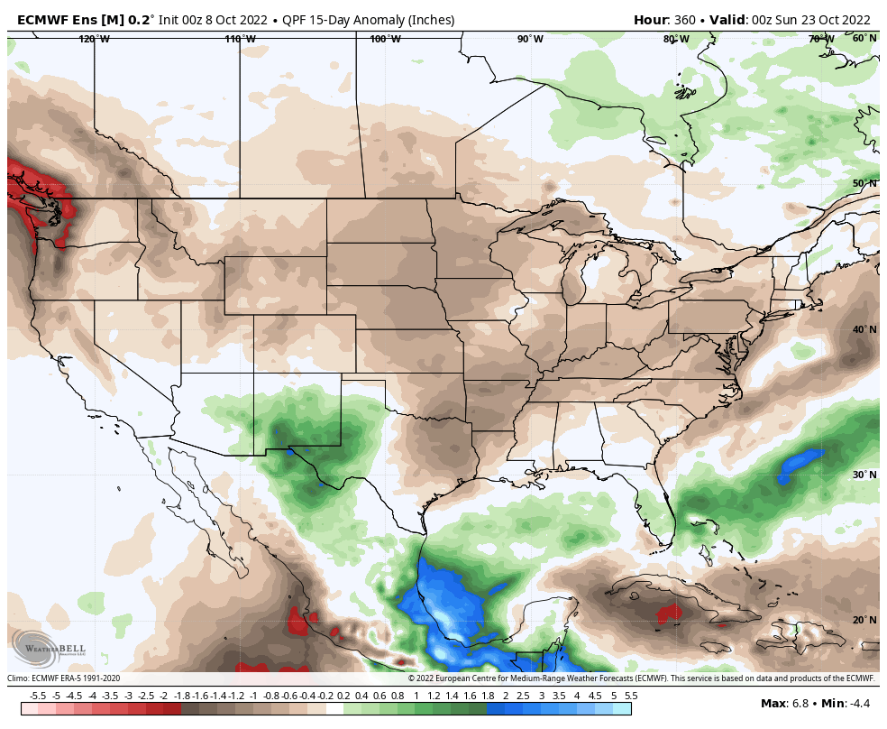
Looking ahead, we’ll note a more significant return of moisture (certainly when compared to the past few weeks) ahead of the first of (2) frontal passages late next week. Long term, however, there’s no significant change in the overall dry regime as a whole when compared to normal over the upcoming couple weeks.
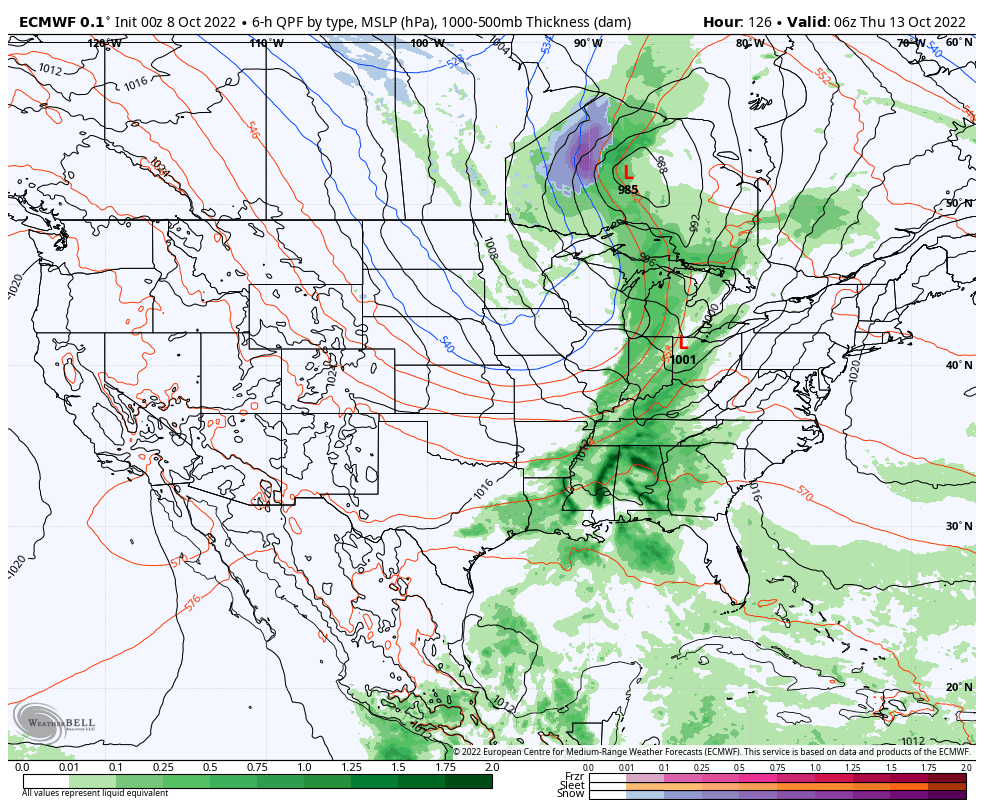
As we center ourselves closer to the immediate term, the first front will crash an unseasonably warm party (making the push for 80° territory Wednesday) with shower chances (maybe a couple storms to boot) increasing Wednesday evening into the predawn hours Thursday. Early data into the forecast office suggests this frontal passage delivers anywhere between 0.25” and 0.50” to the region and we’ll have to firm up those numbers as we get into the new week.
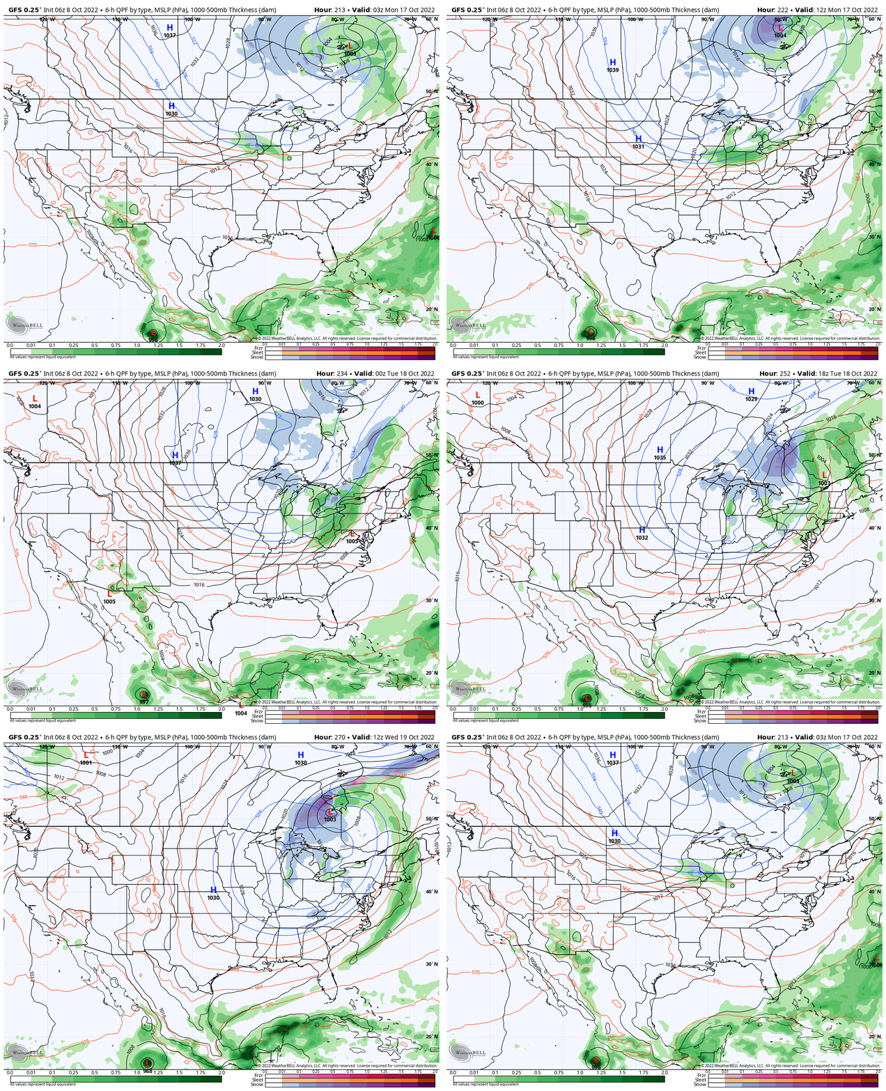
A sharp cool down is on tap Friday with highs at November-like levels (low-mid 50s).
A secondary front follows and is focused on reminding us winter is just around the corner. The first lake effect and higher elevation (looking at you east TN and western NC mountains) snow of the season is on the table early Week 2 behind the passage of this front, along with a hard freeze for the rest of us.
Permanent link to this article: https://indywx.com/the-roller-coaster-ride-continues-1-2-punch-dialed-up-late-next-week/
Oct 07
Updated 10.07.22 @ 7:48a
You must be logged in to view this content. Click Here to become a member of IndyWX.com for full access. Already a member of IndyWx.com All-Access? Log-in here.
Permanent link to this article: https://indywx.com/video-first-widespread-frost-and-freeze-this-weekend-tracking-a-stronger-storm-system-late-next-week/
Oct 06
Updated 10.06.22 @ 9:57p
Without question, October is going to end up cooler to much cooler than I originally anticipated. Note the JMA Weeklies going right to a persistent chill as we go through the remainder of the month:


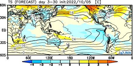
Originally, the thought here is that we would end up slightly warmer than normal for October but that isn’t going to be the case. Don’t get us wrong, there will still be warmer than normal days, but these will be fleeting and likely take place a day or two before a fresh batch of cooler air takes hold behind frontal passages.
The latest ensemble guidance is going right to the cool look, too.
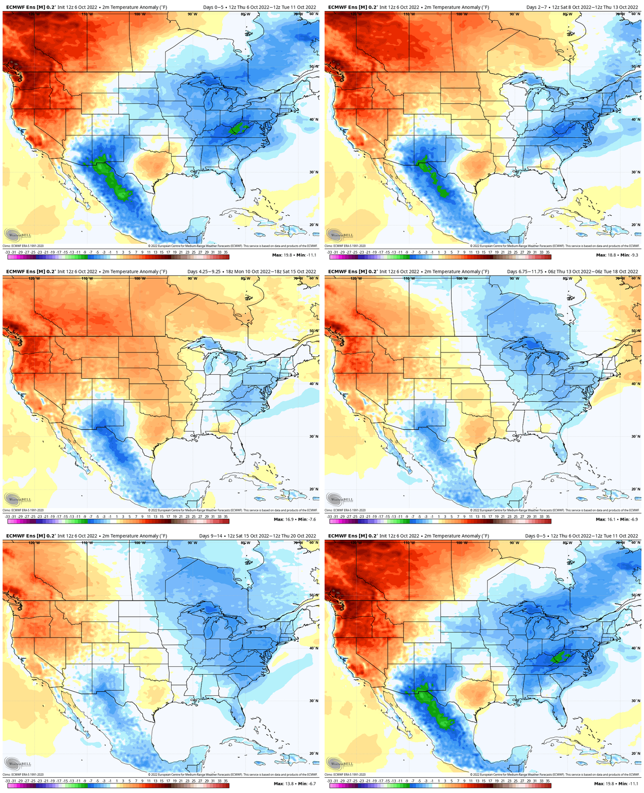
The pattern does look like it’ll continue to run drier than normal, but there should be a more significant return of moisture ahead of mid and late month fronts that will at least help make up for the unusually dry early part of October. Those mid October fronts will ignite the lake effect snow for the first time this year across the traditional snow belt areas of MI, OH, northern IN and into the high elevations of the Appalachians.
As the MJO rolls into Phase 6, this should only mean the trough reinforces itself over the eastern 1/3 of the country that much more come mid October.

Of course the cooler October trends bring us to the next question, should we continue to ride this cooler trend into November or be worried that the idea of a colder, more wintry, regime taking hold in November (emphasis on the 2nd half of the month) is up for debate?
Stay tuned.
Permanent link to this article: https://indywx.com/long-range-disco-colder-october-changes/