You must be logged in to view this content. Click Here to become a member of IndyWX.com for full access. Already a member of IndyWx.com All-Access? Log-in here.
You must be logged in to view this content. Click Here to become a member of IndyWX.com for full access. Already a member of IndyWx.com All-Access? Log-in here.
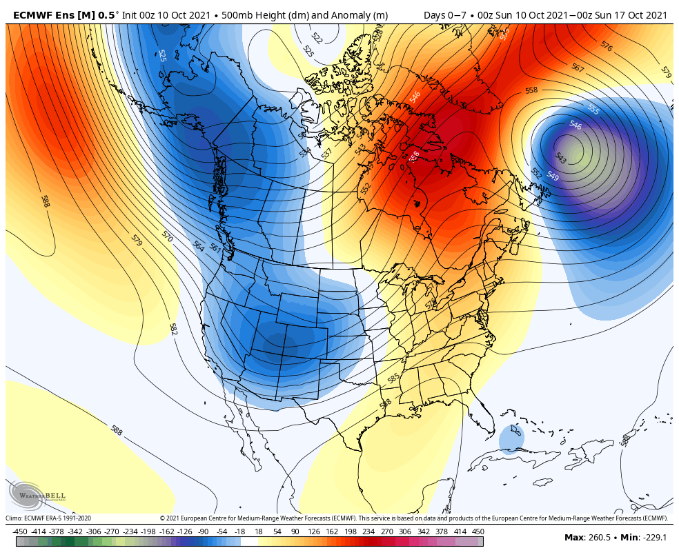
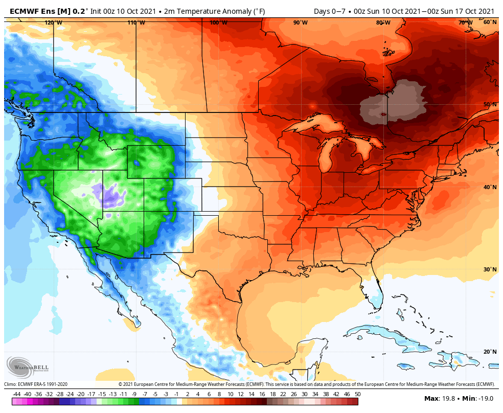
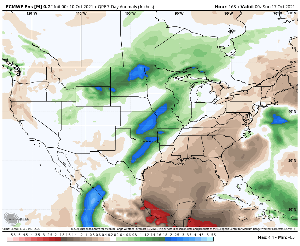
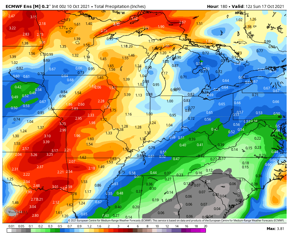
The predominant pattern in the week ahead will feature an eastern ridge and western trough. Temperatures will run well above normal across the East while an early taste of winter will reside across the West. Rainfall will run well above normal this week from the southern Plains into the western Great Lakes along with the northern Plains. We think most central Indiana rain gauges accumulate between 0.75” and 1.25” in the 7-day period.We continue to track the potential of strong to severe storms Monday afternoon and evening.
Forecast Period: 10.10.21 through 10.17.21
While the bulk of the forecast period will run well above normal, this will be a much more active 7-day period than we’ve seen of late. The first storm system will approach Monday afternoon. After a warm, breezy, and mostly dry day, a line of storms will move through from west to east during the afternoon and evening. Strong damaging straight line winds appear to be the greatest threat but there will also be the potential of an isolated tornado. We bracket the hours from 2p to 10p for this line of storms to impact the state. Another storm system will move through the area late in the work week with widespread rain and a shot of much cooler, fall-like air as we head into next weekend. Dry conditions should return just in time for the weekend.
After a mostly dry, sunny, and unseasonably warm weekend, our next storm system will approach as we kick off the work week. Southerly winds will usher in an unseasonably moist airmass to combine with August-like temperatures (highs once again are expected to shoot into the lower and middle 80s).
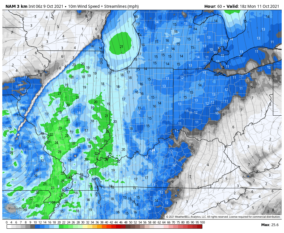
Southerly winds will transport unseasonably muggy air north Monday. South winds will gust 30-35 MPH at times.
Dew points will climb into the middle and upper 60s ahead of the approaching cold front Monday.
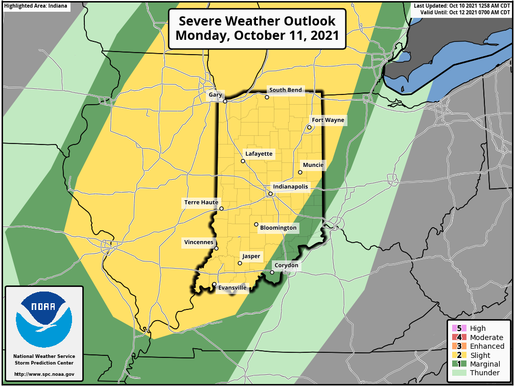
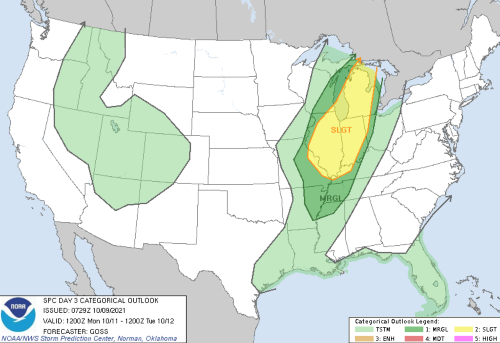
The Storm Prediction Center (SPC) outlines the western Ohio Valley, including most of Indiana, into the central Great Lakes region for a Slight Risk of severe weather Monday.
A surface wave is expected to develop along the pressing cold front Sunday evening and track northeast into the Great Lakes. After a warm, dry, and breezy start to Monday, a line of thunderstorms should develop late Monday morning or early afternoon across western IL. This line will then track east and move into Indiana during the late afternoon and evening hours.
Given some of the ingredients in place, the primary concern with this line of storms will be the potential of damaging straight line winds. There also is the potential of a couple rotating storms within this overall line of storms that could pose an isolated tornado threat.
After the stormy time of things Monday PM (rainfall amounts should check-in between 0.50″ and 1″ for most), conditions will improve as we move through the day Tuesday. Another (weaker) system will push into the area midweek, but as of now this doesn’t look like a significant event.
A stronger cold front will arrive to close the week with more widespread rain. After an unseasonably warm stretch, cooler air should finally filter into the region next weekend.
You must be logged in to view this content. Click Here to become a member of IndyWX.com for full access. Already a member of IndyWx.com All-Access? Log-in here.