Category: Harvest21

September 2021 Outlook: Welcome to Meteorological Fall…

Updated 09.01.21 @ 7:30a

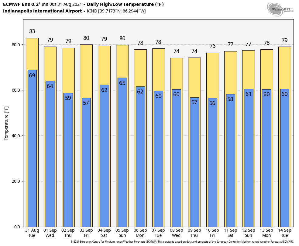
Welcome to fall- at least from a meteorological perspective! Averages in Indianapolis for the month of September include highs that fall from 82.6° on the 1st to 72.7° at month’s end. Lows drop from the lower 60s (62.5°) to the low 50s (51.6°). We average 3.2″ of rainfall during the month.

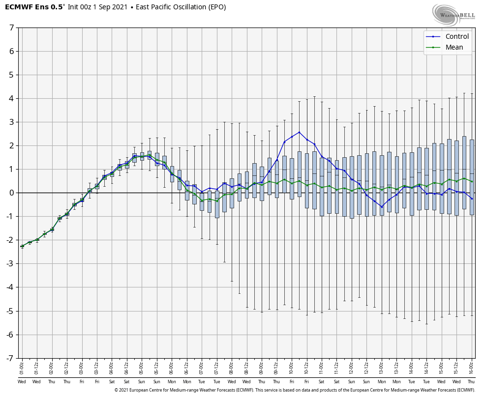
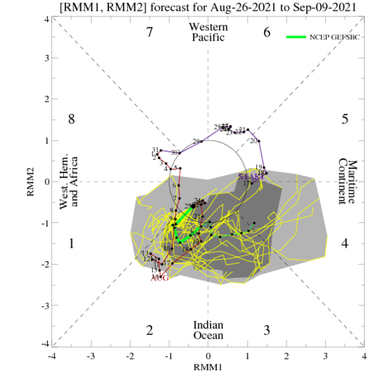
As we look at September 2021, the month will get off to a cooler than normal start, but we don’t think we’re quite done with the warmer temperatures. The MJO is forecast to rumble into the notorious warm phases for September and the EPO is showing signs of wanting to spend most of the time in a positive manner.

The MJO, currently in “cool” Phase 2 is expected to emerge into warmer phases over the next couple of weeks.
While negative now, the EPO is expected to remain neutral to positive through the majority of the month ahead.

We’ll take this into account, along with factoring in the trends from the latest longer range computer models (European Weeklies, CFSv2, and JMA) to build our September forecast:

Summed up, we’re talking about a month that is very near seasonal norms from a temperature perspective (once all is said and done) and slightly wetter than average.

Permanent link to this article: https://indywx.com/september-2021-outlook-welcome-to-meteorological-fall/

Winds Of Change On The Doorstep…

Updated 08.31.21 @ 8:11a

We have one more day of humid conditions, but a wholesale pattern change will have things feeling much different around these parts beginning tomorrow, and continuing for the foreseeable future.

Note the drier air beginning to invade northern portions of IL, IN, and OH this morning. While dew points are still stuck in the mid-upper 60s, locally, that less humid air is heading south.

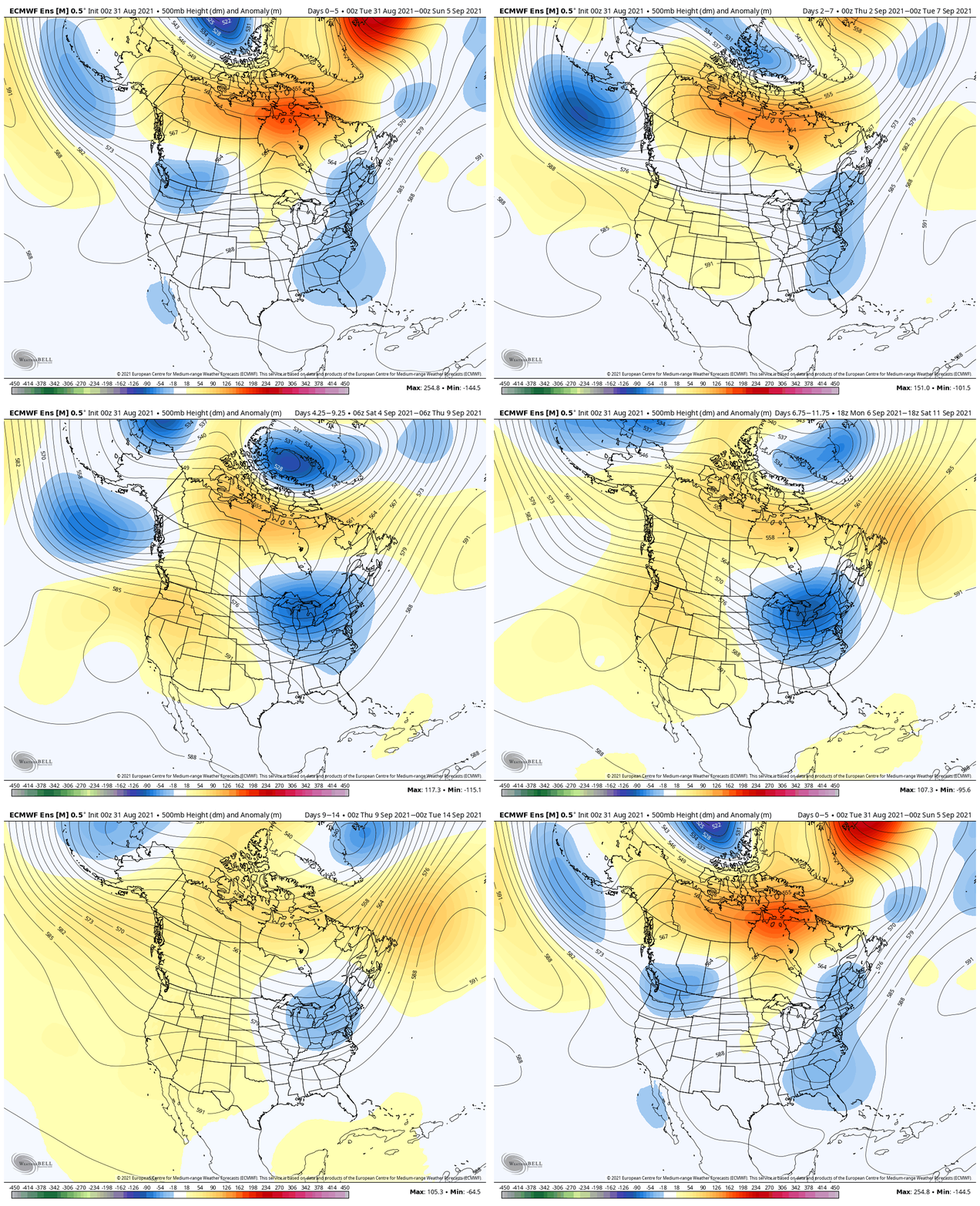
Note how the trough really amplifies next week across the eastern portion of the country. This will pull down an extended stretch of cooler, less humid air as we move through the better part of the first half of September.

A reinforcing cold front will sweep through here Saturday (yes, we’re giving in to building rain and storm chances into our Saturday forecast) with unsettled conditions.

This is likely going to set the stage for an overall wetter, cooler stretch of weather next week. Additional rain chances will arrive Tuesday and Thursday of next week.

8 of the past 10 days featured highs at or above the 90° mark, and was easily the hottest stretch of the summer. Looking ahead, a “hint” of fall shows up on the medium range charts just in time for us to kick off meteorological fall (officially, tomorrow).

Much more later, including our September Outlook…

Permanent link to this article: https://indywx.com/winds-of-change-on-the-doorstep/

Meteorological Fall Only 5 Days Away- Long Range Update Into Mid September…

Updated 08.26.21 @ 8:48a

Is there anything more polarizing than pumpkin spice products?! Count my house in favor of rolling these items out in late August. (I think my wife bought her first autumn candle of the year a few weeks ago and, rest assured, upon our return from the beautiful Gulf Coast, it will be lit almost immediately).

Despite the fact we’re in the hottest and most humid stretch of the summer (mind you, in a summer that really hasn’t been that bad from that from a heat perspective), we’re at a point where we’re shaving off nearly 2 and a half minutes of daylight per day.

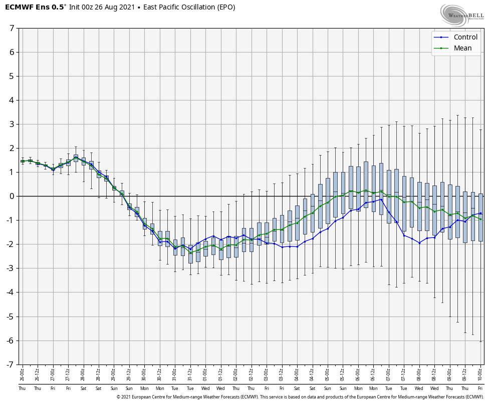
As we look at the upcoming 3-4 weeks, the primary drivers still appear to be the EPO and MJO movement. Pardon us if you’re tired of hearing this word, but it’s still the best, in our opinion, when describing the upcoming several weeks: “transient.”

Consider the more amplified look to the MJO:

As well as the EPO:

Thinking here is that the EPO and MJO will work in tandem to drive a very transient regime over the next 3-4 weeks. Perhaps the past few days have been a hint of what’s to come with more appreciable precipitation into the “heart” of central Indiana- an area that, for the most part, missed out over the latter half of July and first half of August. Officially, Indianapolis is now only 0.89″ in the hole.

Let’s take a look at some of the more trusted medium-long range computer model guidance:

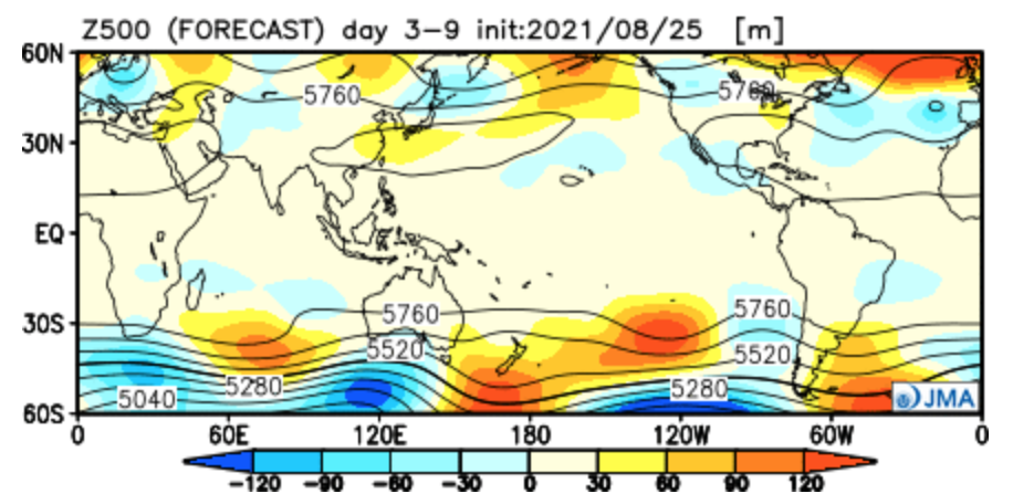
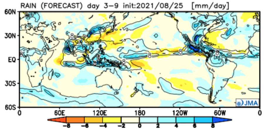
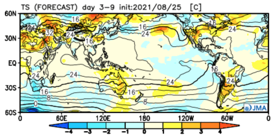
JMA Weeklies

Week 1

Week 2

Weeks 3-4

CFSv2

Weeks 1-2

Weeks 3-4

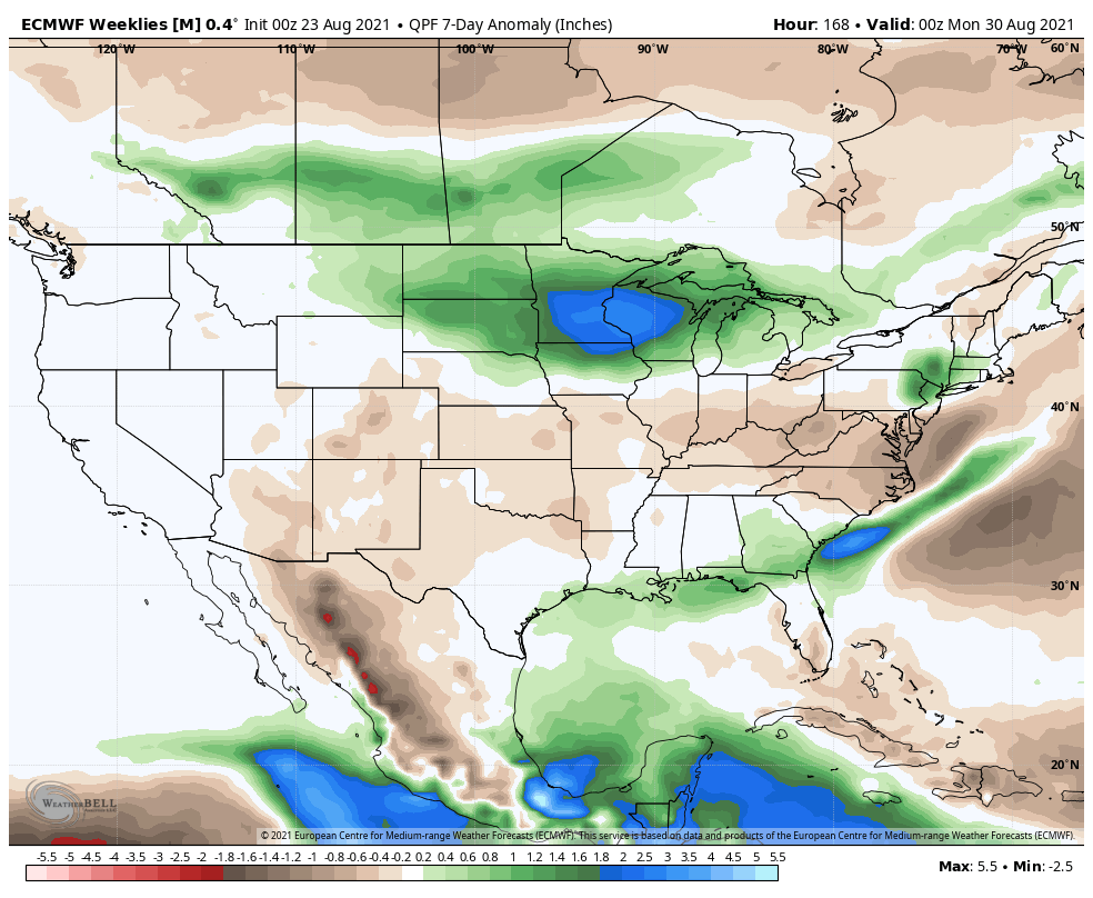
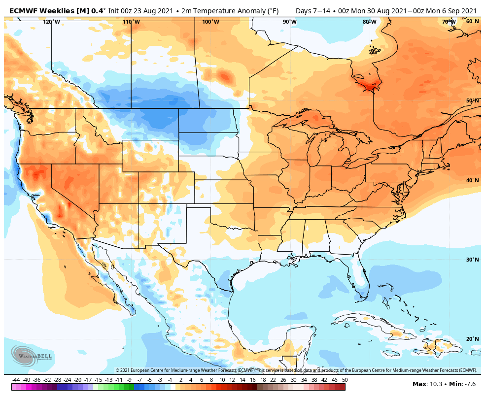
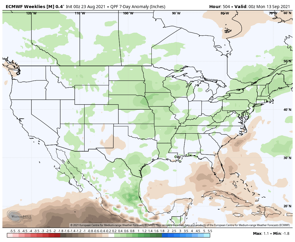
European Weeklies

Week 1

Week 2

Week 3

Week 4

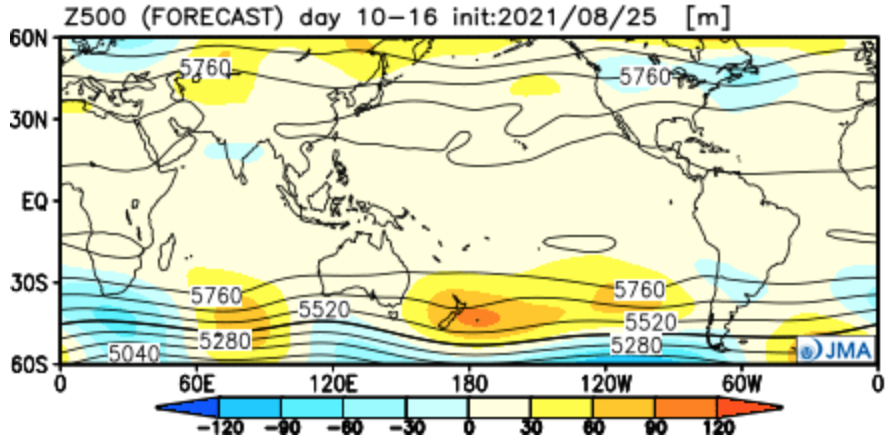
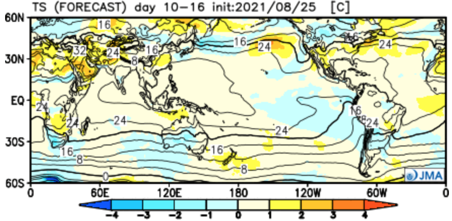
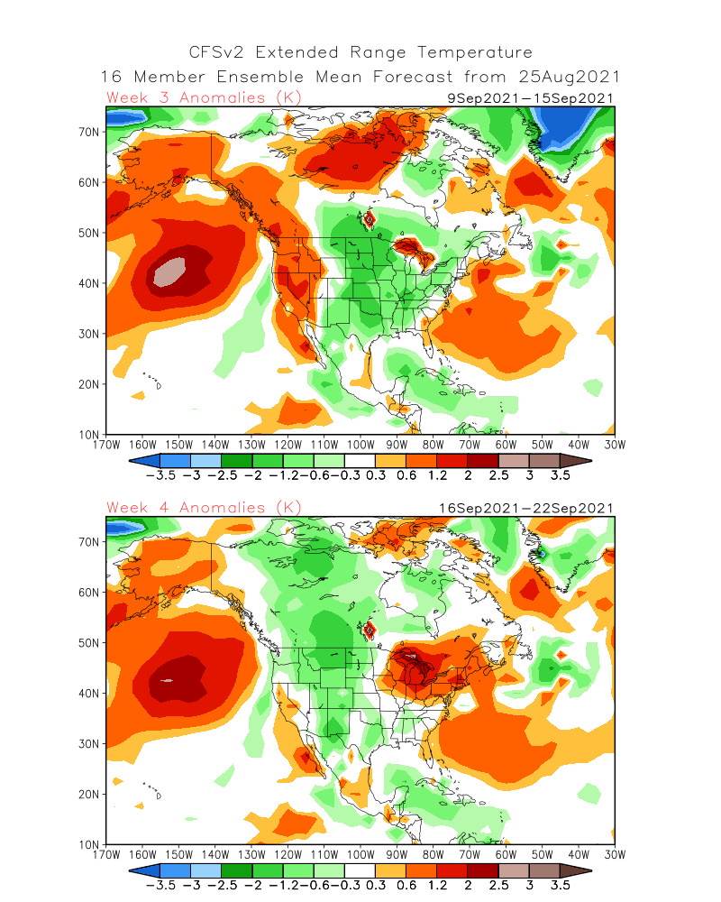
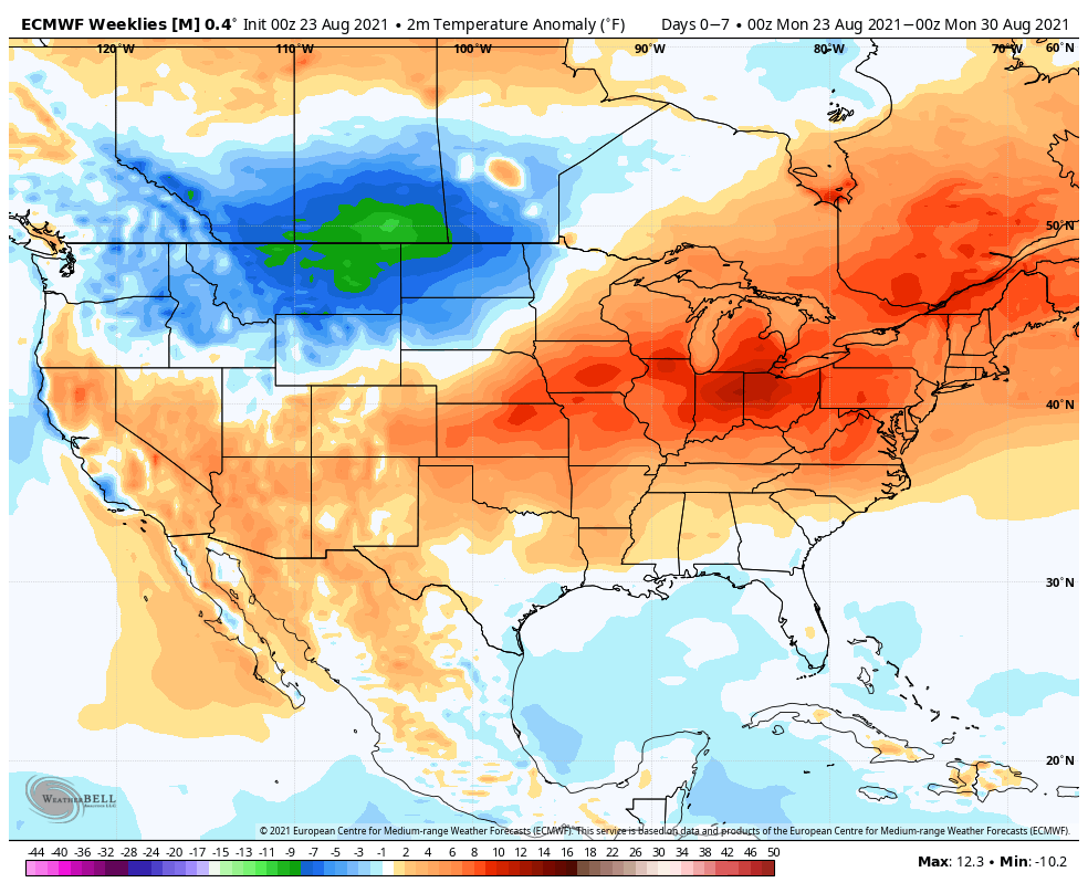
The largest takeaway between the drivers (MJO and EPO) and computer guidance above is that we will inject a wetter regime back into the mix over the upcoming 2-4 weeks (especially compared to the past 4 weeks). While we’ll likely cool somewhat in early September, the pattern, as a whole, looks warmer than normal over the upcoming 2 to 4 weeks, locally. The opposite can be said for the northern Rockies as early winter conditions will make their presence felt during this period. It’ll be particularly interesting to see if the JMA is correct in driving that strong western trough in the Weeks 3-4 time period. Should that come to fruition, it would likely pump unseasonably hot conditions across the East during that time frame, but, eventually, a piece of that trough may shift east late month and set up a cooler regime to end September.

Regardless, be sure to enjoy that PSL… 🙂

Permanent link to this article: https://indywx.com/meteorological-fall-only-5-days-away-long-range-update-into-mid-september/

#Harvest21; Fall 2021 Outlook…

Updated 08.08.21 @ 8:30a

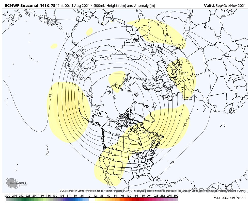
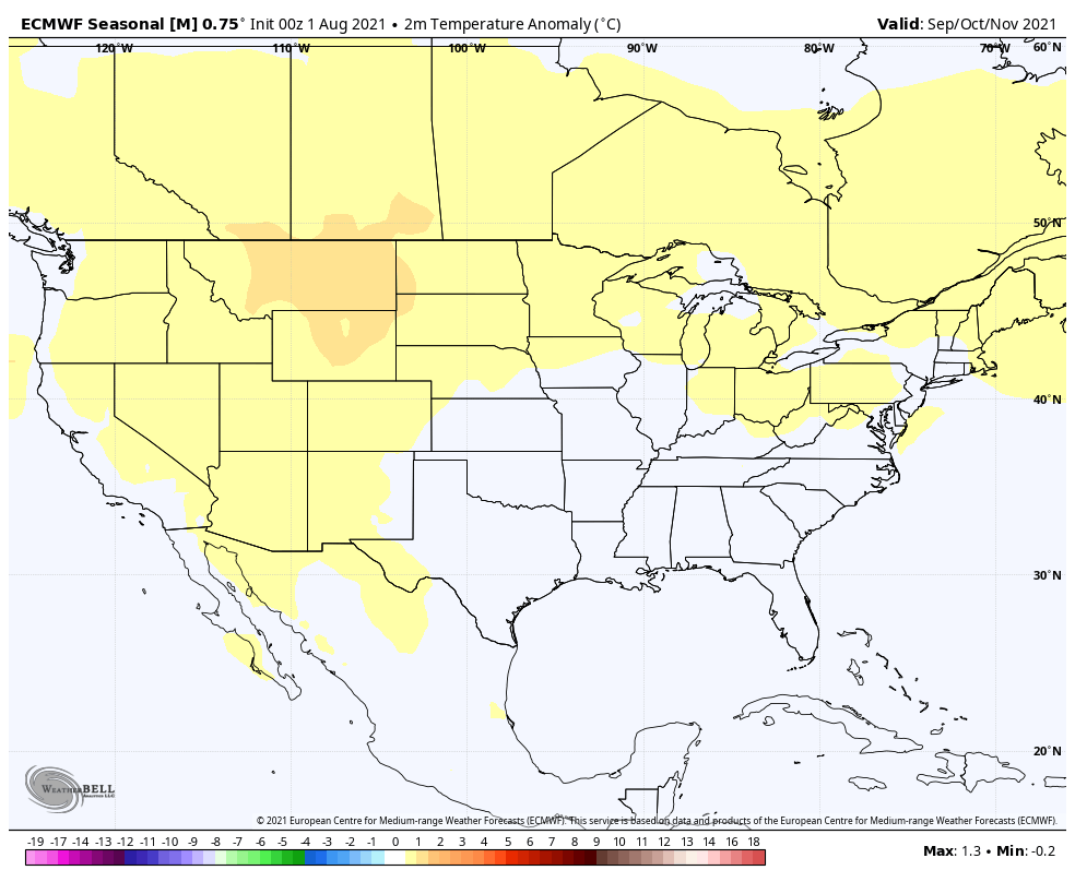
Before we dive into the foundation of our fall outlook, let’s start off by taking a look at a few different computer models. What we show below includes what the European seasonal, CFSv2 seasonal, and JMA seasonal guidance believes will take place in the meteorological fall time frame, or September through November. (The exception to this is the JMA and it breaks down Aug through Oct).

European Seasonal (Sept-Nov)

“Horseshoe” blocky look from the Desert Southwest into the central and eastern Canadian provinces, extending into the north-central Atlantic. Taken verbatim, this kind of look is notorious for an overall cooler to colder than average period into the Plains and East. Perhaps the model is trying to sniff this out, but as you see with the temperature anomalies, it’s more of a seasonal look. The European is also painting a dry autumn for a sizable chunk of the Lower 48. The lone exception? The PAC Northwest.

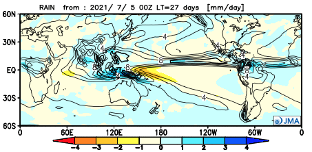
JMA Seasonal (Aug-Oct)

The model, too, has a blocky look, centered over the eastern Canadian provinces. The warmer than average temperatures are found underneath this ‘mean’ ridge position from the Southwest states, into the Rockies, and into Canada. Meanwhile, it’s more of a seasonal look for the southern Plains into the Ohio Valley, and East. Above normal precipitation is noted along the eastern seaboard and PAC Northwest.

CFS Seasonal (Sept-Nov)

The blocky look continues to be the theme, but the CFS is more bullish in the placement of an eastern trough and subsequent cooler look (compared to normal) from the northern Plains into the Southeast, including right here in the Ohio Valley. Large-scale drier than normal conditions are painted along the Gulf Coast into the Southeast states with wet conditions shown for the upper Midwest and Great Lakes.

The models serve as guidance, but must be taken with a grain of salt. When talking about weather patterns months ahead of time (some cases even a couple of weeks out), the risk is very high and, in many instances, things must be adjusted as fresher data is digested into the computer models. With that said, we can take clues from the data and combine that with current sea-surface configurations (solar activity, as well) to try and add more value to seasonal ideas.

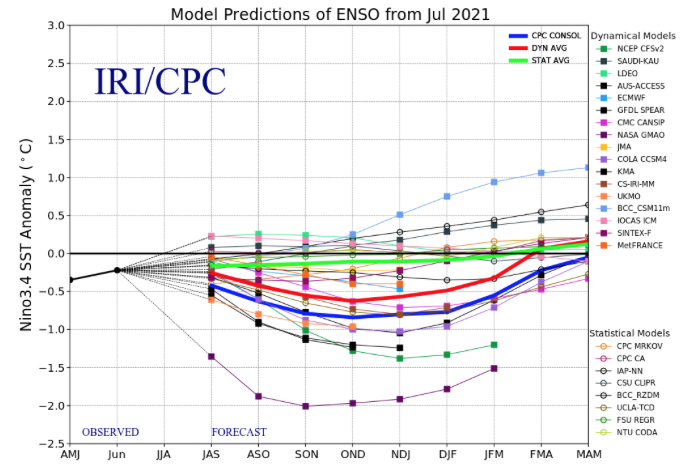
We expect a weak La Nina to hold through autumn, shown above.

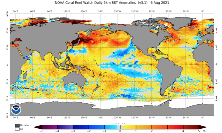
The current sea-surface temperature anomalies illustrate this, as well (cooler equatorial Pacific waters). We also note a couple of additional interesting features that will require a keen eye as we move forward deeper into the fall and as winter approaches:

I. very warm waters in the MDR (main development region) of the tropical Atlantic

II. warmer than normal waters in the Gulf of Mexico

III. well above normal waters across the northern Pacific

We do believe the models are on to the blocky look and this kind of pattern should help produce a “normal” to slightly cooler than normal autumn here in central Indiana. Don’t be surprised by a potential earlier than normal frost (average first frost occurs Oct. 11th). We’re also expecting a robust heart of the hurricane season, and expect a busy time of things in the Gulf of Mexico and along the southeast Atlantic coastline. Given that, I’d lean more towards the precipitation configuration as painted by the JMA. Slightly wetter than normal is the call for central Indiana (0.5″ to 1.5″ above normal for the season, as a whole).

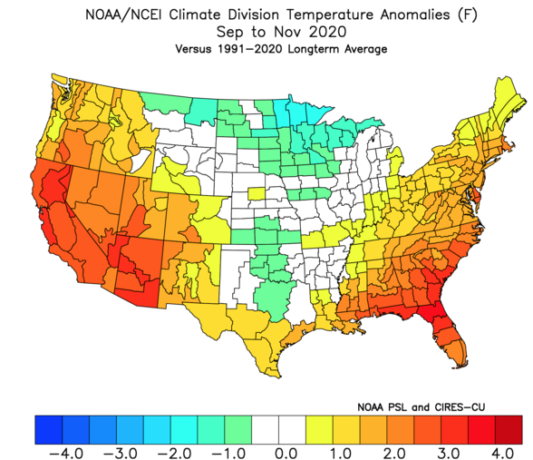
Looking back at last fall shows the coolest anomalies centered in the Plains with warmer than normal conditions across the West and East, including slightly warmer than normal readings here in central Indiana.

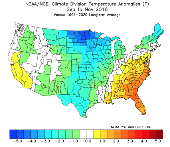
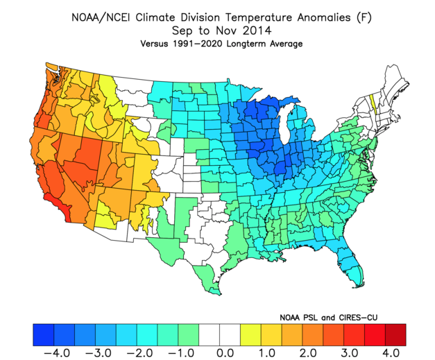
We have to go back to 2018 and then 2014 to find cool (or in the case of 2014, cold) autumns, locally.

Happy *Almost Fall, Y’all…

Permanent link to this article: https://indywx.com/harvest21-fall-2021-outlook/

VIDEO: Timing Out Best Rain Chances In The Week Ahead; Additional Fall/ Winter Rambles…

Updated 08.06.21 @ 7:50a

You must be logged in to view this content. Click Here to become a member of IndyWX.com for full access.  Already a member of IndyWx.com All-Access?  Log-in here.

Permanent link to this article: https://indywx.com/video-timing-out-best-rain-chances-in-the-week-ahead-additional-fall-winter-rambles/