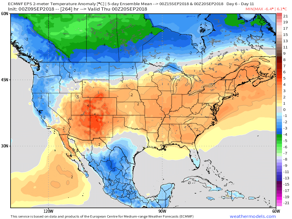
Meteorological fall (began September 1st) is running warmer than average across the eastern half of the country. More specifically, Indianapolis is running 4.8° above average through the period.
 The culprit? A persistent strong eastern ridge (the same ridge that trapped Florence across the Carolinas after she made landfall).
That said, things are changing in significant fashion and these changes will result in much colder conditions as we wrap up the month and open October.
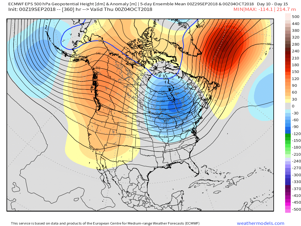
We note the PNA (Pacific North America pattern) trending strongly positive during the period.
 A positive PNA typically leads to an eastern trough- especially during the fall months into the spring. Something like this kind of upper level pattern usually results.
 Sure enough, the models are going to this look.
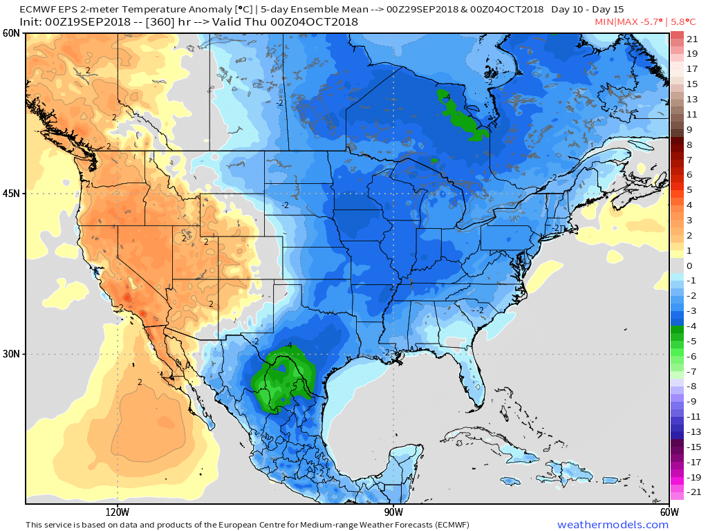
 At the surface, the eastern warmth is reversed in a significant fashion with well below average temperatures. In fact, temperatures will grow cold enough to support high ground snow in the Rockies and northern Great Lakes and the threat of an early frost into the upper Mid West and perhaps portions of the Ohio Valley during the period.
 Ah, true pumpkin spice season is right around the corner. 😉


 All eyes will shift to Florence by midweek. She’ll likely go through a period of significant strengthening on her journey closer to the southeast US coast with a potential landfall along the Carolina coastline Thursday. There’s still time to watch things unfold, but confidence is increasing on a potential major hurricane making landfall later this week.
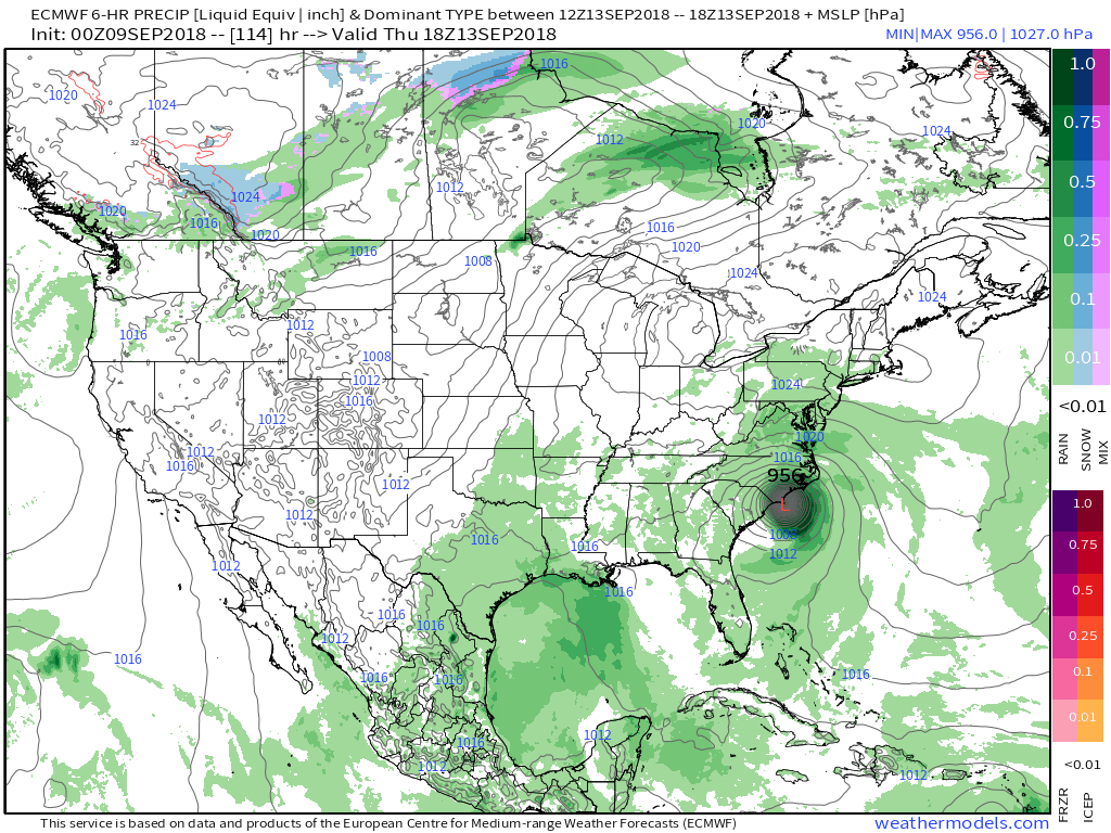 Unfortunately, the upper air pattern and lack of a steering current would lead to Florence either stalling out or “meandering” around the mid-Atlantic region for potentially several days…