The past couple of days have provided a classic fall feel across the region, but changes loom.
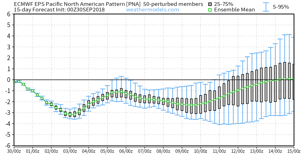
The PNA (Pacific North America Pattern) is forecast negative- at times, strongly so- through the better part of the first half of October.
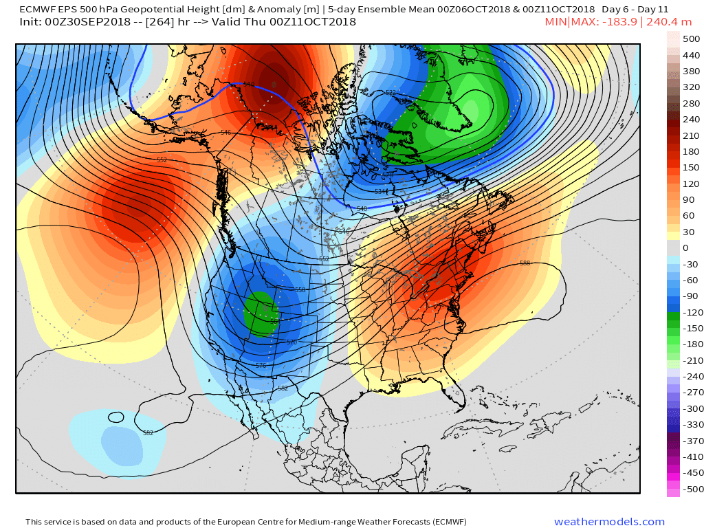
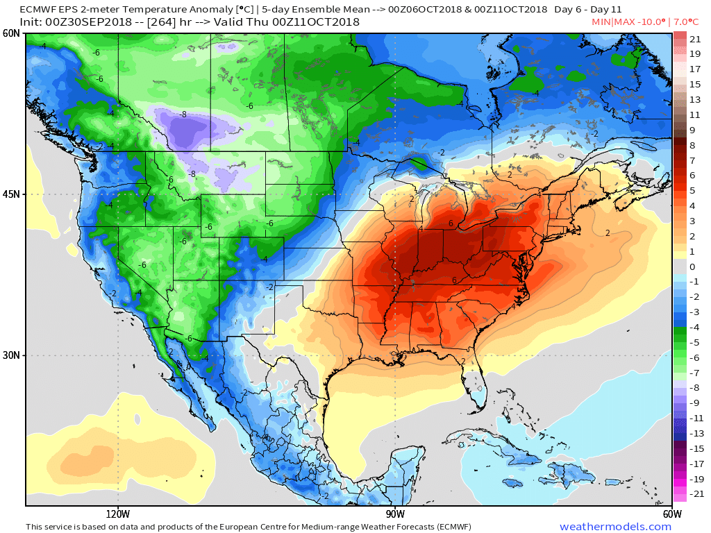
 Accordingly, we would expect to see a deep trough across the west and ridging/ associated warmer pattern across the east. Sure enough, that’s what the modeling is painting.
 A prolonged stretch of unseasonably warm and humid weather will be with us through the first couple weeks of the month. Unfortunately, for fall foliage enthusiasts, for the second straight year, this will have a negative impact on the peak color season. Highs in the middle 80s and lows in the upper 60s to around 70° will be common during the period. Summer isn’t finished yet…

