Potential Is Mighty, But Can It Turn To Reality?
Updated 12.31.23 @ 4:13p
We’re heading towards a “special” pattern over the next couple weeks, especially for winter weather enthusiasts. The potential in the said pattern is mighty, but can potential become reality? Thankfully, we have a quiet open to the month to track all of the possibilities that begin to take their position this upcoming weekend.
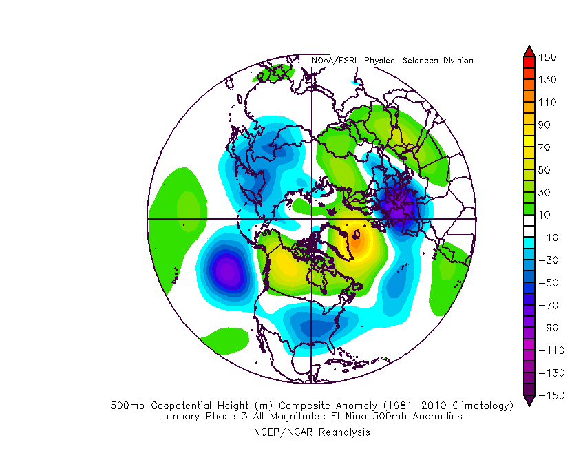
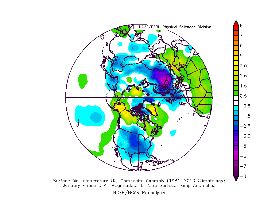
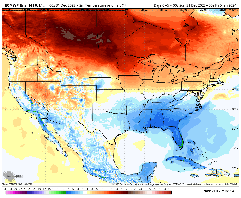
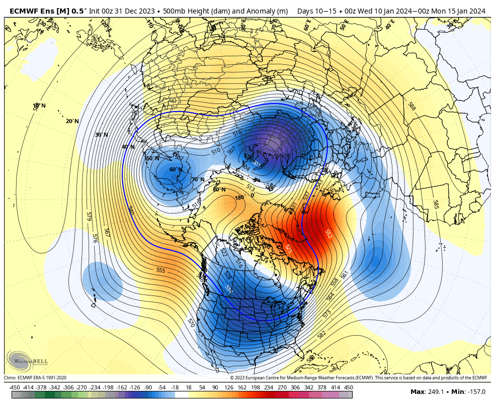
It’s easy to become enamored with the expansive trough and coast to coast cold that follows in the 10-15 day range (by the way, truly bitter air should arrive during this period), but what’s more interesting to me is the building Greenland Block. That kind of block usually promotes all sorts of wintry “fun and games” here and across a large chunk of the country. It’s also note worthy as it tends to lead to more sustainable wintry conditions. Perhaps the “extreme and nothing in between” cold solution/ lean for the latter part of January may have merit?
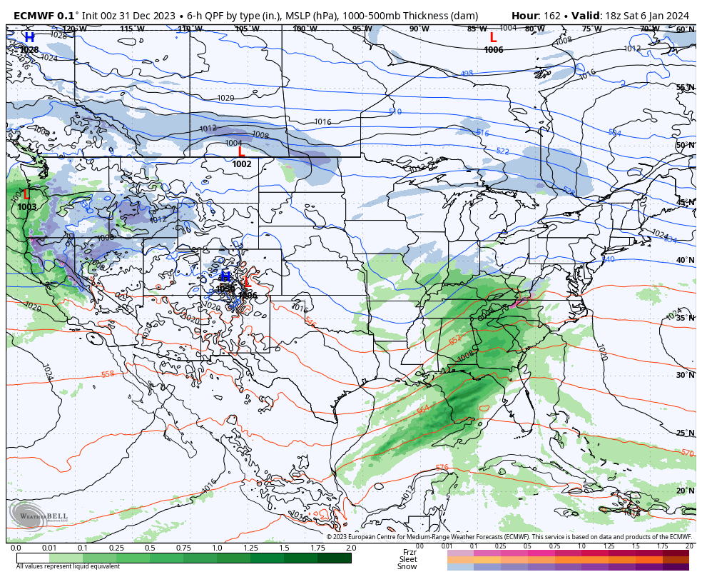
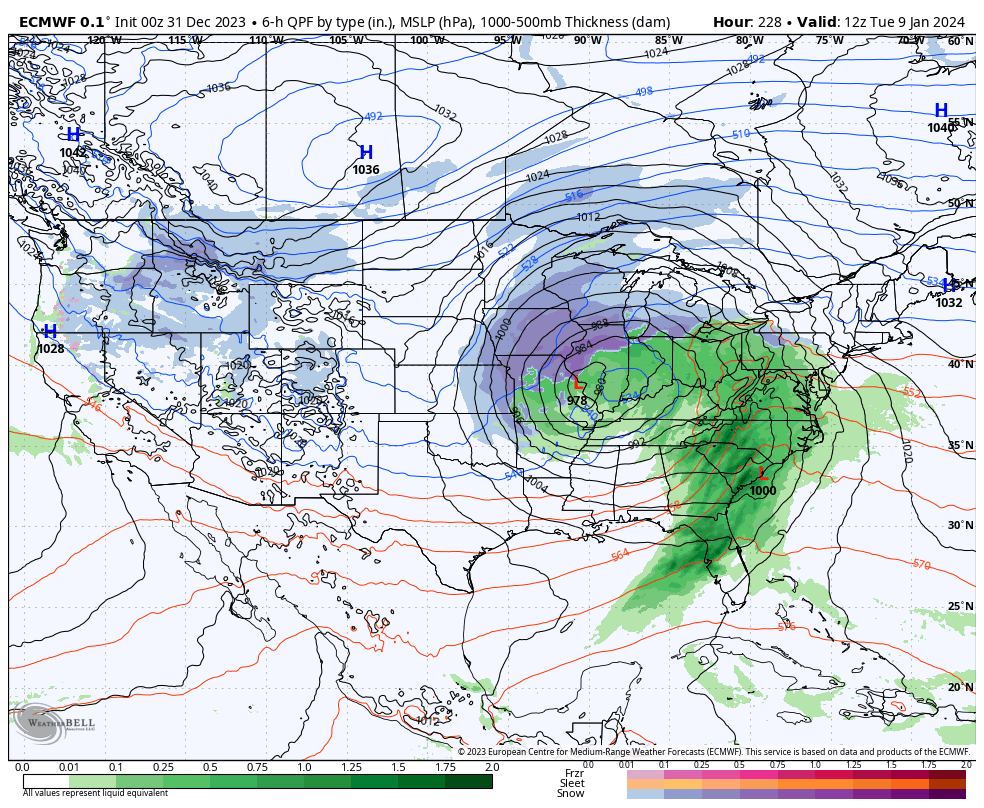
While far too early for specific details, the stormy shift appears to be a good call with the initial storm taking aim on the region this upcoming weekend, followed by a second system that also has the potential of producing wintry weather the early and middle part of the following week. Simply put, the threat of winter storm(s) is growing over the course of the upcoming 10 days.
Details to follow in the week ahead!