You must be logged in to view this content. Click Here to become a member of IndyWX.com for full access. Already a member of IndyWx.com All-Access? Log-in here.
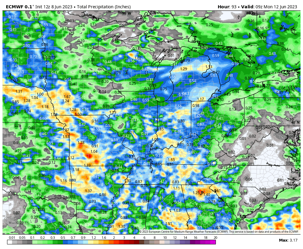
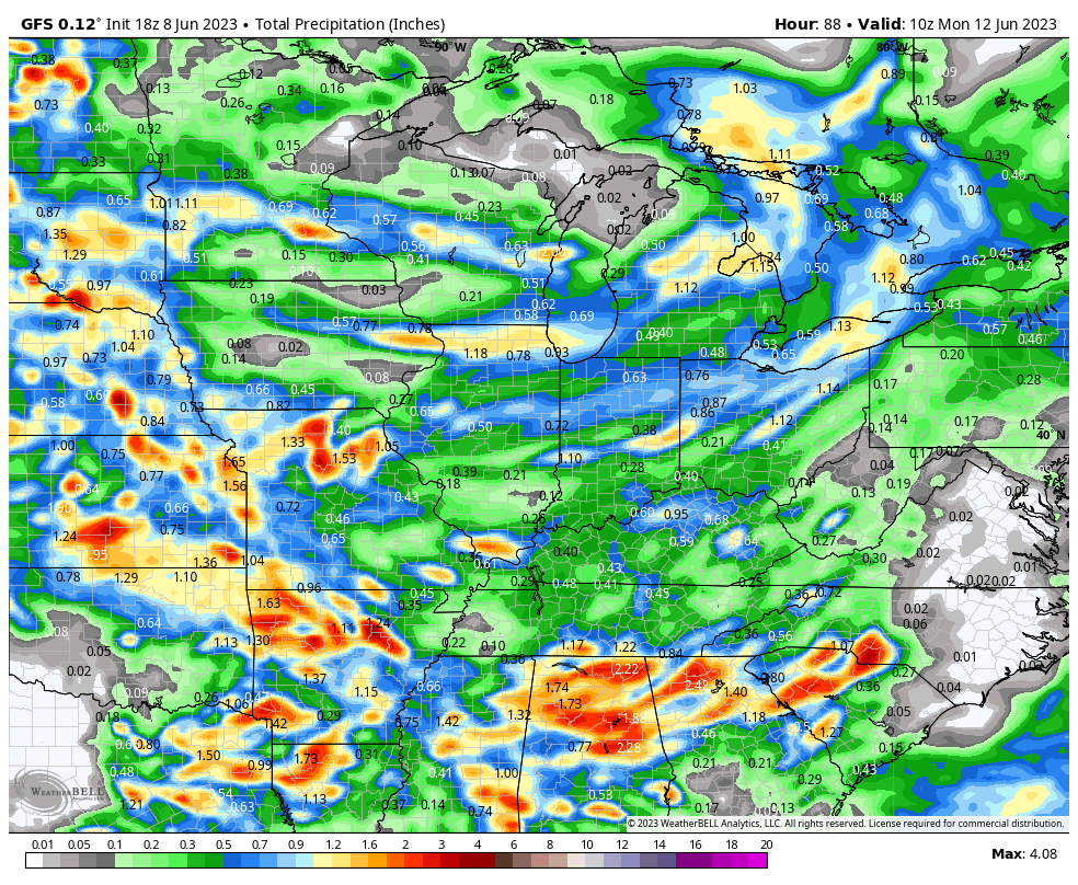
Many areas across immediate central Indiana are running anywhere from 4” to 7” below normal rainfall since April 1st. Despite a few localized “splash and dash” events it’s been a dry and uneventful time of things in the good ole weather department. Thankfully, it still appears as if this upcoming weekend, namely Sunday into Monday morning, will offer up the best opportunity we’ve seen for a more widespread rain of 0.25” to 1” (localized heavier amounts) in quite some time. We note both the GFS and European are in relatively good agreement.
Most widespread rain should fall Sunday afternoon and overnight. At least it’s a start to what should be a more active 2nd half of June. Much more in the AM around this and the longer range pattern that includes early July.
You must be logged in to view this content. Click Here to become a member of IndyWX.com for full access. Already a member of IndyWx.com All-Access? Log-in here.
You must be logged in to view this content. Click Here to become a member of IndyWX.com for full access. Already a member of IndyWx.com All-Access? Log-in here.
You must be logged in to view this content. Click Here to become a member of IndyWX.com for full access. Already a member of IndyWx.com All-Access? Log-in here.