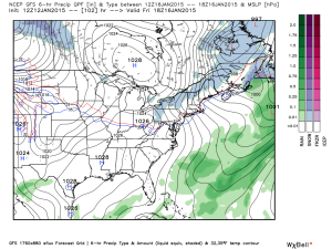
Category: Freezing Rain

Mid Week Light Snow And Reinforcing Cold…

Wed.

Thr.

Fri.

Sat.

Sun.

Mon.

Tue.

 Status-weather-snow-scattered-day-icon

 Status-weather-clouds-icon  Status-weather-clouds-icon  Status-weather-showers-scattered-icon  Status-weather-showers-scattered-icon  Status-weather-showers-scattered-icon  Status-weather-clouds-icon

12/ 35

14/ 27

13/ 31

21/ 43

43/ 57

32/ 51

29/ 36 

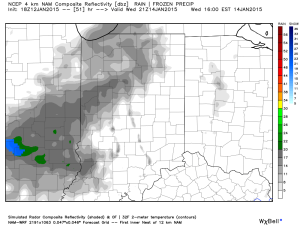
Light Snow…Light snow will fall across central Indiana Wednesday, especially from Indianapolis and points north.  We’re not talking about significant accumulations, but a dusting to half an inch will be possible across the region Wednesday morning.  This is part of reinforcing cold and wind that will once again have things feeling frigid come Wednesday evening.  Southwest winds will shift around to the northwest come afternoon helping drive in the arctic air reinforcements.

Cold Close To The Work Week…We’re anticipating a dry close to the work week, but one that’s much colder than average.  In fact, high temperatures both Thursday and Friday will be significantly colder than average lows this time of year.  Brrrrrrr…. Keep the heavy winter gear handy.

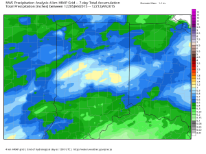
Milder, But Wet And Windy…A big Mid West storm system will deliver a rainy and windy time of things Saturday into Monday.  As precipitation moves into the region, a wintry mix of sleet and/ or freezing rain will be possible during the onset early Saturday.  Otherwise, strong and gusty southerly winds will deliver a briefly milder regime come Sunday with periods of heavy rain.  Early indications suggest weekend rainfall totals reach 1″ to 1.5″.

Turning Colder Again…Once our storm system lifts away from the region, colder than normal air will quickly come rushing back into central Indiana to open up the short Thanksgiving week.  More details later in regards to a potential storm system brewing closer to Thanksgiving, itself…

Upcoming 7-Day Precipitation Forecast:

  • 7-Day Snowfall Forecast: Dusting – 0.50″
  • 7-Day Rainfall Forecast: 1.00 – 1.50″

Permanent link to this article: https://indywx.com/mid-week-light-snow-and-reinforcing-cold/

Accumulating Ice And Snow Then Frigid

Sun.

Mon.

Tue.

Wed.

Thr.

Fri.

Sat.

 Status-weather-snow-scattered-icon

 Status-weather-clouds-icon

 Status-weather-clouds-icon

 Status-weather-clouds-icon

 Status-weather-clouds-icon

 Status-weather-showers-day-icon

 Status-weather-snow-scattered-day-icon

16/ 23

9/ 19

4/ 28

10/ 30

18/ 38

27/ 50

22/ 37 

Moderate

– – –

– – –

– – –

– – –

Light

Light

Forecast Updated: 03.02.14 @ 12:25a

Sunday Winter Storm…The well advertised winter storm is here and will make a mess of travel and plans for the second half of your weekend.  Moisture is streaming northeast over a bitterly cold air mass locked in place at the surface and this will create a mixture of sleet and freezing rain to quickly change to a mixture of sleet and snow during the early morning hours across central Indiana.

We forecast precipitation intensity to really begin to increase across the greater central Indiana region around 3-4 am.  Waves of accumulating snow will continue through the day, though it won’t snow all day.  In particular, we bracket 4am to 10am and then again early Sunday afternoon.

Finally, a wave of low pressure will eject into the Tennessee Valley Sunday night into Monday, continuing the significant snow and icing down state.  We anticipate the majority, if not all, of “round two” to bypass most of central Indiana to the south Sunday evening into early Monday.  So, what’s the culprit behind the suppression?  As mentioned in previous posts, a powerful arctic high will build south Sunday into Sunday night and this is the primary driver for the shift south in the surface low track.

All of that said, we’re still looking at significant accumulations of sleet and snow across central Indiana today, though reduced from the 6-8″ forecast we’ve had out since Thursday morning.  We now forecast 2-5″ of snow and sleet across central Indiana.  Needless to say, we’ll continue to monitor.  Sunday night will turn downright frigid across the region as temperatures crash into the upper single digits.

As a quick side note, we once again have to tip our cap to the Canadian forecast model.  It began to catch onto the southward shift with “phase 2” of the storm well in advance of the other model data (during the mid week period), including the highly touted European forecast model.

Frigid Start To The Work Week With Slow Mid Week Moderation…Fresh arctic air will be locked in place across the area to begin the new work week.  While it’ll be dry, temperatures will run as much as 30 degrees below seasonal norms.  The cold winter of 2013-2014 just doesn’t want to let up.

As we push into the mid week stretch we’ll note a powerful Gulf low that’s expected to push up the eastern seaboard. Early indications here keep us dry with slowly moderating temperatures.  Though we’ll remain well below normal, it’ll be a step in the right direction, so to speak, from the frigid early week start.

Weak Late Week System…The early take on late next week shows a cold front moving through Friday afternoon and evening. This may create a few rain showers Friday evening followed by light snow Friday night into Saturday morning as a fresh push of cold air blows into the state.  We have time to watch this and update as needed.

Upcoming 7-Day Precipitation Forecast

  • 7-Day Snowfall Forecast: 2-5″
  • 7-Day Rainfall Forecast: 0.25″

We’ll have fresh thoughts posted here and on our social media accounts through the day.  Have a nice Sunday and God Bless!  You can follow us on Twitter @indywx and become a friend of ours on Facebook by searching IndyWx.com.

Permanent link to this article: https://indywx.com/accumulating-ice-and-snow-then-frigid/

Some Late Night Thoughts…

It’s been a long day, but we’d like nothing more than to be right here in the good ole forecast office, digging into data for our next winter storm with you.  While “part 2” of the storm remains just offshore as of this post, it’ll likely be trudging onshore by the time you read this early Saturday morning.  That said, the initial wave of accumulating snow (and for some, ice) will arrive as early as late Saturday night/ wee morning hours (well before sunrise) Sunday in the form of an overrunning event- where comparably warmer, more moist air is lifted up and overruns the cold air at the surface.

Early ideas suggest we undergo a period of moderate to heavy wintry precipitation as early as 3-ish Sunday morning, extending into the late morning hours.  Particularly, we bracket the hours of 3am to 10am Sunday for the initial wave of wintry weather.  This will be a mixed bag of precipitation, including snow, sleet, and freezing rain across central Indiana.  An early look at the high resolution simulated radar courtesy of the NAM shows this well- valid 7am Sunday morning.  Image is courtesy of the fine folks over at Weatherbell Analytics.

hires_ref_indy_37

After a “lull” in the accumulating wintry precipitation from late morning/ early afternoon Sunday, we’ll likely deal with another round of moderate to heavy accumulating wintry precipitation Sunday afternoon into Sunday night.  It’s important to note this is where we have more questions than answers in regards to the interaction of a juiced up southern stream of the jet- infused by the powerhouse late season winter storm (still spinning just off shore as of this update).  Powerful arctic high pressure will be sinking south and could result in a more suppressed track of the low. Should this be the correct scenario snow totals would likely be towards the lower end of the ongoing 6-8″ forecast we hoisted back on Thursday morning.  That said, one can’t ignore the pattern as it’s one notorious for heavy snow producers across central Indiana.  A scan over heavy snow events of the past here across central Indiana show similar setups that have yielded impressive snow totals.  Just as the potential of suppression has to be noted, so should the potential of a slightly more north trend that models may currently see as time gets closer.

In closing tonight, 12z model data should really begin to hone in on the area most likely to see heaviest snow and/ or ice accumulations.  Our ongoing forecast of storm totals remains unchanged for now of 6-8″.  Stay tuned, friends.

Permanent link to this article: https://indywx.com/some-late-night-thoughts/

Word On The Weekend And A Couple Other Items Of Interest.

We continue to monitor the goings on for the weekend closely.  As of now we still think snow is the dominant form of precipitation across central Indiana and likely comes in “waves” of intensity from late Saturday night into Monday morning.  Significant snowfall totals are possible, but it’s still too early to pin point totals due to the chance of some mixing issues (sleet, freezing rain) for some and the overall placement of the cold front.  This will be a bit different than what we’ve experienced with our last couple of winter storms and could be more of a prolonged event as warmer moist air overruns the cold air at the surface.  Again, exactly where the arctic boundary stalls Saturday night into Sunday will determine the precise precipitation types and exactly who sees snow versus sleet and freezing rain.  Stay tuned.

In other news…if you thought it’s been a cold winter then you’d be correct. In fact, this “cool” image from IEM shows that central Indiana has been at 32 degrees, or lower, between 60-70% of the time since December 1st.  Impressive, for sure!

BhaPsoICIAAP9Md

Finally, another arctic cold front will slam into central Indiana tomorrow morning and will be accompanied by howling northerly winds gusting to 40-50 MPH and a potential quick-hitting snow shower.  This will set the stage for a brutal Thursday as temperatures struggle to recover to the lower to middle teens for IND and even colder for the northern ‘burbs.  This is hard to handle when considering we’re expected to “normally” reach the middle 40s this time of year.

simuawips-2

Permanent link to this article: https://indywx.com/word-on-the-weekend-and-a-couple-other-items-of-interest/

Tracking A Late Weekend Winter Storm

Wed.

Thr.

Fri.

Sat.

Sun.

Mon.

Tue.

 Status-weather-clouds-icon

 Status-weather-clouds-icon

 Status-weather-snow-scattered-day-icon

 Status-weather-snow-scattered-day-icon

 Status-weather-snow-scattered-icon

 Status-weather-snow-scattered-day-icon

 Status-weather-snow-scattered-day-icon

5/ 18

8/ 14

2/ 23

22/ 37

20/ 30

10/ 20

5/ 18 

– – –

– – –

Light

Light

Heavy

Light

Light

Forecast Updated 02.26.14 @ 7:43a

Frigid Midweek…A brutally cold air mass is blowing into the region this morning, especially considering we’re nearly into March!  This is laying the groundwork for a snowy weekend, but we’ll get to that in a bit.  Forecast highs average at 44 degrees this time of the year and today’s high will be lucky to reach 18.  EVEN COLDER air blows in late tonight into early Thursday and will result in continued dangerous below zero wind chill values.  Needless to say, plan to bundle up upon heading outdoors.  While the calendar may suggest spring is near, Mother Nature and Old Man Winter have other ideas.

Late Week Light Snow…A warm front will lift north through the region Saturday morning and will be responsible for producing a round of light snow Friday night into Saturday AM.  As of now, early numbers suggest around an inch of snow is possible, but we’ll continue to monitor things and update as needed.

Late Weekend Winter Storm…While details are still far from etched in stone, there’s no doubt behind a significant winter storm brewing for the second half of the weekend.  This storm will have significant snow for portions of central Indiana and significant icing potential for others.  As of now, we anticipate air cold enough to support frozen, or freezing, precipitation across our immediate viewing area of central Indiana.  All of that said, we caution that the track and intensity of the storm will likely change between now and Sunday and we’ll continue to keep close tabs on this event.  Early numbers are impressive as far as precipitation goes with liquid equivalent amounts around 1″ churned out, on average, from a variety of computers models.

Arctic Air Reloads…We may be into meteorological spring next week, but Old Man Winter continues his relentless ways that we’ve grown so accustomed to over the past several months. Fresh arctic air will plunge into central Indiana’s potentially snow packed ground early next week and could ultimately help yield below zero air by the middle of next week.  What an impressive winter.

Upcoming 7-Day Precipitation Forecast

  • 7-Day Snowfall Forecast: 4-8″
  • 7-Day Rainfall Forecast: 0.00″

twic

For weather updates and more “behind the scenes” data on the go, be sure to Follow Us on Twitter @indywx or become a Friend of IndyWx.com on Facebook!

images

Permanent link to this article: https://indywx.com/tracking-a-late-weekend-winter-storm/