State Divided Today; Colder, Wintry Weekend…
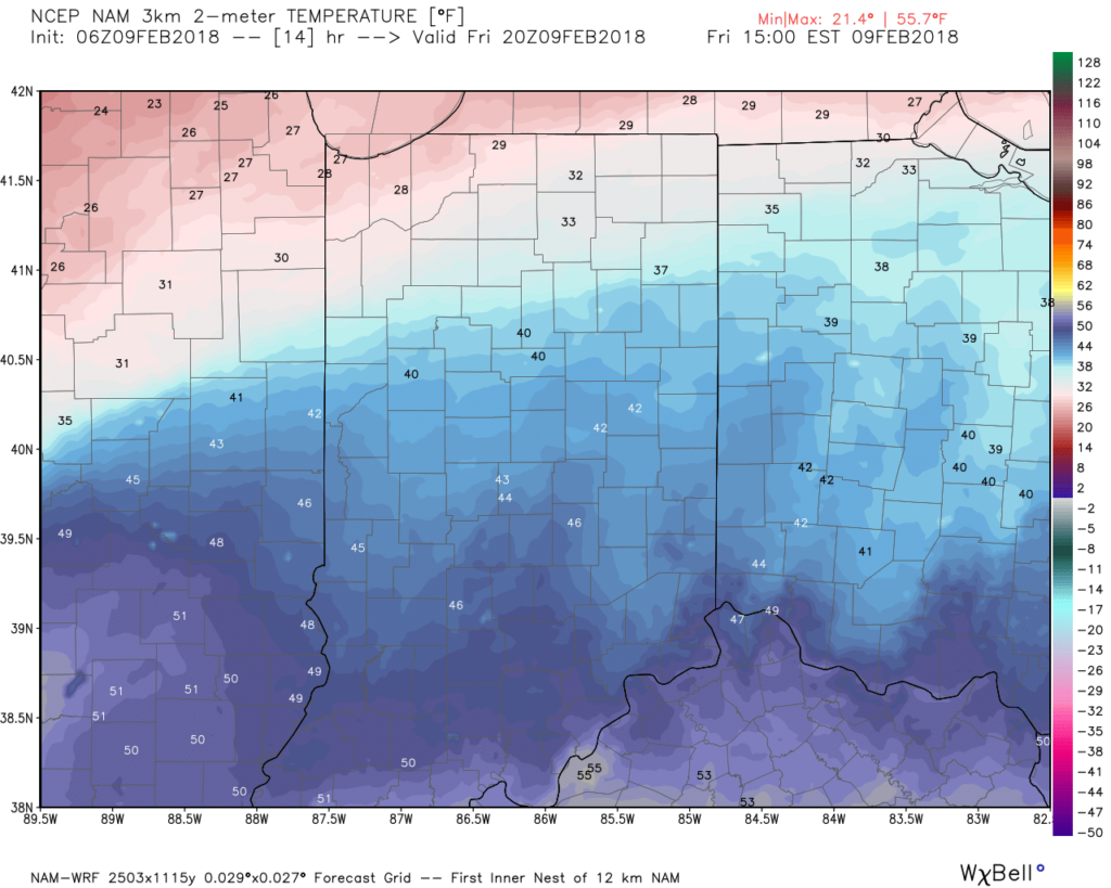
A warm front will drape itself across north-central Indiana today and while this will serve as an ingredient in the hefty northern IN snow event, it’ll allow southerly winds to pull briefly milder air north into central parts of the state this afternoon- middle to upper 40s for many! Further downstate, highs will go north of 50° this afternoon.
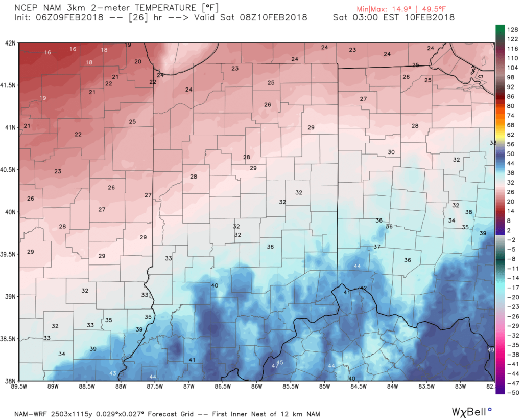
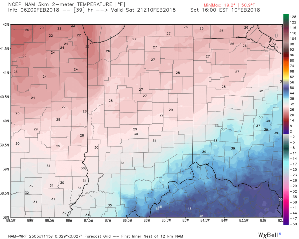
 Colder air will move into the region this evening as the front settles south and we get back into a north, northeasterly flow. We’ll fall to around freezing shortly after midnight and temperatures are forecast to remain nearly steady or slowly fall Saturday- upper 20s to around 30 by Saturday afternoon.
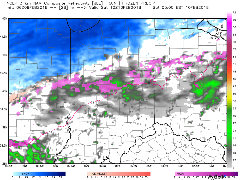
 As colder air seeps back into central Indiana, waves of moisture will continue to push northeast at times through the weekend. While precipitation totals won’t be particularly impressive, it doesn’t take much freezing rain to create issues and we’ll continue to monitor things closely over the weekend.
Periods of light freezing rain and/ or sleet will develop Saturday morning.
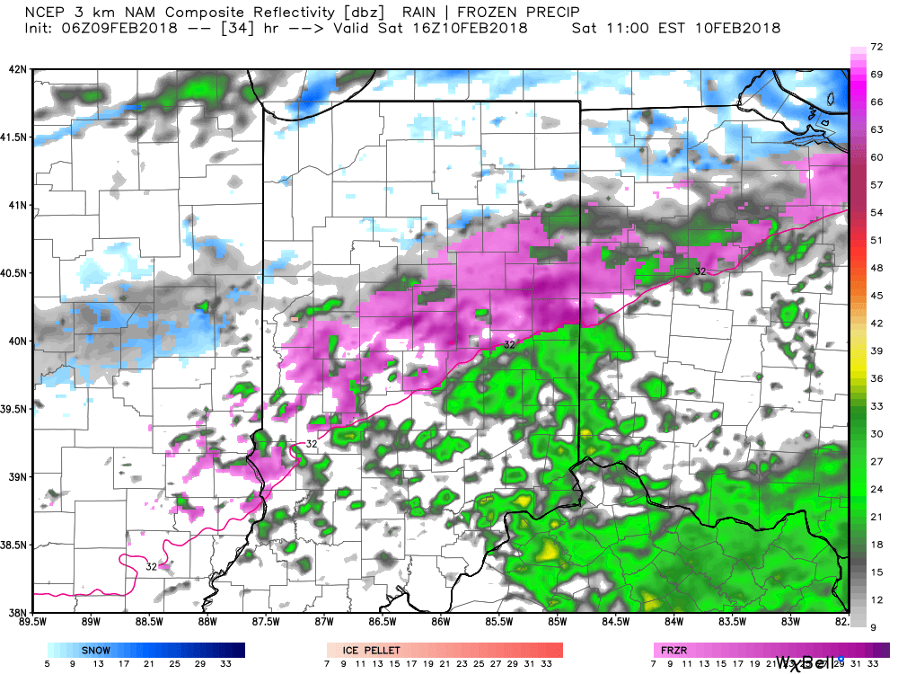 Models differ on various solutions, but perhaps the most widespread combination of light freezing rain, sleet, and snow will arrive Saturday evening into the day on Sunday. Stay tuned!

 Temperatures are in the upper 20s for most central Indiana communities this morning and it’s not until we get into the early to mid afternoon hours when we anticipate temperatures to climb to around freezing. As a result, slick conditions (especially side streets and back roads) can be expected into the afternoon and evening hours.
 Overnight lows tonight will fall into the lower to middle 20s so re-freezing and slick spots on area roadways can be expected into Thursday morning.
 Thankfully, a southwesterly air flow and new warming trend will develop through the day Thursday, along with a return of sunshine!
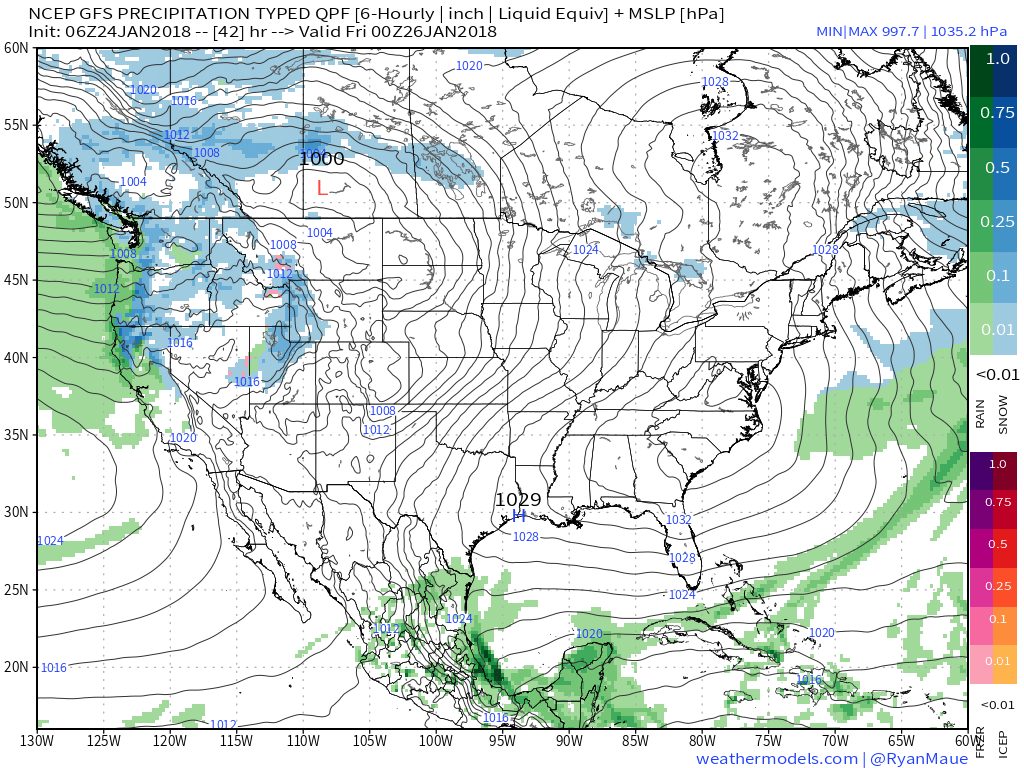 Much more later today on the developing new cold pattern…