Chilly, Blustery Weekend…
 Highlights:
- Band of showers and t-storms arrives late tonight
- Very cool and blustery weekend
- Drier pattern developing
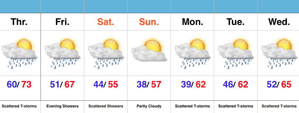
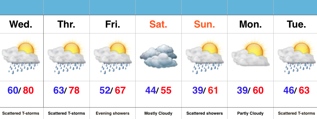
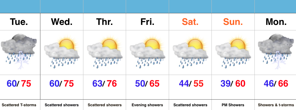
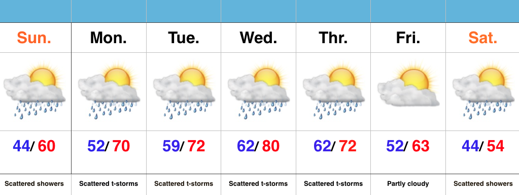
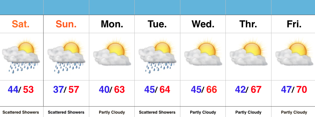
Unseasonably Chilly Weekend…A cold front is racing towards the region and will serve up a fresh batch of showers and thunderstorms overnight. The bigger story will be a gusty NW wind shift and falling temperatures late tonight. The chill will remain through the weekend with highs well below average and a patchy frost threat in outlying areas Sunday morning. Most of Sunday will be dry, but a widely scattered shower is possible during the afternoon hours.
The majority of the upcoming work week looks much drier when compared to recent. We’re watching a significant storm system, but general consensus of forecast model data at this point keeps the majority of significant rains to our south. We’ll keep a close eye on things. Slowly moderating temperatures can be expected as we progress through the week.