Winter Storm Inbound This Weekend…
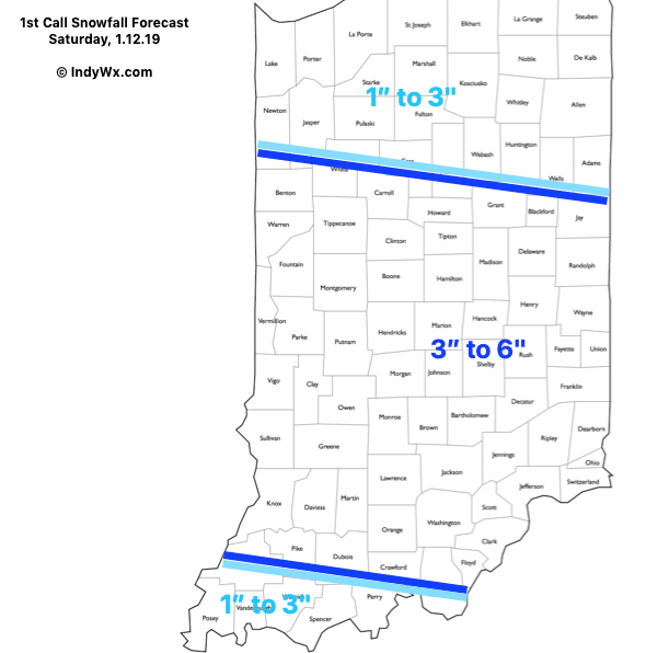
A significant winter storm will impact the region this weekend. Here’s our initial thinking where heaviest snowfall totals will occur on Saturday:

Our morning video discussion:
A significant winter storm will impact the region this weekend. Here’s our initial thinking where heaviest snowfall totals will occur on Saturday:
Our morning video discussion:
You must be logged in to view this content. Click Here to become a member of IndyWX.com for full access. Already a member of IndyWx.com All-Access? Log-in here.
You must be logged in to view this content. Click Here to become a member of IndyWX.com for full access. Already a member of IndyWx.com All-Access? Log-in here.
You must be logged in to view this content. Click Here to become a member of IndyWX.com for full access. Already a member of IndyWx.com All-Access? Log-in here.
Snow will overspread the region during the predawn hours Saturday morning and stick around throughout the day, into Saturday night. Periods of moderate to heavy snow are expected along the I-70 corridor with perhaps the greatest intensity arriving late Saturday morning into the afternoon and early evening hours.
Here’s our “first stab” at storm total accumulation once all begins to wind down late Saturday into early Sunday morning. Much more later!