Frigid Saturday Gives Way To A Messy Sunday Evening…
 Highlights:
- Bitter cold eases
- Mix of snow and ice
- Milder midweek
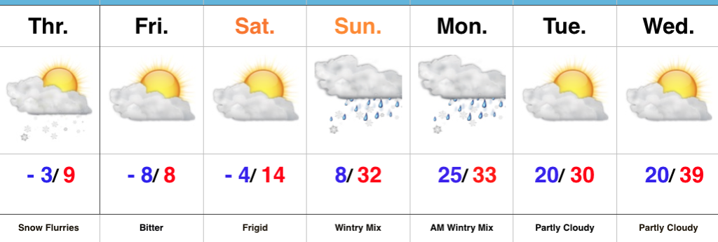
Bitter Today; Wintry Mix By Sunday Evening…Most central Indiana reporting sites are checking in this morning between 6° and 10° below zero, but we note a couple of spots are even colder. Arctic high pressure will remain in control of our weather today, leading to sunny and bitter conditions.
An approaching storm system Sunday will help increase our cloud cover through the morning and we expect snow to develop by evening. As warmer air aloft works into the region, a transition to freezing rain is expected during the overnight into early Monday morning. The morning commute looks very messy Monday.
Moderating temperatures will develop by midweek and as the milder air moves over the cold surface, thick fog and areas of drizzle and light rain will develop Wednesday. A cold front will sweep through the state Thursday with showers and we’re keeping close tabs on a secondary piece of energy that will lead to a wintry close to the work week for portions of the Ohio Valley. In fact, a significant winter event should develop out of this pattern Friday into Saturday. The early call for now is that this is east of our region, but stay tuned. Snow showers will fly in the colder air to close the week regardless.
Upcoming 7-Day Precipitation Forecast:
- Snowfall: 1″ – 2″
- Rainfall: 0.50″ – 0.75″
 Highlights:
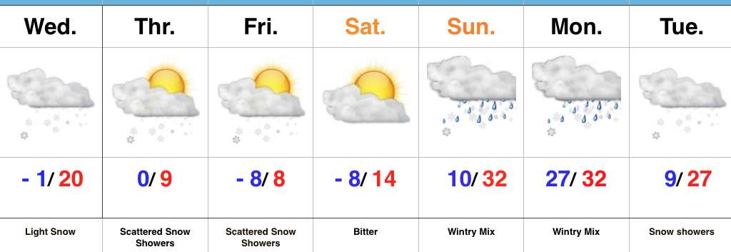 Highlights: