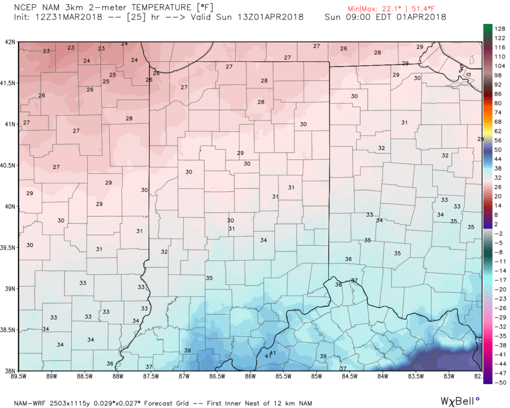
A cold front will blow through central Indiana this evening and colder air will spill into the region overnight. We’ll wake up with temperatures in the upper 20s to lower 30s Easter morning with dry conditions in place.
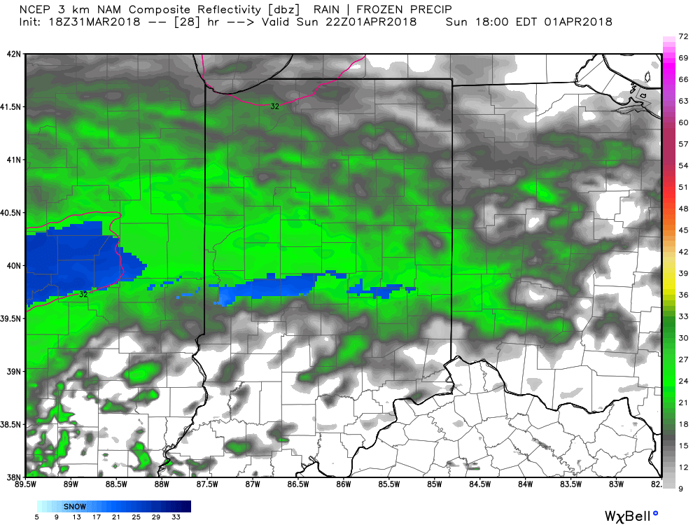
 Most of the daytime Easter Sunday will feature dry conditions. Clouds will increase, lower, and thicken through the afternoon ahead of an area of low pressure that will track through the lower Ohio Valley Easter night. This will spread precipitation into central Indiana towards 5p-6p. Initially, precipitation is likely to begin as a cold rain, but we expect a rather quick transition to wet snow shortly after the onset. Periods of moderate to heavy snow will fall into the nighttime across the I-70 corridor. This will lead to reduced visibility and slick travel as snowfall rates will (once again) overcome marginally cold surface and pavement temperatures. If you must travel tomorrow night and early Monday, expect roadways to be slick at times- including being slush and snow covered.
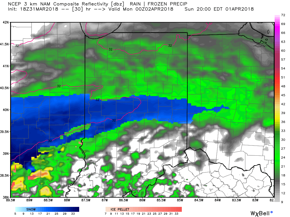
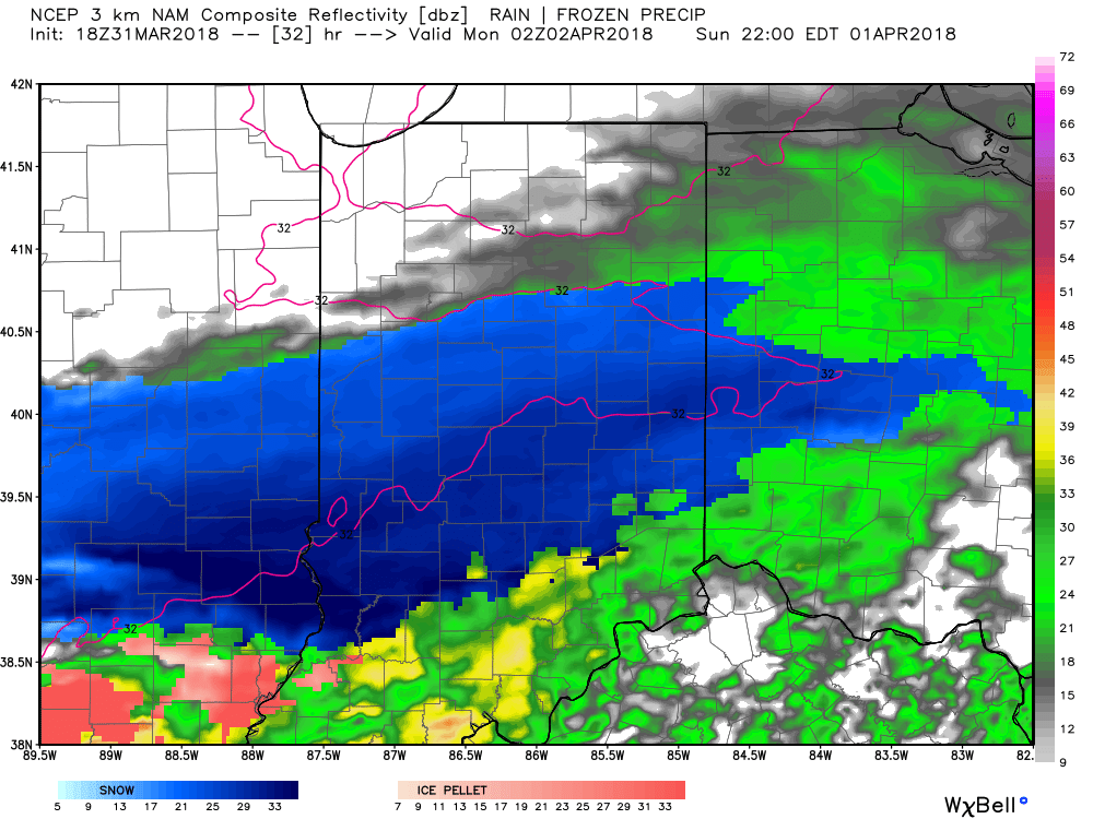
Here’s an idea of what the radar may look like tomorrow night, courtesy of weatherbell.com:
6p forecast radar
8p forecast radar
10p forecast radar
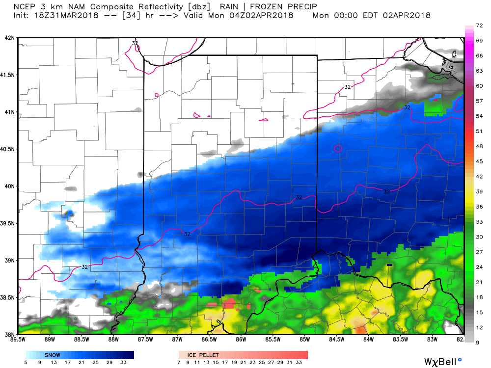
12a forecast radar Monday
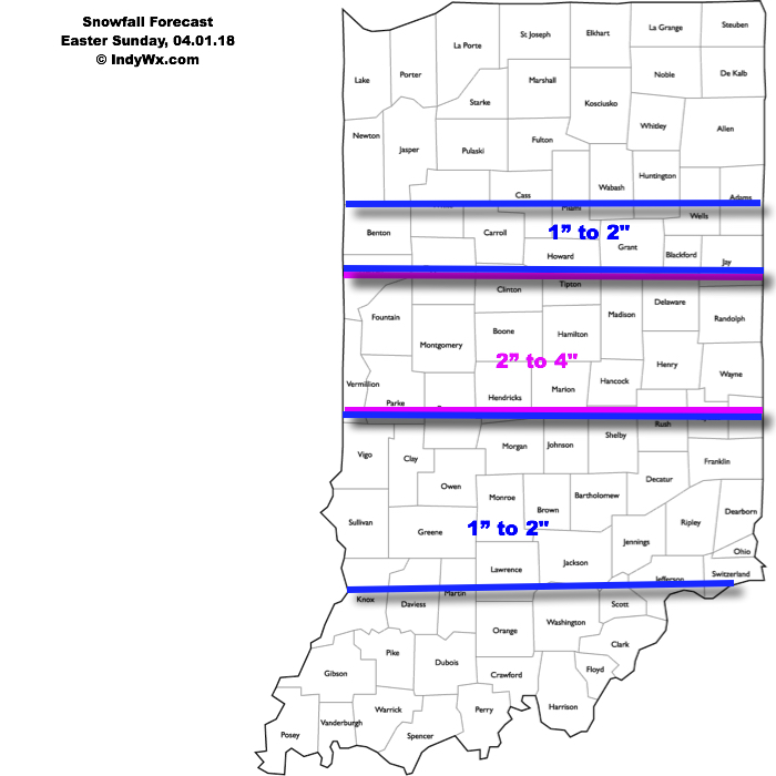
This will be a rather quick-hitting event, but “thump” potential is written all over it, including localized intense banding. These localized bands could result in a couple of reports of 4″+ in spots. We think heaviest snow falls in the 6p-midnight window.
Our current snowfall forecast:
 Another winter event is possible next weekend, including the potential of additional accumulating snow. Should we get snow down, the possibility of near-record cold is present with the late season blast of arctic air next weekend. Lows in the 10s aren’t out of the question at least one night next weekend- likely Sunday.
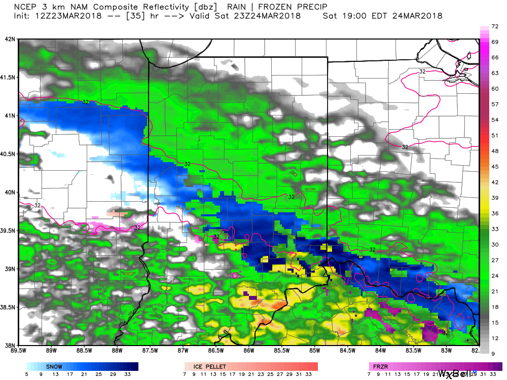
 Heavy, wet snow will continue through the majority of the day for central Indiana. At times, banding will produce snowfall rates in excess of 1″ per hour. On the southern periphery of the snow zone, a mixture of sleet and rain will mix in at times, but as precipitation rates increase, dynamic cooling will keep the predominant precipitation type as snow even on the southern tier.
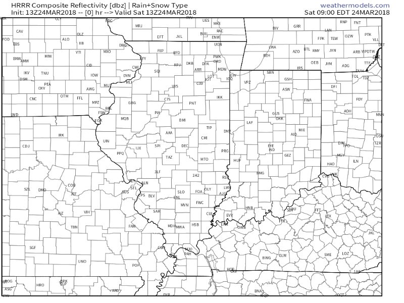 Despite marginally cold pavement temperatures, the heavy snowfall rate is having no problem accumulating on area roadways and multiple traffic hazards have already been reported this morning, particularly in Boone County. If you don’t have to travel today, it’s best to remain at home.
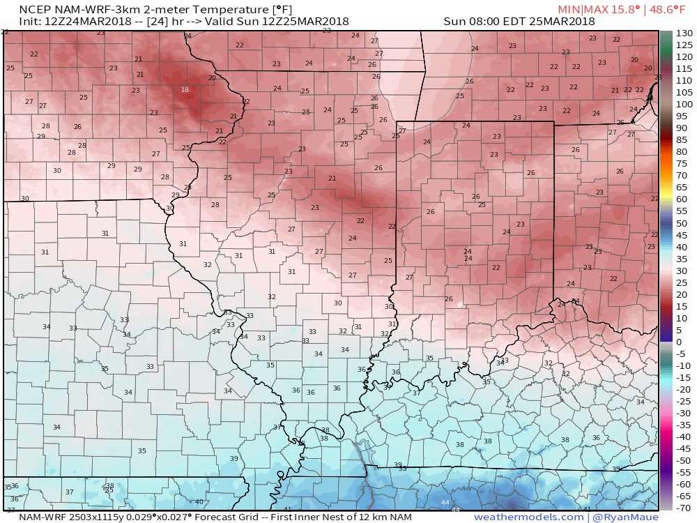 The “big dig” will begin in earnest Sunday morning as dry conditions return and the added increasingly strong March sun angle will also help in clean up efforts by afternoon.
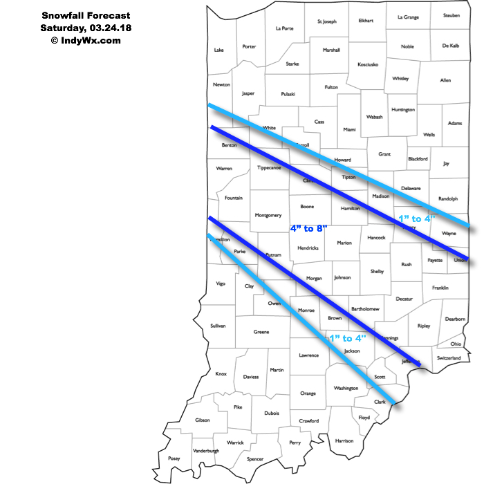 Latest highlights:
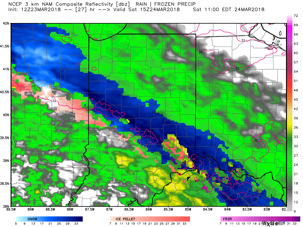
 We remain very impressed with the prospects of banding which could include snowfall rates of 1″ to 2″ per hour Saturday morning into the afternoon hours. With such snowfall intensity, even marginally cold surface/ pavement temperatures will allow for slick and hazardous travel across many central Indiana communities Saturday. Additionally, within localized heavier bands, don’t be surprised for a report or two of thundersnow across central Indiana. Please share your reports with us as things unfold tomorrow! Finally, an icy mixture of sleet and freezing rain will also mix with the snow at times along the southern periphery.