Fantastic Midweek Weather Stretch!

Wed.

Thr.

Fri.

Sat.

Sun.

Mon.

Tue.

 Status-weather-clouds-icon

 Status-weather-clouds-icon

 Status-weather-clouds-icon

 Status-weather-showers-day-icon

 Status-weather-showers-day-icon

 Status-weather-showers-day-icon

 Status-weather-showers-day-icon

62/ 79

56/ 79

58/ 82

64/ 84

70/ 85

70/ 86

61/ 73 

– – –

– – –

– – –

Light

Light

Light

Light

A less humid air mass pushed into central Indiana Tuesday evening and this will remain in place through the next few days.  A light shower is possible this afternoon primarily south and east of Indianapolis, but these will be isolated and most will remain rain-free. Otherwise, look for dry skies through Friday.  We’ll introduce shower and thunderstorm chances into your forecast over the weekend into early next week along with a warmer, much more humid feel of things.  Finally, a strong cold front will sweep the state Tuesday with a potential line of thunderstorms followed by some unseasonably cool air later next week!

Here We Go Again…

What a weather year this has been for central Indiana.  Snow and cold translated to wet and stormy as winter turned to spring.  Now as summer rumbles into the supposed “dog days” we’re really left with the exact opposite.  Our weather pattern will be dominated by a fast moving northwest flow over the upcoming (7) days and this spells an active and stormy open to the work week and next weekend, with an “island” of cool, pleasant weather thrown in the mix Wednesday through Friday.

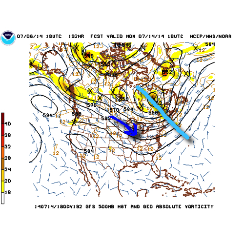
The GFS operational run shows that we’ll remain locked into the rather active northwest flow pattern through the upcoming week.  Note that while the trough axis moves east with time, the northwest flow remains intact.
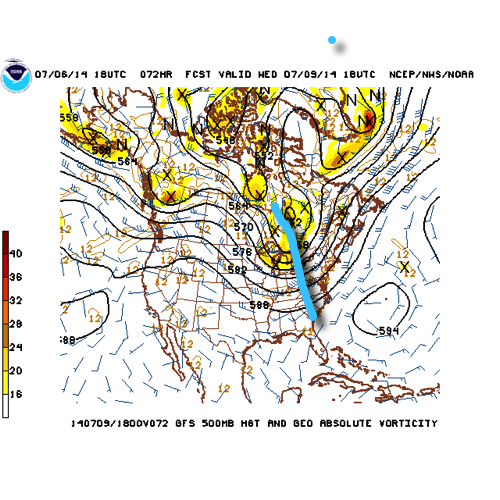
1


2


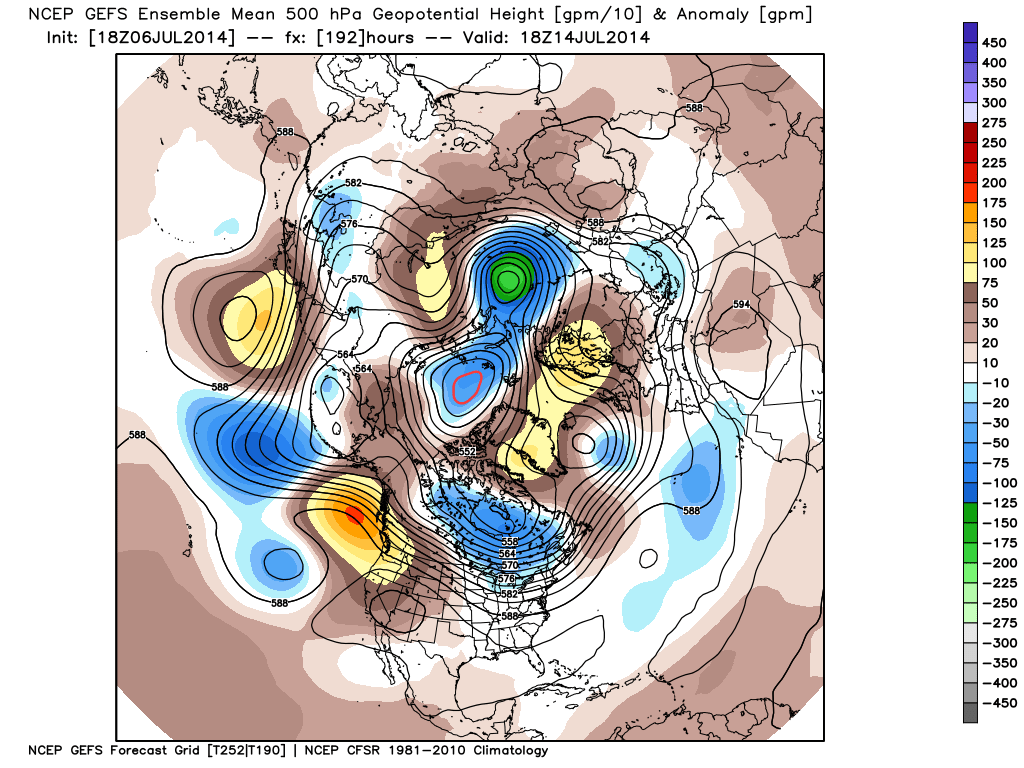
There’s excellent ensemble support from the GEFS and EC, as well.
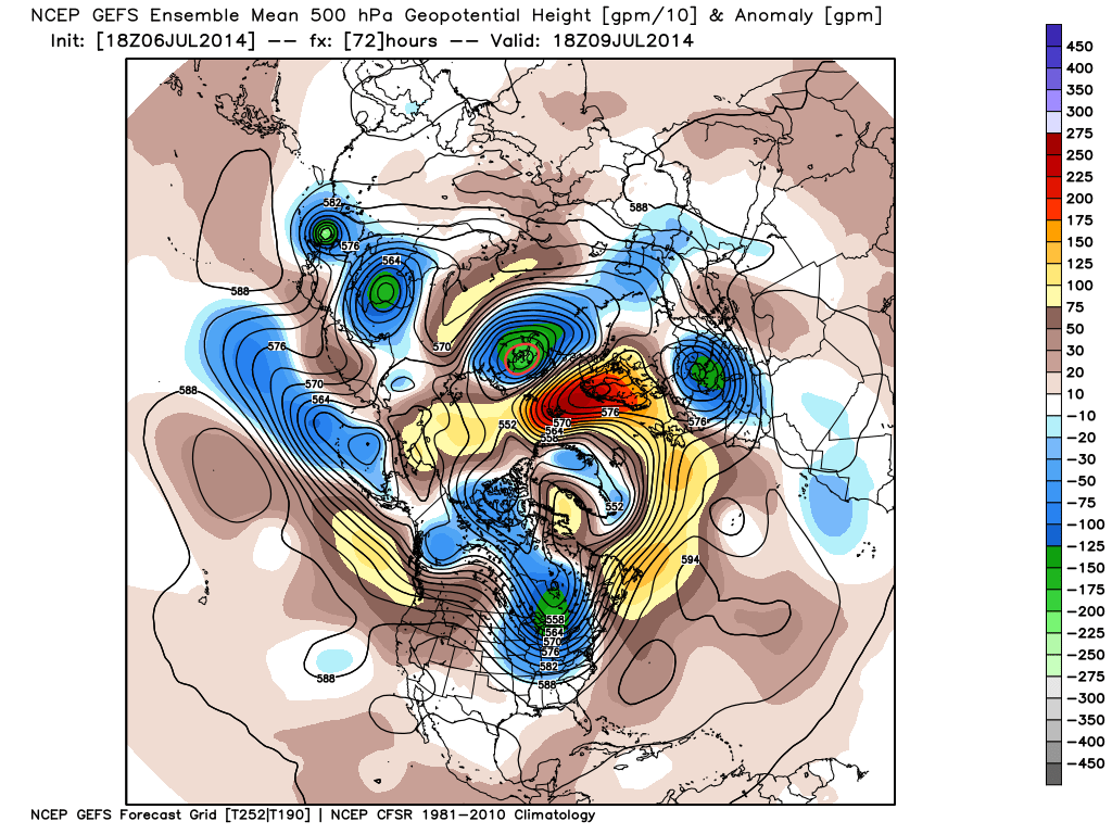
a

b

The end result is a (7) day stretch that remains cooler than normal when all added up, highlighted by the cooler punch of air (worthy of open windows yet again) Wed-Fri.

4

This also remains quite the active pattern in regards to thunderstorm complexes and rounds of locally heavy rainfall.  We bracket late tonight into Monday morning and again Monday night into Tuesday, followed by next weekend for possible storm complexes that will make for a rather noisy time of things here.  As for the severe threat, we’ll have to keep a close eye on each complex.  It’s possible one or two of these could pose a damaging wind threat as they race southeast and that’s our biggest concern as of now.

When you total it all up, the upcoming (7) day period, July 7th-14th, is likely to lead to more significant rainfall over the region.  The Canadian isn’t holding back, suggesting widespread 2-3″ totals.  That may be a bit “bullish,” but we’ll forecast 1.5″-2″ with ease during the upcoming week, including locally heavier totals.
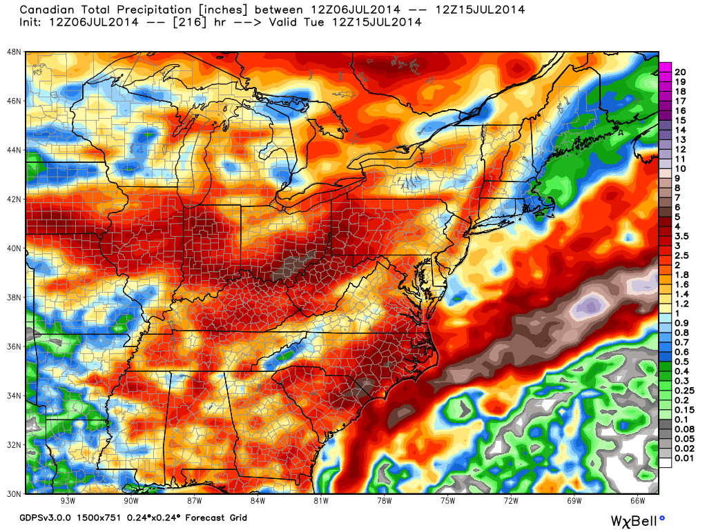
5

Quick summary:

Monday through Tuesday will be highlighted by rainy and stormy periods before we introduce a much cooler and drier regime Wednesday through Friday.  Humidity builds over the upcoming weekend with additional rain and thunderstorm chances returning.

Sun-Filled And Unseasonably Cool…

Fri.

Sat.

Sun.

Mon.

Tue.

Wed.

Thr.

 Status-weather-clear-icon

 Status-weather-clear-icon

 Status-weather-clouds-icon

 Status-weather-showers-day-icon

 Status-weather-showers-day-icon

 Status-weather-showers-day-icon

 Status-weather-clouds-icon

51/ 76

55/ 80

59/ 83

68/ 87

68/ 82

58/ 78

57/ 82 

– – –

– – –

– – –

Light

Moderate

Light

– – –

Happy Independence Day!  Canadian high pressure remains firmly in control of our weather today and for the majority of the weekend for that matter.  As a result, look for plentiful amounts of sunshine and temperatures that will continue the cooler than normal regime we enjoyed Thursday.  Today’s conditions, once again, will have that feeling of early fall.  ENJOY!  A more active weather pattern will return early next week as we potentially have to deal with a couple thunderstorm complexes in the Monday-Tuesday time period.  Heavy rain and the chance of severe weather will return to your forecast Monday night into Tuesday and we’ll have more details around this as we move closer.  A cooler and drier regime will build in by the middle portion of next week.