So Long Boring Weather…
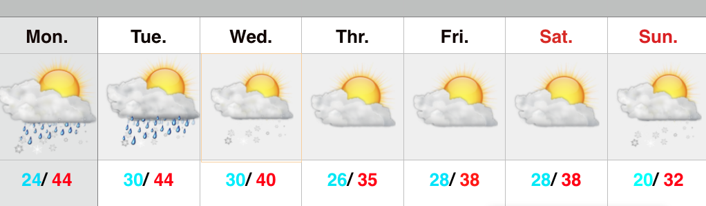
 Busy Times In The Forecast Office…Let’s get to the easy part of this forecast package and that’s today. Look for lots of sunshine along with seasonably mild temperatures after a cold and frosty start.
Things get fun tomorrow as a clipper low dives southeast and tracks in a favorable position for accumulating snow- especially from the city and points north (snowfall forecast below). A mixture of rain and snow will overspread central Indiana Sunday morning and transition to all snow through the late morning into the early afternoon. This will be a heavy, wet snow (perfect for snowball fights or making a snowman). The other aspect to this storm system will be an increasing east and northeast wind Sunday evening into Monday morning. Snow will diminish Sunday night, but the “damage” will likely be done by that point, leaving a mark on your Monday morning commute.
Another (weaker) weather maker may deliver scattered snow showers Tuesday.
Briefly milder air will move in here Thursday with a mixture of rain, snow, and sleet (depending on where you’re viewing us through the state), but the bigger story will be MUCH colder air set to pour into the region to close January and open February. Some forecast models suggest a winter storm will precede the bitterly cold air around Super Bowl Sunday…. Stay tuned.
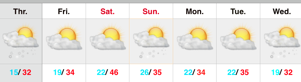
Upcoming 7-Day Precipitation Forecast:
- 7-Day Snowfall Forecast: 2″ – 5″
- 7-Day Rainfall Forecast: 0.10″ – 0.25″