A Closer Look At Thanksgiving Week

Today’s model data continues the theme of a southern and eastern storm for the days surrounding Thanksgiving.  We’ll continue to monitor for any potential shift northwest, but as of now, the trend remains for a “suppressed” storm track.  Here’s a look at the individual GFS ensemble members, off today’s 12z run.  Taken at face value, 3 out of 10 members show some light snow in the air.
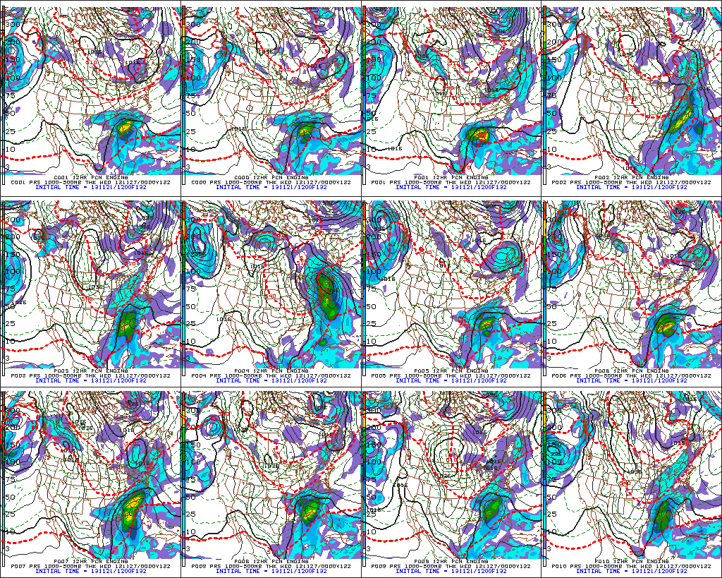
f132

For now, the big story still appears to be the unseasonably cold air around for Thanksgiving.  The ECMWF, Canadian, and American models (GFS and NAM) continue to hammer home the idea of a frigid Thanksgiving ahead (relative to the time of year, of course).  I’m not convinced we won’t have to deal with some light snow next week at some point, but for now, the bigger story still appears to be  impressive early season cold, and this cold pattern isn’t going away anytime soon.

The latest European forecast data illustrates this well.  Note each and every day is well below normal, aside from tomorrow (cold air pushes in tomorrow PM).  This is a snap shot of the average temperature (in degrees C) over the upcoming 10 day period.  The blues, greens, and purples showcase the cold, relative to average.
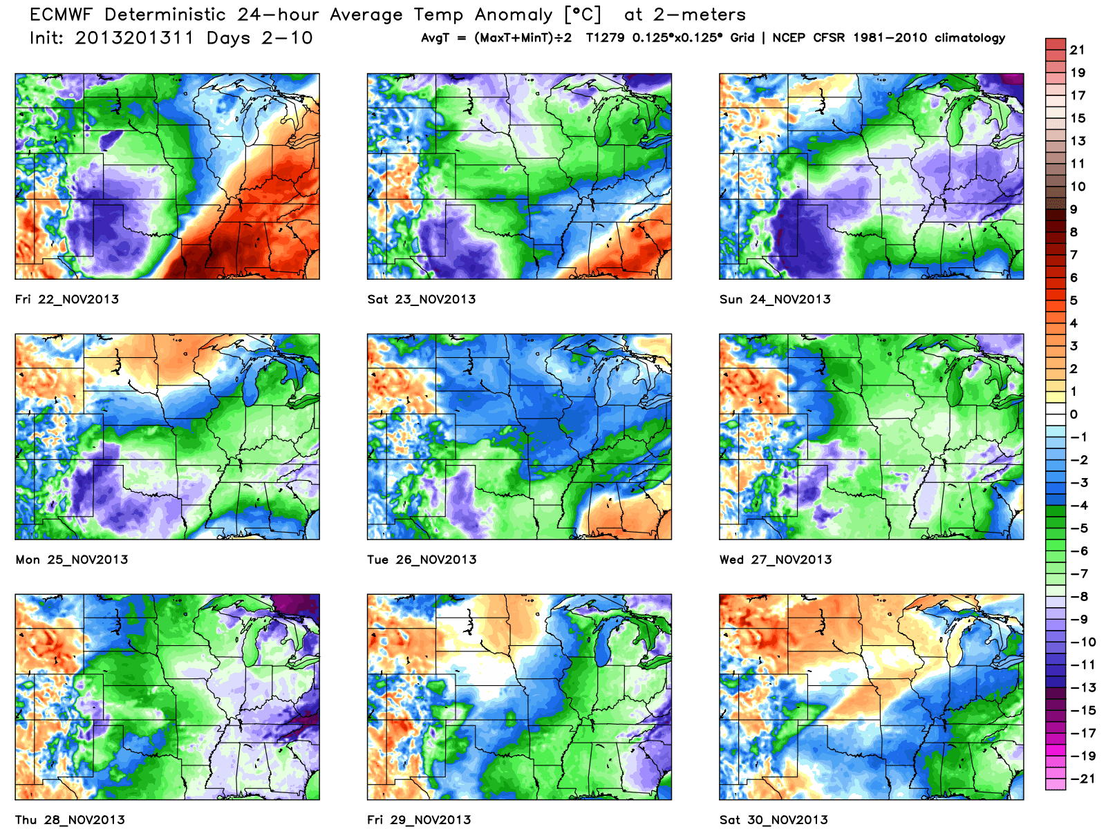
tavg_anom_ecmwf_mc_1


Wednesday Evening Video Update: Rain Moving In; Arctic Blast This Weekend

http:/ Tonight’s Video Highlights: We talk rain and amounts for Thursday and Friday. The coldest air of the season and coldest November day in some 13 years is ahead! A…

You must be logged in to view this content. Click Here to become a member of IndyWX.com for full access.  Already a member of IndyWx.com All-Access?  Log-in here.

Some Saturday Afternoon Thoughts…

We continue to monitor Sunday’s severe weather outbreak very closely.  Simply put, the latest data suggests all of central Indiana will be under the gun for a potentially dangerous and life threatening severe weather event Sunday.  The bullet points highlighted in our previous post haven’t changed, but we note tornado parameters may be even more impressive per latest data.  Unfortunately, I’m afraid multiple tornado touchdowns will be reported across central Indiana tomorrow afternoon, followed by a more widespread damaging straight line wind event mid to late evening.  Certainly please keep abreast of the latest watches and warnings that will come tomorrow.

Showers and thunderstorms will develop tonight, but will remain below severe levels.  The latest NAM simulated radar shows the developing showers and thunderstorms tonight.

hires_ref_ky_18

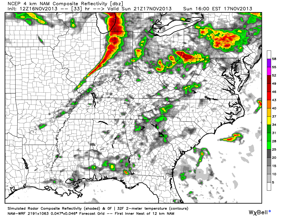
Fast forward to Sunday evening and we note a line  of severe thunderstorms moving through central Indiana, including a potential widespread damaging wind event.

hires_ref_ky_34

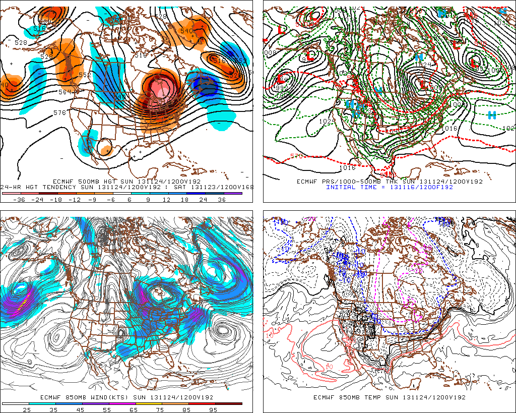
Also, just to let you know, we’re also monitoring next weekend for another possible big weather event.  This time we’re not talking severe weather, but possibly a major early season arctic attack…  The latest European model isn’t holding back.  Could a cold Thanksgiving week be shaping up?  We’ll monitor closely.

f192

Video Update On Snow Accumulation & The Cold

Here’s a quick video update taking a look more closely at the forecast data for accumulating snow ahead Monday evening, as well as the impressive early season shot of cold…

You must be logged in to view this content. Click Here to become a member of IndyWX.com for full access.  Already a member of IndyWx.com All-Access?  Log-in here.