Series Of Fast Moving Snow Makers…

A series of fast moving snow makers will make for busy times in the good ole forecast office in the days (and weeks) ahead.

Of course we’re dealing with scattered snow showers this morning, but this really isn’t a big deal as accumulations will be nothing more than a dusting for most communities.

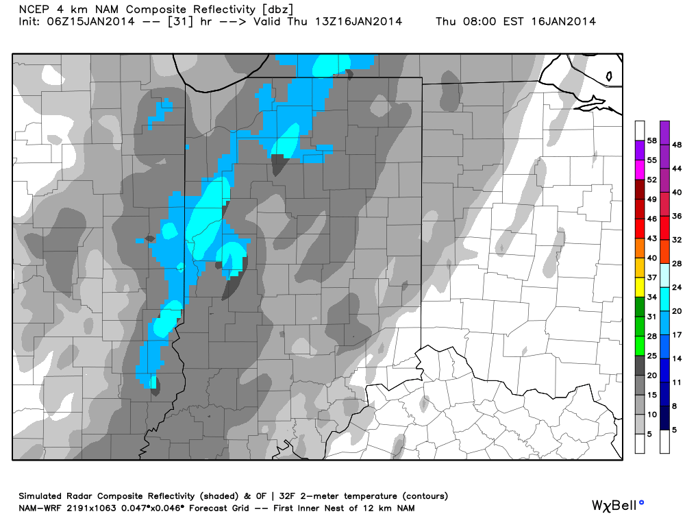
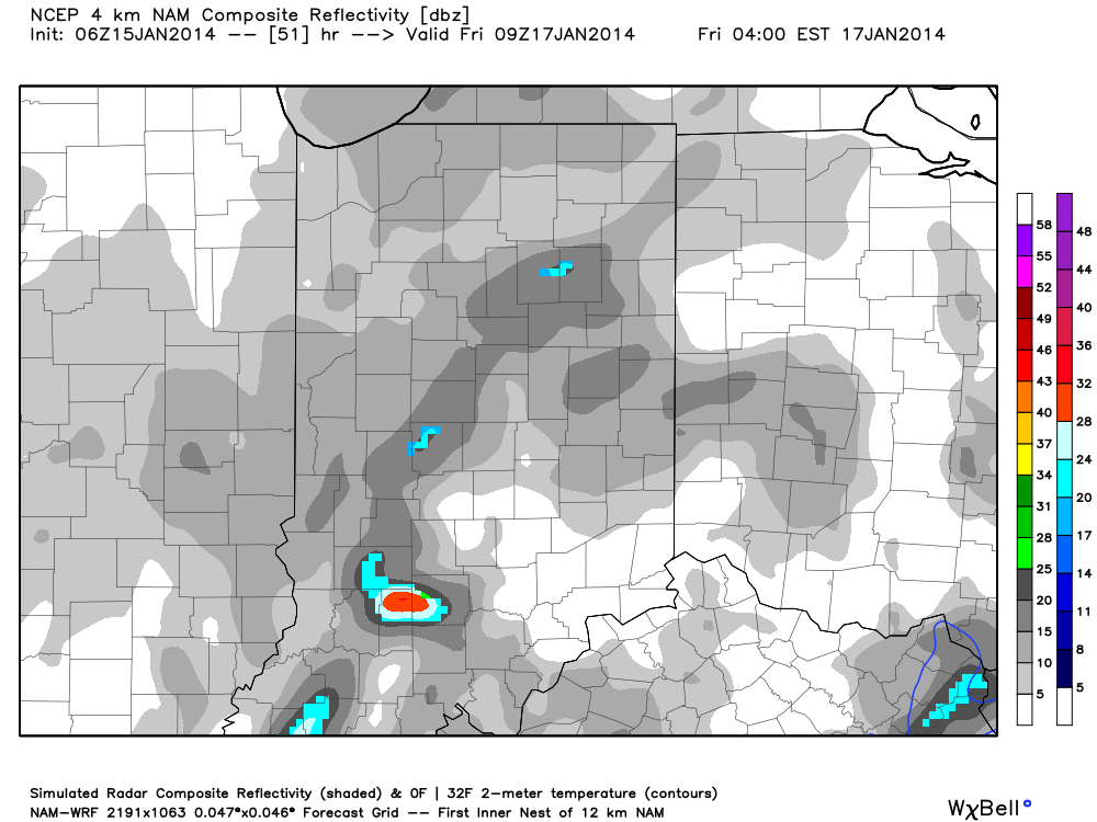
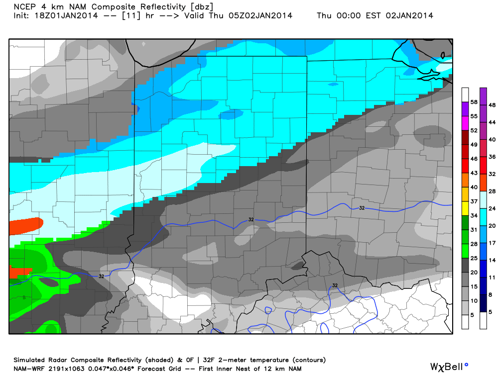
Our next clipper system will deposit light snow and snow showers across the region Thursday and Friday.  Short-term, high resolution data, highlights the chance of some light accumulation Thursday into Friday- generally an inch or less for most.  Here’s a look at the latest simulated radar valid Thursday morning at 8am and Friday at 4am:

hires_ref_indy_32


hires_ref_indy_52

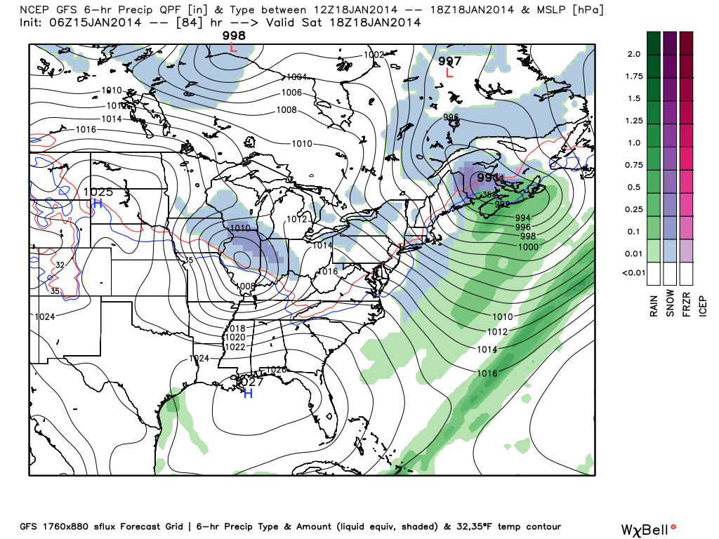
We then look ahead towards Saturday when potentially the best shot of accumulating snow arrives.  The GFS has been leading the way on this system and now other forecast models are following it’s lead.  It’s important to note that these northwest flow systems can be over-achievers (as mentioned in previous posts) and the “fluff effect” can really kick into gear thanks to high snow ratios with the cold air.  We’ll continue to monitor this.  As of now, we think a few inches of snow is possible Saturday as this clipper moves through.  Stay tuned…

gfs_ptype_slp_east_15gfs_ptype_slp_east_16

Challenging Northwest Flow…

We’ve made mention of this in the past and we bring this up again as the upcoming weather pattern is one that’s predictable in one sense, but very challenging in another.  We know it’s going to get colder, that we’re confident on.  That said, models will continue to struggle with the details of snow chances, associated with clipper systems diving southeast into the region.  Issues with timing and snowfall amounts are common in these patterns up until 24-48 hours prior to the event.

Case in point, let’s take this weekend. Three forecast models are handling snow chances differently in the Friday-Saturday period.  The European model and Canadian are jumping more on Friday snow (light accumulations), while the GFS is focused on Saturday snow (again, light accumulations)…

Which is the correct solution?  It’s a tough call at this point, but we’ll go with a blend of the three for now, focused on best accumulating snow chances (1-2″ variety) coming late Friday into Saturday morning.  That said, as mentioned above, it’s a tough call and this will require fine tuning as we move forward.  Make it a great day!

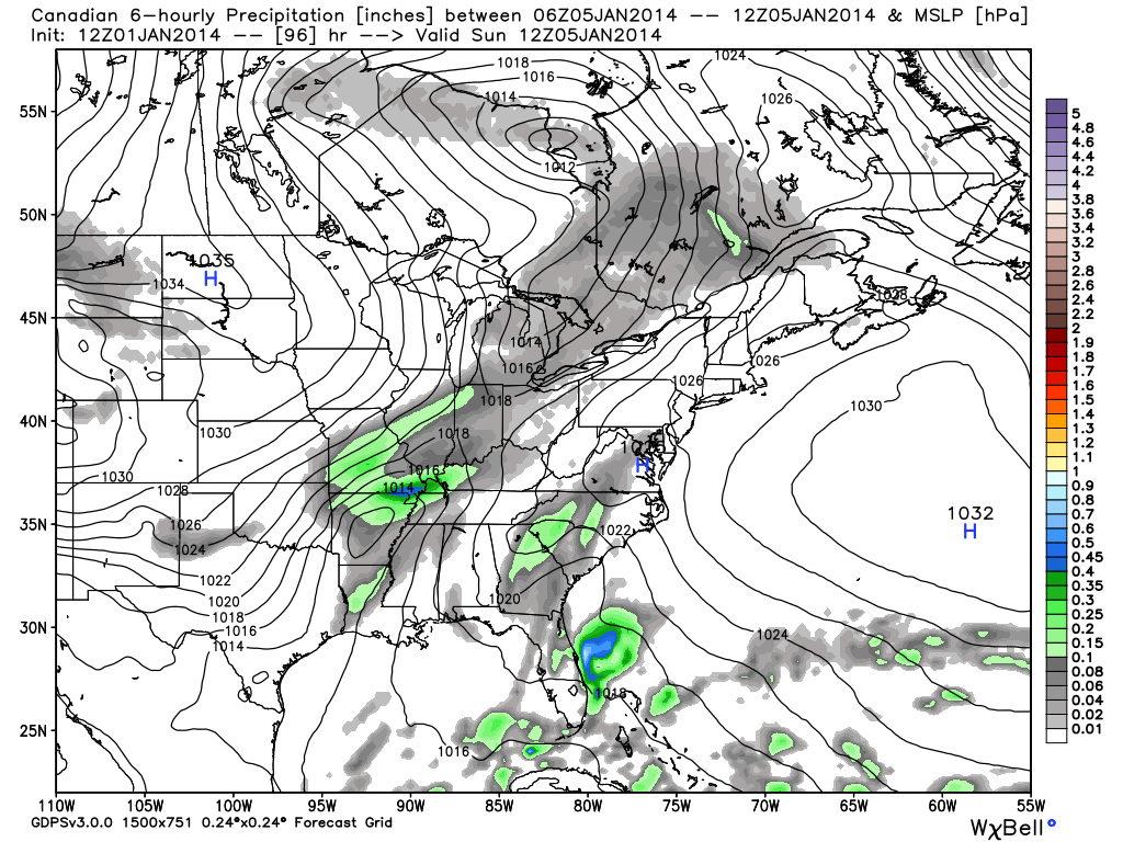
The European and Canadian forecast models are honing in on Friday for best chance of light accumulating snow:

cmc_precip_mslp_east_16

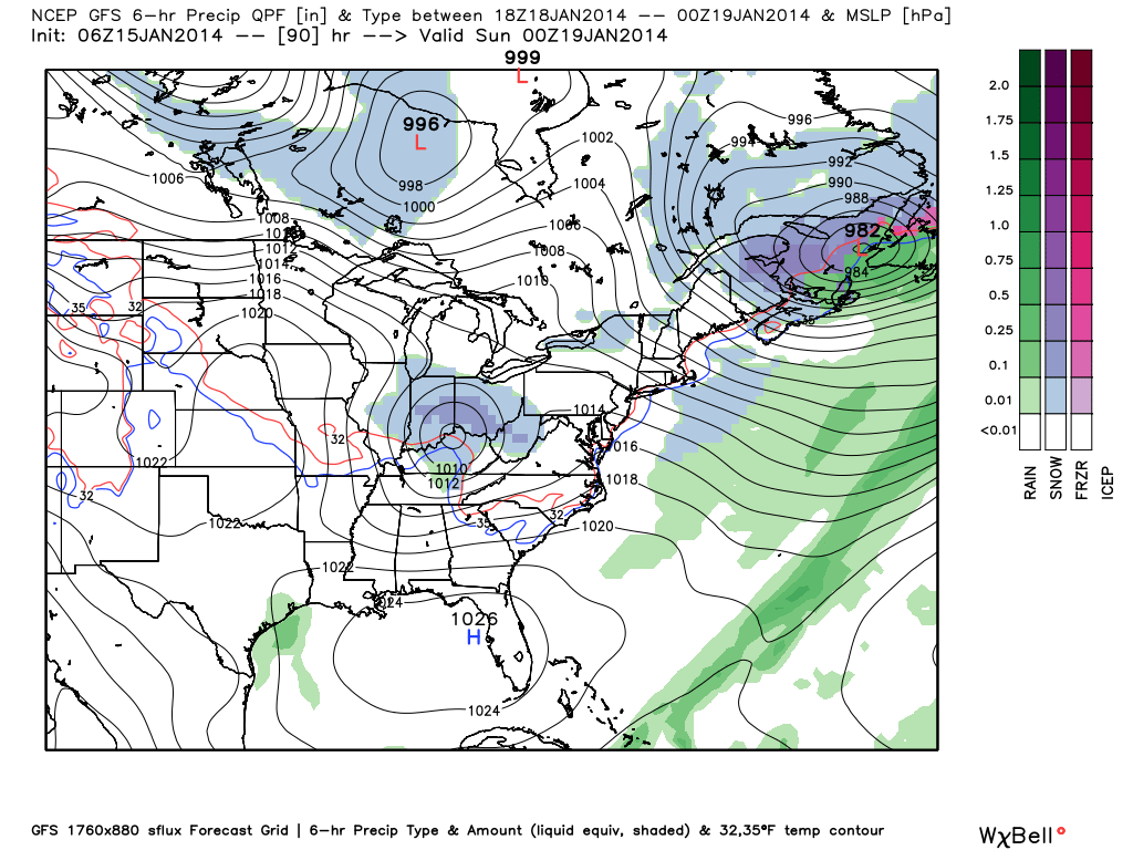
Meanwhile, the GFS is focused on Saturday for best snow chances:

gfs_ptype_slp_east_19

Serious Winter Storm Takes Aim On Indiana

We awake this morning to most of the data very consistent with what we’ve been passing along to you over the past few days…a very serious winter storm is taking aim on Indiana and will result in a combination of significant weather events that ultimately may end up being something we’ll remember for quite some time…

Quick Bullet Points:

  • Snow develops early Saturday morning
  • Heaviest snow falls between 10a-5p
  • Wind increases through the day Sunday and gusts in excess of 30 MPH leading to white outs and severe blowing and drifting
  • Temperatures crash to 10-14 below zero Monday morning with wind chill values of 40 to 50 below zero.
  • Widespread snowfall of 5-9″ is likely across central Indiana, with a heavier band of 9-12″ including Indianapolis and running along and just north of the I-70 corridor on the south side north to include Vermillion to Adams counties on the north side.

This is a hazardous and severe winter weather event that will likely lead to road closures from the heavy snow and wind, as well as extremely dangerous conditions to spend anytime outdoors Sunday into early next week due to the cold.  The bitter wind chills will be capable of frostbite in less than 30 minutes to any exposed skin.

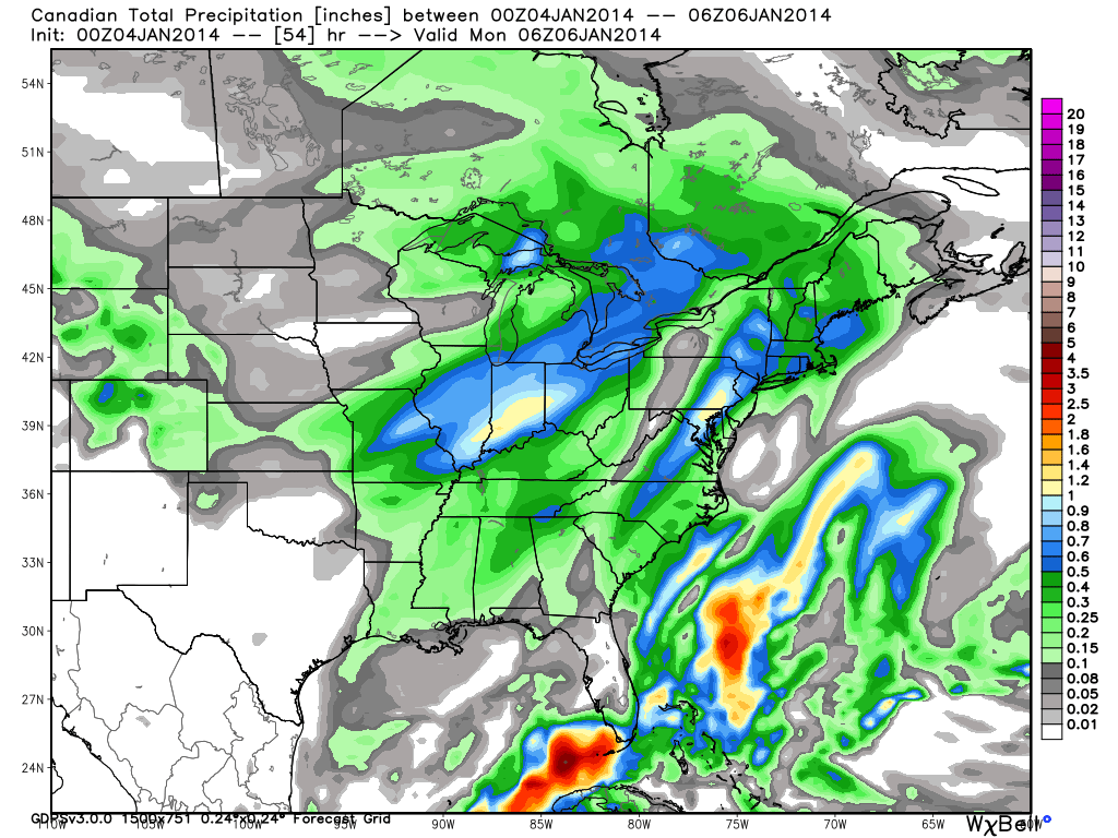
Latest model data shows consistency in precipitation amounts, or QPF. We’re showing you the GFS, Canadian, and European models below.  Please note that the numbers and maps below don’t show snowfall amounts, but show precipitation totals.  Bring in a 12-15:1 snowfall ratio with these numbers and you get the snowfall discussed above.  We’re leaning heavily on a Canadian/ European model blend as the GFS has been more erratic.

gfs_total_precip_east_9cmc_total_precip_east_10ecmwf_tprecip_indy_10


Much more later this evening!

Triple Threat Of Dangerous Winter Weather Ahead…

You can always catch your latest 7-Day Video Forecast in the video player to the right of this post.

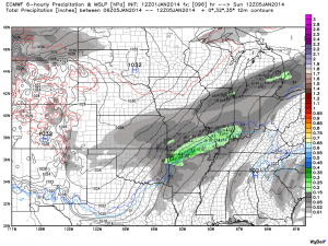
We continue to be very impressed with what’s ahead, winter weather-wise, for central Indiana over the course of the upcoming 10 days.  Simply put, what’s at stake is a 10-day period of winter weather that could rival the all time greats in terms of snowfall and cold.  It’ll certainly be interesting to watch things unfold in the days ahead.

Here are some quick-hitting bullet points of what we’re eyeing…

  • Accumulating snow late tonight-Thursday
  • Accumulating snow late Saturday night-Sunday
  • Coldest air since 1994 early next week
  • Dangerous cold and wind chill values to 40 degrees below zero

First things first and that’s tonight’s and Thursday’s snow event. We think snow becomes widespread across central Indiana prior to, or around, midnight.  The low pressure system that will aid in snow production across our region Thursday AM is organizing across the central Plains this evening and this will move east northeast with time between now and Thursday morning.
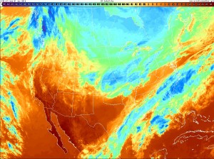
20140101_2130_US_ir


Latest high-resolution simulated model data shows the snow increasing in coverage across central Indiana around midnight.
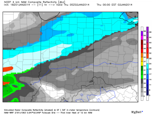
hires_ref_indy_12


We think the period of heaviest snow comes during the early to mid morning Thursday and will result in a horrible rush period on area roadways.  Accumulating snow ends by noon and is replaced with falling temperatures, gusty northwest winds resulting in blowing and drifting, and scattered lake-driven flurries.

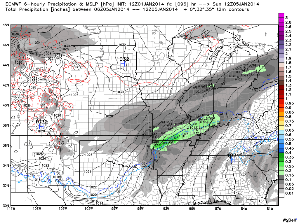
All eyes will then shift to storm number two set to arrive late Saturday night into Sunday.  An arctic boundary will moves towards the region Saturday night and Sunday and help surface low pressure develop.  All of our medium range models (GFS, Canadian, European) are on board with a developing surface low in the Ark-la-tex region late Saturday night/ early Sunday morning and can be seen below.
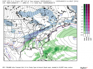
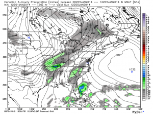
gfs_ptype_slp_east_16cmc_precip_mslp_east_17ecmwf_slp_precip_mc_17


There are still some questions that we have in regards to the extreme snowfall forecasts off some computer models, and we’ll stick with our initial call made here last night of an additional 3-6″ of snow late Saturday night-Sunday for now.  We come up with that range based off an all model blend, including raw numbers, operational data, and ensembles.  An extremely strong arctic high pressure system will be plunging south and will limit how far north the heavy snow makes it.  That said, snowfall ratios and an initial impressive thermal gradient will lead to a heavy snow storm for some parts of the Ohio Valley region Sunday.  Stay tuned.

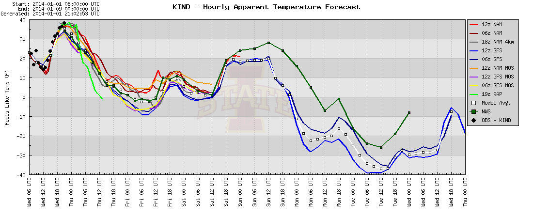
As early next week approaches (and I’m all settled in to enjoy what I hope to be Auburn’s second National Championship in 4 years), the coldest air since 1994 will be blowing into the region.  Downright dangerous wind chill values of 40 degrees below zero will be possible Monday into Tuesday and result in extremely dangerous conditions to be outdoors for any period of time.

Here’s a look at the latest wind chill idea:
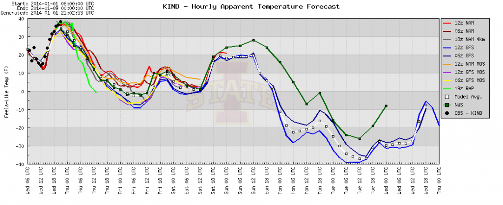
plotterForecast lows of 15 to 20 degrees below zero will be likely early next week across central Indiana with afternoon highs struggling to make it to zero.

Prepare now for a significant triple threat punch of snow and cold in the days ahead. Stay tuned!