Covering Gusty Storms Tonight And Saturday Snow…

Busy times in the forecast office continues.  We are eyeing potentially noisy thunderstorms later tonight and the threat of wet accumulating snow for portions of the area Saturday.  Details can…

You must be logged in to view this content. Click Here to become a member of IndyWX.com for full access.  Already a member of IndyWx.com All-Access?  Log-in here.

Busy Pattern…

A busy weather pattern will keep us on our toes with two storm systems of note between now and Saturday.

Periods of showers will keep most of today wet.  While it won’t rain the entire time, periods of moderate to heavy showers are possible today.  A quick punch of milder air will arrive this afternoon after a chilly start to the day, combined with a strengthening south wind.  Total rainfall today and tonight should average half an inch, or less.

Highs today will reach the lower 50s, despite the showers.

hires_t2m_max_indy_9

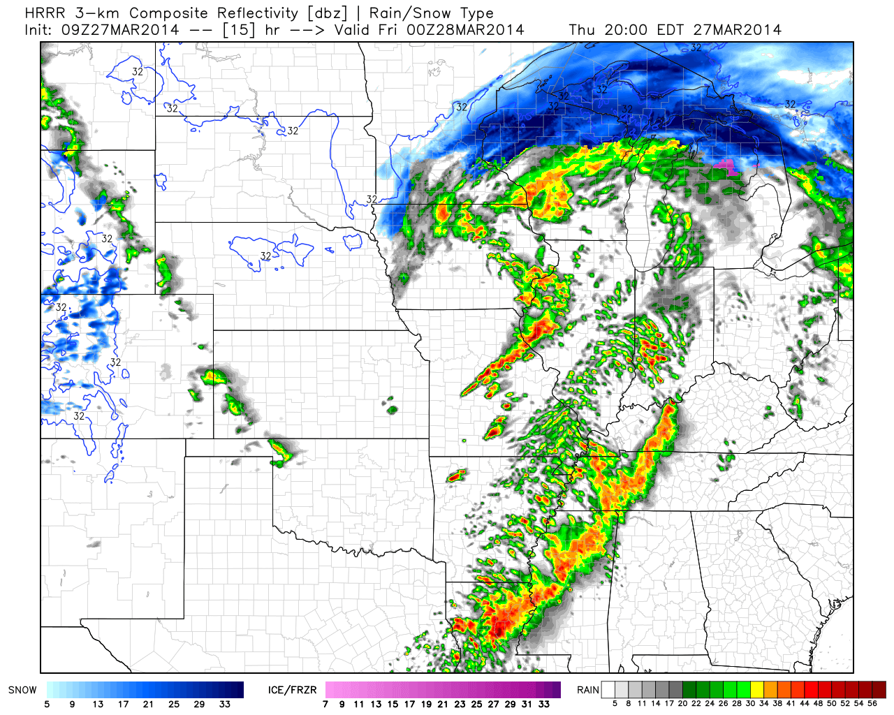
Latest simulated radar data shows the potential of a line of thunderstorms moving through here late tonight, directly associated with the cold front.  A strong storm is possible along with gusty winds as the front slides through early Friday morning.

hires_ref_mw_24hrrr_ref_mc_16

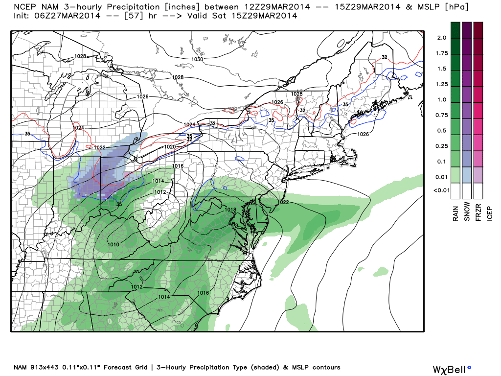
As if all of this wasn’t enough, another storm system will arrive Saturday.  This system will have a wintry component to it, with the chance of a stripe of wet snow along the northern shield of precipitation.  It’ll require our attention as we move forward.  March storms have been known to have a surprise or two and it’s our job to try and help eliminate any of these surprises.

nam_ptype_slp_ma_20


Where We’ve Been And Where We’re Going…

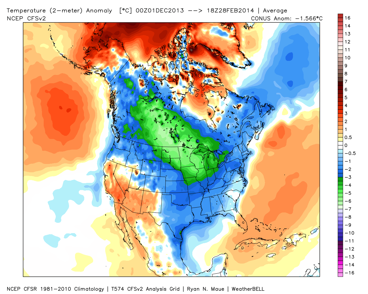
It was a cold winter across the Lower 48, including Indiana:

2

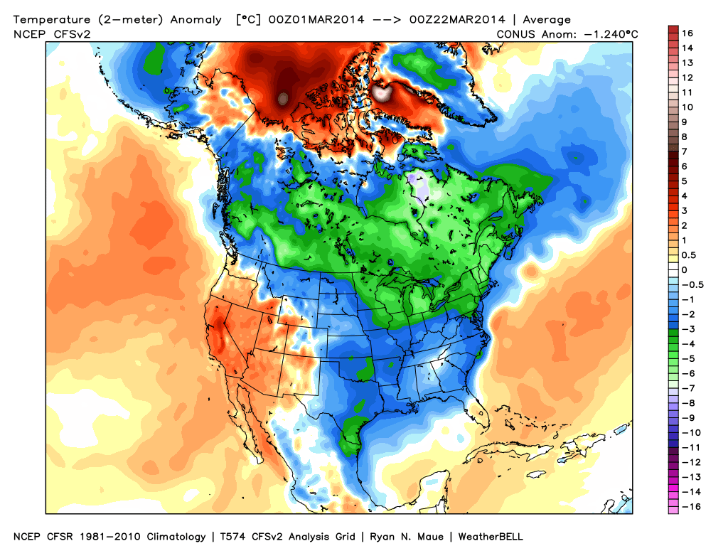
March has followed suite, month-to-date:  Cold continues for the majority of the upcoming week, but we note moderating late week temperatures.

1

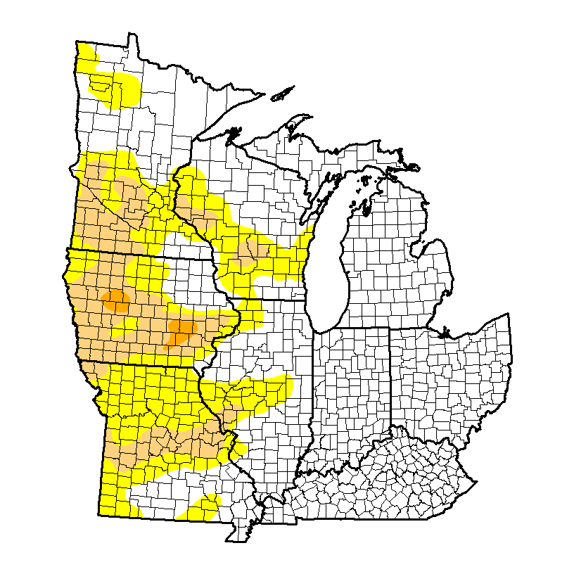
It’s been dry as of late, but after a snowy winter, the region is doing just fine from a drought perspective.  We note abnormally dry conditions west:

4

Latest CFSv2 data points to a wet spring ahead.  We also note the latest European weeklies suggesting a potentially “busy” 1st half of April, including a couple of “bowling ball” systems of note.  With the changing seasons, it’s not unusual to see big spring cut off lows slowly moving through portions of the country.

3

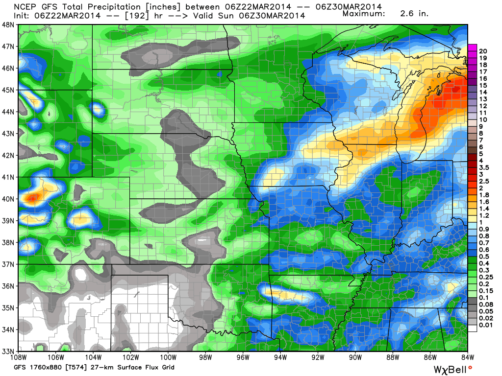
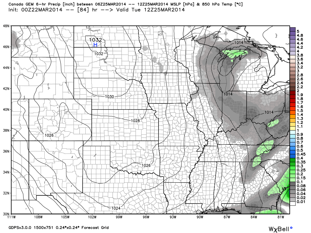
Note the GFS (7-day) and Canadian (10-day) precipitation forecast:

56

We also are still forecasting light snow Tuesday.  Most of this won’t accumulate with the high sun angle and low snowfall rates, but a brief coating to less than an inch is possible in spots:

78

Video Update On The Next Couple Weeks!

Here’s a rather lengthy video taking a look at the weather here across central Indiana the next couple weeks. Oh yeah, we’re also a little excited about Coach Pearl coming…

You must be logged in to view this content. Click Here to become a member of IndyWX.com for full access.  Already a member of IndyWx.com All-Access?  Log-in here.

Changeable Weather This Week…

Mon.

Tue.

Wed.

Thr.

Fri.

Sat.

Sun.

 Status-weather-clouds-icon

 Status-weather-showers-day-icon

 Status-weather-clouds-icon

 Status-weather-clouds-icon

 Status-weather-showers-day-icon

 Status-weather-clouds-icon

 Status-weather-clouds-icon

19/ 43

30/ 56

35/ 50

30/ 51

42/ 65

30/ 45

22/ 37

– – –

Light

– – –

– – –

Light

– – –

– – –

Forecast Updated 03.17.14 @ 12:00p

Quiet, Brighter Start To The Work Week. . .After a “ridiculously” cold, windy, and gloomy Sunday, it’ll be nice to see the sunshine return as we kick off another work week.  Temperatures will remain much colder than average, but with that late March sun working through later this afternoon (once these pesky clouds move east), it’ll feel somewhat better.

Fast Moving Storm System. . .Most of Tuesday will be sunny and dry, but a frontal boundary will race towards central Indiana Tuesday evening and we note some of our high resolution model data trying to bring a thin line of showers and thunderstorms through in association with this frontal passage.  After a mainly dry day, clouds will increase and we’ll forecast quick-moving showers and embedded thunder Tuesday night into Wednesday morning.  Rainfall amounts will remain light.

Dry, blustery weather will return Wednesday afternoon with temperatures just a few degrees below normal.

Late Week Storm. . .After a dry and pleasant Thursday, southwest breezes will kick into high gear and allow temperatures to jump into the middle to perhaps upper 60s Friday (dependent upon how much sunshine we see).  That said, another cold front will have it’s eyes set on our area and clouds will increase during the afternoon and evening hours with showers and thunderstorms developing Friday night as the front pushes southeast.

This will then set the stage for another cold weekend ahead.  While we’re trending next weekend (especially Sunday) MUCH colder, it’s possible we’ll have to lower temperatures even further in the days ahead.

Upcoming 7-Day Precipitation Forecast:

  • 7-Day Snowfall Forecast: 0.00″
  • 7-Day Rainfall Forecast:  0.25″

twic

For weather updates and more “behind the scenes” data on the go, be sure to Follow Us on Twitter @indywx or become a Friend of IndyWx.com on Facebook!

images

After a long winter, sunshine and pleasant temperatures provided a great day to get outside and enjoy the conditions last Saturday in Zionsville!  Thanks to John Salewicz for this shot!

photo-2