Friday Morning Thoughts…

I’m blessed to have family in town this weekend so posts will be a bit off schedule the next few days, but keep it tuned here as they will come!

What a remarkable January this is as temperatures are averaging more than 9 degrees (fahrenheit) below average AND COLDER than last January.  While I know snow lovers are wanting more snow (yours truly included), one has to sit back and really appreciate the pattern for what it is from a cold standpoint.  I would go as far as to argue this pattern is actually more impressive than last January as the cold has come in the face of what’s been a much less impressive snow pack (for the most part).
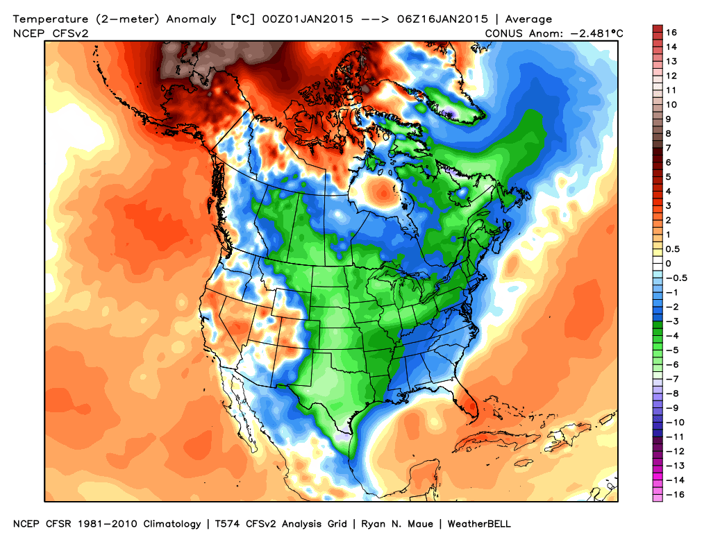
ncep_cfsr_noram_t2m_anom

Despite a brief “relaxation” now, models suggest the cold comes on like gangbusters yet again to wrap up the month.  Given where we’ve been and what appears to lie ahead, it would seem as if this January will be even colder than last January- not only through the first half, but at month’s end.  It’ll be fascinating to watch unfold.

Speaking of snow, I still believe this is the type pattern that can “flip on a dime” in the snow department.  The sea surface temperature profile and analogs at least suggest we’re on the playing field for a stormy ride through the month of February and even into March this year.  Does it mean it has to be a snowy pattern?  No, but at this distance it’s at least nice knowing we’re on the field with a chance to win the game.

In the shorter term, a windy “mild up” will occur Saturday as highs reach the middle to upper 40s with a gusty southwest wind in play.  Winds will top 30-40 MPH so you’ll definitely want to “batten down the hatches” Saturday.
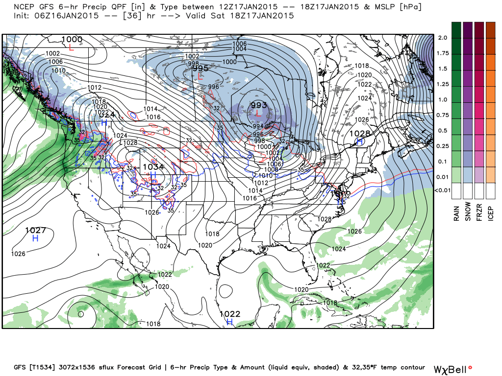
gfs_ptype_slp_conus2_7

Relatively Quiet Now, But It Won’t Last Long…

Enjoy our relatively quiet and briefly milder weather pattern as mid and long range guidance suggests we reload the cold with authority and associated wintry precipitation threats…

You must be logged in to view this content. Click Here to become a member of IndyWX.com for full access.  Already a member of IndyWx.com All-Access?  Log-in here.

Looking Ahead…

January is off to a colder than average start across a large portion of the country, including the Hoosier state:

ncep_cfsr_noram_t2m_anomThe snow and ice pack has expanded over the past couple of weeks in rather significant fashion:

nsm_depth_2015011205_National

Two storm systems have offered up busy times over the Ohio Valley the past week. Note liquid equivalent numbers the past (7) days- most significant over central Indiana.  Most of this has been in the form of wintry precipitation (snow and ice).

nws_precip_indy_7

A weak weather system may offer up light snow chances mid week.  The high resolution NAM and European print off light snow while other models “see” us mainly dry mid week.

hires_ref_indy_52

The other big story in the short term will be more bitterly cold arctic air (single digits tonight and close to zero Wednesday morning).

While we’ll certainly “warm” compared to the freezer we’ve been in the first two weeks of January, sneaky arctic highs remain on the field and will put a dent in the air masses from reaching unseasonably mild levels for any length of time this weekend and Week 2.  See Friday’s GFS output and the sneaky arctic high north:

gfs_ptype_slp_east_18

The next significant storm system brews around the 20th (give or take a day, or two) and could offer up rain or a more wintry option.  Keep a close eye on the period 01.20 – 01.23.

Thereafter, the arctic hounds likely come calling again as the period quickly returns to “lock and load” cold late January into February.  The European and GFS ensembles both show a rebuilding blocking AK ridge and suggest arctic air floods the country yet again as cross-polar flow gets involved:

GFSensembleslateJan

It’s all part of a package that should be the beginning of a colder than average and stormy mid and late winter stretch.  Sea surface temperature anomalies are a textbook setup for a very wintry time of things for our neck of the woods.  Note the Modoki El Nino and warm waters sitting off the PAC NW- both cold/ stormy indicators here:

SSTLateWinterSetUp

Ice Storm For Some Sunday Evening; Late Night Thoughts…

Just a quick update to give you some fresh thoughts on the next winter storm that will impact central Indiana.

We bracket the hours of 1p-3p for the onset of sleet and freezing rain across central Indiana.

hires_ref_indy_19

Coverage and intensity of freezing rain will increase as we progress through the evening hours.  We suggest hunkering down at home (or at a loved ones home) for the Colts game, as roadways will likely become hazardous during the game.

hires_ref_indy_24

Early data hot off the press this evening is suggesting Ice Storm Warning criteria (freezing rain amounts of 0.25″, or greater) is met through the heart of central Indiana.

hires_ptype_acc_indy_15

A fresh push of cold, arctic, air will ooze back into central Indiana during the day Monday. We think overnight lows head back into the single digits Tuesday morning and below zero Wednesday morning.  Needless to say, should power outages take place, a nasty situation will develop with the new push of cold air.

Please stay tuned to your favorite media or means of obtaining weather information, as this will be an impactful event for central Indiana tomorrow afternoon into Monday.