Category: Forecast Models
-
Filed under 7-Day Outlook, Forecast Discussion, Forecast Models, Hail, NAM Model, Race Weekend, Rain, Severe Weather, T-storms, Unseasonably Warm, Weather Videos, Windy
-
May 20, 2014
The region remains under fire for severe weather potential, primarily for damaging straight line wind and hail per latest thinking. The video uncovers when you can expect this and looks ahead to the all-important Memorial Day and Indianapolis 500 weekend!

The region is under fire for severe potential Wednesday.
Permanent link to this article: https://indywx.com/severe-weather-video-brief-tonight-wednesday/
-
Filed under 7-Day Outlook, Forecast, Forecast Discussion, Forecast Models, Hail, Heavy Rain, Rain, Severe Weather, T-storms, Unseasonably Warm, Windy
-
May 20, 2014
|
Tue.
|
Wed.
|
Thr.
|
Fri.
|
Sat.
|
Sun.
|
Mon.
|
|

|
|

|
|
|
|
|
|
57/ 80
|
64/ 80
|
58/ 74
|
51/ 72
|
49/ 74
|
52/ 78
|
61/ 84
|
|
Light
|
Light
|
– – –
|
– – –
|
– – –
|
– – –
|
Light
|
The daytime hours into the evening will be very pleasant today- mostly sunny to partly cloudy, warm, and breezy! A windy warm-up is underway as temperatures are running 17 degrees warmer than 8 o’clock Monday morning. Highs both today and Wednesday will approach 80. We’re eyeing a couple rounds of thunderstorms in our future- late tonight/ early Wednesday and then again Wednesday afternoon. That said, we caution bust potential is high and while a slight risk of severe weather is up for the region for both potential thunderstorm complexes, conditions are far from a “lock.” We’re confident portions of the Ohio Valley will deal with a couple rounds of severe thunderstorms, but there’s the chance the first wave of severe weather is across far eastern portions of the state and targeting more of Ohio and there’s also the chance that round two Wednesday is mostly across downstate Indiana. We’ll keep an eye on things and update later this evening. Regardless, large hail and damaging winds will be of greatest concern. Stay tuned for further updates this evening. Rainfall potential is around half an inch tonight through Wednesday, with locally heavier downpours. As we move forward, we’re very confident on a glorious late week stretch and Memorial Day weekend- lots of sunshine and very pleasant temperatures! A warm front will introduce a chance of an afternoon thunderstorm Monday afternoon, along with a much hotter, more humid feel.
Permanent link to this article: https://indywx.com/eyeing-storms-wednesday-beauty-of-a-weekend-on-deck/
Happy Monday! Here’s hoping everyone had a great weekend! The week ahead will feature a much warmer, muggier regime as early as Tuesday. Rain chances will increase Wednesday night into Thursday (early indications are for around half an inch of rain). We’ll then (thankfully) dry things out and introduce a very pleasant air mass heading into the all-important Memorial Day and Race weekend. We’ll have a full 7-day forecast posted here later this evening. Make it a great Monday!

Southerly winds will transport 80 degree type air and a more humid feel by Tuesday and Wednesday.

A cold front will deliver best rain chances of the week Wednesday night into Thursday.
Permanent link to this article: https://indywx.com/catching-up-on-a-monday-morning/
Many central Indiana neighborhoods are still in the 40s as of this update. Officially, the high so far today at IND has reached 50 and is more than 20 degrees below where we should be for this date.
The upper low continues to swirl over Iowa this afternoon and will help push a band of showers into central Indiana during the wee morning hours Friday. Additionally, the threat is there that a couple of the stronger showers Friday afternoon include some small hail with added instability and the very cold air aloft.

As we look ahead to the second half of May, don’t be surprised by a repeat performance in this weather pattern. We think brief ridging will be responsible for highs above the 80 degree mark the middle of next week, but the stage may be set for another stretch of unseasonably cool air to wrap up the month…. Additional details can be found in the video!
Permanent link to this article: https://indywx.com/thursday-evening-update-repeat-in-the-pattern-coming-to-end-may/
The remainder of the work week will feature plenty of rain and well below normal temperatures.
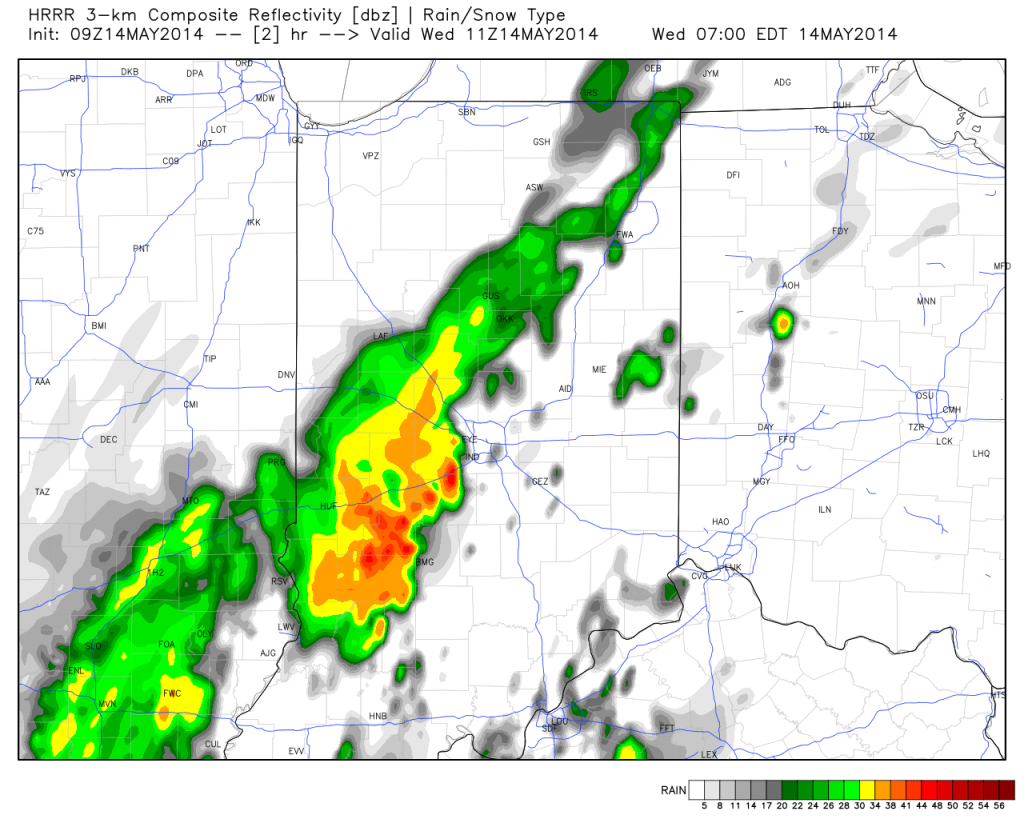
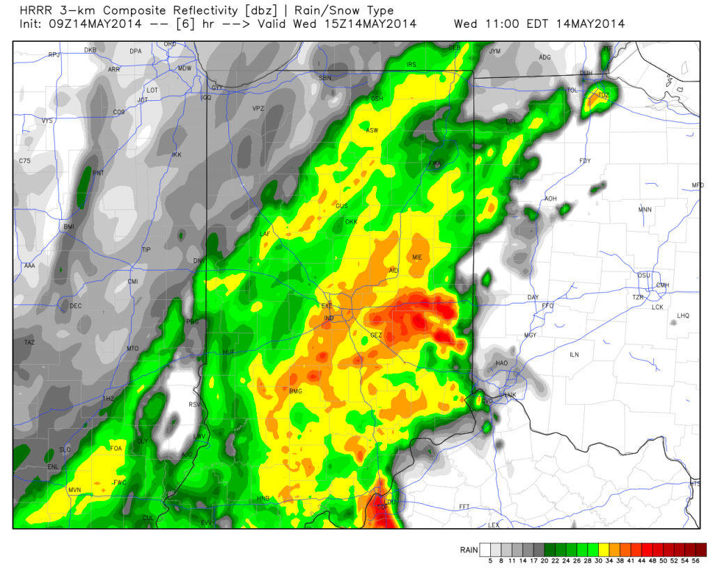
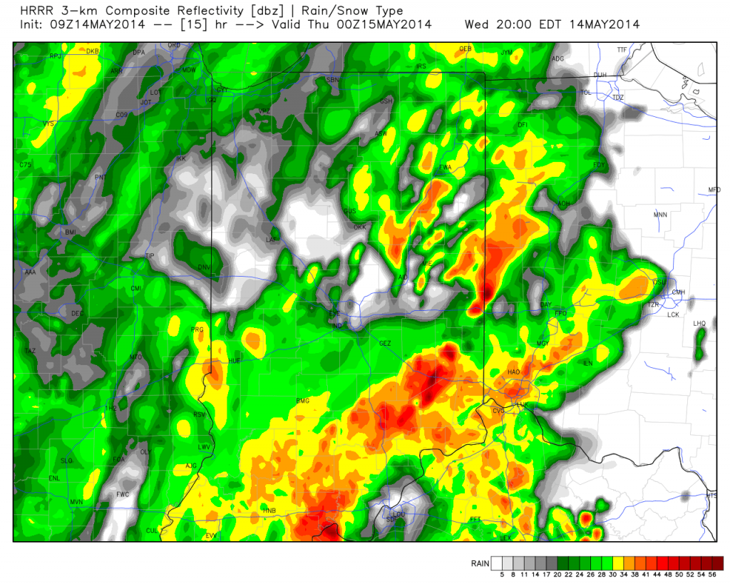
A surface wave will move up along a cold front today into Thursday and be responsible for widespread rain, some of which will be heavy, across central Indiana. Additionally, severe thunderstorms, including possible quick spin-up tornadoes, will be possible across far eastern Indiana and Ohio this afternoon and evening.
Note the forecast radar stays rather busy in the hours ahead!
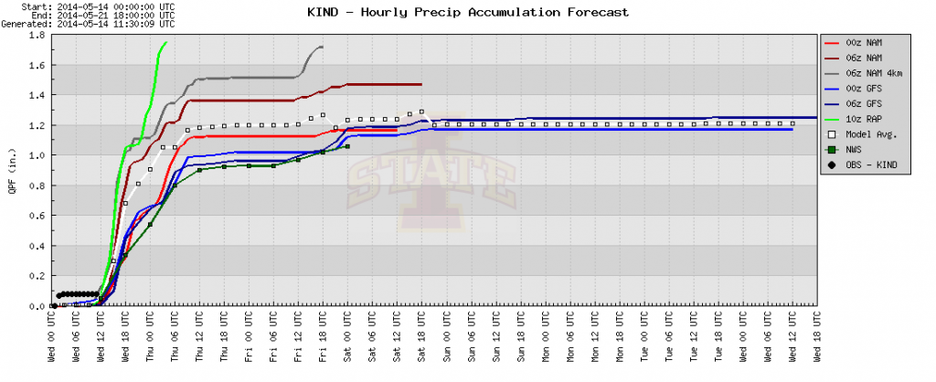
Area additional rainfall total will reach between 1-2″ between this morning and Friday afternoon.

The other big story is the chill. Temperatures are drastically cooler this morning than what we’ve gotten used to the past several days, and the step down process will continue. We still think most of Thursday is spent in the 40s.

Permanent link to this article: https://indywx.com/promised-wet-chilly-pattern-here/


