You must be logged in to view this content. Click Here to become a member of IndyWX.com for full access. Already a member of IndyWx.com All-Access? Log-in here.
Category: Forecast Models
Permanent link to this article: https://indywx.com/video-storms-develop-tonight-accumulating-snow-wednesday/
Feb 04
VIDEO: Nice SB Sunday & Tuesday Severe Potential…
You must be logged in to view this content. Click Here to become a member of IndyWX.com for full access. Already a member of IndyWx.com All-Access? Log-in here.
Permanent link to this article: https://indywx.com/video-nice-sb-sunday-tuesday-severe-potential/
Feb 03
Friday Morning Rambles; Looking Ahead…
1.) A cold close to the work week can be expected with highs today only topping out in the upper 20s (average highs are in the upper 30s).
 2.) What at one time looked to be a significant weekend storm now may not even deliver any precipitation at all to the region. A flurry is possible, but most should remain precipitation-free this weekend. Expect a gusty southwest wind developing SB Sunday. Highs around freezing Saturday will zoom into the middle 40s Sunday. Lows Saturday morning in the middle 10s will rise into the upper 20s to around 30 Sunday morning.
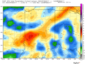
 3.) A more significant storm system will cut for the Great Lakes early next week and this will deliver gusty showers and embedded thunderstorms. A couple of stronger storms aren’t out of the question. Locally heavy rains can be expected, including amounts of 1″-1.5″ (locally heavier totals).

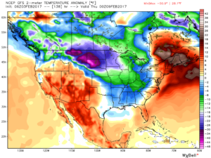
 4.) Cold air will rush back into the region behind the storm and snow showers and squalls are likely by Wednesday.

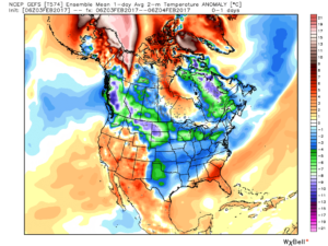
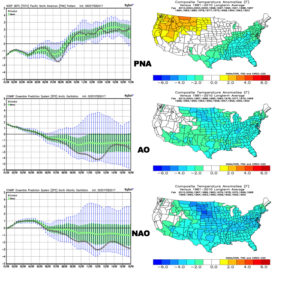
 5.) Longer-term, a real fight is developing on the overall direction we’re heading as February evolves. Analog methods and teleconnections (shown below) would yield bullish cold signals and give hope to winter enthusiasts. However, modeling isn’t in agreement on the wintry ideas. In fact, some modeling is very spring-like as mid-Feb nears. Stay tuned as we try and iron out the details this weekend. Updates will come.

Permanent link to this article: https://indywx.com/friday-morning-rambles-looking-ahead/
Feb 01
VIDEO: Welcome To February…
You must be logged in to view this content. Click Here to become a member of IndyWX.com for full access. Already a member of IndyWx.com All-Access? Log-in here.
Permanent link to this article: https://indywx.com/video-welcome-to-february/
Jan 29
Sunday Morning Rambles…
1.) Our fast-moving NW flow continues today. Snow showers and localized heavier squalls will increase later this afternoon and evening as another upper level disturbance moves through. This won’t be a “uniform” event, but if driving please plan on rapidly reduced visibilities within the heavier squalls.


2.) Overall, the upcoming week looks chilly, but relatively dry. Fast-moving disturbances can be a pain for modeling and “last minute” corrections can take place, but consistency on the next storm system tracking north of the region Monday evening and Tuesday morning continues. We’ll note a gusty wind during this time frame (30-40 MPH gusts), but don’t foresee significant precipitation across central parts of the state.

3.) There’s the chance for snow showers midweek, but our attention will shift to the prospects of a “more meaningful” event next weekend. With this being a storm we’re watching for the day 7 period, confidence is low and specifics vary greatly. Stay tuned this week as we fine tune the details. Just know from this distance, an accumulating event is possible.

4.) The last couple of weeks has featured an impressive January “thaw.” We note the blow torch regime of the past week across the central and east below.

See the shift back to winter, especially across the northern tier as we close January and flip the calendar into February.

The GEFS is bullish on the cold growing stronger as we progress through the first half of February.
Permanent link to this article: https://indywx.com/sunday-morning-rambles-4/


